

base map
Here be some words of the journey:
Preface:
Beginning with my life and what I wanted to do, or rather what I asked that I could do,
would be a good place to start if this were just my story, but my story is one that wants, (and has
been asked) to be a part of a larger, partially unknown and distant story.
This is a common theme in storyteling, telling my own story as a way to hear a larger story. At first my
struggle was just to begin, to see, to hear, to comprehend in some way what was before me. This
turned into a common theme also- to keep those questions, “what is next?” “what am I doing
here?”, “what or where is the meaning in what I see?” before me. The beginning can be the most
powerful part. Time and again I was reminded to keep the basic questions, the first questions before
me, not to go blazing past them, grabbing the answers as if they were the goal.
At first this was all secret, I told no one, and found out later- that there were few to tell
anyway. I found out how hard it was to tell the truth- to say what it was I wanted, or rather what
was shown, offered for me to do, to take part in. The offer was simple- simple and vast: to experience
the trade routes, the connections, between each area, in California, Nevada, the west,
and… the whole country, the whole continent, and later, even to see the connections between the
continents.
Trade routes- the paths between towns, between cultures. The surplus and sometimes the
rare products of humanity and nature. Focus upon the word “paths”, as in “paths between
towns”. These are generally the shortest or easiest routes, but not necessarily. The route may go
around danger, which may not always be apparent- like a seasonal danger, such as hurricane or
avalanche, flash flood or unfriendly neighbors. These paths may be obvious to the first time visitor,
or they may take an experienced local years to remember and follow correctly. The scope and
detail of just this one word, “paths” is infinite and ever changing, but this is something interesting
to me to learn, to experience, and these paths are given to us all, not just to me, they are part
of the Earth itself, the waters, the sea, the mountains, the plains, the desert and even the snow
covered lands with their frozen lakes; all these areas have their special ways to get across, to get
through, to travel from one town to the next. Of course now there are roads everywhere, but
these roads follow, exactly sometimes, the very trails and footpaths of the centuries before cars.
Interstate 5 in California, Hwy 395, Hwy 14, Hwy 1, all follow old trails. Sometimes the road or
even established trail does not find the way across the mountain, the river, or valley to the next
town or area of interest. The route is then found “cross-country”. All places are connected, one
way or another and discovering these connections is a great joy.
Focus upon the word “culture” and you will discover God, or not. All the world’s cultures
were and are a way of remembering God’s blessings, the Earth’s blessings, and the history of the
people who came before us. The paths connect towns and also connect cultures to each other.
Each area is unique, individual, and each is connected one to the other. This is the whole, the unknown.
The whole of the country is on a much larger scale than the individual person can grasp,
yet as an individual, I can cross through and travel the entire country, touch each area, experience
a whole range of people, places and culture, but to see it all at once, to be everywhere at the same
time experiencing the whole people the whole land, whole sea, all at once and continuously- this
I do not do, I can see and experience one segment at a time. Later I may remember the series or
the accumulation of experiences, I may make connections between peoples and places and cultures,
but to experience all of it- this is on a scale beyond human, beyond individual human capabilities.
As much as we can imagine all at once, we can still imagine more that we are missing,
private conversations, ceremonies, memories that only families and generations of families could
recall, and although everything may be similar across the country as far as human experiences
go, they are still not the same. The whole contains everything, even that which has not yet been
imagined; but grand scale is reflected on a smaller, more human scale within each individual person,
a scale which can be grasped, can be experienced. “Paths between towns and cultures.”
Focus
upon the word, “products”, as in “products of humanity and nature”. The real goods, the raw
materials of nature, the fruits the flowers- our food stuffs and even more important, our ornamentation.
Although more than mere ornament, but the very symbol of beauty itself, the prized possession,
the centerpiece; of what is it made? Shell? Stone? No matter the material, what is important
is the rare and exquisite beauty which shines with a life of it’s own; but then the material becomes
even more important and one must know; of what is this made? who was the artist?
The story deepens as it is told of the expensive, the rare, and the unavailable materials
that once existed, but now, no more. The dentillium shells that are no more, even the abalone,
rare and rarer. Used to be sold in restaurants, no more. The taste, the quality- it became expensive
and then… unattainable, unavailable. What was once common can now no longer be found, the
tale of the old people who still remember, who still have memory of things in their hands that we
never even see- this is richness, wealth beyond telling. And yet there is something even more
valuable still, and this is the knowledge that spirit never dies. These “things”, these clamshells,
trees, buffalo, and people, they have more than their physical existence. The physical may be
rich, but the spirit is beyond counting, everlasting so in this trade network, this whole economy
of life and everlasting life, there is a durability that goes beyond the exploitation, the extermination,
the extinction of species, the loss of forest culture, river knowledge, mountain sheep hunting
techniques; there is a durability that transcends the actual, the beautiful and rich and full. We
think we know what rich is, what beauty lies in the forest or on the mountain peak, we can see it,
describe it, take pictures of it, copy it over and over again until we know that this is beauty, this
is richness, but alas, as much as we can perceive these things, even do these things as drawing,
painting, photographing, carving and sculpting, alas to hold it all, to keep it all, to pass it on, preserve
it for our children, keep these things from wreck and ruin-no, these things we have not
done, but still try to do, for in the trying is the very conscious performance of life itself– the part
we say is sacred, the part we adults take on as our responsibility, as if we could actually pull it
off the sky and keep it, this wonder of life.
Who were these people who carved the stone heads, the gold leopards, the ornate masks
of hard burled wood of oak and hickory? The stone tools, the red paint on the cave walls- who?
Who were they that lived, lived on and on through the ice ages, the floods without paved road,
automobile, electric oven or insulated coveralls. Who had no grocery store, no Sears catalogue,
no navy or army? What did they think? Did they think they could possibly survive all those long
years without steel, glass, or newspaper? One thousand, two thousand, and on and on through the
thousands. Ten, twenty, forty, fifty, where was Christ then? We have had Christ for 2 thousand,
but what of the 50 thousand before that, and the hundred thousand before that?
Do we know how many Christ’s have come, how many times the coming has happened?
Unconditional Love is everlasting, has always been and always will be, and so has this story, this
journey, this job, this life of knowing, acting, surviving, loving, saving, planting, harvesting, cultivating
and building. This is a continual process, one I happen to love, working with the blessings
of the Earth. Running; a story in itself, and so begins a story, a journey, something mine and
yet something owned by no one- this love giving life.
Chapter ONE: Beginnings
Such a beginner I was in 1991, planning to arc northward along the spine of the Sierra
Nevada mountains, such peaceful, gentle mountains, and such a beginner I still am here in 1999,
still feeling new and small after going around seven times.
Starting with a prayer in 1991, and even before that, a love of this country and people;
how could one love this wealth, this richness of interesting fascinating complex intriguing unique
ways of not only surviving, but having fun at the same time? Not only having fun but sincerely
thankful and playful and connected as surely as brother and sister, father and mother. Of course
love, these people are taking care of us, making sure we are fed, clothed, and even more so, they
fill our eyes with beauty, beauty unbelieved and unaccounted for, beauty that saturates and fulfills,
the sounds of the salmon flipping in the river at night, the colors of the water washed rocks,
the feelings of autumn, all these things have time and place and order, they come and go with the
utmost respect and dignity, with regularity and dependability no man could match, but maybe we
can see, learn, appreciate, and take note: look! There is a pattern, a predictable, regular, normal,
forgiving pattern every day of the year, every season, every year and series of years, everyone of
our lifetimes and for every lifetime of the whales and the may flies and the giant redwood trees there
is someone talking, the creator is talking, listen! Love, look! Slowly, carefully, patiently,
courageously, steadily moving, spreading, keeping everything alive.
The sun came up in 1991, it came up a lot, there in Bishop CA. I was there to see it, to
pray in thankfulness for that day, for the sacredness around me in those mountains, those springs
of cold, fresh water and hot, fresh water to soak our bodies in that winter.
The water that heals, Keough Hot Springs, where I met my mother, Pat, who adopted me
at age 30. We had a big family reunion that summer of ‘92, I put up my tipi in the campground,
we ate buffalo meat and sat and talked. Don was even persuaded to smoke his pipe and he was
visited by a black bear who casually looked in to see who was there in the tipi. Having already
covered close to 200 miles on foot that summer, I was lean and strong and very much into enduring
even more, many more, miles of trail in the Sierra Nevada. Forty five days times 20 miles a
day, 900 miles on foot that summer, after 6 years of fire fighting- hotshotting around the country,
itching to get on my own trail, my own time, own pace, eager to see what I was made of for myself,
by myself, with no orders, no one to follow or lead, just the forest and mountain trail. I followed
old trade routes, the passes from east to west and back again… circling and covering
ground, making maps of the mountains and valleys I could actually see and… realizing that even
for such monumental trips as I was taking, the mountains were so much bigger. My maps of what
I actually saw were small glimpses, quick looks at what was, and is, another rich abode of life:
complex, vast, tiny, interconnected, unseen, omnipresent, and so many places, so many places in
those mountains that have been for so many years, eons, knowing themselves, familiar with it
all- each of the hundreds of canyons on each of the dozens of rivers, each unique, each different
in flora, climate, even the fish vary from lake to stream to river canyon, north to south, east to
west it is all huge, vast and complex and it fits into one very compact area of a map of California
which is but one of 50 states in this country which is but a part of the North American continent,
which is only a tiny area of the globe, not even a 1/16th of the total surface, to say nothing of the
depths, or of the worlds beyond, but who can talk of worlds beyond comprehending, beyond understanding;
worlds within worlds. Somehow it is meaningful to us, somehow we are not always
overwhelmed and, to us, we see what we see, know what we know, we live on the scale which is
meaningful for us. There are fish in every lake, every stream, but we fish one lake, catch one or a
few fish and eat them. That is it, on the physical level. On the spiritual level those fish, the ones
that live in our minds, the ones we caught, they live forever in our minds and hearts, that lake, it
becomes a big lake, the lake, our lake, the fish’s lake, and everything the fish eat become important,
the rain becomes important, everything becomes connected. Everything is connected, but
we don’t see that all the time. We see our scale, our level, what is meaningful to us; food,
weather, cold, hot, shelter, transportation, money, clothes, women, men, children, ourselves.
Here is a kernel, you hear stories about people having money, wealth, possessions, power,
but then saying to themselves “what does it all mean?” From this lack of meaningfulness all their
power and money becomes worthless- it has no meaning. With meaning then being a goal- how
do you get meaning? I would say love is meaning, simple appreciation is meaningful, being able
to feel, feel anything at all, and especially the ability to feel good and goodness in things, these
are meaningful, fulfilling experiences. These are experiences that don’t have to end, there is no
end to all that can be loved, learned and cared about. Then there are people who work and spend
their time on things they don’t love in the name of survival, in the name of lifestyle. It takes
courage to change this, to live in the name of love, to seek love, to show your love for the moon,
the stars, the clean air, the fresh waters. To love another person takes courage, to love yourself
takes courage. Where does this courage, that you don’t have, come from? The source, the source
of courage and love itself. From life itself. Life used to be free, now it is very expensive. What is
really living? really doing the survival, the art, the child raising, the celebration, the migration?
Really just being able to sit and survive? To sit and feed oneself, and take care of children?
Two basic things have not been resolved; the requirements of survival, and the requirements
of living, loving, being loved- real meanings in your life. We have resolved these things in
the past; people who survived by certain, specific, religiously set ways. The goal being not to
enslave themselves or other people, but to be free to live and survive. Example: a field is needed
to grow corn and staple crops- for survival, but from the beginning- before the work of survival
is even begun the requirements of living (which includes all life) are considered. Who are we to
say that we need to survive? This question is balanced by asking, and then simultaneously hearing
the answer from Life itself. When you ask this question: “Why do we need to live?- before
the last word is even finished, Life itself answers- “You are given life”- Life creates itself, takes
care of itself, there is no question of deserving, earning or working for life- this is a fact, life is a
given. Survival however is another question- Life or Death, Black and White. You live or you
don’t. In this modern world, everyone sees Death off in the distance, not as part of life, but separate
and distinct from it. In this way, survival loses it’s meaning, “because no matter how long or
how well you live (or poorly), Death is waiting to end all your efforts of survival.” When Death
is seen as being right here, with Life, inseparable, then you can feel, you can know you’re living,
you appreciate how sweet it is, this life, because we have the whole thing, and we don’t have it,
that keeps life fresh, free, unowned and not for sale, unimprisioned, uncontrolled. Uncontrolled
means that when you’re feeling really alive you realize that feeling is fleeting- it’s the feeling
teenagers crave above all else; they despise all else but the feeling of being totally alive and free.
Even if something goes wrong, fails; at least that’s real, not contrived= uncontrolled. Survival
has come to be defined in terms of control, and it’s balancing factor- Life, has been denied, left
out, erased, not cared for, but dearly missed. People who have survived, and lived, simultaneously.
They have balanced the controlled, set ways of survival with the unaccountable, unreasonably
generous ways of the ever-giving Life.
The slow, sometimes grueling, repetitive, obvious and simple ways of everyday life when
added ungrudgingly, when the routine is a joy, a savior even, then the addition becomes
more than the mere sum of days, places and people. Something miraculous, unexpected, uncalled
for happens- a payoff, a chance meeting with just the right person, or a touch of recognition from
the world itself, and suddenly all the work, all the day to day survival and drudgery disappears,
Life appears and is effortless, so much bigger than you ever deserved, but here it is right in front
of you; do you have the skill, the resources, the true kindness within you to treat it right? To
honor and cherish, to remember always this sudden gift which is also obvious, plain, human and
yet so divine, such as yourself? How long will it last? and the answer comes- “Life has always
lasted, has never left, “be patient, Life is going nowhere- but you, where are you going?”
We need not stray away from the ever giving Life, but may live within, and let it live
within us. Nothing is too common, too boring, ordinary, plain, everyday, that Life cannot and
will not walk right in and transform survival into the meaning of Life. Very unaccountable this,
this Life.
OOOOOOOOOOOOOOOOOOOOOOOOOOOOOOOOOOOOOOOOOOOOOOOOOOOOOOOOOOOOOOO
There are large periods of time which give me time to think, time to see what is ahead,
and the potential sometimes is so heavy, so full and solid and unmoving- like the potential to participate
in this cleanup, that cause, and another that is so worthwhile, so many just causes, good
fights, so many small people and places being exploited by big entities, and then there are the
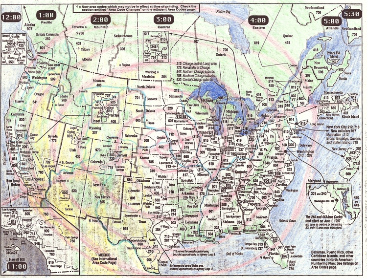
sweeping changes, new area codes added every year, doubled; there are so many people moving
into this country. Many families starting up, all needing the house, the school, the store, the job,
and here I am just sitting, not moving, the summer is over, time to settle down for the winter , time to soak in hot water, eat and sit, watch quail move over the rocks, listen to
birds sing. Sit with immensity of potential and do nothing. This is where action ripens, the winter
of 1991.
Now it is the winter of 1999, November and the heavy scent of roasted turkey is adding
to the building atmosphere of sleep and rest, inactivity and timeless ebb that comes with the winter.
So it’s very easy to remember that winter and almost every winter since 1986, that is when I
started firefighting. The summer’s work was so heavy and full, days seemed like weeks and one
day could put a week’s worth of age on your body. So the winter was a time of collapsing, falling
inward, staying home, visiting, eating and sleeping big sleeps.
Resting and soaking through the winter of ‘91 into the spring when Diane and I stepped
up to the pace, running every day, hiking the mountains around Bishop, CA and visiting with
Ralph, Momma Pat and Nicholas. This is when the prayers for my life and all life
were begun in earnest. I needed, I needed what was here for me to do, the immense potential of it
all and the tiny, individual, specific person of myself. Through the years I worked through the
thoughts and fears of having money, work, a job, a situation- I saw many opportunities, but I
didn’t need many, and this is the step away from security and into the fear; the step toward the
specific, on the spot, the one, the indefinable unknowable one situation, one job, one focus; that
is what I needed. Through prayer, through listening, this is where to start, where I am, so, this
year, this 1992 I begin to take steps to put form, to make a stroke upon the paper, to carve the
block, to enter into the world, a world that has a past, a rich, infinite past whose continuum has
been shattered in one generation, and that shattering took place generations ago, so now one
might say there is nothing left, or one may look and say, “it is all open”, There are also few barriers
to belief, even acting upon belief- this was another fear, but less costly. Acting upon your beliefs
is seldom carried out, fear of what other’s may see you doing, fear that someone will say,
“You there! What are you doing!?” That would actually be nice, it would demonstrate concern or
maybe just acting out of another’s fear of you and your doings, but the horrible reality is much
sadder; the fact is, there isn’t a lot of care for strangers parading around the country, people
would rather not know, too busy to spend another minute thinking about what you might be doing.
Sadly, people may die of neglect more often than being beaten up by bullies for practicing
their beliefs. That wasn’t the case a generation or two ago, but now, neglect, isolation, ignorance
and business inflict more damage than “hate crimes”.
Starting in the southern Sierra Nevada mountains of CA, Lone Pine to Three Rivers and
back, 120 miles by foot trail, and again and again, back and forth, crisscrossing, working my way
northward by going east and west, over the passes, following the old trade routes where pinion
nuts and salt traveled on the backs of generations, through time, for so long that even the recent
break of 200 years is just a momentary, sad, pause. As I did this through the summer I was faced
with two powerful thoughts and feelings. The first; this is absurd, the trade routes are gone, foot
travel is obsolete, and no one, not even the majority of Indians know or even care about trade
routes over the mountains. The second; this is ancient, the ancestors know and care, even when
one person remembers, this is meaningful. And then there are the encouraging feedback signs like
the group in Yosemite who re-trace on foot the old trail to Mono Lake, bringing acorns and
salt to trade for pine nuts, to dance and celebrate mid-summer at the tops of the mountains just
like their ancestors did not so long ago.
So I go on, knowing what it looks like to the outside, and also knowing what is feeling
right on the inside.
After a summer full of hiking on my feet, carrying my food on my back 20 miles a day,
living simply on extended unemployment benefits from firefighting, resting in my tipi and soaking
often in the hot springs, after a summer full of eye filling wonder at the gentle, hospitable
land above the land- (the Sierra Nevada mountain wildernesses), after a summer and fall season
of progress on foot, progress of mind, connection to land and people, past and present, after sustaining
momentum, gathering and recording information , I am ready to rest again, but the momentum, circumstance and
opportunity give me a fling up to Seattle, WA for Thanksgiving. After more prayer and ceremony,
consultation with elders and deeply, deeply asking and simultaneously listening and simultaneously
responding to the immediacy of survival, the next step is seen, shown and presented
for my acceptance. Bend, OR.
And many more steps beyond- the whole picture, the spiral
path around and through and into the country and more.
Days of study, meditation, hours of
praying with maps, tracing routes with my fingers, seeing with my mind, just as Cherry Gap
stood out on the map 2 years before I actually stepped out of the car (as a crewman for four years, stationed in Grant Grove as a hotshot firefighter) and walked along the wonderful
spot, Cherry Gap, an open vista above the giant redwood forest in Sequoia Park. While a crewman on a fire engine in the
southern Sequoia forest, nearly a hundred miles away I saw, I studied, the map, the map saw me
and told me where to look, where to go, the spot grew warm and inviting to my eyes, there it is
again, where did it go?, there it is! Cherry Gap, Cedar Grove, Triple Divide, Cloud Canyon,
Army Pass, all these places I walked through, around, and down into, as the names grew warm,
as the map foretold, so I went, guided and guide, recorder and recorded by streams, mountain
sides, trees and sky. So I went, so I lived in these places, celebrated and enjoyed them.
I don’t think I enjoyed or appreciated these wonderful places anymore than others of my
time, but the connection to all of them, between disparate places- between the trout lakes, where
the trout fisherman go and the peaks where the mountaineers go and the snowfields where the
backcountry skiers go, the cabins where the rangers stay, the horse trails and short cuts where the
packers go, the inaccessible ravines and defiles where the mountain lion go, the thick, dark, solid
mass of huge tree forest where no trail go, but I go, and appreciate, the trail I appreciate, being
able to move- up, down, over and through the mountains until they become more than a collection
of names, destinations, viewpoints and camps. The whole forest becomes home, like your
house. What would you think of people coming from Nebraska just to see your front lawn and
touch your mailbox? What would you think of people lining up just to get a chance to walk from
your living room to your bathroom, and take photos? Of course they would leave litter and wear
a path into your carpet. They might think your bedroom is prime cow grazing country, so don’t
be surprised to find cow shit in your bed, maybe in your refrigerator too. This is what happens
when the country, the forest becomes your home. Maybe it’s better just to be the tourist, lease the
land, rent it for awhile, or buy and sell it, make a little money. Nothing wrong with that. Unless
you want everything. Unless you want to live and want all the animals and plants to live and the
water and air to be fresh and clean.
As a boy I grew up going to Catalina Island, by sailboat, before I could walk we would
go. Swimming is big, a big part of our lives, but we live mostly on land, focus upon the land,
take the land for granted and ignore the ocean. The oceans; pacific, Atlantic, Gulf of Mexico and
California are just as much a part of North America as Canada, Mexico and the U.S.A. Not to
forget the Bering Sea, Arctic Sea, Hudson Bay and James Bay. These waters are also these countries; so to
travel the North American continent is to travel by sea as well as by land. The waters are actually
easier routes sometimes than the land, as well as being beautiful places in themselves, more than
just barriers, our corridors and rivers are our home just as the land is. The channel island
sound, the Los Angeles River, Ventura River; these waters connect the great mass of land, the
San Gabriel Mountains, to the Pacific Ocean. The waters and the mountains still feel like the safest,
surest paths to travel the country. I avoided the interstates and city paths, not so much out of
fear of somebody doing something to me, but initially out of fear of loss of focus; that the distractions
and randomness of so many people doing their own, different things would pull me,
distort me, delay and interrupt me just as they delay, interrupt and absorb the rivers, sky and land
around them without giving much of a thank you in return. So much of nature is willing to give
itself to the needy. A thank you is the uniting recognition that completes the gift, and lays the
ground for continued help, fulfillment and recognition. A thank you says, “I recognize this gift,
this fulfillment of my need, and I’m grateful.” It’s a humbling position, but also one of strength
and honor, one of respect.
So in 1992 I was avoiding the interstate, the big cities and the “fastest route by car.” In
general I stayed to the mountains, following their spine up into Oregon and Washington. For
Thanksgiving that year, Diane and I went by car to Seattle, we went the “back” way. Her friends
Tracy and James were living there in the Capitol Hill district. So this trip incorporated some of
the feeling for the opportunity I was being given; to travel between the ancient nations of Turtle
Island. The trip up to Seattle was beautiful, we stopped and stayed in Winnemucca, Nevada for
the night. Ate dinner at a Basque restaurant, family style, beef tongue and sheepherder bread,
rich soup and a variety of foods. The first and happy little snowfall of the year, a sign for that
winter to come. We stayed with my old friend Sue in Baker City, Oregon. Going through the
Owahee river country in southeast Oregon was exciting, knowing about this river that started
deep in the Nevada desert and cut it’s way north through one of the least inhabited parts of the
country to the Snake river, just getting to see some of this open country, learning about rivers new
to me, learning that yes, there are raft trips down the Owahee river, a navigable river is good
news. The band, the belt of movement that I was following, described in ancient, pre-human stories,
is a wide, fluctuating path that blends, sometimes neatly, sometimes definitely separated
from, the adjoining path. Every path has its parallel path, the alternate route and the next route to
the south or north, east or west. The whole country is criss-crossed and covered with trails; short
and long, wide and narrow, definite and obscure, but these paths that traverse the country, region
to region, spiraling, curving with Earth from North Pole to South, continent to continent, these
paths not marked by trail signs “per se”, although trails and roads and rivers and mountain chains
do coincide with them. These paths are more like ley lines, continuous streams of potential that
not only make the long distance travel easier, they actually encourage and keep people, animals
and other motile life going in certain directions. Sometimes there is a perceived obstacle, a
mountain lays across sideways, an ocean presents itself, or a road-less area the size of Manitoba
and Ontario full of dense forest and huge lakes. These have been obstacles to us, as a civilization,
as a group; there are no cities in these places, but as a consequence of being stopped by these
perceived obstacles, over time more and more people came to this obstacle and stopped, and
there are cities now at the edges of these perceived obstacles. An obstacle for a city, for a group,
a town maybe, but not an obstacle for an individual. Individuals have made the crossing, traversed
the mountain, the ocean, the desert, the road-less forest and great lakes. These obstacles can
be wild, vast, cold, wet, steep, dry, rocky, swampy and road-less, but this usually means the animal
life and hence the food supply, or other natural resource, is abundant. This abundance usually
built if not helped supply the city. Los Angeles in an insertion of one of these lines into the
continent from the ocean, a landing point of people from all over the world, like New York was
earlier, but New York is actually an exit point from the continent into the ocean. Actually there is
still continent underneath both these places in the ocean, so the lines are just following continent
that has been covered by ocean. These lines, these paths and flows of movement are not human
or for human convenience, any more than buffalo, trout, trees or corn is for human convenience.
Some animals and plants are convenient to harvest, just as some ley lines are easy to travel
along. It’s the obstacles, and the human response to them that is interesting . Obstacles to travel
have created boundaries for people all over the world, but these boundaries aren’t set in stone,
even if they are high Rocky Mountains. There is always a pass through the mountains, or a way
around them, and people lived everywhere on this continent, from Death Valley to Denali, Newfoundland
to Baja California, so these obstacles weren’t so much barriers or walls, even the
ocean was traveled upon, even lived upon for months at a time. My point is that trade progressed
and continued across the continent, east to west, north to south and everywhere in between. People
stayed and adapted to their home area, but they knew about, traded with and traveled to their
neighboring areas often. The mountains, oceans, deserts, weren’t so much obstacles as teachers,
educators, a part of the land itself that kept people honest- you had to really know when to go,
what to take with you, where to find how long the journey would take, where to find storm shelter-
for several days or weeks were needed to travel by foot or small boat across these challenging,
beautiful places. People love this time, this time out, away from home, facing the raw spirit
of the land and learning that even here, as everywhere on Earth, there are meals to be had, special
herbs and medicines found no where else, and a special kind of food, a love for the beauty
that hurts it is so big and omnipresent and fleeting and delicate. So this country, this California
with it’s long chain of mountains both inland and on the coast, some of the steepest mountains
anywhere those little coast mountains- 5,000’ feet tall isn’t so big, but five miles from the Ocean!
That is a 1000’ elevation gain every mile. (Wear sturdy hiking shoes). From Mt. Diablo, east of
Oakland, you can see the most square miles of land and sea than from any other mountain. It is
5000’plus in elevation, but the land in every direction around it is flat. A sacred, sacred mountain,
many herbs and medicines there, and now a park, a preserve at the top, along with the radio
and microwave power antennas. Almost every sacred place has been seen as a vantage point, a
developer’s dream, a benchmark, a launch pad for technology. Fortunately most are so remote or
rugged that the old cost/benefit ratio was too heavy on the cost side. Most parks, preserves,
natural and wilderness areas are so today because the economic cost was too high to log, mine,
or otherwise ruin the area.
So what am I doing, going through this motion, moving throughout the country? Well for
one thing I am seeing firsthand, the beauty, the abuse, the neglect, the snow, the air, the people in
every place which is so different than travelling by imagination and vicariously through other’s
stories. I gave my self to God and he gave it back, so I feel like I can do what I want, what I’m
interested in; go where I want to go. Of course I have limitations, these things take time, and
money, and energy. I could only go so far, see so much, spend so many days, so most of the time
I felt like I was getting a quick look, even if I spent all day sitting in the same spot, the sun going
across the sky, me staying in one place, thankful all the while to be able to do this.
It’s easier not to know that to explore the whole country around Bishop, CA by foot
would take several, dedicated lifetimes. It’s easier not to know that this exploration could continue
northward for hundreds of miles along the Cascade chain of mountains into Oregon and
Washington, likewise a parallel exploration along the coastal chain would probably take twice as
long. It’s easier not to know these things, not to know what you’re missing, but this life is not
easy, it is good and hard. The real part I’m missing though is not so much the exploration, but the
years of living in one place along the western slope of the cascades in southern Oregon, along,
say the Rouge River. I saw the Rouge once as a kid, we drove over the bridge at the coast. There
are a thousand such places I would care to spend a lifetime. The spirit of ever-lasting life calms
my fire to do it all, “There is time, an infinite amount of time, you can do everything you want to
do.” Sometimes I get through by saying “sour grapes”, “oh, that place isn’t so great, the people
don’t look that happy, and it would be so much to deal with, especially now days.” Sometimes I
feel like a time traveler from another planet, sometimes I probably look it too!
In my mind, what I would like to do, if I could have things my way, I would like to participate
in a trade system that is ongoing, in progress. A trade system of not only the goods of
Native America, the nuts, rice, acorns, hides, shells and fabric, but the system of culture, the system
of love. These things are not valued solely for their purposes in eating, decoration or utility,
they are loved, just as people are loved. We would no more think of selling the site where turquoise
is dug than selling a mother, a child a brother or sister. And so on with each of our resources;
these are traded, certainly, but more in the sense of shared with neighboring people, just
as our relatives are shared among us, like a child is brought up by everyone, not just the parents,
an elder speaks to the whole community, not just their blood family; so trade, the word trade in
the Indian sense was and still is a win/win situation. Trade helped stabilize, not destabilize communities.
People depended upon their relationship with their home town first, their home economy,
their acorn trees, their salmon creeks, their hunting mountain. Having a good relationship at
home is first and foremost. When each community is strong and well fed in this way, then trade
can commence, trade is a way of sharing surplus and acquiring special, well loved foods, tools,
songs, dances, ideas, marriage partners, memories and joy. This is the way it was done, people
knew how to live, how to take care of themselves and their neighbors. A full and rich life, not
free of sadness and pain, but certainly not just sadness and pain, certainly well balanced by the
whole range of life experiences, with one wonderful and glad blessing- no one group of people was
out to destroy, to totally wipe out, another group. This was not possible, not necessary and certainly
not a desired condition.
All of this has changed, new ideas, new ways of being in the world have been introduced
to this land. A great death, a great sadness was brought to this country. Not knowing how it was,
how people can live on this land; not knowing may be easier, for it is hard to know what one is
missing. It’s hard to know how things ought to be; now they once were, harmonious, sustainable,
for century upon century. But it’s impossible to go on and not know, as is the situation with many
people today who have no memory, no knowledge, no basis, not a clue as to how things can
work; how to base an economy, how to raise children, how to take care of elders, of the ground,
build a house, catch a fish, draw a picture. The really difficult part for people is that think they do
know how to live, after all, they have all the pieces, the education, the house, the spouse, the
kids, the school, the food, the medicine, everything. Everything but one thing, one thing missing,
what is it? The total picture, how “everything” fits together- food, kids, medicine, speech, ideas,
houses, countryside, weather, songs, dances, and dreams. People have sat down and tried to figure
it all out, make budgets, plans, attend meetings, keep the lawn moved, kids fed, plumbing
fixed and do a hell of a job at work. And maybe they can and do keep it all together and fit everything
together- for themselves. But can they do it for everyone else in town? No. Everyone else
has to do it too. We all have to do it, figure it out, follow through and want to keep going. For our
kids, for our elders, for each other, and ourselves. We want it all to work, and it all can work, but
has anybody seen it? Who can see the whole thing, how it all works, how we all work, and communicate
that vision to everyone, gain everyone’s respect? How to bring everyone to the humble recognition
that we don’t know, but here is someone who does!?
Right now it seems we’re in the “we
don’t know, but no one does” stage.
OIOIOIOIOIOIOIOIOIOIOIOIOIOIOIOIOIOIOIOIOIOIOIOIOIOIOIOIOIOIOIO
Driving northward, through the cold- snow is coming, winter, real winter is in the air. We stop in
Pendleton, OR, tour the shop in front of the mill- they sell only yardage-find out that Royal
Stewart is made every 6 yr. or so, the tartans rotate through the years. The half- price clothing store
is in Washougal, WA, so we go there. I bought a nice red wool shirt that I still have. This has
been, and still is, part of the economy here- the woolen mill. They had a good rep with the Indians
around here on the Colombia river. The Indians traded designs for blankets. Entering this country
of the northwest is exciting still, the richness of it is still palpable: after most of the salmon have
been fished out, most of the giant swaths of forest cut down, the rivers dammed and the cities
built, and the place still feels rich in natural resources. The Indians here lived well on salmon,
warm in their wooden plank houses, well equipped with strong bows and arrows, spears, harpoons
and nearly indestructible canoes.
The dentillium shell. The real wealth of this region, as in every region, is the spiritual, the
generous spiritual life which feed the organic life. Native people see the richness and abundant
giving of life itself. The inexhaustableness of the waves coming to shore, the reproductive powers
of animals on land and in sea. The Great Spirit is not exhausted, but constantly renews the
life of the land and sea. Native people want to be rich, rich like God is rich, inexhaustible, freely
giving, renewing and refreshing to the land and sea. It is humbling for a spiritual person to have
to eat solid food, to have to kill animals, process plants into food and fiber. To need trees cut
down for houses, for shelter against cold and rain and snow- this is humbling to a native person.
We want to be at least as strong and tough and happy as the animals who inhabit the land and sea,
rivers, and mountains. The Europeans saw something else. They saw an overabundance, more
food and resources than they held in their collective memories. They didn’t want to be as generous
as the Great Spirit; to eat and live in a house was not humbling to them. They wanted the
fruit, not to be like the tree. Not only did they want the fruit, but all the fruit- to hell with the tree.
The tree was incomprehensibly large, so vast and large it scared them, if there were less of it that
would be better, easier to manage and control. The words of the first settlers at Portland, OR (a
square acre of cleared forest on the confluence of the Willamete and Colombia Rivers) “the terrible
forest, so thick and dark, the awful numbers of trees, so thick they could never be cleared”. It
really was scary to them, this face of god.
We drove through the Yakima Valley apple orchards up over the pass into Seattle, WA.
We stayed for a week in the Capital Hill district, had Thanksgiving there. It’s hard to live in the
city, even for a week. The markets are fabulous, the food overflowing into the street; we ate royally.
The city surrounds you and doesn’t go away. The lack of open, green, natural spaces make
me withdraw, to the point where I had to create a myth; the city is built of natural materials, at
it’s base,. This helped a tiny bit, as did getting away to parks, the arboretum, and Widbey Is. But
the best solution to feeling better was leaving the city and heading back south, in the rain and
snow, after a week of clear, beautiful weather in the city. We took the Wilamette Valley south to
Portland, a more usable city, you can get out of it faster. “Powell’s World of Books”, the city
block, big, huge, bookstore was fun to sit in, reading, absorbing the creaky wood floors and big
doorways, high ceilings, leading to room after room of stories, facts, women, pictures, men, animals,
plants and wars. From Portland we went up and over the pass south of MT. Hood, a full
blast snowstorm had just hit the day before, we had gray rain in Portland, the standard weather
for that city, so the trip around Mt. Hood, in the dark, clear starry sky on snow packed roads, 30
mph. with chains on for hours, was quite memorable. Finally we made it to Madras, OR and
spent the night moteling. Next day to Bend, OR and in 5 min. had met Scott, the huge
German who was to help me so much. He was doing his bills, all spread out at a table at the Café
Paradiso. We spent 3 days in Bend, after which I told Scott we would be back to spend the winter.
Good Luck! We drove back to Bishop, unpacked, packed, cleaned up, Diane went to Denver for
Christmas and I, with truck and trailer in tow, headed north again for Bend, OR.
What am I doing, moving about the country? just because of a line on a map! NO! Yes! Why
not? Why?! People move because they have a job in a new place, relatives, a love interest, that’s
it a love interest, I have a love interest in the country, in the land, the mountain chains, the river
systems, the trail network, the sea coast, a love interest of the vast, trail-less, road-less desert.
And again- if it were just me with this idea, how far do you think I’d get? Not only does mechanics
stop you, finances can stop you, other love interests can distract you, and most of all, without
a very good reason, you will stop yourself, “There is no reason to keep going.” And while wild
abandon may carry you for several days, weeks or months, it will not carry you through season
after season, year after year, away from loved ones, away from people who need your company
as much as you need theirs.
So yes I have good reason, even when it is unknown to me, sometimes I know, and that’s
good enough for me. But to travel around the whole country, to visit 40 plus states, sail oceans
and walk mountains takes more than just good reason, sometimes. What can happen is that a person
can be moved around the country, which is a combination of the personal will to move (with
good reason) and the willingness to be moved by the breath of life, by the wind, as if on a sailboat; but even then it is a combination of the skill and will of the sailor and the will of the wind
and tide. There is a timing to follow, a time to go, a time to stop. Each day and each month, each
season and each year. A quick calculation back in 1995 told me that by ’99 or 2000 I might complete
one seven turned spiral around the country. Back in ’92 I had a vague idea that putting forth
on such a journey, I may finish sometime before 2000. This would be a beginning, with the possibility
of more journeys after this first, but to put forth on this one, to be in motion, this I called
“my life”, what was given me to do. Knowing that I was “skipping” certain parts of the country
by driving a car instead of walking is hard to accept, it’s hard to miss anything, to skip, to drive
right through a town and not stop, to drive around a mountain and not set foot on it.
But even by walking this would happen. I could be in one place, but not another. I would
miss events, human and nature, but this is the nature of individual existence- you can’t do it all,
see it all, be everywhere all the time. Some people give up, stay in place, realizing they are too
small and world too big to even try to pretend to keep up with all the events, with the surge and
flow of life. So they give up, content with the happen stance, the chance meeting or occasional
participation in ceremony and sweeping events. This makes their life seem “spontaneous”, because
they didn’t plan these chance meetings or sweeping events. There is nothing wrong with
planning and spontaneity is way over-rated. To know what is coming, to know where to be, at
what time, and follow through can be thoroughly thrilling. To know, to find out what each area of
the country, each city, each country holds as sacred, the special places are usually public, have
been known for years, if only by locals, and are usually accessible. When you know the places,
the events aren’t far behind, and they are continuous, just as places are. One side effect of modern
civilization is that it disrupts, interrupts, disconnects and separates places. Not only places
but events too. That equals space and time have been broken up. There is one place and one time,
and the event, the happening is continuous, so when you’re awake you are the happening place, not
missing anything at all. So why move, why travel? Well really you don’t have to, but there is
this possibility, this experience of seemingly moving about the country from place to place. But
the mind, the center, the love, doesn’t move, the recorder of events doesn’t move, everything else
does. There is breath, and changes, and the center, love. So to me, this movement is really not a big
deal, I’m grateful yes, but deserving of no accolades- that’s not why I’m doing it, not my rationale
or reason. The reason and practice is to follow my heart and leave my fears behind, face
them, yes, but keep going and not let fear stop me. Fear or anything that someone may say, like
“why are you doing that?”, “That doesn’t make any sense!” I really don’t need to answer questions
like that- I have only to do what I’m doing, and I know, at least for myself, that it’s not just
me doing it. I know that I’m being helped, guided, and that the success of completion is happening,
happening still.
Chapter TWO: West and Center
So in ’92 when I left a good job, family, friends, a beautiful, holy place to live, the questions
other people might have asked were a distant, secondary echo of my own, obvious questions.
But these questions were not and are not important: Questions like, “Why are you leaving
such a good thing?” The important questions are; “What good things are you headed for?” “Why
are you afraid to move?” “Do you trust what you say you believe in?” These questions were all
answered, in good time, but none of the answers were as important as those questions, for they
guide and urge life on- the answers are secondary. One can get bogged down in answers, or miss
them altogether, but a good question- that can keep you going for thousands of miles, years
worth of seasons, and it takes this measure and scope to see that for the vast questions of Ocean
and Sea, there is precious little river to answer. The Nile was an answer, the Tigris and Euphrates,
the Yellow, these are the great answers to the beginning of human civilization. The Mississippi,
Potomac, Columbia, Colorado, Rio Grande, Ohio, Missouri, Tennessee, James, Roanoke
PeeDee, and Delaware. These answers have all but been forgotten, some old history book, let
alone the question- what question? Was there ever any question? Any doubt that we would have
a Freddy Myer supermarket in the middle of the Oregon wilderness?
TTTTTTTTTTTTTTTTTTTTTTTTTTTTTTTTTTTTTTTTTTTTTTTTTTTTTTTTTTTTTTT
After two days of towing the trailer at 35 to 40 mph.- through snowstorms, slush and the
grand finale: the ice and snow covered, multi-rutted highway from Hell, highway 97 north from
La Pine to Bend. Just a 30 mi. stretch, but each time one of the semi-trucks passed me, and there
was a continuous stream of them, visibility was reduced to zero for about 5 seconds while the blizzard
of snow and slush flew off the back of their trailer into my windshield. I can talk about it
now, describe it and say that the tension was quite high for many hours, slowly bumping along,
my trailer lights flickering, growing steadily stronger as the vibration and friction continuously
cleaned and improved the electrical connections. Thoughts of having to chain up, spinning or
jackknifing on the ice, or some problem with the truck (the electrical system is a weak point),
were always there. The length of the trip, and the fact that I had no where to go when I got there, these
things were in my mind, but so were the antelope that ran down the road in front of me, barbed
wire fence on each side, keeping them trapped, dodging back and forth before my approaching
rig. As I slowed, they slowed, panicked a little, dodged back and forth some more, I
slowed more, riding their rumps before they were led to the fence on the left, squiggling under
the barb wire. I was aware of the animals, the deer and antelope living out in the desert, the desert
that was now covered with a foot or two of packed snow. I had it pretty good with my trailer
and food, blankets and propane heat. So when I arrived in Bend the big, half-empty parking lot at
Freddy Myer looked pretty good for a campsite. I stayed there 2 nights. Stepping out of the
trailer, a short walk across the parking lot and into the isles packed with bagels and cheese; this
was a different kind of life. The parking lot. Freddy Myer is a K-Mart, supermart, health food,
and discount auto parts store rolled into one, gigantic mall of a store. I got a gallon of Prestone
and a radiator fluid tester for 10 bucks. The parking lot was the size of most city blocks. My
truck and trailer could get lost in the confusion, the vast confusion of such a lot. There were kids
that played with their cars and trucks, spinning around on the ice in the parking lot. The all night
floodlights kept track of the main event this winter- the snow was falling. This winter the snow
fell continuously. At night you can’t see the white snow falling for all the blackness of a thickly
clouded winter sky, but shine a 10,000 candle power street light into the gloom and you can see
for about 10 feet, and that 10 feet is a moving, white speckled continuum, endlessly repeating
itself, beginning and ending in total blackness.
Each passing day the snow fell I felt more at peace, more sure that this was to be a real
winter, a good winter.
The next day my new friend Scott and I met late in the afternoon, and during the
day I called around town for housing and job prospects. The job hunt went from half-hearted to
completely fake over the course of the winter. I was still getting 400 plus dollars every 2 weeks
from unemployment insurance, as long as I didn’t do something rash, like get a job. Scott and I
met up at 5 p.m., and after a short visit he invited me to pull my trailer out to his land to stay until
I could find a place in town, which is what Diane and I wanted. We were both getting the unemployment
insurance, so we had a pretty good income at 1600 dollars a month, we were feeling
pretty well heeled. That night after dinner (Lebanese restaurant) with Scott and his friend Mark
(who lived in a tipi year round, this being his 5th or 6th winter, and the harshest), Scott and I hit
what was to be the social hang-out for the next four months- the public recreation center’s sauna
room. For 2 dollars and 50 cents you could sit for hours in pure, uninterrupted warmth. The outside
temperature rarely went above 32 degrees F. for the following months, so the sauna really
helped sustain our health and mental well being. A short haul that night out to Scott’s land; in the
morning we parked and leveled the trailer. After setting up the trailer we then pursued our formal
winter occupation- learning to ski.
There was skiable terrain in every direction- east, out into the desert on flat trails and seldom
skied cinder cones, north, more desert, south, more small mountains made of cinder cones
and now covered with a depth of snow, and then there was west, the Cascade range, dominated,
in our view, by the three sisters, especially South Sister, her majesty South Sister. We drove west
that day, the 19th of December 1992, up to Mt. Bachelor, a place I skied as an eighth grader, 26
years previous. We bought (each) a 33 dollars points pass and burned up half of it. Beautiful,
powder; creamy and soft packed powder, and deep, light virgin powder. I skied with a daypack
on, all winter, learning how to travel through the mountains covered with snow as well as having
fun. Just being in such a place as a snow buried forest, with the old volcanic peaks looking down
at us, just standing there, brought such a memory, such a fulfillment, such a feeling of destination,
this is it, the purpose and end. I stayed in my trailer out at Scott’s place east of Bend that
week while I looked daily for a place to rent. I started driving in to town, to the river park in the
center of town, praying there, offering and listening there each morning. On Christmas eve
morning I see a young otter swimming through the icy water with a fish in his mouth. That day I
secure a place to live for the winter with Dave and Jenny Sheldon, 600 dollars a month on the
river water front. Diane is still in California, coming up on the 8th of January. I move the trailer
over to the little guest cottage we’re renting and move in on the 4th of January. Until then I stay
at Scott’s, go skiing with him at Mt. Bachelor, Pine Mt. Observatory, down the river trail and
around the golf course. On December 29th I meet Darla, go to dinner with her and Scott
and McKensie’s. During this time I read the Trail of Tears book and took copious notes on it. On
the 31st I skied around the golf course with Darla, had dinner at the Mexican Rose and drove
home to my trailer. I stayed up past midnight talking with Darla, she told me how much of what I
talked about and said reminded her of her Gurdieff teachings. She couldn’t believe I’d never
heard of him.
This winter was very social and intimate and indoors even though Diane and Scott and I
exercised a lot, did a lot outdoors, but then retreated indoors to our homes, to restaurants, coffee
shops and bakeries. It was one cup of tea and loaf of freshly baked bread after the next. Everyone
seemed to crave each other’s company, always welcomed the guest and sought out the host for
the day. I looked for jobs nearly everyday, everywhere I went, which was all over town, exploring,
seeking, listening, discovering, and amazingly (to me) not one job offer. It was like I knew
that the best thing was to not work and the whole town was conspiring with me to keep the unemployment
checks coming and the ski opportunities constant. On January 22nd Mt Bachelor
had a ski for free day- what a concept, we accepted and did it all day. The next day we just had to
stay home and rest. Beadwork was at hand, I practiced by beading bottles. I thought of Mark often,
living in his tipi in the snow, with solar powered batteries providing light, and his wood
stove and heat. Scott had a yurt that he rented to Twig, who rode his bike to town for work in a
futon factory. Rhonda and Rob rented Scott’s cabin, so Scott lived in his tipi with solar powered
battery light and wood stove heat. Diane and I lived in the middle of city, in the old part, right
down by the river’s edge in our little cottage, surrounded by the right and wrong of the city’s
comforts and convenience; and too there was the river trail that led us out of Bend, right from
our doorstep we skied south and into the woods. The combination of money, cars, restaurants,
people in very nice clothes with the raw desert juniper/ pine tree covered foothills covered with
deep snow struck a sharp contrast between civilized man and pristine nature. The boundary was
hard to see sometimes, the expensive estate homes had spread quite a ways up into the forest,
and then you hit the country club. Oregon was undergoing Californication. Nature and Man were
layered un-uniformly into a thinner and thinner swirl as you approached the city center, and then
you hit Bond Park- the Deschutes river turns into Mirror Pond- the long grassy slopes of the
thinly treed city park slow dip into the Pond, stretching it’s long twisting length and crossing to
the other side to continue up into private back yards that have a public display aspect to them as
well. Marion, a long time friend of Laura’s, has just moved to this neighborhood in
Bend, neatly tying the end of this journey (where I began staying still), house sitting for Marion
while she moved to Bend from where I decided to stop, in Placitas, New Mexico.
The swans: then there are the swans in Mirror Pond, as if there had to be an aristocratic
touch to finish off this pristine city park, private estate contrast. The swans even, are natural, of
course, nobody brought them in, but here they are doing their mating rituals and breeding right
there in the middle of the river, in the middle of the park, in the middle of the city. Not unusual at
all, but at the same time, from a human stand point that has unintentionally gotten rid of such
natural proceedings by intentionally building buildings and uncontrollably more buildings
around a center of buildings that is ringed by and fueled by and has the purpose of expanding into
more and more rings upon rings of buildings like some fractal infinite message across the landscape-
that, then makes the swans being where they are amazing and wonderful and even more
non-chalant. They belong there, and everything around them, the park, the houses, the human
embellishment and paved pollution doesn’t belong there. I kind of feel like those swans sometimes,
belonging to the landscape, but in the present day context I stick out like a big signet on a
little city park pond. Who is out of place here? I have answered that question for myself and decided
that although I may look out of place, I don’t feel out of place, and certainly anywhere on
Earth that welcomes me with conveyance and air to breathe deserves my honoring that gift with
appreciation and upright self dignity. So I walk freely this city, these lands, trespassing not on
anyone’s private acre, but not afraid to stride through public places, to live and be comfortable
and alert to the possibilities of greater hospitality than I could ask for.
eeeeeeeeeeeeeeeeeeeeeeeeeeeeeeeeeeeeeeeeeeeeeeeeeeeeeeeeeeeeeee
Doin’ the Bend thing- working out at the gym with Diane and the local smoke jumpers,
playing in the pool. Shopping for every little thing we needed, which included stocking up on
those necessities of winter life- cooking utensils, glove liners, hats, food, beads and more food.
The news President Clinton was inaugurated on the 20th of February, all hail the Chief!- so his
eight year are up this November, 2000, but anyway the Republicans were out and the liberals
were thrashing around, laughing out whenever they could-the forest was being shut down by the
spotted owl, mills were closing and the era of cut and run logging was coming to an
end.
We got out in the woods all right that winter, up to swampy lakes and broke trail all the
way back to Swede Cabin. We danced to Blueberry Jam with Peter Susman the musician and
skier. We watched the movie “Clear Cut”. The days were clear and cold. I looked for work, made
fry bread and spent money.
In February my unemployment benefits were extended another 6 months so I was set until
October. We rode our bikes around town and worked out, sauna, swam, eat, work, play hard,
rest, enjoy. The Britenbush hot springs were kind of nice, little pools we could rotate through, a
remnant of old growth forest nearby. We skied at Virginia Miesner Snow Park, all the way to the
cinder pit and back. I would ski Mt. Bachelor by day, and the same night be just as ready to do
the full moon ski to Tumalo Falls, that was the same night as Kelly Esterbrooke’s party- hence
the ski to the falls.
We bought fabric, sewed things, I worked on my leather shirt. We hung out with Rob and
Rhonda, spent time with Darla and Ashlen, and on my Birthday we went up to Simnasho on the
Warm Springs reservation to the Pow-Wow. Saw Nathan Jim, he was videotaping the dance. We
met Pricilla Bettles and found out Wanda M. went to jail. The dances were good, hearing the
three sisters pray was better, their singing and praying brought us all into the extended grace period
of reverence and love and for sure, they had been doing good for a long time. We went back
to Bend, it was cold, cold, cold, and snowing and I had to re-take my driver’s license test- had to
drive Kumquat through the snow drifts to pass for an Oregon license. Kumquat, the orange
Honda civic wagon, 70s era, chained up and barely warm enough to keep the windows defogged.
All this time in the city of Bend, with all the playing in the mountains, meeting people
and enjoying life, I knew it was just temporary, which was good, life is not easy or all that fun in
the city. The crowds of people, traffic, pollution and congestion. I was on a journey, knowing that
I would continue- but how or when or where, the details I didn’t know. Diane hears that Alpine
Hotshots are moving to Estes Park, CO and so she is going to apply there for a job. Her mom
lives in Denver, (her dad too) and so we start thinking about moving there. For me it seemed to
be a central location in the country- near the center, so I could rest, work, make money and save
for a trip around the country- but How that would happen I didn’t know- the distances were so
vast, so much land and changes of climate and people involved- it all seemed so impossible, but
this was hopeful- the move to the center, to Colorado to gain some understanding of the whole.
RRRRRRRRRRRRRRRRRRRRRRRRRRRRRRRRRRRRRRRRRRRRRRRRR
We stocked up- I bought a stockpot, a new skill battery charger and many parts and
pieces for the truck and trailer. I went to the high Desert museum, saw porcupines and otters. The
otters were so happy and content playing and sleeping with each other. They had a stream and a
den and food and each other.
I spent time making a bivy sack and putting a headliner in the truck; going out to friends
houses for dinner often. Diane and I went out to the “knapp-in” at Glass Buttes, camped out and
visited with all the flintknappers there. There was a young man there whose work was fantastic – very
fine, large blades. He also made extremely small points- very good skill. I met Steve Alley,
an imitator from Sisters- he reproduced Indian material culture for museums.
I went up to the Warm Springs museum with Rhonda- they had a good history story with
lots of pictures and were experimenting with audio/visual equipment to document their recent history.
Skiing and eating were still the big activities in March, and toward the end of the month Diane
left for California to visit Miriam, then traveled on to Denver to se her mom and to start getting
ready for work in May. I worked on the redwood tables from Sequoia, and the oak ones too,
while still putting in an effort to look for jobs. Writing letters still to Pat, Nicholas, Diane and
Margo. Scott and I dug willows and planted them at his pond. I’m having trouble getting the
truck tuned up- finally figure out that all points are not created equally- the good ones are at the
Chevy dealer. Scott and I skied some more- one day he lost a ski and it turned out that the binding
just broke right off- well I had a good laugh, but he had to walk all the way down the mountain.
It’s April and the snow is getting heavy. I bruised my knee on one run at Mt. Bachelor, and even
Tuamlo Mt. Wasn’t holding the light powder any more. I knew my time in Oregon was growing
short- at the end of April I planned on hauling the trailer to Colorado, to Estes Park, to live with
Diane there. This month of April was full, with skiing every chance, going to a juggling convention
in Portland with Darla and Ashlen, and I even had time to go up to Warm Springs reservation
again and get my truck stuck in the mud. Eight hours of digging and building ramps with
rocks and I was out- not a problem, but I did miss the mini-marathon (that was the reason for going
up there). Caught some good music and had many good dinners with friends. I met Lezeazl,
Pepe and Stacy, we danced to Ed and the Boats at Cafe News. April turned to May and everyone
was running at full speed- they knew I was leaving soon, so things became stressed, separation
anxiety. By the 3rd of May I was packed up and ready to leave for Colorado.
Chapter Three: Holding the Center
A farewell breakfast
with Rhonda and Scott and Andrew and I then launched out of Bend eastward to Burns, then Crane, Oregon for
lunch near the hot springs. The Owyhee river- Rome, the only town for many miles along the
river- this was my camp for the night. This river is amazing- most of it runs through wide open
high desert in northern Nevada and Southeast Oregon, but it runs in a deep canyon most of the
way- so not only is the surrounding country isolated from population and access, but then the
river itself is almost inaccessible, sheer cliffs and maybe one road leading out to the south- no
services no towns, maybe a ranch house, but very few of those. Leslie Gulch. Very remote. I met
two river guides, Dave and Jake. We visited, talked about raft trips, then Dave points out my
broken shock on the truck. The road from Bend to Burns was long, straight and every so often,
a huge pothole, more like a crater, that took out a whole lane of the two lane highway, loomed in
front of me- I would hit the brakes, try to swerve (towing the trailer) and then ca- chunk! Hit the
crater head-on, bouncing through and looking back to see if the trailer was still attached. Lucky
to only break a shock. In Jordan Valley I had it welded back on for 15 dollars. I had a
good visit in Rome though. Saw antelope, went running, a pack of coyotes came near at
dawn. I picked wormweed and talked with the river.
**************************************************
Another special trip in April was out to the
Alvord Desert by myself, in the big green truck. The first night I camped with no else around at
Glass Butte, where the knapp-in had been the month before. Now the ground was very muddy
and soft, except at night and early morning when it was frozen solid. Glass Butte has good obsidian,
large boulders and piles on the surface, but I didn’t dig any. The next day I went to Burns,
hung out, read the paper, then went south down to Frenchglen. Going through the extensive
Malhuer Wildlife refuge, where the only high spot was the road, the vast expanse of wetlands
going for miles and miles, it was all rather dry and barren for such a wet year. Maybe it
was early yet and the water had not flowed in, but he region is so dry and windy, and water may
have been diverted or other uses. Frenchglen is a weird little artsy cowboy place- advertising lots
of local happenings. I went up the Steens Mt. Loop rd. for 10 miles. Until the road was closed
and camped. In the morning I had a nice run for another 3 miles on the closed road. The mountain
has a huge snowfield on top- good for a day’s worth of skiing for a person who would climb
to the top. The weather moves in fast, the creek’s name is a clue to the routine here- Donner and
Blitzen (Thunder and Lighting). I move down the road, lower in elevation and to the east side of
the mountain to Fields, but the weather is big and driving rains is all around up to the Alvord Desert.
I camp at Frogspring, wait and watch the weather, what a show- watching lake reflections
all afternoon. The weather breaks a little and I hike up toward the mountain. A large deer herd of
30 or so sees me and moves ahead- far up the side of the alluvial fan to watch me. I return to have
dinner and write Diane. In the night I wake up scared, feeling a strange fear- couldn’t shake it, so
I actually get up and open the back of the camper, stand up on the tailgate- pray to the night air,
the sky and the shoosh right over my head; an owl swoops by, just missing my head, but the fear,
it’s gone, like he took it- that owl helped me, but I had to stand out there and face that blackness,
that weird fear. The next morning is glorious, running up the road to Alvord Hot Springs. The dry
lake bed is now full of water! Water an inch deep and miles across. I can’t even focus on the horizon-
it appears and disappears, it all looks so unreal- like a movie set. There is no reference
point. Standing on the shore looking at the water- I can’t tell if the water is 10 yards away or a
100 yards away. There is literally no reference point, not a stick, let alone a tree; not a rock, nor a
print in the sand- just smooth, hard packed dirt, then the edge of the water- no grass, no vegetation
at all. The longer I looked the less I could tell about what I was seeing; then the wind started
to make ripples across the water- it actually moved the water around so that land would appear,
the edge was now totally undefined; the water was still coming down off the mountain from the
previous day’s rainstorm. This was still filling the lake. Then the wind and sun of today were
evaporating and moving that inch of standing water around on the lake bed like snow blowing
across a frozen lake. I couldn’t tell if the lake was filling or receding- it was doing both at the
same time and I could see it happening. I couldn’t tell how far across the lake was. I found out
later it was about 5 miles. It could have been one mile or ten or twenty- I had no idea, no reference
again, only a little set of hills just stuck on a short piece of the horizon. At 3 p.m. I headed
back to Bend.
**************************************************
These little trips of just a couple days proved to be the times that were heavy with memories
and deep experiences. The trip to Colorado was planned for the most direct and the least
amount of mountain climbing with the truck and trailer. Having the trailer along was nice for
camping and stopping along the way. The time had come to move again- crossing the country as
I’d not done before- a northern route from Oregon to Colorado via Idaho, Utah and Wyoming.
After running the gauntlet of potholes in eastern Oregon and getting the shock fixed in Jordan
Valley, I was on my way to the Snake River and southern Idaho. The border of Oregon and Idaho
was memorable for the hillsides covered with mules ears (Wyethia) I stopped and walked among
them, observing them carefully.
The border, and I’m starting to notice the borders as pathways, the
good places that are forgotten in between here and there. The no-man’s land conveniently left
behind as “borders”. The seams that are easy to follow. Nampa, a weird town of conservative
farmers, lots of hidden money, power, influence, but deserted, forgotten, and left alone alike so
many small towns that aspired to be big- and maybe they did, but there are only so many bigs, so
many places that not only had the people, but the culture to give an atmosphere, a center to the
mass of people. Boise is the one big in Idaho, and that is just out of sheer isolation of wealth that
Boise is still there- kind of a sub-station, a convenience for other cities- a stop between Salt Lake
and Seattle. And so I hit I-90 to cross that great expanse of southern Idaho- “snake river plateau”.
I took in that whole stretch from Nampa to Twin Falls and then pushed on to Sublett, I.D. for the
night. Good ‘ol Sublett, Idaho. A truck stop there, thriving along like those popular ones do. I
asked them If I could park my trailer for the night just down the dirt road to the north of the truck
stop. I had an unmemorable dinner, and dessert there, called Diane on the telephone to let her
know I was still coming along, then went to sleep in the nice trailer all cozy and warm on that
still chilly May 5th.
In the morning, after a nice run, I headed out for the Big Climb in Utah. My one pass that
I had to cross on the way to Colorado- I was concerned about pulling the trailer for long uphill
distances, and I knew there was already one long grade going up to Estes Park.
The change of consciousness was settling in- going from the northwest with its water and
temperate climate to the dry, harsh windy cold climate of the central rocks. The change from the
gentle, easy cascade mountains to the steep, rocky mountains with their sudden changes and violent
storms- I was physically moving through the spaces between two contrasting mountain systems,
and also moving through the void of people and culture between two contrasting populations-
the hard working logging and fishing communities of the northwest and the hard living,
ranching and oil drilling communities of the rocky mountains.
Driving up the Uinta canyon was pretty easy, not very steep, and at the head of the canyon,
the land dries out, the west facing Uinta canyon turns into another north/south valley canyon,
which the road follows north into Wyoming and the town of Evanston. Small, weird southern
Wyoming towns, rolled over and left behind by the streams of people coming and going to
better lands in the West, California and Oregon. Kind of sad to see these places, these people,
dying of their diet of cokes and cheeseburgers, and the town of Green River and Rock Springs,
looking like land fills with their dirt bowls full of “houses- like- trash” and nothing green, let alone
trees. This was the most “no-mans-land” place I’ve ever been, hard to read, but easy to see that
there wasn’t much happening, just vast expanses of windblown short grass plains. Good buffalo
country when there were buffalo, now antelope are seen in little herds. This is not the fashionable
Rockies, although the continental divide is here, past Green River and the Firehole country,
where I camped in the trailer. The ground was still muddy and wet, and when that red clay gets
wet it sticks to everything. I had red clay stuck on my trailer door threshold for months to come.
This is the “real” country, the “real” people, the ones not claimed by any city, although they sneak
away to Salt Lake and Denver when they get the chance. Nobody wants this country, yet here it
is, to be crossed by pioneer, Shoshoni and city dweller alike; to be left behind, joining the two
halves of the country- east to west, west to east. It didn’t feel like the middle of anywhere, it felt
like a place to get through, not to stop and live. I was to learn later that this was the Red Desert, a
basin in the continental divide. Full of interesting rocks, fossils and home of those oldest fossils,
the stromatalites. A place full of ancient history, rare earths, hard to find, hard to get to, dangerous
in a storm. I made it across. Across the Divide, singing to the buffalo and the grass, the endless
plains. Passed through Rawlins and Sinclair to get to the shore of the North Platte river, the first
river east of the Divide, the one that goes all the way to the southeast Ocean, the Gulf of Mexico.
Stopping there and making an offering to the river, which was accepted; it was an ending, another
beginning. Feeling good I stopped for tea in Laramie, the college town, at Jefferys Too café.
Leaving Laramie was a different story, a flat tire on the heroin edge of town, seedy and worn out,
some guys try to help, but I change to the spare and get going. Seeing the green grass and towering
t-storms of Laramie I realize that I’m thorough the desert of central Wyoming and now am
basking in the green meadow watered by the Laramie river, straight out of the Colorado rockies. I head south for Colorado, Ft. Collins,
and my re-union with Diane. It grows dark, the truck has power problems with the headlights on, so I pull over
at an intersection and the truck promptly dies; no hope of re-start, the battery is totally flat. That’s
when Larry Peterson showed up, gave me a jump start and provided a spot to park for the night.
Sideways in the middle of an intersection towing a trailer with a 30 year old truck that has 0 energy
in the battery with traffic zooming by in the dark- I had my little 9 volt battery operated
light with the flashing red reflector going at the rear of the trailer so nobody would plow straight
into me, but it was pretty harrowing being stuck at that angle, no way to go back or forward. I
was so glad to see Larry, stopping like that to help me. So I had a good night after all, sleeping
there near Cherokee Park, Colorado.
Next morning I saw Larry off, gave him our phone number and said I would come down
to visit and told him to do the same. At the time it seemed perfectly likely that I would have time
to come back and visit Larry. It was so close to Estes Park, and an area I wanted to explore.
++++++++++++++++++++++++++++++++++++++++++++++++++++++++
The drive up to Estes Park was beautiful, slow and full of light, signs of goodness, golden
eagle soaring, mica flashing sheets of reflection on pink feldspar granite. It was like I was walking
up the canyon, pulling the trailer behind me, noticing every shade of color, the dark shadows
of small trees on the steep canyon walls, with the dark blue sky trying to expand, but instead getting
cut into triangles by the vertical canyon cliffs. I knew the canyon had to open up, at least a
little where the town of Estes Park was to be; that’s just the way it is, there is an opening in the
mountains, people build their houses there. So the suspense was building with each curve, each
hidden bend in the road and river. The road wasn’t very steep, surprisingly, and gladly, so I was
content to slowly walk up the canyon.
Eventually I saw the Lake Estes damn and knew I was coming into town, but the sight
that opened up before me- it still is so full of wonder, so big, so much to see so suddenly, the sky
opens completely, only to frame the most complete panorama of high, glacier covered mountain
peaks that I could neatly pack into one scene, whose limits nearly matched my range of visibility.
Just the most perfectly incredible scene I could imagine, and here it is, I’m here, this is it, and
I could well hear every voice saying the same thing, each time a person came into this high
mountain bowl, surrounded on all sides by peaks, the ones to the west the highest, covered with
snow and small glaciers, other peaks coming into and going out of view just as constantly as I
moved through the basin, toward town, an impossibly small town, lovely and pretty, full of little
shops, so clean, abundantly clean, so you could feel it, taste it, here it is, for anyone to just drive
up and see, but at the same time you get the feeling that there isn’t much room here for those
who want to stay; plenty of room for the visitor, but the resident, they must cling to the mountain
walls, pack into the tiny town, conserve each parcel; every opportunity to claim a spot here
seems to be hard one, a prize, a gift, an inheritance. So quickly through the town I followed my
directions, out of town and toward the very peaks themselves, what a place this is! Look where
I’m going, right into the mountains. I love it! The road gets steep, but I’m close to home, right
straight up Giant Track mountain dirt road, now it levels off on a contour grade, I see the A-frame,
and then that must be the Brown’s house, bermed into the side of the mountain, with our
tiny shack of a house next to the garage, I think the garage is bigger. So excited to see Diane , to
meet Cindy and the neighbors, Jill and Eric.
The next day Diane and I ride our bikes up into the national park, it’s so windy we can
barely pedal our bikes; we only get about a mile into the park, but it’s so beautiful that doesn’t
matter, everywhere is incredible, I can’t imaging going deeper into the park to get somewhere
“better”, but I know there must be more and more and more, like other places we’ve lived, like
Bend, like Bishop, like Sequoia park.
The air is so fresh, we’re so high up, above 7500 ft., and the mountains just rise up all
around us, it’s so exhilarating. It’s like living in the backcountry wilderness, and we’re going to
live here! I can hardly believe it. The wildflowers are coming out, I see my first Pasque flower,
and start learning that this is a rich and different place, even though a lot of the trees, the ponderosa,
firs, the spruce and aspens are familiar from California; there is the plains, which are kind of
invisible and covered with farms and cities, so it’s not till a couple of years later that I really explore
and start learning about the plains and how they influence the front range of the Rockies.
But it is dry, and cold, and windy, so windy that I’m glad every day that Dan Brown had our little
house insulated so tightly; we could hardly hear the wind blowing while inside. From the bedroom
we would look out at the big fir tree in the backyard to see if the wind was roaring through
it. You would think we would be protected by Giant Track Mountain, a small hill in comparison
to the peaks around the town, but I think the wind was actually accelerated by this hill that kind
of had an airplane wing shape to it.
So was to begin a life in Estes Park, full and exciting and hard and rich with exercise, fulfillment
of hiking desires, and all the while wondering, thinking, remembering, and trying to picture
what my vision, my journey, would look like, how I would continue from here.
++++++++++++++++++++++++++++++++++++++++++++++++++++++++
My relationship with Diane would grow here too, but also be subjected to the same intensity
and amplification that everything and everyone here was affected by- the undeniable truth of
spirit and beauty- beyond, way beyond, what we humans could comprehend, hold, handle, manipulate
or, shall I dare say, destroy. We have thought other natural wonders beyond our power to
destroy, but now they are gone. At least for now this place, protected by national law, and hopefully
by the heart of millions who see and experience this place every year. The human ego has
the choice, the option, to destroy, to grasp and hold and own, or to let be the wondrous grounds,
to not pave them over, trample them with our numbers. The ego, the awareness of all this builds
up our ego. When confronted with something so beyond our own world of the personal human
unit, something so awesome, so big and clean, giving to us more freshness, richness of animals
and plants, water and blue sky, giving us individuals much more than we could possibly use,
such a surplus, such richness, when seen in a world that is devoid of large populations of wild elk
and deer, squirrels and coyotes and meadow grasses, devoid of fresh drinking water running in
streams down the forested slope, and a world so full of smoggy, murky, hazy air that people have
taken this air for “normal” and good, so that when we come to a natural wonder, a clean place, a
beauty place, the veil of smoke and pollution is lifted and we can see life again, glimpse it’s possibility,
the fullness, the inclusiveness of life that nature showers and lavishes on all forms of life,
plant and animal, bird and fish, lichen and moss. This is giving, this is life. Where are our needs
now? Where is the ego now? Still stretching and grasping to fulfill it’s own needs and satisfy it’s
bodily wants? Or is the body so full of stimulus, so full of excitement from the cleanlines and
purity of fresh air! And so full from all the sights of animals, the smells of pine and spruce, that the
ego, the wants, are reduced to the point of nonexistence. There still exists the choice of the human
mind, the choice of the soul and of the spirit, but when confronted with the awesome natural
wonder of pure nature, the choice is obvious, it is almost automatically made, in other words
there is no denying the truth of life. That is not to say that it not an option, it is an option that
civilized societies the world over have chosen, it is the dominant social construct that exists,
and is spreading still around the world. The truth of life is that life is given and given beyond any
individual’s capacity to hold it, control it, sell it, manipulate it, destroy it or other wise profit for
personal gain by greed and exploitation of it. Yet this is what has seemingly happened the world
over, that the natural world has succumbed to business. It has not been an individual who accomplished
this huge denial of truth and success of business, it took the combined effort of large
groups of people, and still does require massive expenditure of energy to construct this image of
the world as not giving life, but giving death and misery. In a world that seemingly gives freely
of death and misery, deprivation, starvation, crime against humanity, exploitation and exhaustion
as well as exhaust of all kinds, it’s easy to hold, even in the face of some beautiful place, it’s easy to hold a cynical attitude, an attitude
that this beauty place, this clean place, is an anomaly, a throw back, a rarity, not really the real
world, but an escape from it.
So this beauty, this Estes Park, it challenges the ego to exist. Flattens and shrivels the ego,
makes the needs and wants of an individual person pale in the face of such richness, and at the
same time amplifies and highlights the feelings of self need- makes us all the more aware of our
needs. Like going to a foreign country- what you used to take for granted, blending with everyone
else, having a similarity, a shared struggle with all your neighbors and friends, a boring and
tiring and unglamorous struggle, but a shared one. However, in the foreign country, even though
you must struggle just the same, no one can share it with you, you realize how alone a person is
without another language speaker to bounce your common problems off of. You are passed by,
ignored, foreign to these foreigners. All of this is not black and white, there is just as much support
for the ego here as in the rest of the country, but the fact remains, nature is big here, and the
ego shriveling effects of her abundance are an ever present fact of life here. This illustrates a
classic struggle in human experience. So the place is very important. In one way, it is all important,
without it we would not exist- in another way, taking the place totally for granted, which
civilized man has learned to do well, and saying “you can be who you are anywhere, if you became
a doctor you could live anywhere and work, the place is not important, it’s what you’ve
learned, your acquired skill, your ability to make money anywhere you go”. Mastering or rising
above mere place and its restrictions, the ability to move has become equal with social power
and wealth. These things are also true, in the human realm, the realm of ego and business, but in the
realm of nature, place does not disappear too easily. There has been a constant push toward
making business possible in spite of space, no matter where the place is- like a fight against the
given power of place, and today, seemingly, success- cyberspace: a place that exists outside of
place, without it’s pesky limits and constraints, without all the local quirks and subtleties of rule
and proper manner-just one, uniform, standard, easily reproducible code of business conduct.
Seemingly, place doesn’t matter anymore, but all this is based upon an assumption, one that is
taken for granted, as all scientific assumptions are- you must base your science upon something,
you can’t just pull it out of thin air, it must be grounded, and these grounds, the very basis of science,
by necessity, they must be assumptions and must be taken for granted. The assumption is
that there is a ground, a place. Gravity accelerates a body at 32 ft. per second, every second. Here
we have the Earth, and Time, which are givens, you can take them for granted, just as you can
every other constant, the air pressure at sea level. Air and Ocean. Science doesn’t have to prove
that lead exists, or iron or oxygen; science doesn’t have to create these things, they are a given.
Science doesn’t have to create place, a laboratory yes, a building yes, metal structures, yes, but
not the place where the building is built, not the ground. We don’t have to create life either, it exists,
on it’s own, no one knows how this is done, exactly, but we know enough to think we know
how this is done; another assumption: that we know enough about life to create it, that we don’t
need the given, we can create what we need. We can bypass the place problem by creating cyberspace,
which is really neat, a person may forget or be duped into thinking that a real place
may not exist in order for cyberspace to exist.
Maybe the “problems” of place, the limits, the rules, the uniqueness, the attention to detail
of particulars, eventually translate into cyberspace. Given of course, that a real place has a
greater power, is a greater reality, than cyberspace. We assume this is true, but maybe people are
trying to see just how powerful their minds are- test out that free will power of choice and decision,
carry it to some kind of natural limit, if one exists, I always assumed one did. But beyond
assumptions and back to something grounded in the experience of reality, at least in the perception
of that experience, is the phenomenon we call “consequences of our actions’ or “responsibility
for our decisions”. This happens whenever we make a decision, a choice, that the fruits of that
choice are ours to experience. Personal choice, personal power, personal experience. Enough
people make the same choices and we have societal choice, a decision of society. We have societal
experience, societal consequences of those choices.
Instead of assuming that a place exists, and thus taking it for granted, could we not see
that place for what it is, and find out (make the choice to find out) what it is about hat place that
is real, that belongs, to it, and not to us, to our perceptions about it, our fears, our hopes for it, our
ego’s desires? Maybe then we wouldn’t “take it for granted” or ignore or minimize it, but instead
see it as an incredibly fascinating gift that has been given and continues to live of it’s own accord.
So yes, it is a “given” but not taken for “granted”. The fact that science must be based upon
“givens” is as natural as nature that gave it those grounds. When you’re given something, do you
then ignore the fact of the gift and just focus and remember and study and recognize only the
thing? What about the giver of the gift?
OOOOOOOOOOOOOOOOOOOOOOOOOOOOOOOOOOOOOOOOOOOOO
Many weeks went by when I arrived in Estes Park, many weeks of attending events, public
and privte, meeting people, becoming familiar with the place. Getting a job with Kevin,
the roofer, was a glad but cautious occasion, I knew it was something new, a new skill to
learn, starting over again, except for the labor part- I knew I could do that.
So I started working, saving for that continued trip around the country, from place to
place and everywhere in between. It was great to be making money agin, to be able to function,
buy food, ski, play and work for it. Diane had her college friends, her family and familiar surroundings.
I had to adapt, adapt to the climate, the new wealthy class of people moving into
Colorado, the prices were high and going up. Things were getting tight. I made friends, got to
know people and people got to know us as a fun couple. We met Mugs and Pascal (actually Pascal
was still in Europe, we met him later), and Eric and Jill. I worked 5 days a week, we climbed
mountains on our days off, shopped for leather, tools, fabric and car parts. We baked and gave dinners,
had guests like my mom from California- Pat and the family Bartron. The summer was full
of thunderstorms and bad weather, rain almost every afternoon, many tedious hours on the roofs,
nailing, stapling, trying to keep from falling off. It was a whole new body exercise, balance, concentration
of eye/hand co-ordination and heavy lifting. My back and knees ached, I ran, walked
and stretched as much as possible. We were constantly moving; working, running, getting food,
cooking it, walking with friends, seeing movies, music, meeting friends in Boulder, Ft. Collins,
Denver, Colorado Springs. This was all great for me, learning exploring and getting to know
Colorado as well as the people who lived here. So the summer went by and fall came, so I was
invited by Kevin to go with him and several of his friends, all men, on the Hairy Man wilderness
campout.
!!!!!!!!!!!!!!!!!!!!!!!!!!!!!!!!!!!!!!!!!!!!!!!!!!!!!!!!!!!!!!!!!!!!!!!!!!!!!!!!!!!!!!!!!!!!!!!!!
It was just a weekend trip, but I extended it into a weeklong trip, giving myself some
solo days of hiking in the wilderness. We went up on a Friday, up to Chapin Meadows to camp.
The night sky in that dark black meadow made the sky’s stars so bright, and brought out so many
stars, we thought the Start Trek ship Enterprise could land right in front of us and that would be
normal; it seemed as though we were in space, the sky so black, no distant city lights, no light of
any kind but the 10 million starts crowding the sky. The Milky Way looked like milk in the sky it
was so white, chalky and thick. The big dipper was hard to find, hard to tell where it was, our
usual frame of reference was gone, no bright stars and dim stars, only a sky so full of stars, all
bright, even the dim ones were bright, no part of the sky was an open black space, but stars and
thick stars! It was hard to sleep that night, out in space like that.
The next day I started my solo trip up through the north bend of the massive front range
group of mountains- a loop to discover what lay above, in the mountains; what trails, what ways
through the mountains, how much water, meadow, forest- the same things that interested my
hikes in the sierra Nevada. The Laramie River started up here, and through a complex string of
mountain ridges, twined it’s way into the headwaters of the Colorado River. These two rivers
were almost one up here in the deep criss-crossing Valleys of Rocky Mountain NP. The Laramie
River flowed North, to later bend into the North fork of the Platte Rive. The Colorado flowed
south to Lake Granby, then began its steady southwest diagonal across the southwestern US. The
southwest river. The weather was beautiful fall crisp and clear, no wind, such perfection, and a little
weather report that forecast snow next Monday. I planned to be hiking out Monday, so that didn’t
bother me much. The first day out I went down river, crossing the Laramie river and walking
alongside it as a little brook, then as a wider, but shallow, stream. I was trying to find the Flowers
trail, which would take me back up hill and into the heart of the Commanche Peaks wilderness. I
found out later that this wilderness was created due to a deal with the Bighorn sheep hunters. The
sale of their hunting permits would help fund the administration of this great area of mountain
peaks and gargantuan ridges north of Rocky Mt. National Park, and east of the Never Summer
wilderness range. Finding the Flowers trail wasn’t easy. I had a map, but even so, the bends in
the creek and the mileage estimates put me close to the junction, but I wasn’t seeing a bridge, or
a trail on the other side of the creek. I went past where I thought where the junction was, then
back, back and forth a little bit until finally I took my boots off and crossed the creek. The other
side was a steep hill that came right down to the river, not the usual place for a trail junction. I
saw a faint hint of a trail, totally un-used and started up. Along the way I saw one other set of
boot tracks in some soft ground, but mostly I saw elk and deer and sheep tracks. The trail was
barely used by people- here it was, the end of the summer hiking season and this trail was covered
with pine needles, sticks and animal tracks- totally lacking the dusty, well worn tread path
of most trails in the national park, but this was a Forest service wilderness, not well known or
easily accessible to the public. As I climbed up and up, looking forward to the view I knew I was
in store, I marveled at the silence, the lack of people and the abundance of animals. Reaching the
top, the wide open ridge top, it was like a plain, above treeline, the tundra rolled and rolled, in
wide long ridges, beautifully carpeted valleys and steep sided cirques that had mellowed to
something just short of vertical. As I approached the high point of the ridgeline, I could see figures
ahead. I met up with orange clad sheep hunters, and then further down the trail, a wilderness
ranger, who didn’t ask for my wilderness permit, but I could just say the truth- I was headed back
into RMNP for the night. The plateau of ridges and tundra covered peaks around me let me see
far to the north, the medicine Bow mountains and Laramie peak in Wyoming. I could see the little,
long narrow Valley of the Laramie River as it went straight north, to slide past the city of Laramie.
The valley was so great, so secluded, a treasure sequestered away in the deep reaches of a
land with few roads and few reasons for people to be curious enough to spend the time to go past
the reaches of the Poudre River to where the Laramie lie stretched out so oddly straight in this
land of twisted, overlapping ridges and crumpled, random mountain peaks. This was the end, the
north end, of the front range of the Rockies. From here the mountain chain and especially the
continental divide takes a radical turn to the west, then trends northwest across the Red desert of
southern Wyoming and across northwest by way of the Wind River mountains to the holy hold of
Yellowstone and Tetons, up in the very northwest corner of Wyoming. So to see such a thing as a
mountain range turning, or ending, just seeing such things makes this a day worth living. Coming
up to the top to see down and away, to see where I am- this refreshes me, satisfies a deep need
and gives me a sense of understanding the natural world. After spending the night up on top- I
headed back down to Mirror lake, down the rocky defile, off trail, down to where the ranger had
come up, to a pristine glacial lake (post glacial) passing around the lake I went out into the
Mummy Pass area for lunch. Wide, tundra covered bowls with snow in north shadows. Mummy
peak and others surround the pass. This would be a great area to ski in the winter. I head down
the pass, toward the east and back down to tree line. The trail follows alongside the north side of
a canyon, which comes out at Pingree Park. I didn’t want to go all the way down to Pingree park
just to cross the canyon and creek and come back up the south side of the canyon to meet the trail
continuing east to Stormy Peaks Pass. So I decided to go down into and cross the canyon at a
reasonable place, about halfway to Pingree Park. After several miles off trail I came into a
wooded area that had a presence of silent people. It was here I looked down and saw the moccasin
print in the mud. Going through this area I felt as though this was a place people were living
and raising their children, away from the world. I knew the edge of the canyon was close, then
finally, I descended. Through thick trees, logs sideways across the hill, almost too big to climb
over, steep and horribly cluttered with down logs, thick trees- so much so that the way I was going
was about the only way through. Reaching the bottom of the canyon I thought it would be an
easy, short crossing of the bottom, then a steep but short climb to the other side and the comfort
again of the trail. Wrong. The bottom was again as thick as the side I just cam down. Almost too
thick to walk through. Lots of ducking and crawling and going around, trying to find a path. Finally,
the creek, and I could cross it, but I was starting to worry about the time and effort this was
taking. I figured by now that this was almost equal to walking the extra 10 miles or so to Pingree
Park and back, but no, this was definitely less miles, just slow and tedious. After crossing the
creek I worked my way up stream, thinking that this was easier than climbing up the other side
of the canyon, and that the canyon would naturally have a shorter wall the further up stream I
went. I knew this wasn’t necessarily true, but by my map it looked easier farther up stream. As I
walked, crawled and dodged my way up that stream I started to think, “here I am, in a very inaccessible
place by myself, far off the trail in a place that very few if any people would care to go.” I
was getting tired, worried, but the remoteness also brought a great sense of wildness and beauty,
untouched and quite alive. About this time I hit my shoulder against the end of a fallen, dead
tree. The tree trunk was small, long and narrow and pointed straight at me, so I really didn’t see
it, or know, until… pow! I was knocked backward, reeling, stunned, regaining my balance, not
wanting to fall, not knowing what- but knowing I hit a branch, just didn’t see it, and finally falling
down- Ok. I’m okay, just, man! That was scary! My shoulder was sore, but not really injured,
so I kept going, more cautious, it was so thick- branches and sticks came very close to my
eyes. The boulders were very large, so too the trees, a small deer trail was barely followable, and
finally the stream got too steep and wildly crowded with boulders and logs to follow, so at this
pint I started the climb up the canyon wall.
It was hands and knees at 3 different points, steep talus broken boulders, not so many
thick trees, fortunately, but the steepness! Almost straight up; and as I tried to zigzag up, going
diagonally to minimize the strain of going straight up, I was thinking about the trail- where was it?
I took breaks, drank water, ate some food, was getting very tired, worried about how tired, exhausted
I was. I stopped, tried to relax, rest, I told myself I would take a good break when I got
to the trail, even take a nap. Finally the trail, I was so glad. Took my rest and relaxed, ate and
took a nap. Now I kind of felt ready for Stormy Peaks Pass. My water was almost gone, and far
away I was now from any creek. Started to walk.
I walked slowly, scouting out the trail, it wasn’t steep and I realized that I had climbed
almost all the way to treeline. Now I was above treeline and headed for the Pass- I could see it,
the route wasn’t steep, nor very far away, just a walk up a grassy valley to the gentle pass. I was
happy now, knowing I would make the pass before night fall and be able to camp at treeline on
the other side- ready for an “all-down-hill” day tomorrow for my last day. I looked over my shoulder
to see how much sun I had left for the day. What I saw was awesomely real and quickened
my blood.
Looking west was a sight not soon to forget- for it was just me there on that tundra with
my pack and sleeping bag, my hat and my stick, and my boots, my clothes- what I saw made me
very aware of exactly what I had with me, and what I didn’t have, like water, but that suddenly
paled in comparison to something else I didn’t have and would race to find- shelter.
The sight to the west, was, to put it in one word- black. The clear blue sky of the last few
weeks had come to a sudden, definite and impending end. The bank of rapidly approaching
clouds to the west had been approaching for hours, only I was in a deep hole and couldn’t see
anything but the sky above me. Now that I was up and away climbing a wide open pass on a tundra
field, I could see the front very clearly, about an hour away, moving fast, thick, thick low,
dense clouds that were to eat the sun in just a few minutes. But it was that color beneath the
white puffy tops of that cloud band that made the whole situation so dog gone real. That color
was the blackest of black that you see while the sun was still shining. Like looking into the
mouth of a giant cave, eating mountain tops like candy before it. I was probably at around 12000
feet elevation at the time, still had to go over this pass in front of me, and kind of concerned as
to how far down the other side I would need to go to reach the greenline and relative safety/
shelter of their protecting boughs. Of course if there was some water on the way I would grab it.
A quick look for information that could save my life (on the map) was in order, so I did that, calculated
that I had just enough time and light to reach the treeline and there may even be water
there too as the map shows the beginnings of a creek near the treeline. My legs were suddenly
energized and up and over the pass I went. On the way down the other side the frontal winds hit,
blowing my hat off. I laughed and chased after it, but it was soon apparent that my hat was going
much faster than I was, and even later, looking in bushes and everywhere it may have been
caught or slowed down- nothing, it was gone. About this time, along with horrific winds came
the snow. First a pelting, freezing rain, then a driving snow. Shelter became the priority over water,
and I headed for the first trees, a thicket of firs. I figured the sun still had some time before
setting, or at least the twilight would have just started, but all this was just a mental exercise
in what must be happening somewhere else, or on some other day, because today, right here, it
was dark, dark and getting darker with that eerie kind of blackness that comes from snow falling
so fast that even its whiteness is gone. Right away the fact that the trail would be buried by
morning and I might not have such an easy day tomorrow after all stuck squarely in my mind and
wouldn’t budge. First things first, I had to get through the night- find a sheltered spot. I set my
pack down in the trail and did a quick assessment of where I was. In the gloom I could see a few
trees around me, I slowly walked toward where I thought the thickest trees were. After walking
past a couple of trees and seeing a couple of more trees, all about the same 10’ distance apart,
and after looking under one of them to see that not much snow had hit the ground there yet, I began
to slowly realize that I was now ready to go back to the trail and get my pack. This train of
thought was interrupted by the almost total blackness that now surrounded me. How was I going
to find my pack? I slowly and calmly walked back the way I thought I had come. This was going
to be like trying to find a small daypack (my backpack) in a group of trees in total darkness in a
driving blizzard. I walked back to where I thought the trail was, didn’t recognize the tree spacing,
had to think, I hadn’t really paid attention when I set my pack down, I was thinking about shelter,
now I had to find warmth, my sleeping bag, food and water purifier. Quickly I came to orient my
self to the trees- found the ones I recognized, then traced in my mind back to where I started. The
pack had to be here somewhere. I figured I could see about 2 ft in front of my eyes, foggily. I
could just make out the dark shapes of trees in the gloom- so it wasn’t totally dark yet. I kicked
something in front of me- covered with snow, my pack! So I tried laying out my bag, putting the
space blanket over the bag. Leaving most of my clothes on, I climbed into the bag and tried to
relax. After a few minutes of laying there, not too calmly, I noticed that the snow was really thick
on top of me already. I shook the space blanket to unload the snow and tried again. Laying there
with the snow accumulating on me it became increasingly difficult not to think, to think of the
trail being buried beyond recognition, to think of this hopeless darkness- no way I could find my
way out tonight- but I had lots of energy for doing just that. About the last thing I could do was
doze off to sleep. Eventually I got up and shook off agoin, and after a out 3 or 4 times of doing
this I thought about trying something else. I got up, put on my boots, dragged all my stuff over to
the biggest tree I could find that was within 10 feet of me, and crawled under it. There was
hardly any snow on the ground under there- just a dusting, when there was already about 3 or 4
inches on the ground out in the open. There wasn’t any room to stretch out under there, so I put
my pack under my butt, left my boots on, and draped my sleeping bag over my head and
wrapped it around. I was warm, dry, and comfortable and couldn’t sleep a wink. So began a long,
sleepless night under a tree in a snowstorm. I found out later that two men died of exposure that
same night at the base of Long’s peak.
Every so many minutes, just to interrupt the on-going obsession with the trail being covered
with snow, and possibly being obliterated from view in the morning, with 10 miles to go to
the trailhead, and that being the closest trailhead, not the one I said I was coming out at, so this
meant I had to be out early, before noon to avert a possible panicky search for me in the wrong
area, so just to interrupt this constant repetition of thought I would try to guess how much time
had gone by- was it midnight yet? Had an hour gone by? Or just 20 minutes? Pretty much torture,
to have depended upon my body and ability to move, to hike my way through difficulties,
and then be stuck like this, not being able to move for hour after pitch black hour. No, I didn’t
have a flashlight, nor would it have been much use. In such heavy snowfall the light would be
good for a foot or two of confusing, blurry fuzziness.
After many hours of not doing very well mentally and emotionally, I would get up and
walk around a bit, just around the tree to stretch my legs and try to relax. The extraordinarily
heavy snowfall in the pitch black night was not relaxing however, so I went back under the tree
to close my eyes. Many mental exercises, meditations, reveries, and just plain old defeated waiting
for hours later, the miracle of dawn began to happen. One of the best dawns of my life, the
sky slowly started to lighten and with every micro-lumen of light my spirits lifted. Soon it became
apparent, even though the snow, amazingly, had not let up one flake per second, it was apparent
that I could begin to actually see things. There were the trees, I slowly packed up my bag and
tarp, anxiously walked over to where the trail was the night before.
Looking down hill in the direction of where the trail should be- there it was! A small,
long dent in the surface of the snow, and the tell tale clearing of brush and trees on each side of
the dent; and the best part, the snow was light, light powder that just flowed around my walking
strides- which was fortunate, because at a foot deep, that would have made for a brutal hike in
heavy, wet snow Nearby, the creek had flowing water, so after filling my bottle I was on the trail,
snow still coming down like it would never stop. From the longest night, in to the most beautiful
dawn, which continued into a very beautiful 10 miles of striding through foot deep powder. All
morning I walked down and out to the Reserve Dunraven trailhead. No other humans, no pits in
the snow, just mine coming down form treeline at stormy Peaks pass.
Upon reaching the trailhead, I realized there was till about 3 miles to go to get to the Glen
Haven store and a phone. A family in their suburban was driving up, just to check things out, and
offered me a ride to the store. I arrived at the phone just before noon, minutes before Cynthia Elkins
was set to panic and call for a search- later they heard of the men who died that night- exhausted
from trying to climb in the storm, they retreated, too late, too dark, too tired. They were found in
crawling positions, fully clothed, a few yards from reaching their camp and shelter of their tents.
Diane came with my truck to pick me up; arriving in town to the same constant, intense snowfall,
was like a continuation of the same drama, hearing stories of others who had been stuck, stories
of buses, the bionic school buses with automatic chain attaches on their tires, that got stuck and
delayed and eventually canceled school, a first and not to be repeated event, not in a long time.
!!!!!!!!!!!!!!!!!!!!!!!!!!!!!!!!!!!!!!!!!!!!!!!!!!!!!!!!!!!!!!!!!!!!!!!!!!!!!!!!!!!!!!!!!!!!!!!!!!!
Next day the sun was out, the snow had stopped, the wind blew and sun melted, I was back up on the
roof tops during the day, and after work, working in the forest selecting tipi poles. Over the
weeks I cut 15 poles, peeled them and one evening, took them all out of the forest at once on my
truck. I continued taking hikes, with Mugs, Diane, who ever would go with me. Diane wasn’t too
keen on having me go anywhere alone for awhile. Mugs and I went up Estes Cone after work,
also up the Ute Trail to Trail ridge, elk bugling in the full moon meadow on the way home. Pascall
arrives and we all hike in Wild Basin. I meet Mug’s brother Chris, and earlier, Diane and I
had an experience with her little orange Honda station wagon that was pretty miraculous. Jill and
Eric moved to Denver during this time, and the Notchtop Café had been up and running, giving
us great bread, a place to sit and write, read, visit and some good friends .
* * * * * * *
The car Karma of Diane was kicking these days, her little orange (Kumquat) Honda wagon was
sitting in the driveway warming up one day, as we prepared to go hike the lawn Lake trail. Diane
came out the door to put something in the car, and, in disbelief, noticed the car was gone. She
came back in as I was going out and said, “Wasn’t there a car here?” We both looked at each
other in horror and disbelief mixed with a growing amount of concern and panic. Just then the
neighbor who lived in the 5th wheel trailer parked in the driveway came out and said, “I just saw
your car go by!” We ran to the edge of the driveway and looked over the edge, down the hill toward
neighboring houses. We didn’t see anything, just some tire tracks through the sagebrush.
We ran down the hill, after the run-a-way car we couldn’t see. Thoughts of the car lodged
into someone’s living room flashed through both our heads. There was a house straight ahead, things
didn’t look good. We came to a dirt road that crossed in front of us, still no car, then, as we
crossed the road, we saw the car on the bottom of a sharp drop off- a dirt parking lot cut into the
hill, fall of, what else? But junk and junk cars!
The car was still running, nicely warmed up and ready to roll. Our neighbor and landlord, Dan
Brown came down with his truck and winched the car up and out. I jumped on the bent hood to
straighten it out, then we drove it home! After replacing the folded front bumper, spray painting
the hood, and some other minor repairs, Kumquat was ready for the used car market. Diane sold
that car right away and bought a sweet Toyota Tercel wagon, dark blue. The next week, while
parked across the street from her mother’s house in Denver, I witnessed a speeding car, after flying
blindly through a busy 4 lane intersection, hitting the dips at both sides of the intersection at
around 40 miles per hour, out of control, hitting the car behind Diane’s squarely in the rear- I
couldn’t believe it, no! no! NO! Her nice new, used car, smashed between two cars by a delirious
teenage girl. The girl said she was being chased, by who or what we didn’t see.
* * * * * * *
So while we were getting the wagon fixed, we planned trips to southern Colorado- to meet
up with Tracy and James, friends of Diane’s from Seattle, and I was looking into working at a ski
area for the winter, so I could check out Wolf Creek Pass as an option. Meanwhile, I worked with
Kevin, roofing the new Alpine Hotshot Dorm building.
I started learning Tai Chi from Eric Adams, invited to class by Mike Polland, who worked
with Kevin also. Still getting ski stuff together for mountain winter exploration, skins, gaiters, etc.
Skied at the old Hidden Valley ski area, skinning up and skiing down- some of the most challenging
conditions yet! After that winter of telemarking in Bend, OR I thought I knew how to
ski, but this was a while new set of conditions, and it would be several tedious attempts before
finally being able to ski a whole run without falling. We skied regularly at Bear
Lake, Emerald Lake and Hallowell park. Working at a ski area didn’t pan out, so I just skied
Rock MT. National Park instead. Trips to Valhalla, Loveland Pass and Eldora expanded my skiing
range and ability to trust the techniques I’d learned. Going into this winter I was buys; busy
with work, till the end of November, when 70 mph wind shut down our roofing project and also
blew down a three story house in the process of being built. 10,000 dollars worth of windows plus
3 stories of stick framing wen down in a heap. There was hardly a stick of wood that wasn’t broken.
It looked like a bulldozer had driven back and forth over a pile of lumber. The architect had
called for hurricane ties, but they had not been put in yet. So with work over with and snow falling
regularly, I looked for snow-related work and play. This ended up being shoveling snow in
Boulder (periodically) for pay and skiing on the cross-country trails and tellemark hills of Rocky
Mt. Natl. Park for play. Usually I would rest as much as possible during the winter, but the excitement
and cost of living in Estes Park was high, and activity was pretty much a constant. Our
friends Mugs (Megan) and Pascal became close, we played Volleyball (indoors) skied, hiked and
traveled with them regularly. We took the new Toyota wagon and camped, first
in the Cuchara Mts., then at the sand dunes. It was cold and lcear, beautiful sights of a new place
(for me). A rich forest near the small town of La Veta (Cuchara) and the incredibly steep and high
Peaks of the Sangre de Christo range, which harbor the Great Sand Dunes national monument.
I traveled across the wide expanse
of the San Luis Valley, the low point being 7,500’! seeing as much as I could along the way, and
keeping my sensors on high, the towns of Alamosa, Monte Vista and Del Norte, which became
progressively nicer feeling, more rural, and then South Fork, which bordered on the worlds of the
great San Juan mountain conglomerate. I knew South Fork would have to be “home” if I worked
at Wolf Creek Ski area, so I looked closely at all the possible ports to put my trailer, and the
cabin rentals- one of which shouted, “protected warmth.” The town is rather small and bleak, the
main feature being the highway running full speed through it, buildings set back a safe distance
from the trucking highway/salt/sand spray. Then the climb gets to “Wolf Creek Pass, upon the
Great Divide,” like the song says, it’s hairy! Pre-viewing this prospective “commute” from South
Fork did as much to convince me not to winter there and work at the ski area than anything else.
The road is small, winding, and steep, with truckers putting on chains, and some not putting them
on, a worrisome sight.
Then there are the avalanche sheds. You drive through “tunnels” that are man-made protection
from the avalanche chutes poised above your head as you near the summit. These tunnels are
permanently paved with a nice layer of ice all winter long, and to top it off, there are some nice
curves waiting as you exit the darkness into the glaring light of alpine day. I drove right past the
ski area to make my appointment in Pagosa Springs with Rhonnie Doctor, the one who does the
hiring at Wolf Creek ski area. We had a good interview, she found out about me, I about her and
Wolf Creek and I concluded that I would not take the job. Maybe it was the stories about the
guys who got hit with avalanches every winter as they drove to work; no, maybe not, that was
the story that I chose not to live, or tempt. So I drove back up over the Pass, up the huge switchback
cliff face with it’s frozen waterfalls and signs that proclaim “no stopping or standing next
5 miles”! To keep people moving along while under the ominous throat of the avalanche chutes,
the signs, were printed in nice blood red ink. Getting over the Pass and back to South Fork was
relieving, and getting back to where Diane, Tracy and James were was even more so, as they
were now at Valley View hot springs.
There is work, what you can effect, and there is what is beyond what you can ever effect.
There is a part of life we touch, and part, a very large part, that is beyond our touch. To this part
we can only hope to affect through radiance, like George Bailey in “It’s a Wonderful Life.” We
don’t know what effect, what touch, we really have, how far it goes, or how near.
I started weaving a willow basket, a split willow twined weave burden basket. Weaving,
skiing, weaving, every year between Thanksgiving and Christmas. We joined with Jon and
Brett to go to Crested Butte. We stayed at Spencer’s house, a teacher at CSU who recently
moved to Gunnison to teach, and freeze. Gunnison is regularly the coldest place in the
central rockies. We skied for three days, taking telemark lessons and visiting an old friend, Linda, from the Arrowhead crew. She and her husband had just built a house there, where there
is very little private land available. This trip was also to mark the beginning of a very painful injury
cycle to my right thumb. While skiing, very tired form a long day of tellemark exercise, I
fell, straight downhill with my upper body, while my legs lazily sped off to the left… I fell with
my arm, holding the ski pole, straight out in front of me. The impact was first made with my outstretched
right thumb, dumb. After slamming face down, arm straight out, like it was going to
stop or break my fall- it broke my fall alright, and my thumb. The pain was pretty intense, even
though I had plenty of snow to numb it with, it still hurt and wouldn’t stop hurting. The next day
on the drive home I felt bad that it still hurt, I felt like I had really done something wrong. My
thumb was swollen and useless for weeks, and to this day, seven years later, it still doesn’t
straighten out, or bend back to press, and is still slightly swollen. This injury left a mark on my
joy of skiing, especially at ski areas (lifts). We stopped at Princeton Hot Springs, and I received
some healing there. This is a wonderful spring, and I’ve returned to it since many times. Mt.
Princeton is a 14,000 peak, part of the Collegiate Range in central Colorado, running north/south
along the western side of the Arkansas river. Following the river up to it’s source, we stopped in
Leadville and visited with Heather. The punk rock music, the new house, the uncertainty, the
town of superfund site Leadvelle, CO- it all rolled into one in Heather, she was something- hotshot,
fast living, but practical woman, she just bought a house! It’s just one person after the next,
a litany, a plethora of names, places, events, histories and interweavings. Next stop: Silverthorn
to sit Meg and Steve. Meg wasn’t home, so we hung out with Steve for awhile before heading
home.
We got into staying home, not working, Christmas time. Another old friend, Shawn
Wheeler (wheels) from Arrowhead visited, he had broken up with his Diane last year, gone to
New Zealand to chill out, had quit drinking, and was looking pretty good- going back to smoke
jumping this year.
We played volley-ball with Mugs ad Pascal, indoors at the gym, bouncing the ball off the
walls and ceiling. Hours of exhausting, hilarious fun. Hiking with Diane, hiking alone up Prospect
Peak, a sheer face that the tramway was built to glide over, and skiing with Mugs at Loveland
Pass while Pascal demoed snowboards for a company. I started to just walk downtown with
a snow shovel and offer to shovel the sidewalk for the businesses lining the street. The ones on
the south side blocked the sun from hitting the sidewalk, so their snow didn’t melt, and the city
ordinance said each place was responsible for clearing it’s own section of sidewalk, in 24 hrs. I
got a job shoveling snow in Boulder. The company would call at midnight to tell me to come
down at 2:30 am- shovel till dawn the walks of Boulder. Boulder at dawn, covered with snow.
This sight was usual for me in that winter of ‘93/’94. Juggling 3 balls was a major accomplishment
in my life, and this was attained in the month of December 1993. Busy doing, not really
hurrying, but the days were full. I skied at every
chance- Bear LK repeatedly, Emerald LK., Hallowell park, and one day, seeing Kym up at
the Bear LK trailhead with a friend of hers, I could see her at her finest, happy and excited to be
on the snow, with her upstate New York accent and winning smile- a phenomenon of nature.
Through the cold, the warmth of friendship shined through.
I was working on sewing loincloth and studying my Cherokee language when not working,
skiing or hiking. Tai Chi class was a constant now, twice a week, plus practice everyday at
home.
The wind and snow continued to be a big factor in life, and was glad I had a weather-related job,
I didn’t want to fight this Rocky mountain weather, which was brutally harsh, hard, biting wind,
driving snow, below zero temperature or lack of temperature, along with sudden changes to
blinding sunshine, above 32 degrees temperature, no wind, melting spring mildness, and then to
make it worse, back to the biting cold, wind and snow. This alternated at a dizzying and random
pace, throwing off any kind of rhythm or comfort or stability or moderation that one might expect
from alternating warm and bitter cold- the warmth just made the cold that much colder.
Another week of volunteering, shoveling, skiing and sewing,
and it was birthday time!
Skiing again at Cameron Pass with Tom and Kym and Debbie and Paul was challenging
(icy cold windy snowstorm) and fun, once we warmed up and started doing turns. We went
above the Pass to some bowls filled with powder. The snow is much heavier and piles up quicker
than in Estes Park, but the drive up the Poudre canyon is so long and winding, it’s not a regular
ski trip. I still have not been over Cameron Pass to the west, or to Steamboat Springs.
After the beauty and thrill of Cameron Pass, the next week we skied up to Lock Vale, one
of the most gorgeous trips in the whole area. You go up a narrow canyon that has continuos
mountain sides, running for thousands of feet vertically, coming right down into your little canyon
bottom. From the trail head looking up, it doesn’t’ seem possible to go into the mountains
here, but the deep, narrow canyon winds and steps it’s way up and around and through the seemingly
impassable walls of snow and ice covered rock, until finally you arrive at a high mountain
lake, long since frozen and snowed over, and still you are surrounded by mountain walls, but
now you can actually see the tops, the windswept rocky peaks. We rarely saw another person on
these trips, and the trip down was incredible! Incredible that we made it at all, and so fast and
steep and tightly hemmed with trees and rocks and drop offs- but it was just tame enough to be
so fun!
I continued to shovel snow, as it was still snowing hard in March, the big snow month, and that
meant only sporadic roofing jobs. Cynthia’s baby finally jumped down on March 14th, after a
long weekend of labor. Diane had to leave town, ironically, and returned from New Mexico on
the 15th. I read Cabeza de Vaca’s journal across North America, and saw the first spring flowers on
a walk. Adian Joseph Crisopher Elkins had come into the world, I stayed away a month to let
them rest before seeing him- made some little mocs, but he had already outgrown them.
I went in to see a doctor in Ft. Collins about my thumb, had it x-rayed and paid $150 to have him
tell me that it would just be better with time, which didn’t happen. I believe you must do something,
must learn something for healing to really take place of pain, and this was so intense pain. We
planned a trip to Moab with Mugs and Pascal. It was going to be Diane’s birthday, so we packed
the bikes and headed for Utah while we still could. It was a good break from the snow and cold
to go along the Colorado River, into red rock country, and camp along the river. The air was warm
and mild, the vibrant greening was happening in the trees and plants that would become wildflowers,
and this contrasted vividly with the sheer walls of red stone. After a killer bike trip of 30
miles in one day, over rough and steep terrain, we were exhausted, for the next day too! Pascal
can sure pick the adventures, and we saw some beautiful country- Fisher Towers from up on the
rim, but didn’t get back to the canyon until dark. Finding our way down by flashlight along the
steep, swithcback clift trail wasn’t too much fun, but we made it- thankful for our lives, we slept
well in our tent along the river. Tai Chi in the morning by the river’s edge, the silently moving
river oozed by, full of red silt. Wading out into the water was to experience the silent strength of
that river, pulling on my legs like a giant arm reaching form the Gulf of California all the way up
into he high plateaus of Colorado, Utah and Arizona- clawing and pulling huge handfuls of soft
red earth down the deep canyons, into the belly of the sea. Quiet yes, until you step in, then the
rush of water around your legs is embarrassingly loud, almost like causing a scene, “no, I’m not
drowning, just wading in the river!” We went on runs in the morning, up Negro Bill canyon, and
while Pascal trained on the slick rock, we went to Arches to walk among the giant holes in the
sky, made of red stone. We viewed Canyonlands from the mesa tops, and headed back home, but
not after returning to our tent on Diane’s Birthday to a howling wind storm, which had Mugs
and Pascal’s tent upside down on the edge of the river. In a raging sandstorm, we salvaged their
tent, which had a cooler in it, so food and water was plastered all over the insides of the poor little
dome. Everyone got into our tent, which by now had weak zippers and was being pushed flat
down by the wind. The finest sand was also coming in, steadily, like cake flour sifted down from
above. We had to decide, stay here and laugh hysterically at this ridiculous situation, this hopeless
mess of trying to eat and relax while the tent blew down on our heads, while sand got in
food and in our tea; or do we go get a motel? We waited, and ended up staying in the tent, the
wind died down in the middle of the night and we all slept.
We came home, stopping in Glenwood Springs for a long soak and swim in their gloriously
warm and hot pools, along with the multitudes that stop there from whizzing by on I-70. We visited
Meg and Steve again in Silverthorn, Meg had been diagnosed with Multiple (or maybe just
single at this point) sclerosis of the spine. Such sweet people- it was so hard to see them hurting.
We got home, I did some roofing, some skiing at Eldora and Hidden Valley- the snow, the snow,
it was so good, such a thing to do, such a way to get down a snow covered mountain as to ski.
Jon and Brett were home from Mexico and we saw their slide show; it was a trudge up the volcano,
some snow, mostly a rocky trail to the top. At a “camp” on the way up was a hut, a little
cabin- how cool! But some bararchos drove their cars up and had themselves an all-nighter,
whew boy, how’bout that mountaineering in Mexico! The view from the top showed just how
polluted Mexico City is, a brown layer 60 degrees around, a red sun dying into the haze below.
We went to Ft. Collins and danced to the Atoll.
Mugs and Pascal announce that they will wed on Easter at the Peacefull Valley Chapel. Pascal had a
pre-nup party, Chris and the boys treated him to many embarrassments. We danced with Omar, what
an experience that is; quite the energetic dancer and elegant, and mindful of his women
partners. Later when I met another person from Senegal, I mentioned my friend, Omar Badgi.
She said, “Oh, Badgi, he should love to dance.” An education in Senegalese culture.
We skied at Bear Lake, another workout in the beauty of nature, so blessedly quiet and pretty. We
went to Cynthia’s baby shower. Lots of people and gifts, quite the happy community for her
healthy baby. Diane made him a hat, so cute. We danced to the Iguana’s, and in between all this, I
roofed houses. Mug’s and Pascal’s wedding was so beautiful, while Linda played her hammered
dulcimer and calmed the fussy children, a gentle, flake by flake snow began to fall, small beams
of sun angled through here and there as the ceremony proceeded. The minister had jokes and ribs
for Pascal, which he had to take without come back or laughter, although we could laugh, and
this seemed to relieve some of his tension of the most important moment… We had a really fun
reception at the Swiss Challet in Nederland, which has since closed- an enormous building where
we danced, met his Swiss family, and the highlight- when his relatives carried in a big bell, the
kind the cows wear around their necks, ringing and singing to him an old Swiss song that
brought tears to the joker’s eye. After the wedding, and Cynthia’s baby shower, was Kevin’s 40h
birthday- what a week! Diane and I got a wonderful offer from Linda- to rent her house for the
same low rent that she had been paying for 12 years! At 300/month it was a steal, a large, rambling
three bedroom(plus) house, located on High Dr. near the entrance to the Park, and walking
distance for Diane to work. We were riding right now, things were falling into place, Cynthia was
relatively happy, had her baby, was starting to really get over Kevin, and Mugs and Pascal were
married, we had a great house- got to ski often, were making friends left and right, and to top it
off, it was Abe’s birthday, a very respected friend of Diane’s, and we were hosting the party at
our new house with no less than Omar himself doing the cooking and the D.J.ing!
We had a lot to be thankful for, and after a trip to Winter Park to ski, Diane helped me renew all
the sacred things in our life at the river. After the renewal, and Abe’s party, which I thought we might get kicked out for, on our
first day in the new houses no less! But things were quiet enough for our landlord- Ray, who
lived in the house behind ours.
It started to snow hard. We skied at Mill Lake.
That week I met Dan, then care taking at St. Malo. He and his girlfriend, Kathleen
we’re to become good friends. The field trip with the kids from E.P. elementary to the Park was
good therapy for me. I walked with the slow group, the kids who had overweight or other health
problems that limited their hiking ability. They had fun though, and made it to the Pool, a beautiful
walk.
There was a roofing job Kevin got to do in Wyoming, north of Laramie, and he invited Marty,
Marty, Mike and myself to do the job. We went on a day trip, just to paper the roof, it was on a
ranch, 40 miles of dirt road north of Laramie, beautiful country.
We were still skiing in May, and Mugs and Pascal decided to move to Breckenridge. They stayed
with their friend Marco in Evergreen.
++++++++++++++++++++++++++++++++++++++++++++++++++++++
It ws durring this time of loss that I met Niki, who had
come with a group of friends from Rhode Island to Colorado for the summer. The connection of
spirit with her was a feeling of brother to sister, she felt like family from the beginning, and I
made every effort to honor that connection. I ran the Little Valley memorial run with Bill
and the gang- Mike, etc., a long but beautiful run ending at the bottom of the hill in Fish
Creek Valley. Mugs and Pascal decide to stay with us until plans finalize in Breckenridge. We
had Pascal’s Birthday party, and hiked up Mt. Yipsillon.
Niki helps me season the tipi poles at Kathy and Rene’s, and since Diane’s dispatch to Craig,
Co last week, I’ve been adjusting to not having her by my side. I wanted very much to work with
her, to be with her, but for the time, it felt like we just had to wait, to wait until we had time together,
to be, not so full of things to do. I still had energy to do things though, and felt like things
would be o.k. with me and Diane.
I ran the Horsetooth 8 miles fun run, coming in with the first woman runner. Niki and Dave
and I did some things together- watch movies, and that night, the sky transformed into
the most incredible sunset- for 45 minutes of luminescent color and texture.
We went down to Boulder also to hear the “Instrument Panel”- a jazz/improvisation group that
was fantastic. Cindy and Linda and I visited Michael’s land in Ward, and all the while I was still
roofing with Kevin. We went back to Wyoming to stay for a week while putting the metal roofing
panels on the house- a huge barn-like structure. Nikki went with me to Linda’s 50th Birthday
party at the Kent’s house.
Toby and I hiked to Thunder Lake hottest day of the year so far. We both jumped into the icy
cold water. He also helped to oil the tipi poles at Kathy and Rene’s.
+++++++++++++++++++++++++++++++++++++++++++++++++++++++
During this time I was planning
to go with Mugs and Pascal on their yearly trip to Canada. On June 28th we left for Blind
River, Ontario, the family’s old cabin and reunion. This was a great opportunity for me to journey,
to continue and renew the vision of travelling the old trade routes in a spiral fashion. To
check and see if this was really something, (I knew it was), and to experience the difference between
vision and the reality I would find.
We left in their new vanagon, heading north for the Black Hills. From Cheyene we went straight
up through Chugwater to Newcastle, where we camped in a roadside rest area. We could see
Mato Tipi in the distance, like a nuclear power plant cooling tower, eerie and unreal. There were
walkers from the town who came to the rest area to walk around the parking lot in circles. I guess
it was a good place to walk. I went for a run and prayed and waited for Mugs and Pascal to get
up. We drove in to the majik land of Matoe Tipi, the ancient camp ground along the Belle
Fourche river. The red earth, banked against the foot of the towering column of rock, slowly followed
the river’s meandering course from the southwest to the northeast. We didn’t stay long,
just a long look and headed down river to Rapid City and the Badlands. I was to come back to
the Black Hills in ’95 and really explore and learn and take in each area, as the whole country
here has so many stories, so rich in detailed sacredness. We picked sage in the Badlands and saw
some enormous buffalo. Again, we were quick about our stop and headed for Pierre. The drive
through new county was exhilarating. I saw a pile of hay bales, round ones stacked like this .:. I
said, “look! Little pyramids!’ I thought they were stone; Mugs and Pascal laughed, knowing they
were hay. The open plains! A new experience, even though I’d come through Wyoming, and
lived in Colorado, the mountains were never out of sight. But now, the mountains were gone,
even the Black Hills. The dry grasslands were something I’d expected and seen in Colorado- east
of Denver and Boulder, but now, going north to Bismark, N.D., the land changed to green again,
with numerous small lakes, real prairie, and the Missouri river, wide and muddy- the Big Muddy.
We stopped near Bismark in a small town, marveling like tourists at the hardware store right out
of the 50s when we were asked “you here to see the Welk farm? “Welk farm?” we replied… my
mind racing as to make sense of the question- “well, no, we’re just driving through- headed to
Canada (fortunately, we thought). But we were vexed with question- what the heck is a welk
farm? Well, you heard of Lawrence Welk? His farm is right down the road, his kids have it now, everybody
stops to see it, you should go down and see it! Well, we passed on that one, had to get
to Bismark- I think there was a bakery there, maybe we spent the night. All I remember is the trip
across North Dakota- headed east , into totally foreign land, the west fast disappearing, the humid,
flat, mid-west farm heat was dead-ahead and stretched to infinity. This is where the time
started to slow- were we even moving anymore? Oh yes, there is a tower (a radio tower) in the
distance, and it appears to get closer, so yes, I think we’re still moving. The speedometer says
65mph, but it feels like 2 mph. We found out that tower was a record holder, the tallest in these
parts (several hundred ft high I guess). All I had to do was keep my eyes open till we reached
Fargo/Moorhead- the Minnesota state line, that was sure to be an eye-opener. I prayed and
thought “God” over and over, and this helped. It was the dead-zone, 3 in the afternoon. We finally
made Fargo, what a great sight that was, restaurants, people, stoplights- a big change from
the never-ending farmland. We crossed the Red river, became officially easterners, (actually, still
mid-westerners), and headed for Cass Lk. and Michael’s cabin. We arrived into the green thick
forests of Minnesota, lots of water, lakes, trees, but still, horribly flat. The cabin is on the east side of Cass Lk. (actually, Pike Bay),
which would swallow most Western lakes whole), on a dirt road that weaves through some old
growth timber lands. The day had not yet grown dark, so we beat the mosquitoes into the cabin
and set up house. We spent the next day there, riding bikes around the lake, into town, and when
we drove out the next day, Mugs got hit on by an Indian local Chippewa- “Hey, where ya
headed?” Her milk white skin and rich blonde hair just smacking that guy in the face- he just had
to smack back and let her know how much he noticed her. I guess she was used to it though, she
wasn’t as embarrassed or, maybe just a bit naive- she actually answered him, engaged him, wrong.
Then her naiveté was swept away as she realized this bozo was not for real.
Stopping there at Michael’s cabin gave us a needed break, and time to really notice that we were
in a different country- not just in the same bus! We were actually swimming in a huge lake!
Much different than the dry plains, or even the little lakes of North Dakota. I started to get a
sense of distance, of transitioning- not only climactically, but this was a different culture area, for
the Indians as well as whites; the mid-west for whites and the Ojibewa or Chippewa for the Indians.
I found a simple, but thorough tourist book on the Lakes Indians of Minnesota, Wisconsin,
Michigan, what a translation of these names was, as well as some basic history of these people I
knew hardly anything about. The name for the people- Anishnabe included three groups, who all
met every year on an island near Sault Ste Marie- Mackinaw island. The ones to the north, the
Huron, the ones to the south- in Northern Michigan, The Potowatami, and the ones who settled
Egg harbor Wisconsin- the Chippewa. We had traveled quickly to get here, so I didn’t really get
all the transitions, the connections, but I was as open as I could be to listening and watching for
the reality of life- the old land, now all cluttered with highways, towns and random farms. Not
that these modern things don’t point to or follow the old paths- they do, it’s just not conscious- if
it was, the buffalo would remain, the sacred plants and rocks remain, their rich soil would remain,
the rice filled lakes would have remained pure enough to drink, the fish would still be
plentiful, the mosquitoes- would they be as thick? I think that too is a balance that has been upset.
So concentrating on my own task was a challenge, and still is; to see what is really here, what
has always (or at least for a long time) been here. To see it, and to see how some people are still
conscious of that and how they work with that reality- the reality of place, the blessings bestowed
on each unique place.
The best thing about this trip with Mugs and Pascal though was that at last I knew, I knew this is
possible, this trip, going to these places. To actually go was a great foreshadowing of the years to
come. A dream I had before we left was of a drum, dark, black, representing the north, the spirit
of the north, Anishnabe drum. When we arrived at Michael’s’ cabin in Cass Lk., MN, I saw there
on the wall a small, black drum.
The next day we drove out to Duluth, known to me only as the coldest place in the lower 48
states. This was summer though, and Duluth looked innocent enough, very different though- I had
never seen an industrial mid-west town before. The old brick, the ugliness of industry, it was all
too gross to hold in the face of the Beautiful Lake Superior. We drove up the north shore, along
the Lake- how incredible! As far as you could see- fresh water stretched to the horizon, like an
ocean. The lake was flat, no wind or waves. We stopped during this hot day and actually swam in
it, the top layer (1 foot) being warm, but hang your legs down, and the iciness of last winter was
right there. We went through Grand Marais, and on to the Canadian border. After crossing into
Canada, the first town (city) is Thunder Bay, quite gross again with industrial matrix that
stretched for miles. A big city for this pretty country. You could see the large ski jumps up on the
hills above town. We went on through and immediately started looking for pull outs to camp in.
The evening turned dark, we had gone nearly to Lake Nippigon, when finally we found a road
that wasn’t a driveway. We camped in the van, right off the highway. The next morning, we saw
this road was someone’s driveway, so we left right away- seeking out a more defined camp for
this night. A Provincial Park was near the end of a day’s travel around the Lake, so we planned to
camp there. Now the houses disappeared past Nipigon, but there was a small town to stop for
lunch, however, the paper mill is not a tourist friendly industry. We started to see, finally, what
was going on around the Lake; the industry of logging and of iron mining had come to an end.
The money that had built these towns was gone. The tourism industry had not yet caught on here,
people were still lamenting the end of an era of mining and logging. We camp in the Superior
Provincial Park- a beautiful place. Doing Tai Chi the next morning on the beach, along with an
Indian praying on a bluff by the water. Gitche Gume. The Big Lake. We had driven our van 600
miles for nearly 2 days, and still were not around the Lake. It’s a big lake- the fresh water
Ocean. There is no feeling like being on the edge and touching a glimpse of the spirit of the Lake.
This puts you on your butt quickly. This is a scale of grandness so far beyond the individual human
perception- that even to glimpse for a moment a sense of this scale is to be completely
overwhelmed. It would be like an ant being able to see, just for a moment, the distance of one
mile, and suddenly realizing that “I’m an ant”, and being able to feel just how small that is, because
another whole scale of existence, another world, had just been glimpsed.
We headed for Sault Ste. Marie the next day, I was all eyes, looking and scouring the shore, the
surroundings, taking it all in, to see this famous place- but it wasn’t much, I don’t remember
what the town was like, except for that unremarkable quasi- industrial/urban feel of a remote rural
crossroads town. I don’t even remember if I saw the rapids on this trip or not- the rapids are a
low stretch of rock that the water of Lake Superior spills over into Lake Huron. Huron and
Michigan aren’t physically separated at all, the straight between them is spanned by a frighteningly
long and high bridge. The sacred Makinaw island is on the Huron side of the bridge. All
this I saw on the return trip, as we headed south to Saginaw, MI. But for now we just went east,
right through Sault Ste. Marie, and along the north shore of Lake Huron- which you couldn’t
really see, as there was an inlet along side the road, and several islands just off shore that paralleled
the edge of the lake. The country was still that great lakes green, forest of birch and oak and
some pine, a small Indian reservation, the Mississauga (Huron?) and we then counted the miles
to Blind River, Ontario, where Pascal talked about how he was going straight into the lake to water
ski, and canoe, and all the other things he did last time he was here.
Just to be up here, to be on this journey, on the path that I had wanted to follow- but more than
just me wanting to do it- it was the prayer, the asking and seeing this as part of the answer; so
now, to be answered, to be given this leg of the journey, to be able to afford the expenses, and the
plane ticket back from Detroit, all of this, to have the time off from work- the opportunity! To
make such a long, complex trip on such a small budget, the whole thing was miraculous. Pulling
into Blind River was a thrill, you still couldn’t see Lake Huron, just the estuary, the blind river
that fed into the lake.
The town was small, but had the big community buildings which had been
funded by all the iron mining, timber cutting and just recently- the latest blow to the local economy
that everybody was still talking about- the closure of the uranium mine.
Grater still was the
thrill of pulling into the driveway of the cabin by the lake, just beautiful. I met Mugs family- her
grandmother, who had the big house, and her brother and his wife and child who now lived in
Atlanta. I think Pascal was already in the water, then he got Uncle Bill to go water-skiing with
him.
The next day we went canoeing, I didn’t want to go speedboating, but we did take a tour by
speedboat and visited other families on the lake, Mugs’ family had been coming to this spot
every summer for 3 or 4 generations, she grew up with the kids from town, the other kids around
the lake, and knew everyone who was an old-timer here, as did uncle Bill Anderson, his wife,
and grandma. We paddled the canoes out across the lake to an old firetower, hiked up and picked
blueberries. This is where I started to learn about insects- the farther from the middle of the lake
you got, the thicker the bugs. The biting black flies did make it out to the middle of lake though,
so there was no escaping them, but only a few of those persistent biters.
It was during these days of bliss that I called home to talk to somebody. Diane wasn’t home, so I
called Cindy. Immediately she said that Diane was o.k. I said, ”Huh?” She said, “you haven’t
heard?” The big fire in Glenwood Spring- I said I had heard- from Pascal, who had called Switzerland,
and they saw it on the news- big fires, but he didn’t hear about the fatalities, which is
why Cindy said first thing, “Diane is o.k.” Then I heard the news from Cindy- 14 firefighters
died in Glenwood Springs, CO. Hotshots and smoke jumpers. I was chilled, for days. This was too
much, and one, Rodger, who I had worked with on the Arrowhead crew had been burned to
death, overcome by flames. Over the next weeks and months the story came in, but the baseball
strike was going on, so we didn’t get much news from the t.v. or radio, or papers. This hit very
close to home, I personally could have been anyone of those killed, I had been there, so many
times, we could have died so many times, and now, they all died, such a group- this many to die
at once- we thought those ignorant days were over, we thought we had learned. I was stunned
for several days- feeling how that could have been me, wondering what happened, what could go
so terribly wrong, and to know that Diane and the others were out there still, and the politics
would not help them. Life continued, and we set out the next day for a long canoe adventure.
Paddling from lake to lake with Mugs and Pascal, being in nature, silently seeing the shore from
the water.. it was a long trip, and Pascal biked home from the take out. Physically exhausted, he
declared that was a stupid idea the next day. We saw fireworks at the edge of town one night, visited
and played some more before heading back to Michigan. A vacation, a learning experience,
and just living life. Also seeing how others live life. We headed back to Sault Ste. Marie, and
then south, over the big bridge with Mackinaw Island on the left. We followed the shore for a
while, down the coast of Michigan, along Lake Huron to Saginaw where Bill and Marsha live.
They followed us down, we visited at their home, saw the old decrepit remnant of downtown
Saginaw, and the next day went up to the Culling’s home in Frankenmuth. It’s a German theme
town in Central Michigan. The next day I was taken to the airport early in the morning for my
flight back to Denver. Mugs and Pascal continued their trip by Vanagon to Quebec, Canada before
returning home.
++++++++++++++++++++++++++++++++++++++++++++++++++++++
I needed a ride home from the airport, so after taking a shuttle to Boulder, I met up with Kate
and she gave me a ride home- a common thing, as they were always picking people
up from the airport. I got a little visit with Kate, she heard all about my trip, told me I just missed Diane,
she had left for the White River NF in CO..
I focussed on getting the tipi poles finished-
it was summer in Estes Park, so beautiful, a time to meet new people. Explore, work and live! Toby helped me oil the tipi poles, and Niki too, we sanded and rasped and oiled and fired
each one of the 15 poles and 2 flap poles. Cindy had finally had enough of Kevin, she was going
back to Virginia to stay with her mom for a while, maybe a year. Niki had her 19th birthday, we
celebrated with Louis and Dave up in the park.
Finally it was time to set up the tipi; Kathy and Rene let me use some of their land. It was fun
going through the process again, set up, take down, set up, take down, figuring out all the dimensions
again. I was roofing regularly with Marty, doing shake jobs, and shingles as
usual. On a trip out to Michael’s cabin in Ward we installed a sink in the cabin, and his brother
Steve came out for a visit from Alaska. The Mike Walen memorial run was happening in the
park, so I entered that, a 6 1/2 mile run, mostly downhill, which turned into a race between me
and Mike, with Mike passing and leaving me once we hit the flats near the end. I did the
6 1/2 miles in 48 minutes, steaming right along for a rough mountain trail. Bill won the
race, but he fell and had some pretty bad bruises/scratches. My lungs hurt so bad afterward that I
thought I was injured; the only thing I could think it could be was smog that had come up from
the plains. Some others had pain too, but after that I didn’t feel like running hard anymore. Later
that same day I went to Lyons for the Bluegrass festival with Tom and Kym. We hard Dale
McCury, Hot Rize, and the Fiddle Puppets, The next day, still recovering form the run, Pascal
and Toby and I went up to the top of Eagle Clift, a short, steep hike. The ants were swarming
then, all on the highest part of the peak, flying off.
So I had my work, and my friends, Diane and my mutual friends, to keep and enjoy.
I made fry bread and buffalo meat for Mugs and Pascal, and that weekend went up into Moraine
Meadows in the Park to pick chokecherries. I made chokecherry jam, and prepared for the future
by working on my truck. Trying to be normal, to keep track of what was happening, finding
friends, keeping company, struggling to hold on to this good life I had found here in Estes Park,
and all the while seeing how fragile we are, how distant we are, and can become, so easily, so
easy to drift off, not have much contact, not be considered- so realizing this, it was I who did the
considering.
For now it was September coming, gorgeously beautiful in the Rocky mountains, the Aspen turning
gold and fluttering those round coins before your eyes. We went up to Wyoming, the roofing
crew, and put metal on for a week. All food paid for, sleep on the floor of the “guest house” the
old ranch house, while Kevin’s contractor friend built the new barn style house and we roofed it
with red metal. When I got home, Mugs and Pascal were ready to move to Alma and start working
in Breckenridge, their ski area dream come true. I met the poet Rumi that weekend in the
bookstore, and probably Amanda too, the green eyed queen of the highlands. I stayed close to
Niki before staring another week of work in Wyoming. A week of work, a weekend of visiting
mugs and Pascal in Alma and having another set of close friends, Jill and her boyfriend Eric,
move to Denver. Spreading out, people and work dispersing, growing thin, but growing strong.
My roofing skills improving, my relationships with Jill, Eric, Mugs and Pascal growing deeper
as they opened their hearts and minds to me in a time of need and pain. Spending time also with
Toby and the McGills, hiking, talking, meeting Ann Dunbar, Kathy’s sister in Albuquerque.
There was Niki and Louis and Sara and Roberto and meeting their friend Michelle. Spending
time with people, keeping relationships going, Linda and Michael , Cindy and
Adian, and on the 14th another friend, from Bend, OR arrives.
OOOOOOOOOOOOOOOOOOOOOOOOOOOOOOOOOOOOOOOOOOOO
Scott W., my good friend
from Bend arrives, meets Niki and the Gang, and then we head south on a road trip that Scott had
wanted to make for a long time. This was a good break for both of us and a time to re-connect.
He wanted to see Crestone, Taos, and Santa Fe, where he would catch a bus back to Oregon. We
left on a Wednesday, after work. Stopping briefly at Michael’s cabin in Ward. We made it to Mugs
and Pascal’s place in Alma for the night, had breakfast with Pascal in the morning and headed for
Princeton Hot Springs. This is one of my favorite hot springs, an old resort, made with the river
stone. The natural pools along the river are the best for soaking, but you have to be careful, the
water comes fresh out of the Earth at 140 degrees F,. hot enough to scald your skin. The full, fast
moving creek full of ice old water rushes by, the cold currents mixing with the hot, but at 140
degrees, the hot likes to stay on the very top of the pool surface. Some hand or leg mixing is
usually necessary, so this puts me into a state of alert, active movement. Working with the hot
and cold for a while is a part of the pleasure. Even when I’m nestled into the hot sand and gravel
bed of the pool, it’s still necessary to keep a leg or an arm active, mixing and moving the waters
together. After a good soak at Princeton we drove on in Diane’s Toyota Tercel, the blue hatchback,
to Taos. We stopped along the way in Crestone. Scott had always wanted to visit there, so
we stopped in at the “Road Kill Café”, he got his aura cleaned, we ate, then headed back to the
forest service land and looked around by the creek. I found a grinding rock that looked like a thick
bicycle seat. We continued on to Taos that day, had dinner at the “End of the Universe café”,
hang out for a while, listened to music, walked around town before heading north back to the
river to look for more hot springs (stagecoach) and sleep. The next morning we saw the tiny tubs
along the river, and had a soak. We hit the Farmer’s market in Taos before heading south to
Espanola and Bandolier national monument. Scott was asleep in the car and didn’t’ want to get
out when we arrived in Bandolier. We finally did get on the trail, but had only a short hike before
getting out of there and driving over the mountain to Jemez Springs. We stayed at the Zen
Center there; at Michael’s suggestion we asked to spend the night, his friend Hosen being
the abbess there. Soaking in their hot springs was just as good an experience, and by now our
hot springs tour was looking pretty successful. This was definitely helping my healing process
with Diane, but this winter I could have used a hot spring in my house. The next day we drove
back over the mountain to Espanola and down to Santa Fe. Eating watermelon and walking the
Plaza, we looked for a market (food) and found out they had all had to move away from the
Plaza where rent was not going to put them out of business. After shopping we went to the bus
depot and parted ways once more. I headed back home, going up to Leadville, then taking 1-70
to Idaho Springs. It was Sunday, and I hit the traffic jam of skiers coming home to Denver. Hours
of stop and go later, it cleared up right before my exit to Peak to Peak hwy. The aspens were turning
though, one of the peak days that September 18th, so the drive was mostly enjoyable.
OOOOOOOOOOOOOOOOOOOOOOOOOOOOOOOOOOOOOOOOOOOO
I went
to work the next day, and continued to prepare for winter a little bit every day. I hauled extra
plywood to Michael’s cabin, taking Louis and Niki along to see the place. They loved the cabin
and the land, as people do, but I don’t think they ever came again, at least during that period of
years. Winter weather was pushing in, and I kept telling Kevin I would quit as soon as the snows
came. But after each little snow, the weather would turn warm again, that beautiful fall calm
glory, and it was during one of those spells, the next weekend, that I picked up Victoria in Fort
Collins, drove up to Keystone and stayed with her and Christine for the weekend. The plan was
to ride bikes around Dillion lake and enjoy the aspen color. We got to ride our bikes around the
lake, but when we got to the marina and pulled into take a break, the hill was a little too steep,
the dirt road a little too slippery, and as I tried to ride down (instead of getting off and walking
down) the bike tires slid, I forgot how to control a sliding bike and high sided, flying over the
handle bars headlong down the hill. I didn’t have to land on my thumb, but I did, the same inured
thumb from the Crested Butte skiing adventure. The pain was so incredible I almost laughed,
how could such a small part of my body cause so much pain? I had to sit down on the dock and
pray- incapacitated, the only thing I knew to do, trying to let go of the pain, trying to see what
caused this, what was this thing with landing on my thumb? After about 20 minutes of sitting,
Victoria and Christine were ready to go, I couldn’t go, but stood up and walked the dock. We decided
to walk and look at the boats, and lo and behold there was a man in his boat looking for a
crew! This lifted my spirits and we accepted the invitation to go for sailboat ride on Dillion lake.
The pain was still pretty bad all the while we were sailing, and I couldn’t do much with the lines,
or with anything, but try to take my mind off the painful thumb. After sailing we rode, me gingerly,
back to the condo- Christine’s dad’s. Picking willow branches and wormweed that was
growing there in the sub-alpine meadows helped ease the pain, as did soaking in willow bath,
wormweed poltices on my thumb. We tired to go dancing at the Underworld in Breckenridge, but
no music that night. The next day, after treating my thumb again we went to visit Mugs and Pascal.
After our visit we went up to the Bristle Cone pine forest for a picnic lunch.
Finally
finishing some important beadwork, my armbands that were started years ago, lent urgency and
importance to this time, a time of conclusion, and new beginnings. I packed my green International
truck and headed to Wyoming with Dean to work on the metal roofing job again. This time
it was the garage. We stopped in Hobo hot springs for a dip (Saratoga) before arriving in Duer
ranch for the night. We worked there four days in the cold and wet and wind. I had to replace my
heater core in the truck, a long story finally resolved in Loveland Radiator shop. When I got
home I found out the tipi had blown down while I was in Wyoming. A few of the pole tops had
broken off, but it was o.k. I hadn’t tied it down at all, and one of those big gust off of MT.
Meeker blew it down. Niki was sick so I made her some Yerba Santa tea, she recovered with that
and remembered years after how wonderfully it worked. She was learning to weave basket at that
time too, so I helped her cut some willow rods. Reading Rumi at the bookstore, a time for the
deepest of meaning, and the smallest of tasks. Playing Volleyball after work, and Tai Chi class,
finally finishing the long form, about a year to learn. Our instructor Eric Adams is nominated to
the Olympic team in Aikido. Michael has an open house out in Ward, and I meet Bebau’s son,
and drive home. Staying close to Kym and Tom, visiting with ma Gilbert in California, watching
“Francesco” with Linda and Michael. Already the winter slow-down was setting in, all the activity
of the fall was coming rapidly to a halt. There was one more major thing I wanted to do
though before winter set in. Niki and I had decided to adopt each other as brother and sister, so as
part of that ceremony we were to go up and greet the sun together on the mountain, as well as
give a dinner for the community.
The time had come, the moon was full, so after work we hiked up the mountain. Carrying deer
and water, bedding for the night, we went up, sweating. Sleeping under the stars, ready to wake
on the mountain, to face the Great Mystery and stand in the morning sun. This we did, a prayer,
talking to each other, talking to the Creation, the Knowledge that already knew- so we were just
acknowledging what was obvious, but in so doing we acknowledge what is greater, beyond,
larger and encompassing us. We hiked quickly down the mountain to find it was already 10 am,
both of us late for work! Before Niki and I gave our dinner for the town, I was invited down to a
dance in Ft. Collins with Diane’s old friends and Diane, kind of a going away party for her, she
was leaving for Seattle to stay with her friend Tracy in a few days. I spent the night at Toby’s
apartment after the dance, and the next morning I took him to breakfast at the Laurel St. Bakery,
we ran into the gang, they were into lounge mode and not talking much, so we left for Longmont.
Meeting Dave in Longmont, we all headed into Denver for a jazz concert.
Jazz live is wonderful, so full and rich and invigorating, really good music there, sponsored by a
group who grab musicians as they go through Denver. We crashed in the back of the truck that
night in Boulder. Next day, after breakfast at Moe’s bagels and Ideal market we head to Michael’s
cabin and work on his road a bit. The road to the cabin is always in need of repair and
maintenance. We also cut a new log for the rotten log at the bottom of the cabin wall. We went
back to Toby’s house for dinner.
My jaw had started to
tighten though, and through that cold, cold winter of working outside, standing in the cold all day
at work, then sleeping in a house that was so hard to heat- cold all night, on the floor by the
heater, trying to stay warm, it didn’t work, and my jaw tightened. So much so that one day I
woke up and couldn’t open it to eat, only barley, and chewing was so painful. I started to worry
that lockjaw was setting in, when did I have a puncture wound? Was it my thumb that hadn’t
healed and was still locked stiff and straight?
Before all the jaw tightening started, Niki and I did give our community dinner, we ate elk and
rice, squash and cornbread, gave gifts and played music, danced and sang “Many rivers to
cross”. The next day Jon called and was interested in rooming with me. He ended up staying
with me all winter, which helped pay the rent, but that was about it, we didn’t really connect
that well with each other. It was snowing regularly now, I really needed a little car, all I had was
my big green truck, I needed to stop roofing,
but still was, and needed a new job. So for a few weeks this went on, the transition of trying to
slow down for the winter, but knowing that this winter, after all these years, I would have to work.
I went to visit Jill in Denver, looked for cars in the paper there, spent the night, calling and
looking for the Toyota Tercel hatchback, and the next day Jill went with me to look at one. I
ended up buying it, with 165,000 miles on it, and drove it back home the next week. After talking
to Rene and Pokey about Diane, they invited me to work with them on Henry’s Twisted Pine
renovation. This was a welcome break, things were starting to change, but as I went into the set
rote of work in the winter, something I hadn’t done before, my life started to change. I saw less
of Niki, something had happened and she was distant, Michael and Linda were having a hard
time in their relationship, the Volleyball season had ended, so my social life was slowly slipping
away, work grew to take all my energy. It was hard work, nail hammer guns, loud and dangerous,
with people I was unfamiliar working with. I realized my lock jaw problem was directly related
to the cold, among other causes, but warmth really helped relieve my jaw.
+++++++++++++++++++++++++++++++++++++++++++++++++++++++++
For Thanksgiving, Kathy McGill invited me to go with her and Toy and Erin to Albuquerque, to
her sister Ann’s. This is when I met Ann Dunbar for maybe the second time and her husband
Terry and kids Brooke and Adam for the first time. We had Thanksgiving dinner at the restaurant
in Chimayo, a old Spanish weaving town that had taken over and even older Indian town. The
days were warm and sunny, but slow and sluggish, so I took the opportunity to play basketball
once we were back in Albuquerque. Playing with Terry and Toby and Adam would gave been
fine but we got into a competition with a local group of boys on the court, fast and furious it was,
a little too much, even for me wanting to accelerate through the sluggish atmosphere. Again my
thumb came into injury- being jammed into the ball. Everyone wondered why such a little injury
caused me so much pain, and why I had to stop playing. This gave me serious pause when it
came to playing anything anymore. Skiing then biking, and now basketball- the old thumb just
wasn’t going to be the same anymore.
++++++++++++++++++++++++++++++++++++++++++++++++++
When we got home I went to the doctor in Ft. Collins, a
hundred and ten dollars later, (he looked at my thumb 5 minutes) and an x-ray, the doctor declaring
that it was a tendon injury and it would must take time, maybe 6 months, to heal. Here we
are, 6 years later and my thumb is just as restricted as ever. I have healed some, the swelling is
pretty much down, the pain all but gone, strength almost normal, or I have adapted to the restriction-
the joint nearest the thumbnail doesn’t flex outward, but remains straight. Flexing inward is
almost full range of motion.
While visiting Ann and Terry in Albuquerque, they asked me about their roof. It needed repair
and refinishing, being shingle (wood) that had been painted or treated with something to give it a
coppery green- blue patina. I promised to come back and take a look at what I could do, maybe
next spring.
So now I was working, December, frigid, no sun, lock jaw, weak and painful thumb. Not a strong
finish to the year- emotionally drained, but not really drained, just kind of disabled, for a time
working through the hardness.
It bothered me the way Diane and I had broken up, and that we still didn’t, couldn’t, wouldn’t
talk to each other. I wanted to just have a normal, non-romantic relationship with her, to not have
this silence and hardness between us. Going through the winter this way was so difficult, and talking to people about it grew wearisome after the first sentence. My louge entries stopped during
this time, up until now I had jotted down the daily events, who I was with, hours worked and
where, all this to jog my memory and keep the annoying loss of history at bay. Between November
of ’94 and July of ’95, there is a gap in the daily log. During most of this time, from late November
through May, I worked with Pokey, who, during this time changed his name to Mark,
and Rene. It was a fairly dry winter, very cold, light snows. For my 33rd birthday, Linda made a
heart shaped cake for Michael and myself, his birthday being 2 days later on February 14th. She
put three long, slim candles on the top, and I remember stretching my jaw open as wide as I
could, which felt like about 1/2 way, to pretend to bite the whole cake for a photo. We went skiing
on the golf course that day. I felt like my presence shifted Linda and Michael out of themselves
and lightened them up. What are friends for? But I could only be with them sometimes,
and it seemed they needed this shift, they needed to have this shift, this ability to shift themselves.
Seems like we all need to have this ability, to go outside of ourselves, to get away from our
own afflictions.
The dry winter ended suddenly in March. The rain and snow started with a flood in Glenhaven.
It seemed like I picked that day to move my trailer up to Michael’s land in Ward. His culvert had
washed out at the bottom of the driveway, so I went to Glenhaven to get timbers. Setting two or
four timbers across the gully, I carefully drove the truck and trailer across and proceeded up the
steep dirt driveway. About halfway up the drive, the steep part that is, the truck wheels started to
slip, then spin, no, no, not a good place to slide in the mud, backwards, with the trailer, on the
steepest road around. I brought the whole mess to a stop, got out to examine the situation- a
jackknifed trailer, sideways on the steep hill, it looked fairly hopeless, if not scary. Upon further
examination, I realized that one of the bridge timbers had lodged itself under the trailer axle; so
that’s why I couldn’t get up the hill! In crossing the homemade bridge, I had missed with the
trailer wheels, they went to the side of the timber, falling down into the gully. The timber caught
the trailer’s fall, but was impaled by the axle’s s metal U bracket. The impaled timber was then
dragged, lengthwise, up the hill, or halfway up the hill before the truck reached it’s traction limit.
No problem, I would just have to block the wheels, jack up the trailer, remove the timber, and by
that time I would be exhausted and it would be dark. After getting a night’s sleep there at the
cabin, (Michael was not there, so I was alone on this adventure), the next morning with plan in
hand I went back down to the truck and trailer. After getting the truck into 4-wheel drive, I went
up the hill to some gentler terrain. There we chained up and backed back down the hill. Somehow
I got the trailer hooked back up, and this time, without the timber under the axle and the truck
chained up in 4-wheel drive, we made it up the hill, no problem! Backing into the little niche below
the cabin was easy, then leveling the trailer, and wha-la, there it is, a great storage spot while
I travel for the summer. Summer was a song way off still, we had to go through three months of
almost daily rain and/or snow. By May, the continental divide looked like a polar ice cap .The
sun was hidden by clouds for so many days that some of the plants in the Big Thompson canyon
started to turn yellow. I joined a writing group that winter- Dan, Kathleen, Claudia, Dan, Stacia, and others. We would get together and do exercises from
“writing down the Bones”, mostly 10 minutes timed free from writing. This really helped open
up a new avenue of expression for me. By the spring though we all started bogging down, wanting
sun and activity. My new used care needed work as well, so the money I had been saving up
started to slip, but the car had to run well, so the front bearing were rebuilt. It wasn’t until the
end of the job, in May, that the money finally started to stack up, but still, I saw that it was only
enough for a few months, without any unexpected expenses, and on top of that I was giving up the
hose- my lease would run out, but that is not where my concerns lay. The preparation for summer
travel went well, things were lining up, laying down, or whatever they do to let you know it’s
going to be ok. Like Diane coming back to town just before I left and having a normal conversation
with me. That’s all I wanted, I didn’t want to discuss our past or rehash or figure anything
out between us, I just wanted to be able to be in the same room with her. O this was a great gift
and sign that things were clearing up. The clouds however, did not part until June 19th, the day I
left for the northern plains and Canada. Another blessing of being single was the freedom to go
traveling for months at a time. Until now, I didn’t know how I would be ale to continue, and I
still didn’t know exactly, but I knew I could start.
Chapter Four: Testing the Waters
The initial plan was to go for about 3 months, June, July, August, then, in September, figure out a
plan for the winter- ooh shudder! Let’s enjoy the summer first!
After organizing clothes, supplies, food, blankets, medicine, tools, etc. in the trailer and car; what
to store? What to pack with me? I asked the town to send a token with me, something I could
wear as I ran, to remember them. Linda gave a small shell, Kate a white ribbon, Jill’s mom some
fabric. While at the museum in Ft. Collins there was a gift of buffalo hair. These things I made
into a pin which I wore on my vest that Darla helped me make in Bend, OR.
With this vest, my car packed, and a fanny pack slug over my shoulder (with a water bottle, water
pump purifier and some snack food) I left my car parked at Michael’s house in Estes Park and
set out on foot- running the first 25 miles of the journey from E.P to Ft.Collins. Leaving early
was a good idea, the traffic was light in Big Thompson canyon. Now I was running down that
canyon I had driven my trailer up just two years before, running down river, following the speed
of the flowing water, arriving in Drake before noon, another few miles and I would be at the entrance
to the lower canon. I planned to rest there and wait till late afternoon to run the lower canyon;
there is little shade or chance to stop there- the walls of canyon are so sheer. Running the
last _ miles into the shady glen where I was to stop and rest I see Mike Bielos driving by- we
shout to each other, and he continues on. While resting by the river, a bug crawled into my ear, but
finally I shook him out. That was un-nerving though, and I had to calm down for a while. Just as
the road enters the lower canyon, there is a little chokecherry pie store, and the woman owner
was out front fixing a sign. She had her dogs with her, so I stopped and picked up rock. Unfortunately
she ant’ very nice, and her dogs did bark and start for me, but I got past them without
throwing the rock. The lower canyon went smoothly, not too hot or too many cars. After coming
out of that tight, winding canyon, where a landslide closed the road for several days last year,
there is a turn off to the north. This got me off the busy highway onto a quiet little road that follows
the river for a while longer before turning north again, following a creek which waters a
beautiful little valley. There is an organic farm up the valley a few miles, so I stopped to check it
out. I told them what I was doing, running to Ft. Collins, and could I stop there for the night?
They said no, but I was welcome to eat dinner with them. So after dinner and some light socializing,
I headed out for Horsetooth State Park. Twilight and a June bug sailed into the side of my
head. Summer had come suddenly and completely today, after three months of clouds, rain and
snow storms. I wondered if the plains ahead had been watered as well as these mountains? The
full moon rose as I entered Horsetooth State Park, a beautiful warm night, but I had no sleeping
equipment- this wasn’t so well planned. Still, I was excited; I had just run all day long to start a
three month journey, and continue a journey that was more dream than anything. So after a very long night, I started early, way before dawn, and ran
around the lake and down into the waking city of Ft. Collins. Chris and Marissa had an apartment
there, so we had agreed that I could come crash there. It was hard for me at the time to explain
what I was really doing. It was easier just to keep it simple, to tell people I was going traveling,
destination: Saskatchewan, Canada, also, the Black Hills, that people understood, but Saskatchewan?
Anyway, I tried to keep it simple.
“I’m running to Ft. Collins”. Or “I’m travelling for the summer.” Also, this whole thing was from a
vision, something not totally explained anyway, There was also some feeling of not saying
too much for the reason of having people stop, slow or delay me- intentionally or not, out of love
or other reason, so I didn’t’ say too much, make more plans than I absolutely needed, or make too
big a deal out of leaving.
Arriving at Chris and Marissa’s doorstep, I could have fallen asleep right there, and probably did
for a while. Since they weren’t home, I went over to the CSU library and fell asleep there for a
few hours. After contacting Marissa by phone, I finally rendezvoused with theme at their apartment,
eating, sleeping, visiting, was quite good, funny and bizarre- for them. They gave me a
ride back to Estes Park where I got my car, starting the journey again; circle the camp, then head
out.
This time I went around the skirts of Ft. Collins, I had been in the city enough times, this time I
went as a different person, a person with a different viewpoint. Stopping at the museum for the
first time- history of FT. Collins, buffalo hides, and lots of western shit. Skirting the town, the
freeway, and another main route, I saw the country north of Ft. Collins, the mines, factories out
in the middle of nowhere I’d never seen before, I soaked it all up, the way the land rumpled and
rolled, observing how the elevation gained as we rolled north to Cheyenne. I felt good, being on
my way, the open plains ahead, some of it previewed when I went to Canada with Mugs and Pascal,
but lots of new country ahead too. I had to go on I-25 eventually, as I couldn’t find any other
way to get to Cheyenne, but even going 60 mph on the freeway, I could feel the land, and see the
changes. The farming land, rumpled and rounded, comes to an abrupt end at a series of steep,
short cliffs. There is a rest stop at this transition, which is not neatly defined, but runs in ragged,
complex strips and circles. After climbing up onto the small hill tops, the land itself doesn’t look
that much different, except that the farming completely disappears. This is the high plains, relatively
thin infertile soils which support a short grass prairie. This has been converted into cattle
grazing country, mostly, and some buffalo ranching as well. The Terry bison ranch sprawls to the
east of the freeway, a huge ranch, the gently rolling hills giving an impression of forever continuing
land. The Platte river system has eroded the hard, overlaying layer of the high plains, exposing
a softer, richer layer of soil, and thus the farmland which extends along the front range of the
Rockies form south of Denver to this point north of Ft. Collins, and east 40 or 50 miles. This creates
a shallow basin, which has a lip that rises to the east- which is strange to realize, as the common
sense conception is that the land goes down from the great mountains as you go east to the
Mississippi river. You don’t expect it to go back up again- high enough to completely hide the
great Rocky Mountain peaks when you’re on the eastern side of this lip looking west. It’s not until
you “crest the rise” in eastern Colorado that suddenly the Rockies appear, as though they had
been there all along, and you just didn’t notice their approach. All of this I didn’t learn until later,
when I started to study the High Plains and learn about the subtle, obvious, hidden, and truly
dramatic features that scatter and run through this much overlooked part of the country. Not that
it was drama that I was seeking, but the wide and long and empty forever plains- vast and expansive.
To tell people that I was to travel out onto the plains… and that it, no destination, no other
place in mind, this was usually too much to say with a straight face. So, the Black Hills was
what I usually told people, “I’m going up to Canada, and stopping at the Black Hills.” “Oh, that’s
nice,” they would say. Most had never been there, but Tom had, and Anne
goes to the Devil’s Tower with her South Dakota native husband (Dave ). It seemed so far
away, these places, and then there was getting back, anyway, all that didn’t stay long in my mind,
I just focussed on each day, each short little goal, and enjoying the fact that the sun was out, the
plains were still green, and getting greener, the spring rain and snow had reached out onto the
pains, and I would keep track of the greenness as I went along to the north. First things first, and
a first shop, and seemingly my last stop among familiar friends, was in Cheyenne at Jill’s
house, She was staying with her mom, as Eric had left her, left town, left everything without a
word, without a call, nothing. So Jill had moved back to Cheyenne, from Denver, she was
crushed, as I, and so I just held her, and knew we were both vulnerable to that “Kind of love that
comes too soon”, as Kate Wolf sings in “some kind of love’. We held on to our separateness, my
leaving, her pain, and confusion and loss, I don’t think she even had a clue as to what or where I
was going. Her mom’s house is on the north side of Cheyenne, their street runs headlong out
onto the High Plains. You can literally walk right out of the 20th century… into the earth. I
stayed for a couple of days going for runs in the morning, scouting out the route out of town. I
decided, with Jill’s help, to run out of town, 5 or 6 miles, and have her bring my car to me. Her
step dad Pete would follow in his car and give her a ride back home. So this is what we did, it
was wonderful, just being able to run like that, out onto and into the next adventure, the antelope
looking on, running to see what the heck was going on. Running along the road, the little highway,
little traffic, out for a run on a clear, warm morning. The plains are not so plain. They roll,
and become small, the large expansive view suddenly appears, but doesn’t last. The intimate, or
boring little vale is all you have sometimes. As we parted there, across the street from that proud
old farming house, and I got back into my car and drove the rest of the way, my drive only interrupted
by a short 3 or 5 mile run each day; I moved through a very uninteresting, even depressing portion
of land. Although the Lodgepole creek did come down from Laramie Mountain this way, I
crossed it and was on toward Torrington before I could really see any vast, incomprehensible
“plain to infinity”. Suddenly the land dropped away, what was this? Oh, the North Platte river valley, yes, and down below is the farmland boxed around the muscular length of river. Alongside
sat Torrington, a little western museum there with some things from Lusk, references to Lusk, a town
to the north, out in the middle of nowhere, but rich with Indian ancestral life, bison and the ancestors
of bison were hunted here. The tools, sharp stones, remained and piled
up over the millennia, so that now we were wading through relics, or we were, until thieves made
that all but disappear, but they still talk about that richness here. Keep going, up, up, to Nebraska.
I didn’t know about how much to spend on museums yet, but didn’t think the one in Torrington
worth it, but found out later that Lusk and the area around it, is rich (still) in evidence of prehistoric
hunting.
Already I was starting to feel, the pattern of this journey, my mind. Riding in the car, but sensitive
to stopping the car at any moment, aware of the moment, aware of the fact that this is what I’m doing. I am moving this car forward. I can choose which road, how long to stay, what to
think- and that choice, what to think, is a very subtle one indeed. One aspect of my mind doesn’t
want the interference of a brain that is thinking, but that is what a brain does, so I let my thoughts
flow through. Another aspect is the truth. The truth of the green grass, continuing across the
plains. The truth of what perceptions, coming to my eyes at this moment, and the feelings too, which
ones were true? Feelings also that there are people here who care about this town, this
land. At the museums you might meet one or two who care about the history, the stories, the artifacts,
the culture, the ways of people past and present, and get a sense of continuity, of memory,
that there are people here who remember, and not only remember, but want to preserve, protect and
even enhance that memory of life- the memory of how it was that people came here, how they did survive, what was important to them, what is their legacy? So yes, I had feelings, and I paid
attention to them, and I didn’t pay attention to them- there is always more than my feelings, my
perceptions, and to be open to those I tried not to make conclusions. I tried to remember that
there is everything, everywhere. No matter how small a town looks, how empty the land appears
to be, how dead the Indians may seem, or the living farmers for that matter, I could feel and
know that there was more, always more, and the variety and complexity and richness of life in
these areas, as far from any city, just surprised and encouraged me to no end.
Another part of the patterns that wove and formed before me was the idea people had of me
travelling for the summer. The idea people have of anyone who isn’t staying at home and
working, is that they are on vacation. Or, if you’re travelling, you’re getting somewhere- a destination. Every moment was my destination. You know that feeling of starting out on a road trip when everything is new, and it doesn’t matter, nothing matters, because you’re moving, ready for
adventure. Well I was aware of this feeling too, but exciting as it was, I knew it wouldn’t last and
I knew that I wanted to last, to be able to keep going. So this was part of my pattern, my
mental pattern- that in order to keep going, I would necessarily be in tune with movement. I
didn’t have the resources to squander on mistakes, on spacing out, leaping in or losing my way. I
couldn’t just buy my way- the journey was too long, too complex, expensive (in money, time and
energy) and involved the land, the weather, the people living and the ones who lived before, as
well as the ones to come. This all meant to meant I must use my resources wisely, frugally, and
most importantly- be open to unexpected resources. Money was on my brain quite a lot, too
much, I thought. But then I also knew that if something was occupying my air space that it was something to treat with respect. I had to realize over and over that money was important. And I
told myself over and over that it’s not the most important thing. But I had to be able to realize
with this ideal, with this thought of mine that I was pretty sure was true. People lived here for
thousands of years without money. Until very recently, people lived their whole lives with little,
if any, money. One thing money did do for me- it focussed my intentions, my actions, what I
didn’t do with my time, and not only that, but more (most?) importantly, I had to really put my attention
where my beliefs actually were. If I was to believe that money was not most important, then
money was to put me to the test- what is most important then? Love, people, god, life. This became my mantra and focus. Plants, culture, usefulness, of natural resources, rivers, trade, history
of people, geologic history, these all kept me focussed too, focussed on learning, living, caring,
being aware of my surroundings. I found relating to people about what I was doing almost impossible.
The world seemed to just go on working; people seemed to be concerned with work,
and I seemed to be on the other side of that world, by observing, an onlooker, looking in, but not
really able to communicate. I attributed some of this situation to simply be the nature of traveling
through an area- it takes time to get to know people, to go beyond the obvious or first impression.
So I told myself that these feelings were partially the result of being a traveler, a “tourist”,
of not really having a commitment to stay in a place. I told myself that my observations and feelings
were partially true, I was seeing something real, but there was also more that I didn’t see.
Any time I observed, “these people aren’t very cheerful”, I would also say, “look at yourself,
Peter, are you cheerful?” As time and journey grew longer, this self-reflection grew into, “give
what you want to receive, Peter”. You don’t’ want people to judge you? Forgive them their
judgement, for isn’t that what you want when you are caught being judgmental? Give people
what you yourself want. This proved to be very effective. But that came much later in the journey,
for now I was wrestling with all sorts of thoughts, but not constantly wrestling- there were
times of incredible freedom, lightness, pure living and joy of being alive- the reward. Being rewarded
for your efforts make them worthwhile, and lends a special meaning to life. The richness
of life can build as you accept the various rewards for efforts made. Sometimes I would see people
making lots of efforts, but then kind of ignoring the rewards. The idea that money is the valid
reward, the real reward, had me and a lot of other people ignoring or not valuing some pretty nice rewards, or not seeing them as rewards. I slowly began to realize that this journey was a
great reward, a great gift that few receive. Not that gifts are withheld from people, it’s just that
sometimes a person really has to connect with a deep source of courage, and humility to receive,
to actively receive what is offered, what is before them. An old saying comes to mind, “to know
what you are given, what you’re gifts are, this is wonderful, truly a blessing, but then to use that
gift, to be responsible with it, that is what completes the gift, makes it whole”. A person may be a
gifted musician, but will they use that talent, and how will they use it? People are good at complaining
about what they don’t have, about knowing what they want, need, and must have. However,
many times their prayers will be answered, the gift will come , but somehow, somewhere,
people get the idea that it isn’t supposed to be work- that you get what you want and then everything takes care of itself, that a gift should not be hard, or challenging, or take every bit of your
ability to humble yourself and believe that there is courage beyond what is in your own body that can help you face the fear and implications of receiving this gift.
No, I hadn’t met a lot of people
that told of their lives changing forever when they followed their dream, enacted their vision and
demonstrated their long lost talents and yet held on to the way their life was before. People want
changes, excitement, challenges, riches, meaning, they want all these things in their life, but they
also want everything to stay the same, they want to be able to complain, to be bitter, to be
robbed, cheated out of what they deserved- then that way, they’ll fit in, be accepted by the
crowd, they won’t stand out as some “holier than thou”, righteous, perfect person who is living
in some kind of fantasy dream world.
Certainly, when your prayers are answered, when your dream comes true, your ship comes in,
when it’s your lucky day and everything falls into place like it was meant to be, surely this
doesn’t mean that it’s time to get to work! I think that is why “winning the lottery” is such an
overused dream come true- because that entails not having to work, not having to make money,
now you can do what you’ve only dreamed of doing! (which means, if that is going to be anything
meaningful, that now it’s time to go to work!).
Anyway, people have lots of ideas of how it’s
going to be when their ship comes in, and that’s great to know when it has, but the real greatness
comes from leaving shore, getting on that ship- and what does that do you future? What does that
do to your life as you have known it? A lot of questions, lot of changes, and if you’re the sort of
person who needs the answers before you move, well then you’re not likely to move, not likely
to accept, to use, to do what you’ve been given to do. Not knowing, being able to live with not
knowing, is a great thing, a great skill, a practiced art. All of this tortured and tested my resolve, my will, my ability to accept and allow, but I knew it was me doing the torturing, the testing. I
don’t believe in a mean god, an angry or deceitful god. I do believe that god is love, and that love
is caring, supportive, present, has feeling, color, warmth, and life. So with belief, this courage of
love to love in all places, to be ever present, I pointed my space ship, my time machine, north to
Nebraska and entered the unknown as a known person.
WWWWWWWWWWWWWWWWWWWWWWWWWWWWW
I came to know my car as a time machine.
For so many thousands upon thousand of years we have been calibrated to the speed of
human locomotion- walking, running, and who knows, but very recently started to ride horses
and other animals; which isn’t a whole lot faster than walking. Time equals distance traveled divided
by your rate of speed. Traveling long distances (hundreds of miles) at 3 mph, means you
can go about 20 to 25 miles per day, traveling very lightly, and on a route where water and food
can be re-supplied. A car going 60mph is 20 times faster, which means people now go so fast
(comparatively) that they literally disappear, then re-appear a day or two later, having traveled 10
or 20 days into the future and back again. For the person in the car, time is the same, it’s still the
same day, or the next day; but for the person walking, it seems as though the person driving has
gone 10 or 20 days ahead and back again. We don’t really see it as time travel, we see it as distance
travel; jumping great distances whether by car or airplane in a single day. We don’t seem to
go into the future or past, the day is still the same day- but the relationship between time and distance
changes with rate of speed. Not only have we gone a great distance, but our time has
changed as well. Time travel is usually seen as jumping out of one time and arriving at another,
future or past, without experiencing anything in between. We do this distance in our minds constantly,
“I’ll be in New York tomorrow”, says someone in Los Angeles. The person physically
jumps from one place to another, without experiencing anything in between. Space travel, it’s the
same as time travel. The space has been compressed by a machine, and the time too has also
been compressed, so it doesn’t seem like you’ve lost any time, or jumped through time, but just
as the person in the plane or in the car doesn’t experience the places in between, they also don’t
experience the time in between either- the two things- time and place (or space) are related, tied
together, and our perception of them has been calibrated to a certain rate of speed. This is the
complaint of people traveling on the inter-state, you can travel across the whole country and not
see a thing. Just as our perception of distances has been compressed, our perception of time has
also. The world is getting smaller and faster because we are going at a faster rate of speed and
perceiving less (smaller). The argument for doing this is that is saves time- we can do more, 20
or 100 times more, in the same amount of space or time. The focus has been on doing or accomplishing
instead of perceiving and experiencing. How long does it take to get an accurate, a truthful
impression of a person, or a place? How much time is there? Walking 60 miles may take three
or four days. Driving the distance may take one hour. What are we doing to our time? Are we
saving it? Or just compressing it to the point of eliminating it altogether? We complain of “not
having enough time”. Time is the same, a constant, like distance, place and change. The factor
that has changed dramatically is our rate of speed through this place, through this time. What I
think we’re really complaining of is a lack of experiences, which is how we perceive the richness
of life. A great deal of our experiential reality is tied to place, and the time we have to experience
this place. Place and distance are nearly synonymous, as place can mean the spot where you
stand or the whole Earth of the entire Cosmos, so space necessarily encompasses distance. As
distances are conquered by people who want to reduce them further and further, the end point
would be that they would be eliminated altogether. As distance disappears, so does time. Distances
are measured in time, and time is measured by distance. Maybe what is desired by these
people is a whole transcendence of this reality to a “place” where time and distance are irrelevant,
non-existent. The only thing left, presumably, would be the inventors, the people or person,
but just their mind(s), as they wouldn’t or couldn’t exist physically. Presumably also this whole
goal would be to enable these people to travel vast distances, in small amounts of time- to expand
their freedom to be wherever they wanted to be, instantly. Presumably to experience another
place, other people, without having to experience what is in between. Experiencing what is
in between “places” is one of the main goals of my journey, so the car, as helpful as it is, was also
kind of an interruption or disturbance. Like a blind spot, the convenience also limited my experiences.
WWWWWWWWWWWWWWWWWWWWWWWWWWWWWW
Driving east form Torrington, I finally entered Nebraska, a new state, but still along the same Platte river. I could see the big, sharp buttes guarding Scotts bluff, and the boarding high
school for kids who lived far out in the sand hills. I turned north just before Scottsbluff at Mitchell
and drove up the hill, gaining a good view of the Platte river valley behind me, and entered a
very beautiful, vast section of the high plains. Following the border of Wyoming and Nebraska, a
land with no towns, no people as far as you could see, which, while driving 60 miles, was quite a
bit of country. Some trucks would drive by, everyone waving, which is reassuring when there is
no “town” for an hour in any direction. Traffic was very light, I got used to uninterrupted poking
along. The cheat grass was thick, still green, but covering acres in some places. The natural prairie
was diverse, thick and green and rolled on to infinity like ocean swells. I was headed toward the
next river to the north, finally getting out of the Platte River drainage, where I had spent the past
three years. I had contact with Tim, a former Arrowhead Hotshot, and found out he lived
and worked at Agate Fossil beds in Nebraska. This was along the way, so I stopped in to visit.
Arriving at the Niobrara creek (river) drainage was a wonderful sight, just a small creek, but to
see the change from the seemingly endless contours of grass and hills to a sharp dip down into a
small, flat bottomed canyon- with trees! Trees along the creek, what a feature, what resource in
the sea of grass. A small ranch house, where the road crosses the creek, sits back to the west, surrounded
by bushes of lilac and willow, cottonwood trees and lawns. This house now belongs to
the N.P.S., but once was a family ranch. This family donated the house and ranch land containing
the richest bed of ancient mammal fossils on the high plains. Once a home to camels, rhinos,
small horses and other large grazing animals, such as the ancestors of the present day bison- who
had much longer and thicker horns, this fossil bed in one of the best in representation of diversity
and sheer numbers of fossils, as well as complete skeletons. As I went into the visitors center, I
learned that not only the land and house were donated, but also a mind-blowing collection of gifts that
were given to the family by chief Red Cloud of the Ogalla Lakota nation. Moccasins, shields,
arrows, bows, horse gear, dresses, shirts, all beautifully quilled and or beaded, drums, rattles,
parfletche, feather fans and headdresses, in fact, almost every item of plains material culture is
represented, as well as letters to and from Red Cloud’s family. Such an amazing treasure I’ve never
seen in any museum, nor had heard of this collection in all the travelling and museums I’d been to
over the years.
After exploring the nearby trails through the prairie grass- mowed to expose any rattlesnakes,
which I found out later were as common as sparrows in this country, and the trail up to the fossil
beds-kind of a little hill or butte with an exposed layer that just spilled ancient fossils, I went to
Tim’s residence to find Veronika there with their new baby, but Tim had gone
to Minnesota on fires. I stayed a few days, till Tim got back-went to a birthday party for a local
family’s daughter that Veronika knew- she had been volunteer teaching in the area and got to
know some people. I went running every day, exploring some of the dirt roads and trails. The
county seat, Harrison, has a population of 290. Kids start driving themselves and their siblings to
school as soon as they can reach the pedals. The one-room schoolhouses are basically unchanged
from the 1800’s. Kids get “time off” from school to help with harvesting, planting, branding, round
up, or any other time the family needs them. Veronika found out that schooling was usually not a
top priority. Running the ranch was. Tim offered and asked if I would be willing to care take
their family cabin in Hot Springs, S.D. for a while this summer. The cabin needed some work,
and to have someone there would help air the place out. So I accepted, gratefully, the offer, and
made plans to headquarter out of Hot Springs while I explored the Black Hills. About 3,500
square miles to explore.
They recommended a tour through Toadstool park, a badlands formation with mushroom shaped
rocks, and the Hudson- Meng Bison kill site, an old bison hunting ground that was recently rediscovered
wen a rancher dug up a layer of dirt with his tractor that was almost solid bison bone
fossils. This country was just becoming more and more interesting with each passing day. This
area too was one of the places that an arm of the spiral path I was drawing and re-drawing on a
map of the U.S., (trying to define a path, see the path that is there, connecting west coast with
east, north to south and, after seven turns, connects with the center of the country in Kansas),
passes through. On my route to Canada I would pass through several of the “loops” of the spiral,
and part of my “destination” was to the northern most, or second to northern most loop, the first
loop- the one that connects with the one I was following on the west coast and coastal mountain
ranges. I wanted to experience that path as I perceived it on a map- travelling across Canada to the East Coast.
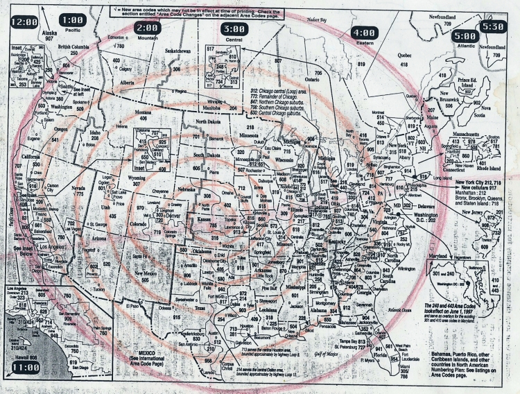
“Seven turn spiral inside red circle”
Was this really a connection, or was it just a convenience of my mind? Even
though I had a car, this trip was still not that much of a convenience, already I was starting to feel
the challenge of being “on the road”. But the unexpected treasures that were popping up all
around me made it more than worthwhile- I felt like I was truly living, and that people had done
this all before, so many times, for the love of experiencing the land, the animals, and the other
people that complete and launch life forward. I felt that the Niobrara river was an important part
of the spiral I was seeing connect the country, and this was the entrance to the Niobrara “area”.
Even though I saw and drew lines on the maps, they were more like “swaths”. Imagine a snail
shell, with the obvious “line” that spirals around, but there is also the shell which fills the space
between the line of the spiral. So, even though I was following a line, I was also concerned with
the swath, the “shell” of that line. So, really, I couldn’t miss! I was simply noticing where the
path was concentrated, dispersed, easy to find or follow, blocked or hard to follow, and what
natural and cultural features lie along, across, between or stand alone in relation to these lines,
these pathways.
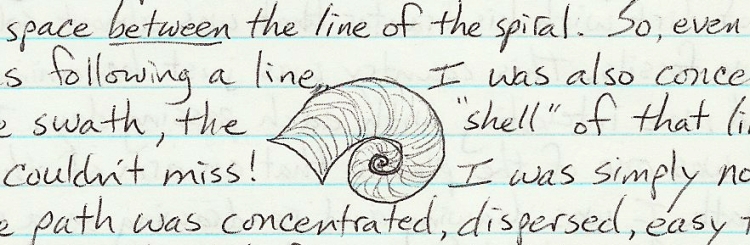
When I left Agate Fossil beds for the Black Hills, I went east, along the Niobrara river (still a
creek at this point) to a dirt road which led north, across a small divide- wide rolling hills, the
high plains, with a mantle of sand, loess, and grasses. On the north side of this wide expanse of
hilly grassland, was the next river, the beginnings of the White river, which flows into South Dakota,
and meets up with the Missouri river. Alongside the White River, the remains of a large fort
from the late 1800’s, Fort Robinson. Large groves of cottonwoods grace the river valley, which at
this month, in this year, was as green and growing as could be. I read some of the signs and flyers
at the fort, which was important historically- in the story of the Cheyenne, who starved through
the winter here, they finally “broke out” and tried to escape in the dead of winter. Crazy Horse
was murdered here while unarmed, by his own “guards”. Almost every hill, every butte, every
creek, has a story of battle, chase, deception; and all this country was lived in, hunted in, born
and died in for thousands of years, just like every where else in the world. Here, the story is unmasked,
unhidden by modern structure and modern story. The old hills are as they were, visible
and feeling, dramatic and solitary; speaking out still- their stories still as much of the front page
news of these small towns as ever before. I went into the town of Crawford, got some ice cream,
and headed north to Toadstood Park. The “toadstool” formations are part of the badlands found
in several parts of South and North Dakota and Montana. This extreme north part of Nebraska is
on the north side of Pine Ridge, which is a nice pine covered ridge of hills that separate (or connect)
the Niobrara river to the White River. Also, the Pine Ridge defines the Missouri river
drainage into it’s upper, northern realm and the central/southern realm of the Platte, the solitary
Niobrara, and the system of the Kansas rivers (Republican, Smoky Hill, Saline, Solomon). North
of the Pine Ridge, something dramatic happened geologically. A mountain rose up suddenly-
Paha Sapa, the Black Hills, and water started eroding the gentle plain very quickly- a flood of
rivers. The White, the Cheyenne, the Little Missouri, all these rivers connect with Pine Ridge and
the Black Hills and all have created spectacular “bad lands” type erosion that has left it’s mark
indelibly on the land. This is the geologic story, the symptoms of a greater and deeper story of
the Earth, and how she grew and aged.
The plains are not an endless table of grass, devoid of trees and people, but many, many hills.
These hills are not from land being pushed up, but they are the land that remains- what water has
not washed away to the sea. Washed, and washed again. This land we walk, this Earth which is
so stable, this endless life keeps reawakening. What was once pushed up as mountain, is washed
down into lake and plain. What was once lake and plain, is washed apart into hills, tables, buttes;
and meantime, the whole may be folded into itself, or punctuated by volcanoes, overlaid by lava,
or be intruded by granite. A dizzying combination of stories for the geologist to explain; but seen
in the context of lifetimes- human life on Earth, animal life on Earth, plant life on Earth, and the
Lifetimes of the Earth herself- we see who is older, who is passing stories down to whom. The
Earth is telling her story, geologists are just now catching up, catching on to the big picture; realizing
that the hand of man is small indeed, and the story of the Earth- they haven’t yet begun to
listen to her tell it. They haven’t yet begun to recognize, to hear, their mother. So while geology
is useful for explaining physical processes of the Earth on her scale, it’s still a bunch of rocks
(rock heads?), dead, inanimate; in opposition to or at least separate from, the life sciences. Life
has been squeezed in, compressed into layers of rock. Man has not yet begun, in a short 900 and
ninety-nine thousand years, to add up to even the thinnest of layers. It could be quite a depressing
study of death, records of death, fossils, layers of rock, dead to the world. I know she is quite
alive though, her bones, her blood, down to her core and up to her sky. Taking a trip across one
of her continents, Turtle Island, part of her flesh and blood, was quite an honor for such a small
child. I am here to learn, possibly; to remember, maybe; to live, hopefully, and thankfully. So,
again a great honor to see, to witness some of her story, to hear the tale of the “Toadstool” park; I
ran along the sandy bottoms, walls of clay, flesh and gravel cemented together, blood. Coursing
and turning, coming from… the land itself. Her story reveled again, and again, telling of mountain
building, erosion, loss, animals buried alive, dying… born by the thousands, eating grass
with teeth designed especially by their mother. Thousands of days blooming flowers. Thousands
upon thousands without freezing temperatures. Eternity, multiplied by 100, and then those eternities
diversified and multiplied again into many more hundreds of- eternities. Millions, the word
millions means eternities when referring to years. Human years, days for the Earth, lifetimes for
the child. All this and much more in those layers of rocks, blood cells.
Nearby is the Hudson-Meng Bison bonebed. A layer of fossilized bison bones (approximately
600 animals) re-discovered by a man tractoring a road. Now, the scientists are trying to tell a
story of bison dying here in ancient times. The bison’s ancestor- much larger, bigger horns,
thicker bones; they died in this one spot by the hundreds, leaving a layer of bones several feet
thick. Several stone spear points have been found with the bones. Human layer- very small, animal
layer, visible; plant layer- large enough to sustain this civilization in oil and gas for centuries.
Layers of Earth, layers of flesh, of blood, of bone. When will science discover these?
While “scientists” argue about whether the ancestors of Indians wiped out the ancestors of the
bison, or not, the present day descendants of both Indian and bison have been wiped out, intentionally,
by those same “scientific” men from Europe. Their point of argument seems to be “if
Indians, or their ancestors, could wipe out a species by over hunting, or if the evidence of cannibalism
or scalp taking or any other thoughtless, barbarous act could be proven to be a part of
who Native Americans are, then, by God, they can’t point the finger at us and say that we are the
horrible monsters that wipe everything out.” These “facts” have been sought out by learned men
of the European mind since the first days of Indians being slaughtered to ease the conscience of
the butcher. To an Indian, a person keenly aware of how an animal can literally give itself; and
aware of how people can give of themselves to help another person live, and how this giving is
the greatest act, the wondrous miracle that begins life to breathing; and aware of the honor in
recognizing, appreciating and giving a humble thank you in return is about as close as we get to
being able to emulate; to be as big as, as giving as, one of those creatures, those beings we call
elk or deer or fish or bison. To an Indian, being able to receive, in humble thanks, a gift such as
the life of one of these greatly generous beings, is a sacred task, a holy responsibility. Not that
killing for killings sake was an unknown danger, it did happen, and stories of it happening to
such a wide and total extent that all the animals got together to wipe out the humans are told. The
only ones who took mercy on the humans were the plant people, who still help them today. The
Indian’s point is, yes, we are human and capable of great harm, but we have learned, we have
safeguards and checks on ourselves now, and we teach these to our children. What happened to
you Europeans? It seems as though when a population is small, that people can check each other,
things don’t get out of hand. The people breaking rules of spiritual conduct and holy responsibility
are few, they get caught, mostly by themselves, and are shunned because no one wants to die
from their mistakes. Now it seems the population is so large that those one or two people now
ratio out to thousands- whole sections of society. To the Indian perspective, we are not the givers
of life, certainly not the takers of life, but our task is to be the humble receivers of life, and to
honor that gift by recognizing who is doing the giving and why. To honor that gift by accepting
it, and the work that comes along with it. There are myriad ways to honor the gift of life. There
are just as many ways to ignore, reject, deny, shut off and separate yourself from that gift. As an
individual, the consequences of that dishonor stay pretty close to that individual. But when whole
families are raised this way, when whole sections of society come to exist in this way, the consequences
go far beyond those individuals to affect a broad range of lives.
These discussions, realizations, thoughts, continued ever deeper, ever wider, in places like this
bison graveyard, or Toadstool Park. When I left these places, I knew there was more to be
learned, more to explore. Only time, spending more time, living more lives, could fill out the experiences
in each of these places. My story was to say, time to move on… to the next place, there
is only so much time for this journey, and I can always come back. This kind of turned the experience
into a survey. Not enough time to experience each place for years, through the seasons-
“only so much time”, I would say. Yet, there was something else, a knowing that time eternal was
also here, that I would have plenty of time to experience all the things I wanted, and even more,
didn’t expect, to experience. How long do you have to watch the sun rise and feel the cool air of
morning before all that changes into the heat of another summer day? I experienced many mornings;
praying sometimes for hours into the morning, into the heat of the day.
Spending the night at Toadstool Park, the next morning set out for the sacred experience of the
Black Hills- Paha Sapa. I didn’t know how I would fare away from the mountains- the San Gabriel,
Sonoma, Sierra Nevada, Cascade and Rocky Mountains had all been a constant support and
survival companion. I liked Nebraska though, maybe I knew the mountains were close by, but I
enjoyed the vacant land, low populations, the county seat of Sioux county Nebraska, Harrison,
has a population of 600- it’s the biggest town in the county. There are many counties like this in
western Nebraska. I instinctively stuck to the borders of states; maybe they were like mountains,
shunned, ignored, barriers to population. It’s not that I don’t like people, I just don’t like what
people seem to have done. Most towns, even small ones, seem to be draining, straining to rip
something off, but normal enough to be innocent of any wrongdoing. None of that I feel in the
woods, the mountains, and the unbroken plains. On the contrary, I’m being given to in these
places. It seems like all the giving that is going to be done in the towns or cities has happened
long ago, or never was, or is, going to happen.
Off in the distance, a low mountain squatted on the horizon. It was Black. I approached in prayer
from the south, crossing the Cheyenne River at Coffee Flat. The Cheyenne River encircles the
southern half of the Black Hills Mountain, originating in the open plains of the Thunder Basin
grassland. The Belle Fourche of the Cheyenne River encircles the northern half, originating very
near the southern fork. They meet, these forks, northeast of Rapid City, forming the main Cheyenne
River, which then flows east to the Missouri river. After crossing this southern fork, I was at
the door to the Black Hills. Praying, thanking the river, thanking creation and creator for this
wonderful place, the honor to set foot in this blessed place. The dirt road I was on followed a
creek, which flowed to the Cheyenne River I had just crossed. Wanting to make a more personal
contact with the water, I stopped at a developed parking area (without houses) and discovered
for myself the wonderful Cascade Falls. A small waterfall, but so pretty, and so much water! A
wide, boldly flowing creek cut all the way across by a curved, natural dam of rock, which sloped
gently downstream, creating a perfect cascade of foamy white water. The water looked very fresh
and clean, with lots of grass and growing water plants alongside. I prayed and made offering of
thanks and thought how nice it would be to come back here and swim. Hot Springs town was
still about 10 miles away, so I slowly drove on toward town. I only got about a mile though before
I saw a beautiful little glen along the river, and a sign for Cascade Springs. Could it be? This
is the source of the creek, which, only a mile away, was already quite a river? I parked and approached
an area thick with willows and trees. There were several pools, cement rings with water
overflowing, one with a gazebo over it, and following all this water a short distance downstream,
I saw the creek appear, with all the water I just saw at the cascade- it was like a river coming
right out of the ground! This was enough of a sight to convince me of the special nature of this
place, as if I needed to see wonders! I was already so full of the feeling of this place, this ancient
hunting ground, this place of water and grass and trees and plants- an island in the sea of plains. I
slowly drove the rest of way to Hot Springs, carefully observing how the land changed, what is
here, rolling hills, little peaks, green green grass thick and varied; the road turns to pavement and
heads straight into town. A slight rise in the road just before town, and a whole new scene lays
before me- a field, so green and pretty, lined with red hills,
encircles the town. A sign for the
mammoth fossil excavation on the edge of town- people and animals have been coming here for
a long time. I found Tim’s parent’s house and cabin right away- they had sold the house and
moved to Omaha, but kept the “cabin”, a small summer house in town, for hunting trips. The
cabin is right next door to the house, right in town, in one of the residential areas. I set up house
and started enjoying my little home right away.
Each morning I would go for runs through the town, finding the Veterans memorial home a good
place to run undisturbed; I often went there and ran around the rambling grounds. The old part of
town was a long snaky street that followed a creek, Fall River, and had, as one of its sources, a
hot spring that had been developed into a public swimming pool. The pool was large, chlorinated,
and indoor. I went in only once or twice, with the family I met at Wind Cave National Park.
I had found out that Kym was working at Wind Cave, so I went up there a lot,
sometimes spending the night. The nights were warm and mild, the days could be hot and sultry,
but sometimes the weather was just perfect. I could see how this place is such a refuge, winter
and summer. The hot springs and trees of the forests protect you in the winter, and the elevation
and again the trees provide coolness and shade in the summer. Something else the Paha Sapa
provides in the summer is the ability to attract thunder storms. The thunder beings dance and
breed here, sometimes lingering for days at a time. This summer was relatively dry, but all the
spring rains and winter snows kept the plains green until September. Wind Cave had a tiny natural
opening, and today there is an elevator, which takes you down into the cave system. I didn’t
go in, but I saw pictures of the “box work” calcium deposits, curtains, straws, ice cycles, and
maps of the cave system. The cave is in limestone, which breaks fractures and dissolves into a
pattern of right angle branches. These form a horizontal layer, but are connected by natural shafts
to lower layers. These layers and the horizontal, right angled caves are still being re-discovered
daily. Hundreds of miles of caves have been mapped, and it is suspected that the entire Black
Hill is laced with thousands of miles of natural caves, with just a few outlets to the surface. Jewel
Cave is a small national monument to the west (about 20 mi) of wind cave. Worlds within worlds
within worlds. Wind cave also has about 45 sq. Mi. of natural prairie and forest protected in National
Parkland as well. There is a buffalo herd, and many prairie dog towns. The sourberries
were plentiful and ripe, and service berries could probably be found there too. I stayed around
Wind Cave for a few days, met Kym’s boyfriend, and Jackie and Rich, and Dawn.
Jacke and Rich had 2 kids, a boy and a girl, one of them was having a birthday, so we
celebrated with games and prizes. After a few days, I decided to get going on my next leg of the
trip, which was to go all the way around the Black Hills via the “race track”, an ancient, legendary
feature of the Black Hills. Starting back in Hot Springs, which also has some little springs,
still used for healing, a kidney spring and another one, both protected by gazebos or similar
spring boxes, with pipes coming out of the ground. Hot Springs is also home to a large mammoth
elephant fossil skeleton which is being excavated/shown in it’s own museum which was built
over the excavation site. Quite a tourist draw. I was more impressed by the large bowl of green
grass over slippery red clay which the town and the area around it, sits in. The whole place is one
gigantic large animal trap. Natural traps, box canyons, blind turns and sudden drop offs or cliffs
are favorite hunting places of anyone who has large herds of galloping animals to hunt. The Hot
Springs area is one of those ideal places for animals to come and graze, get water, even healing
mud and water, and seek protection from the harsh plains. But it was also a death trap. With steep
gullies and ravines, full of rushing water, and slippery mud slopes worn bare by so many animals
coming down to drink, the area became a mud pit trap. Wooly mammoths would sink down into
the mud pit and not be able to get back out. I started following and mapping the race track west
of town- following dirt roads and getting out of the car and walking trails as well, trying to see
the limits and boundaries and the land that defined the race track. In some places it was easy to
see, easy to follow. In others, the hills twisted and sunk, obscured and doubled the long, slender,
winding valley that encircled the Black Hills. Long ago, before Indians hunted buffalo, it was the
other way around- buffalo killed people. This situation was disagreeable to the Indians, so they
pleaded for a remedy. The creator heard the plea and decided that a contest would decide the
matter. The buffalo people could choose a runner, and the Indians, since they had oinly 2 legs,
could pick any animal to race for them. Buffalo slim, the fastest female, ran for the buffalos’,
while the Indians picked Magpie to run for them. All the animal people ran along, as well as
many 2 leggeds. Everyone ran so hard and so well, that the creator honored everyone by turning
the race track red- in honor of the blood that was left on the earth from the torn feet of the runners.
One lap around Paha Sapa, who ever came back first was the winner- here comes buffalo
slim, way ahead of everyone else, but with Magpie riding on her back! As they approached the
finish line, Magpie flew up off her back and swooped down to win the race. So Indians won the right to hunt the buffalo (again) and the race track became a favorite hunting ground.
############################################
Pg. 160
Water and grass, the cover of trees, all the way around the huge circular complex of limestone and granite rising out of the plains. A marvel of nature , of topography, geology, biology, hydrology, beauty, uniqueness, a true blessing, an obvious blessing for all to see. The hogback, the triangular shaped bulwark against the plains, the Dakota sandstone-impervious to weather, standing up in a continuous band; the outer circle, popped up with rising granite, the lifted limestone. This razor hogback, this Dakota sandstone, this hard layer, lays over the soft, red layer of clay skin- but where it has been lifted, the hogback, the red racetrack layer is exposed, weathered, grown over thick with grass, trenched deep with streams-irregular, but continuous around the circumference of Paha Sapa.
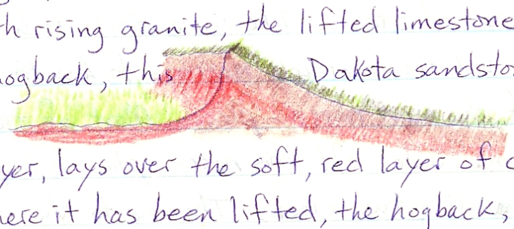
Slowly, thirty-five mph, following and stopping along the dusty roads that skim the edge of forest, prairie, farm and stream. I would get out, walk to the edge of fences, take pictures, trace on the forest service map I had of Black Hills National Forest, the edges of the racetrack. The outside edge, hogback, the inside edge was often a limestone cliff or ledge with thick forest atop.
Following Hot Brook west from Hot Springs, another of the streams that feed Fall River, I traced it to its source, the middle of the racetrack, while yet another branch, Cottonwood Cr., went north into the forest to Cottonwood springs and beyond. As with Fall River, there are numerous small creeks that have broken through the hogback, creating “buffalo gaps”, places where the buffalo and people could easily flow into or out of the racetrack. I saw two of these gaps, the first having a fossil bed of cycads, which is now a national monument. The second, much narrower, named Red Canyon, as most of them were small, red colored draws. The circle starts to bend northwest and the racetrack narrows to less than a mile, one of the most narrow places. Most of the racetrack is about 2 miles wide. At this narrow place is a pass or saddle, separating two creeks. The one to the north, Pass Creek, flows out through the hogback-making the third and final gap I would see that day. As I crept along to the northwest, I began to study the map for a camp site. The next day I would reserve for slowly approaching and visiting a very special gap in the hogback- Whoop Up Canyon, one fo the most intensely pictographed and studied ancient sites in North America. Teepe Canyon joins Pass Creek, and I followed this canyon/creek northwest almost to the Wyoming state line before heading north into the forest. At that point there is a beautiful little ranch with wind power and pretty Elk mountain sitting up just to the west.
After camping for the night and taking a little run down forest roads in the morning, I headed back to the racetrack, which now had paved Hwy 16 running through it, from Jewel Cave to Newcastle, Wyoming. I entered the highway and slowly went west to the Wyoming state line. Just after crossing the state line is an intersection, and just past that intersection the racetrack seems to run straight into a steep hill! My instructions to Whoopup canyon were to turn left at that intersection, and that is just where the racetrack bottom land seemed to go as well. I could see how Indians could easily turn a herd of buffalo here with men on top of the steep hill to the west- where the racetrack actually continues, and turn them into the easy going, flat terrain which branches off to the south. This little side branch of the racetrack headed straight for the opening of the narrow, ever deepening, ever narrowing trap- Whoopup canyon. Before I could get to that opening however, the dirt drive ended at a gated fence. Asking about access at the trailer house there, I met the Hamby’s, and had a long discussion with the husband. He told me about how he had found numerous knife blades and spear points, arrowheads and other stones in Whoopup Canyon. Then he showed me the prize possessions, with comments about how the BLM wanted him to be the gatekeeper- he said no way! Didn’t want the responsibility, and wanted to continue to exploit this resource, for him, a treasure house of ancient artifacts. He told me about Lusk, and how rich that area still is with stone tools.
I went through the gate and drove through very tall grass to a parking area. From there I walked down into Whoopup Canyon. There are interpretive signs from the BLM along the path- pointing out the major petroglyph panels and that this area was used as a big game trap- the animals being corralled and selected or stored for ritual, for food, for ceremonial thanks. Paul Fernhaber had told me about this place and given me directions. He had described the excavation at the base of a petroglyph panel going down 10 feel into the ground, and that there were still petroglyphs on the wall at that depth! I walked down the canyon, then up, along the high ridge to the west. Looking down I could see the twisting corridors below, leading to a large meadow, surrounded by rock walls, with one narrow canyon leading out. There is a whole network of canyons, corrals and narrow squeeze chutes in this area. There were signs of cattle grazing, and the large, infamous LAK ranch loomed to the west.
The petroglyphs, including elk and moose, buffalo, deer and sheep are phenomenal, as usual. As I looked down from the ridge, I could see the drama of thousand of animals, over thousands of years, many generations of people- the opportunity to see, to hold these animals in a pen, close up- what would be the price for doing such a thing? An old law that has been known and taught through the generations here on Turtle Island is that the greater ones possessions, whether they be physical, emotional or mental, or spiritual in nature, the greater one’s possessions, the greater one’s sacrifices. You don’t get to have anything, really, without giving something of equal value in return. So what would we have to give in return for having these herds of animals come into our corrals? This is what I thought about up there; I knew it wasn’t like the idea of capturing and killing animals, as many as possible, just so people could east some meat. First of all, the land during this time was rich with edible plants, wild potatoes are still plentiful, and small animals, as wells as high protein seeds and corn, squash and beans, which were cultivated along the rivers, stored and carried great distances, which all added up to not really needing to slaughter hundreds of large animals for the sake of survival. Hundreds of thousands, millions of large animals were available, but again, the law of giving and receiving, let alone the fact that just facing these people of such vast wealth, these buffalo people, these elk people, would humble a human being greatly. To ask for even one buffalo- which one? Not an old bull, not a new calf, not a pregnant cow, which means a human would have to know, to sacrifice in order to know, which is which? By sacrifice I don’t mean kill, that is the wrong idea. By sacrifice I mean to give something up, not something useless or even something you could use but no longer need; but to really sacrifice means to give up something you really have, maybe your attention, maybe your clothing; not that a buffalo would need your clothing, or your attention, but these are things that may wear out, become sacrificed, in the process of learning one buffalo from another. A young man comes back to camp, his clothes in shreds, exhausted, but now he knows which buffalo is pregnant, which one is sick, which one may offer itself to the tribe of humans. Now the next sacrifice must come, the offering for the life of a buffalo. Not just the body of the buffalo, but the spirit of that animal, a powerful spirit, may it be released to the humans as well. What are we to do with this spirit? How can we work with this? Keep from being killed or driven insane? These are real questions, still valid today, as well as back then. Many more questions, problems, challenges, and gifts the Indians of those times had to face. So many in fact, that we can’t really imagine what it was like. The intensity of so many animals, so much life! Ironically, it probably wasn’t so much a problem of physical survival, as portrayed by modern historians, but really one of how to deal with so much life, so much spirit. The physical fact being that a human could more likely be crushed by so many buffalo rather than starving from lack of food. The spiritual challenges must have been immense- nothing less than the spiritual survival of the human race, on this continent at least. It’s hard to imagine, especially in this modern society where, if one has succeeded in capturing all the physical necessities of life (i.e. financial necessities), then one is “set”; it’s hard to imagine then what the other life-threatening challenges there are that exist to challenge the continuation of the human race. Focusing on the individual, as this society does, individual success is what is valid, what is real, and what matters. The human race, from this perspective, goes on no matter what an individual may do, become, or fail at. There are some things that are recognized as being good or bad for society at large, but not much short of a wild spree of nuclear missile launches really makes an individual conceivably capable of destroying the human race, and again, this is on a physical level. What could wipe humans out spiritually? That question is one which Western man has really shied away from, as it is one that is not only pertinent to his history and mythology, but also one which is taboo for him, should not be brought up- lest someone go ahead and do it. Ironically, he is doing it, and has been denying looking at that, for those very taboos, which are too little too late, for the switch has already been thrown, the die cast and the decision made by the only one who could make such a decision. The man himself. It’s not such a hard question to see the answer to; there are many things that kill from within, fear, hate, fighting- these are not things to hide or hide from, they are part of every human, and to each comes a day when they must be faced, but hopefully faced not alone (for we’re not equipped to do that) but faced with community of human, animal, and plant people who live here as well as the best friend of all, the love of the great creator who started it all.
These questions of survival and lessons of survival were very pertinent to a relatively small band of humans surrounded by the awesome, raw, gentle, and numerous forms of nature. Today it seems as though nature is surrounded by humans. Today it seems like it’s up to us humans how much nature will remain for future humans. Imagine the other way around; like it’s up to nature how much humanity will remain for the future of nature? Even though it seems like humans are deciding the fate of nature, instinctively we know it’s the other way around.
Leaving the Whoopup Canyon area, back at the parking area, I saw a school bus coming in. It was full of Dakota Indian men.
Going back out to the highway, to the racetrack, to see the intersection again. The place where animals turned, or were turned by people with two legs. The door.
I went northwest, following the racetrack up over that steep hill, and at the LAK reservoir on Beaver creek, I turned off the racetrack to the west and drove into Newcastle, WY. Visiting the museum there, I met two old people who told me some things about the area, about Whoopup Canyon, and how, if you ever see a ball of lightning sitting on top of your horse’s ears, you had better get off quick, because when that ball snaps, that horse is going to go down. I watched a movie there in Newcastle. I think it was Mulan, the Disney movie of that summer. In the thousands of miles I traveled that summer across the great plains- to dozens of small towns, I think about three or four movies were playing, the same three of four, in every town, but only one per town, please. To get a hold of the most common, the most mundane, the overused and most copied bit of commercial merchandise produced in American cities, was still something of a novelty, something of an enjoyment out here on the Great Plains. In the wide open spaces, where nothing of commercial America exists, where nothing is produced but beef or coal or crude oil or the lumber of small forests, commodities for the stock market, raw materials- for from the refined products of the cities, a coke or a McDonalds or a Disney movie looks like something of a high culture, distant and exotic- yet somehow familiar.
I went back to the narrow stretch of racetrack at the LAK reservoir. This is where the circle turns north directly, and following dirt roads again along Beaver Creek, I approached the little shred of high ground that separates the south flowing waters of Cheyenne river from the north flowing waters, the north fork, the pretty fork, the Belle Forche of the Cheyenne river. Paha Sapa, so symmetrical, even in the rivers that flow off of and surround entirely the round and rounded, the circle and encircled Paha Sapa. Mt. Pisgah on the west side of the racetrack, and now it widens out; two, three, four miles wide. Reaching the north/south divide- the place where the Cheyenne river meets itself, I went up into the forest to explore this place a little more. Cattle grazing is common in the forest meadows, so they have been rendered rather unexciting. There is much private land, old ranches, mostly along the road corridors. I drove back out to the racetrack, and now, north flowing waters, the Belle Forche headwaters, I followed them as the racetrack turned to the northwest, toward Matoe Tipi. Matoe Tipi, Bear Lodge, is the Dakota name for Devil’s Tower. The reference to ‘devil’ in many western place names in English, is to the “devil cat” or mountain lion that habitually dwells in places of high, rocky, torturous (to humans) terrain. Having visited this ancient holy site last year with Mugs and Pascal, I decided to focus what little time and resources I had on exploring country I had not seen before, and to completing one circuit around Paha Sapa, which having not yet gone half-way around, seemed like enough of a challenge at the time.
Following the nearly five mile wide racetrack here, I approached the beautiful Inyan Kara mountain to the west- the racetrack netted with the many veins of Inyan Kara creek. The road is paved from here to the town of Sundance, which lies just off the racetrack to the west. At this point, a major interstate (I-90) comes into the racetrack, and follows its easy terrain all the way around the northern edge of Paha Sapa, almost to Rapid City. I came into Sundance to see the racetrack expand to its widest pint, about 6 miles, forming a huge grassy bowl between Paha Sapa and the Bear Lodge mountains to the northwest. This is where the racetrack turns and straightens into the north, then starts to bend northeast at Medicine Lake.
It’s not hard to imagine that the huge, grassy bowl of the racetrack near the present day town of Sundance is where sun dances were traditionally held. This is such a powerful and sacred ceremony however, that I’m glad I didn’t see or read any evidence of this in the town of Sundance, which didn’t seem holy or special or feel particularly good. The museum was in the old jail, downstairs below the courthouse. There were some fine things in this dungeon, but it made me appreciate the Newcastle effort even more. There was a monument to the Custer expedition outside of the town, but it was far enough for me to be up at sixty mph when I passed it. I followed I-90 at this point, heading northeast, mainly because it was the only road which followed the racetrack. I had heard about the Vore Buffalo Jump coming up, and didn’t want to miss it, but after about six miles of interstate, I turned off on a side loop that went up to the forest, then back down to the I-90 at Beulah. As soon as I turned off I-90, I saw along the side road some major cliffs along Sundance creek. I don’t know how old they were, or if they were used in Buffalo hunts, but it looked like they could have been used that way.
Going up onto this corner of the forest, I could see down on the racetrack, and see the part of the great spiral around the country that I had been sketching in on various maps of the U.S. This sketching and re-sketching of the spiral path was not easy, although the general, intuitive feeling was obvious; the specific trace always seemed elusive and fluid. It was hard to trace in the entire spiral, especially without having been to these areas. I thought, “Once I’m there, I’ll be able to feel and see more specifically where these paths are.” Here in the Black Hills though, I felt like this whole mountain system was “on the path”, and the racetrack being the pathway into and around the mountain. This particular place though, is a natural opening between two mountains- a natural migration path, a “pass” between the Bear Lodge mountains to the north and Paha Sapa. I went down to Beulah and then back a few miles to the west to the Vore buffalo jump. The site is wedged in between I-90 and the frontage road. Partially excavated, this steep sided pit in the ground has a layer of bison fossils 10 feet thick at the bottom. Many thousands of years this trap has been here- but to the sea of bison that flowed to this area, this trap was like removing a bucket of water from the sea. Like any point of entry or interface with such a vast and elemental part of nature, this site is a sacred place, a blessing to be cherished and honored by the human beings. The red pit was silent, but vibrant, still alive with the blood of so many centuries, that this time seemed like a small, quiet moment. I turned around and continued east to Spearfish town, which was another wide bay in an already three mile wide racetrack. After checking out the town, I drove up Spearfish canyon to find a camp. There are many suitable campsites in the area, I spent some time along the river and saw some families combing the river bottom for fossils and other rocks. Just a glance at the rocks in the creek and it becomes obvious that there are many different kinds of minerals here, little prospect digs are everywhere, and some names like Tin(town) Mineral hill, Cement ridge, Carbonate, and Galena remain. It is now January of 2002 as I write this, and I’ve heard recently that the big gold mine in Lead is finally closing down. Back then in 1995, I had heard that the mine went over a mile deep, and the temperatures at that depth, even with air circulation coolers, was a stifling 105 F. Men went down to work for days at a time, then had to take days off to recover. Even with the high rate of pay, the men couldn’t do it for long; their bodies would just wear out. The infamous Black Hills gold; the greed for gold was, in 1874, so great that the U.S. government sent troops to protect illegal mining activity. Illegal, because at the time the Black Hills had been given by treaty to the people of the plains- human beings north, south, east and west of Paha Sapa. The violent tearing of land, the armed guards, the cursing savage miners, the wholesale deforestation, animals wiped out and scared off, poisoned by the mining; the air, the land fouled and cursed by this armed gang of violent men. This describes the scene in the northern Black Hills, around Lead, and Deadwood. This action sent Crazy Horse to war against the lawless squatters and miners, which prompted the U.S. government to send Gen. George A. Custer to wipe out the human beings. A disagreement? Or a total mistrust of groups of people who were on not only different pages, but on different worlds. ÒYou are not of our world,Ó could be said equally by Indians, by human beings; or by people who considered themselves the only human beings worthy of the name of civilized man. The clash of those worlds is still evident as the noisy foreigners smash rocks together to open their insides. Is it a fossil? Nope. Smash. Another rock, and another. Yell. Smash. Yell.
TTTTTTTTTTTTTTTTTTTTTTTTTTTTTTTTTTTTTTTTTTTTTTTT
How to deal with the alien, invader, refugee, settler, prisoner, resistance, workforce, imports, exports, culture, ideas, religion, habits; how to deal with the alien coming into our country, the alien already in our country, the alien in our town, in our house, in our own bodies? How to deal with the alien element is only becoming more of a question. It is not a question that has been answered by history, by actions; but one that begs and multiplies. A new challenge for the human race. New because the old methods and ÒwaysÓ of dealing with the alien have not really been ways that resolve the conflicted practices. The old method of killing, hiding, ignoring, defaming, marginalizing and denying the alien world is no longer viable. There are too many aliens outside and inside of us- no escape now, no saving this world. ItÕs time to look into the face, be scared, sacred, angry, and finally accept that this face is our own. ItÕs a hard thing to do, because it leaves one with nothing to do, apparently. But you donÕt know what to do until you reach that point, that place of transcending being able to do something- to that place of not needing. The fear is one of being taken over, giving up, giving in to the enemy, surrendering, and even worse, complicity. The fear of extermination, or worse, being ignored to death by the occupying army. The fear seems justified, there are plenty of peoples who have been exterminated, or ignored to death in various stages today. From this place of fear it seems the only way of hope is to fight, for a long time, forever.
TTTTTTTTTTTTTTTTTTTTTTTTTTTTTTTTTTTTTTTTTTTTTTTTT
I camped up there in the hills above Cheyenne Crossing, the ford across Spearfish creek. The next day I drove down into the mining and casino crap of Lead, Central City and Deadwood. I couldn’t wait to get out of there. I drove back down to I-90, just eat of Spearfish and started tracing the racetrack again. At the approach of I-90, the racetrack was huge, but seemed to disappear to the east. The four or five mile wide Centennial prairie is cut off to the east by a sharp ridge that sticks out to the north from the forest of Paha Sapa. This ridge ends at Elkhorn peak, just a half mile from I-90 and the now squeezed down racetrack. Only a fourth mile wide here, the racetrack snakes around the north edge of Elkhorn ridge, with I-90 firmly planted in the middle of it. This chute is about two and a half miles long, then it opens up again just before the town of Whitewood. I had to make a big circle drive all the way around Elkhorn ridge to really see what was going on here with the racetrack. Another large embayment (Centennial prairie) with a squeeze chute at the other end. This was yet another hunting trap or corral. In this part of the hills I encountered “saw flies” for the first time. One of the most annoying flies ever. They don’t shoo away, they stick to your skin, and if left there for a few seconds, they start to “saw” into your skin with their tongues. This feels like a stinging little bite, enough to make you try and shoo them away, but then, then they land right back on you and the whole thing is quite maddening. I finally got them out of my car and off of my legs and drove southeast, now on I-90 toward Sturgis. This is where I realized that the small, steep butte just off to the north was Bear Butte, the most holy of places in this holy land. I would visit Bear Butte later in this journey, for now, I just looked around in Sturgis, a pretty town, as Spearfish is, and kept going down I-90, mapping the racetrack, going through the towns of Piedmont and Blackhawk. There are some caves and caverns on the map in this area, but no real forest access roads along this stretch from Sturgis to Rapid City. I got to ÒRapidÓ as its called and checked out the Lakota museum there. its a beautiful museum, downtown, with a big lawn, harboring old Lakota men- hanging around, seemingly to be near their culture, their fine things.
I noticed that there was a buffalo processing plant in Rapid City, so I asked about getting a box of buffalo fat. They did processing later in the year, in the Fall, so I would stop here again on my way back to Hot Springs from Canada.
Continuing south along the racetrack was difficult from here to Hot Springs; there were no roads that followed along or in the racetrack, as there had been. There are four paved roads which cross the racetrack within ten miles south of Rapid City, so I checked out some of these. The main one, Hwy 16, leads toward Mt. Rushmore- a place I avoided. The racetrack seemed to stay fairly narrow along this north-south stretch of the eastern side of Paha Sapa. There is a highway that runs north and south, but it parallels the racetrack to the east of the hogback, so a person cannot see the racetrack unless you go cross it on one of the east-west roads, or unless you walk or ride down the length of it. There is one more paved, east-west road about twenty miles south of Rapid, and this leads into Custer State Park and on to the town of Custer. I didn’t ever go in to Custer park, its a state park, and they charge an entrance fee. I heard that its a great place to see wildlife, though- a large buffalo herd and over a hundred square miles of land. The park’s boundary is just west of the racetrack, it then covers the next eight or nine miles to the west- the forested limestone hills and rolling grasslands cut deeply by meandering creeks. In the middle of the park in French Creek, a roadless area that some of the guys from Wind Cave N.P. traversed on foot. One of the most natural, least visited places in Paha Sapa. From this paved road into Custer park, I turned south on a dirt road to follow the racetrack for a few miles before the road turned east again and met up with the paved Hwy. 79. For the next twelve miles, there were only a couple of small, private dirt roads that crossed the racetrack, and none that followed its length. This was nice actually, to know that there was at least a part of the racetrack with no road in it. I felt lucky to have been able to drive (how convenient!) as far as I had. Most anywhere you want to go in this country, there is a road you can drive. The few roadless areas seem like anomalies- to think, a hundred years ago, it was the other way around. I wanted the roadless areas, cherished them as real and protected places, places where you had to take your time, places that challenged the body of the human being. This was a paradox- I wanted roadless areas, to walk, to go by foot, to traverse the land as it was meant to be, and is most meaningful for us still; but also I was glad to have the car, the time machine, to transport me through regions- there and back, to Canada and back, to the store and back- its such a mental game, this saving of time, this ability to do more, to see more, to experience more. I wasn’t experiencing any more than I would by walking, so why did I drive? It was comfortable, I was use to it, and I did feel driven by time. I felt like I had a certain amount of time to do this traveling, and that this was not a self-imposed time limit, but one that was part of a natural rhythm, a cycle.
Driving along Hwy. 79, out on the plains like that, even though just a few miles east of the racetrack, it was a different world. I felt lost and lonely, separated from the mountain like that. I finally reached the turn-off- Hwy 101, back to the west, back through Buffalo Gap, along another Beaver creek to the racetrack, Martin Valley, and back to Hot Springs.
WWWWWWWWWWWWWWWWWWWWWWWWWWWWW
Basking in my sense of accomplishment for having done a portion of what I had set out to do, I relaxed in Hot Springs for a few days, eating, exercising, praying, and resting. On one of my trips up to Wind Cave, I saw a book by Paul Gobel in the visitors center. It was a book about the racetrack- an illustrated children’s book. I thought about Jill and wanted to get it for her, but it cost about twenty dollars. I had started to make a leather doll, with buffalo hair braided to look like real hair. I was just finishing the doll when I got the idea to trade it to Jackie Garicke for the book. She worked at the visitors center and could get books at a discount, and she had a daughter who would love the doll. So we traded, and when I gave to book to Jill months later, she told me that she knew Paul Gobel personally and loved his work. I was starting to get kind of desperate about money, but found out that the Garicke’s had just bought a house in town and were fixing it up themselves and would need help later with the sheet rock. Rich was a plumber and general builder, so he was doing most of the renovation, but could use some help later- maybe by September. Jackie was interested in native plants and especially medicinals, so she showed me the purple cone flowers growing on Battle Mountain, a small, steep hill just east of town. A large state preserve spreads around and east of the mountain- about five square miles. There was so much to learn about the plants here; all the varied grasses, flowers, herbs- the trees were fairly familiar western forest varieties, but the diversity of herbs and flowers just seemed to go on and on.
This rest was brief, again, pushed by lack of money and keeping to a time schedule, I got ready for the continuation of the journey- north to Canada. I told Kym and the others there at Wind Cave that my plan was to go north, through the center of Paha Sapa, stopping and hiking in the Black Elk wilderness, maybe spending a day or two there before heading north again to follow the Montana/North Dakota border to Saskatchewan, Canada. I would come back this way to stay in Hot Springs again in the Fall. So saying this and getting wished well and welcomed back, I set out from Wind Cave, slowly driving the winding forest road, keeping my eyes open. I drove through the town of Custer, which lies in a very open forest meadow. Very touristy. I just checked it visually and drove on through. I drove on up to the Needles area- the center of Paha Sapa where the limestone, forested plateau is pierced by granite spires and domes which push up to over seven thousand feet. Sylvan lake is here, looking like any Rocky Mountain sub-alpine lake; the Cathedral spires, the Needles, and on the northeast side of this granite area, the Mt. Rushmore, its granite sides charactered with the faces from human history; very recent human history.
MMMMMMMMMMMMMMMMMMMMMMMMMMMMMM
I drove through the state park area of the Needles and Sylvan lake, into a stretch of private land between that park and Custer State Park, whose entrance was just two miles to the east. Along this stretch of private land lay forest service administered wilderness area to the north and south. I turned to the north on an access road and drove to where it ended; a trailhead into the Black Elk wilderness. This is where I parked for the night, and feeling comfortable about leaving my car here for the night and next day, decided to hike in and camp out under the stars. The sky had the familiar clouds of summer; the Thunder Beings seemed to be gathering around these granite peaks; but I felt they would break up or move on as night time cooled off the air. I was so wrong. Camping off the trail near Grizzly Bear creek, I found a fairly level place, away from trees that could attract lightning, among some large granite outcroppings that looked like whale backs breaking the surface. Watching the clouds as I lay down to sleep, imagining them breaking up, moving off the mountain tops, and seeing the reality become quite different than what I had hoped. The clouds stayed, began to drop rain and grew thicker yet. Well, I thought, a thunder shower, and then they will break up and move on. The rain really started coming down, the lightning too. I thought about going back to the car, but it was so dark, I had no light, and so I committed to weathering out the storm. I had my space blanket tarp pulled over me diagonally for maximum protection- I was staying dry so far, but was fairly uncomfortable mentally as the storm continued without a sign of letting up. It was probably only a half an hour, but a wide awake half hour, and finally the storm started to break, the rain slowed to a drizzle and I looked out to check the clouds- still thick as could be. I fell asleep for maybe an hour or so before the storm started up again. This time the lightning grew closer and the rain started to flow under my back- I was getting wet, but this was summer time, so I didn’t think I would die of cold. The lightning was flashing so bright, that even with my eyes closed, the light was coming through. Now with the rain coming down hard, and with my commitment to stay put, the most intense part of this test began. The lightning came so close and was so frequent, the deafening sound of thunder simultaneous with the blinding flashes of light, and this happened several times each minute, that I started to feel the fear of death, the fear of being hit right in the face by a lightning bolt- drilled right through with thousands of volts of electricity. My wet clothes and body being good conductors, the big slabs of granite, rich in iron, another good conductor of electricity, these thoughts only fueled the fear that grew each minute and became unbearable. To say I was paralyzed with fear wasn’t quite right, I did feel as though I could move (to where?) if I wanted to, it was just that this was it, there was no place to run, no place to hide, all my safety and comfort had been and continued to be, stripped away. The feeling became more and more one of looking down into the barrel of a gun, and God had his finger on the trigger, and with each passing minute, my building fear was only matched by my growing knowledge that God was going to pull the trigger, right now. BOOM! Another thunder clap right in my face. There was literally no place to go, not even in my thoughts, everything was too immediate, too imminent. I now knew how helpless it is to face God, to face Death, to have nothing, nothing. Nothing but the feeling of imminent death. There was nothing else. I did not want to have this experience, but on some level I knew I was facing a very dark, very dreadful human fear. Was I facing it with courage? I can’t say that I was. I felt terrified, like I was going to God with nothing in me but fear- it was not a good feeling. There was no time to calm down, no time to relax between thunder bolts- only that dark, infinite barrel of the gun. There are some experiences you have that are really horrible, really scary, really intense and challenging- but you know that it’s going to be over, that it will end, that you will get through it, look back on it, grow from it, and maybe even laugh about it. This did not even come close to entering my mind. This was not one of those experiences. This was unlike any experience I had ever had, not one to be wished for in any way, shape or form. This was death. Fear of death realized and death from fear realized. All the while with God looking on, waiting, me knowing that this is what it’s like to stand, or lay, before God with none of that noble goodness, no memory or substance of the ego saying, “Alright, I’m going to die, it’s o.k., I’ve led a good life, I feel good, “I’m ready”- no, none of that. I was totally unready, unarmed with any of what we claim as humans to be our common sense, or our innate goodness- no, no protection from thought or fantasy or reality, no nothing. Bare, naked (even though clothed), wet, stripped of sense, comfort, options, I was there completely unready and unprepared to die. What I wanted was being killed, my ego is what wants- wants comfort, reliability, sense, options, places to go, things to do, a sense of self, of a good self, one that is prepared and able to face life’s challenges, including death.
There have been many times in my life when I have been brushed by death, and known that I had just had a close call. Again, this was not like that at all. This was an absolute knowing that I was going to die, with no other options, no conditions, nothing I could do or say or be to change this fact. Not only that, but the way I felt could not be changed or altered in any way either. When you’re terrified, even helplessly terrified, you still possess at your core a will to fight whatever it is that is terrifying you. Fight or flight instinct, and when the flight option is take away, all you’re left with is fight. Can you see the ridiculous of my situation? What blow could I strike? What does a blind, cold, wet, prone human have to fight a thunderstorm with? Not only was it ridiculous to have this fight instinct at my core, but in the face of God, to where I was returning, to whom I thought I could surrender- I felt completely humiliated in my ability to face God calmly and openly, with love, and acceptance; with the knowledge that my soul would be opened up completely to reveal the true inner contents of my being. BOOM!!
Another thunder clap and another, and slowly, slowly, I perceived that the thunder was moving away. More rain, my back and sides completely wet now, I began to worry about how long this night would be. One more time the thunder beings came that night, this time not as intensely in my face, but more rain, and it was all I could do to remain calm and try to rest. After the third thunderstorm, the sky calmed down, but remained cloudy for the night. I lay awake, trying to sleep, trying to relax, still not knowing if I would really make it through the night, or worse, if it even mattered. The shame and guilt I had felt at being so scared, and for fighting my death, was very great. The only thing that helped was the humiliation. The experience of extreme humility in the face of this experience is what gave me strength for months and years to come.
MMMMMMMMMMMMMMMMMMMMMMMMMMMMMM
The night finally began to give way to the earliest inkling of dawn. The rain had stopped, it looked as though the clouds might even let in some sunlight today. I got up and shook off the rain water, started to dance to keep warm, started to pray, to say thank you creator for this life, for my humble little self who is so weak. I really had to dance hard to stay warm-waiting, waiting for the sun to come up over the ridge and dry my clothes. Here it comes! The first ray of light, high up on the mountain, and slowly, evenly, the sunlight spread down the sides of the mountain; and finally down to where I was. I danced and sang and hung my clothes up to dry and was so thankful for the warm sun on my body. I prayed for a long time and really tried to allow the experience I had to sink in, but it was the kind of experience that most human beings would want to shut out, to deny, to get beyond or forget about. Every time I thought about it, I realized that there was nothing to be done about it, no way to fix it, or make it better. It was the kind of experience, I told myself, that I was glad to have had, but in no way would have wished for. I had died. And now was alive. All through no doing of my own, but at the mercy of the powers of life and death.
Had I really wished for that experience? I did put myself there, had wanted to go to this place; and now everything was so beautiful, the mountain forest after a rain. Everything was glistening, fresh and green and vibrant. I packed my things, had some food, and took to the trail. Right away I saw the most incredible mushroom I had ever seen. I had only seen them in books on mushrooms- there was always the color glossy photo of the deadly fly aminita mushroom. Bright red, flat as a tabletop, with little white sprinkly flecks on top that looked so fake, so much like someone had just sprinkled some white, chopped flakes of mushroom on top, just to add garnish to an already improbable creation of nature. But here it was- just like in the books, it must have just come up with all the rain last night, in its full glory, untouched, unblemished, totally perfect in its redness, its flatness, its roundness, the white flecks- everything. The top was so red, it looked like fresh fire engine red paint. Nothing in nature I had ever seen looked so man-made, so unnatural, so surreal as this piece of mushroom work.
A little while later, down the trail, I saw another one, and then, backing up to look at it, almost stepped on another one! A whole group of them- all fly aminitas, all perfect, and all so incredible that each one looked like I would never see anything so amazing again. But there they were- and now there was an orange one- just as bright and non-real as the red ones looked, but bright orange- just incredible, I didnÕt know they came in orange! Now, as I walked, I started to look for them. I so very much didnÕt want to become use to seeing them- I didnÕt want them to become common to my eyes, and yet I really wanted to see more of them. Sure enough, a little while later, I saw some more, but already there were flies on these, and they had been eating them! There were bites out of their perfect edges. I saw these mushrooms all day long as I walked around the Black Elk wilderness.
Following the small forest trails, I climbed up and up to the highest point in South Dakota, Harney peak. There is a rock shelter on top- it looks kind of like a fort. A few people were up there, but I hardly saw anyone on the trails, just the mushrooms. By the afternoon, they were all in various stages of decay of half-eaten.
There was a sense of urgency to complete the loop trail, I didnÕt quite know how far I had to go to get back to my car. At the same time I felt calm and relaxed, energized by the beauty and serenity of the day. Following the small trail around the perimeter of the Black Elk wilderness, I completed the loop in one day; actually less than a day, for I got back to the car and had time to continue travelling (by car) up to Spearfish.
In recounting this story by writing it down, I sometimes lose track of my log, my “facts”. At this time, while writing, I thought for sure that I would have spent the night back at my car, still in the Black Elk wilderness, after that harrowing experience and then spending the next day hiking all around that big loop. But no, in checking my log, I see that I got back to the car in time to take a leisurely drive north, studying the forest sights all the while and the little towns of Custer (which I didn’t like and drove right through), Hill City, Mystic, which is in the middle of the forest, a little logging town, drove down the beautiful Spearfish Canyon to the nice little town of Spearfish where I did something normal and ate at a restaurant and went to a movie, “First Knight”. This was quite a day.
Also I called Darla Smith in Bend, OR, and after talking to her for a while, realized that she wasn’t going to drive out here and meet me and travel with me, not even for a day. It was kind of a sad and anxious phone conversation, I don’t think I’ve talked to her since. I miss her and her son Ashlen, they are just kind, simple people, the kind you wish would always be around to spend time with. This was another time of anxiety, for I was making another step, another commitment to the unknown journey, a step away from the relative comfort and safety of the Black Hills into the vast expanse of the northern plains where I knew no one. There was no reason to be anxious, I was in a slow moving little town, very pretty, nothing wrong- why way I stepping away? Why was I doing this, traveling? I knew I didn’t have to, this was not a requirement, this was a choice, a gift, and an opportunity.
Driving away that night from the movie, I retreated in the dark to a secluded place in Spearfish Canyon I had picked out earlier, while there was still enough light to see. I slept.
In the morning I ran, as usual, and as usual, I prayed in a private place, quiet, as to hear the world without being heard. Quiet, so to think without interruption; quiet enough to say, and hear, what needs, what place, what there is for me to do this day. To say thank you; to say it enough times; to remember where everything comes from- even the ability to be thankful is a gift, maybe the most precious. Of all the things we receive, there is the thought that we receive everything, even that which we give, such as thanks, or our bodies, all we have to give has come from somewhere, has been received.
So on with the day, shop for food- that’s eight dollars, then, up to Belle Fourche town and turn west to cross a section of the Bear Lodge mountains. The road is being re-paved, but first, while in the Bear Lodge Mts., this is where I ran, and prayed, and had breakfast that day- so many details like this are clarified with the log book, as important as they are. Driving down to Huelett, another logging town, and on to see the sacred tower, Bear Lodge, again; each time I’m here I have the feeling of a sacred place, a place of many camps, for many generations, a place of long enduring peace and tranquility. After writing some postcards, I headed back north again, through Huelett up to the Montana border. I could hear the drum beating, the songs of the buffalo, the wide open buffalo plains open before me, it is more than I need to see, but this is what is here- so big and so empty, so beautiful and so real- way, way beyond the human individual.
Page 195
But as a society, as a race, we have filled up other such spaces, made them seem small and crowded with our numbers, building cities, etc. I drove through Alzada– I think that was the town with the railroad tracks and the bars, lots of drinking establishments, not much else. After crossing the Little Missouri River I headed west to Eekalaka – an old Lakota name for a tiny town with a dirt main street, lots of bars and a small park, some trees and the hills around dotted with pines. Pronounced Ee-ka-la-ka, I don’t know what it means in Lakota. It was a good place to stop and rest though, in the middle of the day, in the middle of July. I found some shade, did some writing, had lunch and then packed up and headed North along the border between Montana and North Dakota. The day was clear and sunny, the grass still green, so the rolling hills were pretty with their pine dotted ridges.
This is new country for me, exciting to be in, yet it being plain and simple the landscape is also grounding and monotonous. Following the “ridge” of land that separates the Little Missouri River from the Yellowstone and its forks, I drove up to Baker, Montana. There is no defined ridge really, rather the land looks more like a sea bottom – with small buttes rising here and there, looking very ancient and untouched since the sea actually did retreat from here. This country of Eastern Montana is unique in the lack of human beings, the lack of prospects for human beings, and the lack now in the 20th century of 20th century “things” marking up the landscape. It’s great to see so much land, to know it’s here and beyond the reach (so far) of the man. Like the wilderness makes you crave the company and closeness of human works, the plains can give the company of others a “fellow pilgrim” quality. The wonders of civilization are dearly appreciated when one reaches the trailhead, back from the wilderness, back to the car and food and shelter and rest, away from the demands of exposure to the elementals. Here in Eastern Montana I’m hundreds of miles from any interstate highway and further from any town that is even modestly connected to the conveniences of civilization. Civilization – you don’t know what it is until it’s gone – far away, and accessible and quite inconvenient. I’m moving into the realm of “towns with less than 5,000 population”. I’m moving into and staying in this realm, purposefully, and for quite a time. Normally, I would take a trip, a weekend or week at the most and come right back home. Home, which was close to a city or two. I’ve lived away from the city since age 7, but close enough to get to one easily if I wanted or needed to. Now I was moving away; away from any Denver or Salt Lake or Minneapolis – days and days away. In fact, this part of the lower 48 states is as far away from any city as you can get. Not only that, it’s not particularly attractive to tourists, if at all. In fact, any tourist here would be going somewhere else. How far to Yellowstone? The Black Hills? Jasper and Banff? A long way from here. Wherever I went in this vast northern great plain I realized “no one is remotely interested in being here”. Of course this made the whole thing fascinating to me. I love the overlooked and the obvious, and this is more of that than any human could stomach! The amazing thing is that this open country is not a huge empty warehouse with white tile floors, empty steel girded walls, fluorescent lighting, that stretches beyond anywhere you have already gone. It’s not. This is still earth, and “it” is alive. She still supports and amazes me with her beauty and freshness, even though the small towns full of bars live over oil fields that stretch from Baker to Glendive (actually, there are no towns between Baker and Glendive, as the cow flies). These towns live off of cows and cattle and feed and cowboys and girls and old men who play the commodities market. The human reality is not that inspiring, or maybe I’m just missing it. I am seeing and experiencing the land reality however, and, as always, she gives so much and so so very little is given to her. What can a person give the earth? I can give my attention, my appreciation, my thanks and gratitude and maybe, maybe a helping hand now and again. I think she likes the appreciation the most. That’s what I like when I’m doing things for people.
From Baker, Montana I kept going north on Highway 7 to Wibaux, noting every single thing I saw along the way. Which was mainly a grass covered rolling plain. All 46 miles of it, glorious, not a town, maybe there was a ranch, I don’t know, but at some point a branch of the Little Missouri starts up, and we followed it into Wibaux, the road and me.
At Wibaux, Highway 7 hits I- 94, the interstate which connects Billings, Montana population 80,000 (is that a city?) with Bismarck, North Dakota – which is definitely not a city. Bismarck is 420 miles from Billings, and to the east of Bismarck, 430 miles away, lie the Twin Cities of Minneapolis and St. Paul which Bob Dylan promptly pronounced a “Berg” upon his arrival from a town of less than 5,000 pop. in northern Minnesota and quickly beat it to New York City. So Wibaux is about as far from anything that is happening in this country (civilized that is) as you can get. Even I left Wibaux and headed west for greener pastures in Glendive, Montana a mere 30 miles away. The attraction of Glendive was that the Yellowstone River flows right past it, gracefully not washing it away. Also, the map indicates a State Park with camping – a welcome sign of civilization, at Makoshika State Park (“Badlands” in the Lakota language).
OOOOOOOOOOOOOOOOOOOOOOOOOOOOOOOOOOOOOO
The Yellowstone River was flowing fast, a big snowy spring was melting away here still on July 17th. Driving into camp at Makoshika, I spotted the RV with duct tape on it and the canoe, the trappings of a beatnik rambler. After setting up camp, I went over and introduced myself to Darrell Black and his dog Bear. We visited for a while, he seemed nice enough, but had some definite opinions about women being the cause of the trouble in the world, and he liked to shoot his gun. The next day, after a run and prayer in the park and doing some food shopping in town, I came back up and visited with Darrell some more. We talked about the Little Missouri, and I asked him if it was possible to run it in a canoe. He said he would like to try it, but he had to fix a hole in his holding tank. I rode with him down to the town park to help him fix the tank – mostly I just kept him company. After driving back up to Makoshika, he had a hankering to fire his gun, so while he did that, I took a run up to the top of the hill overlooking the Badlands. Praying for all creation was easy up there, in all that beauty. When I got back to camp I found out that Darrell had smashed the beejezus out of his finger while shooting his gun. I don’t quite understand how he did it, something to do with a stuck hammer. Anyway, any plans we had of doing a canoe trip were canceled. I went back up to Artist Point for sunset and practiced tai chi.
OOOOOOOOOOOOOOOOOOOOOOOOOOOOOOOOOOOOO
I camped one more night there at Makoshika before heading out for North Dakota and more unknown territory. Before heading out though, I made a prayer while standing in the river. Not being in a hurry, I did a little writing, went for a walk along the bluff and gathered some pretty stones, even a grinding rock. I practiced throwing rocks with my sling. Then I started a letter to Jill.
Now I’m heading east on I – 94, back to Wibaux, and continued east the 10 miles into North Dakota. I picked up a pamphlet for $.50 (what could you buy for $.50?) That described, and just enough detail, the geology of North Dakota along I – 94. The interstate runs neatly across the entire state from East to West (and west to east) in a straight line, right through the middle of the state – uncomplicated, kind of gives you a hint about the state. One of the most surprising and exciting things about the geology of North Dakota is that it has one! That there could be enough variation to produce a full-color, six page pamphlet was enough to hook me. I was sold (for $.50), North Dakota it does have topography!
The most recent ice age had melted back considerably by 9,000 BC, but not before covering most of North Dakota with its weight. Only the very grumpily Southwest quarter of the state was spared the renewal by ice. The earth renews herself by various means, and ice age is probably one of the more gentle and subtle methods, except for maybe Continental submersion in ocean. Over a period of thousands of years (two or three or four thousand, like a good cook, she doesn’t measure precisely, but the results are fabulous) the snow falls, but doesn’t melt, so the ice builds up. For the past couple of million years the cycle seems to be: a few thousand years of ice buildup, followed by rapid melt and then about 10,000 years of warm, followed by a few thousand (three or four) of ice. We’re at the end of that 10,000 year period of warm. As a species, we seem to just be getting warmed up. Or maybe were exhausted, I don’t know.
The layers of sand (stone), Clay (stone), silt (stone), coal and baked clay stone (scoria) were deposited in Western North Dakota by the slowly eroding and newly formed hills to the west that would become the Rocky Mountains. This deposition started 30 million+ years ago, if anybody is counting. The land rises from “forces deep below”, the water runs off this high ground, and rivers are born. The Missouri River, which enters the state in the middle of the western side, goes halfway across the state to the east, then dives south for South Dakota, an uncomplicated right turn. Flowing south, it goes right on out of the state. The big thinkers say it used to flow North, to Hudson Bay – along with the Little Missouri, but that the ice, from the Ice Age, turned the River south then deposited hundreds of feet of rock, sand and gravel when they (the glacier’s ice flows) melted. This deposition of new rock, sand and gravel raised the elevation of the land enough to prevent Missouri River water from flowing north. The glaciers formed ridges which now separate the north flowing Red, Souris and Sheyenne rivers from the south flowing James and Missouri River system. This ridge of separation is not very obvious, in fact it so subtle that few people even know about it. Mostly the farmers care about such things as the direction of water flow, but anyone can tell you,” If you know your rivers, you’ll never be lost”. This ridge pretty much trends diagonally across the face of the state from the northwest corner to the southeast, with an eastward bend in the middle where the James and Sheyenne parallel each other for about 60 miles.
All this information is part of what I’m doing – driving around the country seeing what is there (here), and in particular, noticing when I cross one of those lines that I’ve been drawing on the map of the USA. I keep several maps going – one is a windshield sunshade that has the US and part of Canada and Mexico on one side, showing the major interstates. A cheap way to make maps of the US is to photocopy the area code map in a phone book. I noticed toward the end of my journey around the country that the area code map changed to a less accurate stylized version, and that the area codes exploded with the rise of cell phones. With these inexpensive maps I drew and re-drew, refined and defined the lines of travel – the seven turns of the spiral path that “started”, (where I started, in Southern California) on the West Coast and “ended” in the Midwest. There is no beginning and no end to a spiral, they are infinite fractal “forms” without form. You can see them “frozen” into seashells and pinecones, but even then they take your eye beyond their form and suggested a deeper mystery. This, again, was the paradox of what I was doing – why it was so hard to explain, even to myself, which I still had to do. Even though I was loving the mystery and newness of it. The paradox of knowing I had this journey to do, but not knowing how to do it, and again, seeing how simple it was – to walk right up and touch the people, the land, the path between them, yet also see how vast, how incomprehensibly vast the whole system is; and how elusive the concrete explanation or connection between people, between people and the land can be.
The path that connected the Black Hills to the four corners was behind me and the one that connects the US/Mexican border to the US/Canadian border is the one I’m approaching. Going to Glendive, Montana was part of reaching out and touching the path, as it follows the Yellowstone River to the Missouri River confluence, then arcs up to the Canadian border at the middle/top of North Dakota – touching Turtle Mountain, before arcing south again to Gitchy Goomy and Michigan.
I didn’t follow it directly from Glendive to Fort Union because I wanted to see Teddy Roosevelt National Park and the Little Missouri River. Also, I wasn’t following the spiral at this point, but crossing it to notice any difference between the rest of the land and this particular path. I kept an open mind to notice any and all paths along the way, but especially the big ones – the coridors, the migration routes, the trade routes. Some followed rivers, some valleys, some went along mountain ranges, but they all made sense in many ways. There were the ways which were easy and made for comfort of travel and there were ways that led to resources, for survival and for economic exploitation. There are the ways that made no sense except for spiritual reason – these were the more difficult, not comfortable, not economic – you really had to want to go this way, but for no apparent reason. The benefits of these paths were direct, they were not so much a path to take you from point A to point B, in which the points A and B are what is important, but rather these paths in themselves are a goal. Just to be “on the way” is fulfilling in itself.
It was great to be in North Dakota. Even though I was on the major interstate, there were hardly any cars. The Montana/North Dakota border is a high point, literally, between branches of the Little Missouri River. About 20 miles into North Dakota is the town of Medora, where I stopped to get ice cream and money (ATM) to buy it, as well as a map of Teddy Roosevelt National Park. The visitor center is nice, and they do a good job of geology and natural history. Being in Medora, I realized, slowly, that I was kind of depressed, maybe being around people, or realizing that I would eventually have to be around people, sent me down a bit. I don’t know, I think I was probably tired and didn’t want to be, but anyway it was kind of odd, because I didn’t really know of a reason, but then I rationalized that I didn’t need a reason. At some point though on one of my many trips into the town of Medora over the next three days, I walked toward some children on the sidewalk, and as I approached them, they spoke.
As comfortable and friendly as I am, or thought I was, I was completely taken off guard – I didn’t know how used to the fact of children “not talking to strangers” I had become. They said “hi”. I walked past them, with what must’ve seemed like a ridiculous look on my face, still too taken off guard to even respond to such a simple gesture. I think about it still – there are places in this country where children are not only not afraid of strangers, they speak to them. “Welcome to the Midwest”, I thought!
Medora is a tourist town, mostly for North Dakotans and Minnesotans. There are old West buildings, restaurants, shops for gifts, etc. It’s hard to imagine more than a couple dozen local inhabitants, but there probably are a couple hundred. I picked up my wilderness permit here, as the National Park border comes right into town, with the visitor center on a hill overlooking the town. After mailing off a letter to Jill, I set out for my first backcountry trip since the Black Elk wilderness trip in the Black Hills.
Keeping my eyes on the weather, I hiked out from the Peaceful Valley trailhead. Right away I had to cross the Little Missouri, which had a bridge for the stock trail traffic, (horseback rides) but the trail itself was engulfed on both sides of the river by leafy spurge, an introduced weed that was out of control. The spurge grew up over my head, and as I waded through it, all I could think about was rattlesnakes. After nervously following the trail along the river, it finally turned up and out of the river bottom, so I gladly made my way up to the Ridgetop to camp. The next morning the coyotes were singing as I prayed for the waters and land and animals there. The buffaloes were grazing down in the bottom, and it felt good to be out with them. On the map, the Petrified Forest is shown to the northwest, so I tried to find the trail to it by going up the ridge I was on to the south. On the ridgetop I could see eagles soaring above. Following the trail through the short grass on the ridge tops I wished I could just stay up on these ridges where I could see and feel safe from the hidden snakes in the thick grass below. This trail though did not follow a major ridge, so soon the ridge turned west and dove down into a creek. Already there was petrified wood and agates along this ridge, and before hitting the creek, I spooked two elk who appeared to never have seen a human that wasn’t trying to kill them. They moved faster than any elk I’ve ever seen, about two seconds later they were scrambling over the next ridge and out of sight. Their summer coats were beautiful and shining in the sun.
As I approached the creek I could see that it was going to be an incredible effort to get across, and started to weigh the choices. The creek banks were incredibly muddy and slippery, and it looked like the trail again followed the bottom for a while, so, after sliding around in the mud for a while, I reluctantly decided to head back the way I came. Not looking forward to crossing the river again, but also wanting to get it over with, I went back to the place I started yesterday, ending a brief visit into the wilderness. I was content to sit and study geology and write down some of the history so I could start to learn it and get a sense of, and familiarity with, the geologic names and times of the rock layers so that I could recognize them later as I traveled.
Hanging out in the park, I met some kayakers who had just shuttled back to their cars after a 4 ½ day trip on the Little Missouri from the South unit of the park to the North – a distance of 140 River miles. That evening in camp nearby on E. River Rd., the sky clouded over and started to sprinkle rain. The next day I decided to rest and have a “day off”, so I went into Medora, got a shower, cleaned up, put milkweed sap on my mosquito bites, and did some gift shopping. After sending off some postcards to Britt and the McGill’s, I slowly made my way east on I – 94.
The national Park continues to border the interstate on the north for about 12 miles. This area is covered with the painted Hills of North Dakota Badlands. At painted Canyon visitor center I stopped and again studied the geologic timeline – trying to fathom the depth and complexity of this history beneath our feet. Feeling rested, I continued to the town of Bellfield, a nice small town, where turning north, I drove the 52 miles to the north unit of Teddy Roosevelt National Park. I found out from the kayakers that usually the best time to run the Little Missouri south of the park is May and June, and for the North unit, it’s July. The small town of Grassy Butte is the only population between the North and South units, and the grassland between the Badlands looked excellent this year. North Dakota was much greener and wetter than South Dakota or Montana, and the feeling of being in the “North” kept increasing. The highest elevation in North Dakota is in the southwest corner at White Butte – elevation 3,500 feet. Most of the state is closer to 2,000 foot elevation, so at this point the latitude of north starts to outweigh the low elevation. This is the latitude where it starts to snow at sea level, and where you hear people talking about the northern lights. The US/Canadian border is at 49° north latitude, and at the North unit I was about 90 miles south of that border, but it would be almost 2 weeks before I crossed it.
I got into the North unit in the evening and drove out to the far end of the loop road to camp in an interpretive pullout named “Man and Grass”. I settled down into my sleeping bag, pulling it over my head to keep out mosquitoes. That night I could hear the Buffalo, they were close by, grunting and calling to each other. Sometimes the rumbling, groaning sound they made gave me concern for a moment, but mostly it was good to hear them and have them so close. The next morning was beautiful, the scent of Sweet Grass heavy in the morning dew. I drove out to the end of the road and took a run up the trail to Sperati Point. On the way out of the park I stopped at Wet Coulie and ran up to Caprock Overlook, another 4 mile run, it was such a beautiful day. After picking sage, I went to the picnic area for lunch. Stopping at the visitor center on the way out, I met the maintenance man, a Cherokee/Delaware Indian who told me about a gathering of storytellers taking place today and tomorrow in Knife River. Since I was ready to head out and had few plans, I decided to go to Knife River.
To get to Knife River Indian villages (a national historic site) I first had to retrace the road back toward the South unit. This road follows the ridge which separates the North flowing Little Missouri River from the east flowing Knife, Heart, and Cannonball rivers. These three east flowing rivers all start and end in North Dakota – starting along this north-south running ridge (which connects to the high point of North Dakota, White Butte) and ending in the Missouri River. Just south of Grassy Butte, the turnoff east on Highway 200 follows the North Fork of the Knife River the whole way to the confluence with the main fork and on to the site of the ancient Mandan villages along the Missouri River. It’s a pretty drive-through grassland, pasture, and the further east you go, the more like farmland the land has become. But since the population is so low it’s not the intensely groomed over farmland you see in most of the Midwest. This looked more like low impact farming – not agribusiness.
Halfway to the villages is Golden Valley, where the famous Knife River Flint comes from. Stone knives were, and are, made from this waxy, beautifully colored Flint. I arrived in at the Knife River villages in time to hear Regina Schanandore, Mandan storyteller, talk about the Lewis and Clark story of Sacajawea, which they pronounce Sakakawea in this part of the country. Also speaking was August little soldier, talking about how the young and old remember the Custer Battle, the battle of greasy grass. They just had a half hour each, so it was pretty brief. Larry billets, a man who makes reproductions of Indian (Plains Indian) tepees, clothing and other articles, mostly brained tan leather goods, talked about and showed how Buffalo vertebrae bones are used as “brushes” to paint rawhide and weather. The bone absorbs the paints like a sponge, then is rubbed and brushed across the leather to paint J Macek designs. There were several other speakers, and it was a nice day, quite pleasant for the middle of July; being this far north was great for beating the summer heat. Walking around the circle of vendors and demonstrators, I met Carol to Eagle walker. She encouraged me to walk the old trail along the river to see the pottery coming out of the ground that the old village sites. I did this and it was at once exciting and sad to see the evidence of so many people living for so many years here, to be wiped out by smallpox and invasion.
I went back to camp at a campground outside the nearby town of Stanton. Carol and her friend Tony Schneck were camping there, so I ate dinner and visited with them. In the morning I went running a few miles with Carol’s dog, then got ready to go back to the Indian days at Knife River. Pretty much the same program was lined up, so I wandered and talked with people more. I met Emerson Chase, a Mandan Indian who seemed like a big old friendly cowboy. We got to talking about Indian culture, and I thought to give him some of the white chalk I was carrying for trading purposes. The white chalk comes from California and is great for cleaning leather, especially brained tanned white leather. He appreciated it and also had invited me to come up to his ranch on the Fort Berthold Reservation and stay with his family. I told him I would accept his generous offer. For tonight however I had planned to go to Bismarck, as Carol and Tony had invited me to dinner and stay with them. After gathering wormweed and visiting with folks all day, it was great to go out to dinner and have a place to stay indoors.
The next day I drove out through the small town of Mandan, stopping at the bakery there to get bread and pies. I decided to take I – 94 from Mandan straight back west to Dickinson. The Heart River comes into the Missouri at Mandan, so I was roughly paralleling it is I went back west (upstream) to Dickinson. Just before reaching Dickinson I crossed the Heart River, and again when going north from Dickinson to the Fort Berthold reservation. Dickinson was a small town like Mandan, just enough of the basic services to keep a person going. They have a nice dinosaur Museum there though, so I learned some more geology there, as well is getting some laundry and food shopping done. The quest for bread had begun in Mandan; here I was in the Midwest, and the wheat belt, the “bread basket” of the world, and could I find anything but wonder white bread? No. No wheat, no rye, no special bread, multigrain, nothing. My quest continues. From Dickinson, Highway 22 goes straight north, crossing Highway 200 at Killdeer, then crosses the Little Missouri River, now flowing east since reaching the North unit of Teddy Roosevelt National Park. Just across the river on the left is the ranch where the Chase family lives. The Fort Berthold reservation is an island in many ways. Physically it is divided into peninsulas by the incredibly large Sakakawea Lake, the dammed up Missouri River. The base of each peninsula, instead of being connected to something, is cut off from the surrounding rangeland by the reservation boundary. The land is very different on the reservation, the grass is seldom mowed, and there is much natural short grass prairie. As Highway 22 crosses the river, you can look to the east and see the lake, the backed up Missouri River. As I arrived at the Chase place, I met Emerson’s son Manuel, and his sons Chon Dee, Luke, and Matt, also grandma and Polly and the other girls. Emerson was in Ogallala and wouldn’t be home for several days.
++++++++++++++++++++++++++++++++++++++++++++++++
From a small book on prairie plants which described spiderwort and tumble mustard, I learned to identify “tipsin” the important staple food of the plains. Called Indian turnip, these little potato like roots are seen tied together by their tops like garlic braids, hanging on the walls of Indian homes all over the Midwest. Likened to the wild rice of the Great Lakes as an important starch staple, these little turnips can be gathered in great quantities by just a few people. In the late summer, the entire aboveground portion of the plant breaks off at ground level and blows away. Late July was perfect for gathering tipsin in this part of North Dakota. I found a good digging iron while in the Black Hills, and found that with just a few well-placed digs, the root could be found and pried up. It was fun looking for the little plants, about a foot high, among the grasses and other prairie plants. They still had blooms on them, and were fairly prolific there on the Chase ranch. I gave a nice long string of them to grandma, and Luke liked to peel and eat them raw. Luke and I cut some brush along the fence line, since I had spotted the chainsaw and wanted to do something helpful; I offered to clean and sharpen the saw and get to work. After a few days on the ranch, visiting with grandma, picking service berries with Polly, cutting brush with Luke and picking turnips, I was ready to head out for a day up to Ft. Union to see the famous trading post on the confluence of the Yellowstone and Missouri rivers. After stopping in Fairview for lunch, I made it up to Ft. Union. A pretty location, but it was a Fort, even though it was built for trading, so the feeling of death was all around. This was also the spreading point of smallpox epidemics, brought up by steamboat. This happened also at the Mandan villages at Knife River. At the store (Museum) I got some trade wool, green paint and beads. On the way back to Emerson’s place, I stopped in Williston and got some groceries. It was July 29th, I was getting ready to go to Canada.
The next day Emerson went to church, I dug more turnips, grandma caught a cold, and Luke leaves today for Fort Yates North Dakota on the Standing Rock reservation. After hanging out there another day, watering and weeding the garden, hiking the hills and digging turnips, and having a nice meal with the family again, I was ready to head out the next day for Canada, Saskatchewan to be precise.
+++++++++++++++++++++++++++++++++++++++++++++++
It felt good to be on the road again, but the stay there with the Chase family was very good as well. Emerson is kind of a dreamer, like me, he has a love and respect for the traditions, for horse trading, making connections and traveling. He was also quite sick with diabetes and heart trouble. He was living his dream though, moving ahead as best he could. Emerson had to go to the clinic again the day I left, and my prayers were with him.
After stopping for gas in Watford city, I drove up to Williston again, across the Missouri River on the north side. Just outside Williston, on my way up to Writing Rock historic site, I saw campground called “Buffalo trails”. I decided to stop there and check it out, maybe take a shower. I did get a shower, and in their office they had an aerial view of the campground showing why it was named Buffalo trails. From the air you could still see the numerous trails made by the buffalo herds over 100 years ago. Some of the trails were worn down into the ground several feet below the surrounding grassland. There is a crook in the river course that makes an elbow point to the North, and the buffalo would come down from the north to this point in the Missouri River to drink (see drawing).
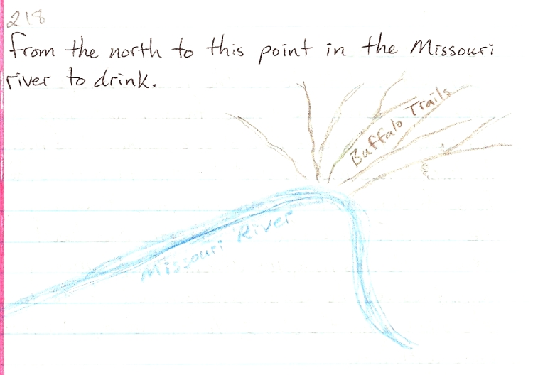
YYYYYYYYYYYYYYYYYYYYYYYYYYYYYYYYYYYYYYYYYYYY
It was still early in the afternoon, so I headed up to find Writing Rock. The roads were straight, the Earth is dark black in color, planted in wheat or fallow. No fences, no cattle, no fences. You could tell where the cattle were, it was only there that people would put up a fence. There was no need to fence in the wheat, so the land was continuous. One wheat covered hill after the next, rolling on up, up north. My trail led Northwest so the Montana border was close at hand to the west. I couldn’t see very far in this country – just to the next hill, usually less than a mile. I passed the last town on the way to Writing Rock, the towns were now just small clusters of a few buildings, maybe a post office, no gas no stores. Deep in rural North Dakota, you can feel every square foot of earth, you know that someone knows these fields intimately. People live here, even though there is no one around. The road turns to dirt, and I still have nearly 10 miles to go. The signs for Writing Rock turned me this way and that, I feel like I’m slowly circling, spiraling into the center. As I approached, I see a large factory to the north, much concrete, no windows, it looks like an abandoned military something, and probably is. The last mile and the road climbs and climbs, what is this! A hill! Arriving at the site is a treat, the visibility is great as this hilltop is the largest for miles around. At 360° view of the surrounding country. The view is farmland, wheatfields, planted and fallow – “as far as the eye can see” which must be five or 10 miles at least! This is a huge vista for this country, an uncommon place, and here, in a cage, are the two stones covered in deeply grooved designs. A large bird is carved on the large stone, and on the small stone, a miracle – a Plumed Serpent design. Way up here, he lives. There was no one around. I was glad to camp here for the night. This site was far from the “tourist” trails, it was set up as a local picnic ground, a few shelters with tables, restrooms, and a playground with slides and a merry-go-round for the kids. The petroglyph stones had their own little building with an iron gate on one side so that people could see them, but not touch them. The enclosure was built around the larger rock in 1956, but the smaller rock was not added until its return from the studies of the University of North Dakota almost 10 years later. The smaller rock was removed from the site by white settlers in 1930 and moved to a nearby spring. Soon after that is when it went to the University to be studied for nearly 36 years. After the settlers moved it, the Indians say that this is when the prophetic properties of the stones were interrupted.
Hoi Wakan, Spirit rock. The Assiniboine, Lakota, and plains Ojibewa all hunted these plains and came to this place. In 1931 the Syverud brothers formed the Writing Rock historical society, and in 1936 the society bought the present site. It’s good to know there are places, rocks, people, who exist and live in these high and lonely places, seldom touched by the uncivilized hand of “civilized” man. For as changed and diluted as the site is, it is still a high hill amongst the sea of lower, obscuring hills, where a person can still gain a little perspective and rise above for a time. The anciently carved rocks are like an anchor for humanity. Some people have taken the modern notion that we don’t need anchors, they hold us back, keep us from evolving and moving freely. There are disadvantages to everything and as humans we have the ability to see, the disadvantage and the advantage. Another young man who was traveling across country stopped to camp this night as well. He was from Illinois and was taking the high, high line across the country. I – 2 is known as the high line, and goes from Duluth Minnesota, through Williston North Dakota and on west through northern Montana. He saw the sign for Writing Rock and decided to take the detour.
YYYYYYYYYYYYYYYYYYYYYYYYYYYYYYYYYYYYYYYYYYYYYY
The next morning, after my usual run and prayer and breakfast, I drove back down the high hill into the sea of wheat fields again; I went north up past the abandoned military (?) factory to Highway 5 and turned west to cross into Montana. The first little town in Montana is Westby, which did have a post office, so I mailed off a letter to my friends in Estes Park, Dan and Kathleen. This little hamlet, like so many other towns in this part of the country, allow a person to camp in the park “downtown”. There are few actual campsites in the northern plains; and since most of the land is covered with wheat fields, it’s nice of the town to allow camping, for free, in the town park. Life seems open and free here. The attitude is one of, “hey, if you’re here, you must want to be here, and even if you don’t, you’re here anyway, so welcome, because there aren’t many of us, and another human being out here in an ocean of wheat is welcome as a sign of life” kind of like that. Not that anyone is rushing to throw their arms around you, but it’s different than the closed off feeling you get in most populated areas (most of the rest of the country) from there being just too many people, too much vandalism, theft, fear of strangers, and so on.
Northeastern Montana is a lot like North Dakota. The striking change between the two states 120 miles to the south, where I last crossed their border, is not evident here. Here the wheat fields and rolling hills continue, there are still small lakes, and the feeling of water is still present. The next town was Plentywood, I don’t remember but I don’t think there was plenty of “wood” or trees there. I continued westward, through Plentywood, traveling along to the north of the Fort Peck Reservation to Flaxville, where I turned north to go the last 14 miles to the Canadian border. These “towns” were hardly existent at all and I definitely got the feeling that this whole area of northern Montana was another “border” or no -man’s- land. I found out later, while in Canada, that this part of Montana was known to the Canadians as a lawless place for thieves and illegal traders to hide out between trips into Canada – smuggling whiskey, furs, horses, and anything else that could be had. The RCMP had a route, a trail, that they patrolled on their side of the border. The US had no such organized law enforcement on their side.
Crossing the border at the port of Big Beaver, there was a small shack with one lonely Canadian border guard. This being my first border crossing by myself in a long time, I was on guard to questions and procedures that I might encounter later as I did this more (possibly) in the future. The guard was being as professional and “official” as he could, given the utterly abandoned feeling of this entire area. There was no other traffic in either direction, except for maybe a couple of locals who he just waved through. I was a rarity, a real tourist who is coming from Colorado to go to Saskatchewan. Again the question, what are you doing up here? Well I told him I was touring around, headed to Wood Mountain, I had heard that is where Sitting Bull went after the Custer Battle. Yes, okay, that was normal enough, and surprisingly, he told me about a sacred site just up the nearby hill – an ancient Buffalo effigy. This site was not on any map, and its still used for prayers and vision quests. I drove up and visited the hilltop, quite a high one for this area; the Buffalo effigy, outlined in stones, covered a large area on top of the hill.
I continued on to the town of Big Beaver, and found out this is reunion time in southern Saskatchewan, each town is decked out for the yearly event. The family reunions are quite phenomenal – not something you see in the US, or at least I haven’t, because the reunions are not only familial, but tied to the town and to the region in general. It seemed like there were a lot of French and Métis (mixed blood) people here. After going north to Big Beaver, I headed west to Coronach, and then north again to Willow Bunch. These towns were very small, maybe a gas station and a store, and other than being fixed up for the reunion in bunches of petunias and that neat and tidy esthetic that tends to be throughout the Midwest farm country, the obvious signs of lack and poverty showed everywhere. The crumbling concrete of public buildings, the peeling paint, unmaintained roads and lack of services slowly made me realize that this was it an economically depressed area.
Pg. 225
I found out a little bit more, (later on) just how depressed and how large this area was. Near Willow Bunch is the Legare Regional Park, so I decided to pay $23.00 Canadian for a park pass and camp there for the night.
The park is a wooden, hilly area, thick with trees and grass, a green island in a sea of hot, dry wheat fields. It felt good to be in the cool woods; I went running before dinner enjoying my first day in Saskatchewan.
In the morning light, the coulee top is gorgeous. Praying to the directions, for the good fortune to be in Canada, in the summer time, in the land where the rivers flow north to the Arctic Ocean. Actually, in writing this I stopped to look at the map and saw that this area around Willow Bunch, once I passed out of the Poplar River drainage to the south between here and Coronach, is really a great basin. The water all ends up in Old Wives Lake south of Moose Jaw, making the Wood River drainage an 11,000 square mile basin in southern Saskatchewan.
After going into town for breakfast, mailing letters and getting gas, I drove up to the nearby petroglyphs at St. Victor. They are located atop a sandstone bluff that overlooks the immense plain below. You can imagine the buffalo herds darkening the flat expanse of grass below. The petroglyphs are mostly large tracks of large animal and people. Separate and mixed together. These petroglyphs are carved into a horizontal surface, which is fairly rare, and show up dramatically when the sun casts long shadows.
Leaving the beauty of Legare provincial park, I headed west about 15 miles to another wooded group of hills which held great importance to me, in that they were the retreat of Sitting Bull and his people after the Custer Battle. Not long after this Lakota band came up to Canada, the last herds of buffalo were being wiped out. The Assiniboine people who were already here were starting to run out of food. The RCMP couldn’t keep supplying the Indians with food, so eventually Sitting Bull led his people back to the Dakota Territory, surrendering himself to reservation life. Arriving in the wood mountain area to a humble picnic area and a few small buildings, I went for a short run and decided to camp there in the picnic area. I had this feeling that this area is one of the most important places I would visit on this trip. I didn’t really know why, it just felt important.
While I was praying the next morning, a car drove up to where I was standing. A man in a station wagon pulled up alongside me and started to talk to me. He was friendly enough, and then I found out he was a minister, a pastor from Alliance. He was nice enough, but I always get that vibe from these Christian leader types that says: “if you show any weakness, any ignorance, let alone any willingness to join me, I will lead you, teach you, instruct you, give you the teachings, and all you have to do is follow.” I think they find it hard to accept, or believe, that I don’t want to follow them, and that I don’t need to. They see that I’m a spiritual person, yet their language doesn’t reach me, I don’t engage with them. I’ve met very few Christians who will not say the words, but simply live them. I think people can be quite dim when it comes to context, and that speaking in contextual alignment (in the level of the person’s perceptions at the time), can be the quickest and easiest way to communicate effectively. A teacher does not speak above the heads of the students if he really wants the students to engage with the teaching. Nor does the teacher speak below, or to the side, or in the past, or in the future, but the teacher, if that is really who they are, will be able to see where the student is, far more than the student himself can see; for this is also what defines a teacher, and be able to speak to where that student is in the vocabulary (whether it be spoken or silent or actions or else) the student understands fluently. The particular pastor let me know who he was. And he did make some inquiries of me, some leading questions, but he didn’t push himself on me, and he actually seemed like a really nice person.
I went over to the Wood Mt. Post museum and visited with the interp. lady and met a Métis family who were also there visiting. They were fine people, very interested and proud of their heritage in a quiet, wounded, kind of way.
I left Wood Mt. that day and headed up to Moose Jaw, I couldn’t pass that name up, even though it was on the way. My tentative plan, from N. Dakota, was to go up into southern Canada in a kind of loop, and since the path of the spiral proved to be so strong at each crossing, I decided to go up near Lake Winnipeg in Manitoba. On the way to Moose Jaw, I stopped in Assiniboia. Looking in vain for some kind of wheat bread in the bakery there, I realized again how poor and run down this area was. I began to wonder about Moose Jaw and Regina, the two largest towns (cities?) in southern Saskatchewan. Regina is the capital, but what would the capital of a vast, poverty stricken area look like? Wheat is the main crop of Canada, and Saskatchewan has the most wheat land. The U.S. has under sold Canada every year for the past 10 years in the wheat market. That means Canada takes a loss, every year. The farmers are subsidized, and bought out by larger and larger companies, just like in the U.S. What are people doing? How are they surviving?
From Assiniboia, the land becomes very flat around Old Wives Lake, the basin into which all the rivers for 11,000 square miles around drain. There isn’t much of a “ridge” around this basin, in fact, the land between Old Wives Lake and Moose Jaw was some of the flattest land I’d ever seen. Moose Jaw sits on the confluence of Thunder Cr. And the Moose Jaw River, which contribute water to the vast and complex drainage of the Saskatchewan River. The Saskatchewan River starts in the Canadian Rockies of Alberta with 2 major forks, the North and the South. These eventually come together near Prince Albert, and somehow, after merging and melding with numerous lakes, this water makes it to Hudson Bay.
After all the hoopla, Moose Jaw wasn’t all that much to jump up and down about, so I just drove on through to go up to the Buffalo Pound Provincial Park. This is a place on the QuApple River, where the Moose Jaw River comes into the QuApple. The QuApple is a major tributary to the S. Sask river, coming all the way east from near the Manitoba border. Buffalo pound was a great place, it’s on a reservoir, but the land on both sides of the river is a natural prairie, and there is a herd of 22 buffalo there. I went for a swim in the lake, got some ice cream, and then headed up to see the buffalo. A surprise was to see the babies in the herd, their coats were soft like little sheep, and, for the first time, I got to see buffalo running. They ran down a large hill to an area right in front of where I was parked. I spent the night there and got to hear them running around at night.
Sometimes, like that night, there would be something keeping me awake and agitated. This time it was something under my sleeping mat, or it was my own movement disturbing the grass and making rustling sounds. Anyways, I was always on a kind of alert, sleeping out by myself like that, so sometimes the slightest thing would keep me awake. In this case, I retreated to my car and slept inside with seat reclined all the way. I had to resort to this tactic on several occasions, but was always much happier to get a good night sleep outside on the ground. Not having a tent would prove later to be more than a small inconvenience, but for this trip, I made do by pulling the blankets over my head, or retreating to the relative calm of the car.
The CBC radio broadcast here in Canada were great to listen to, I found them on the AM dial, as I had scoured the airwaves to find something besides country western music stations. The shows were different in format and character and had a refreshing blend of intelligence and hominess about them that was very enjoyable. The next day, after a nice run around the Nicole Flats loop, I headed out for the big capitol city of Saskatchewan, Regina. There are two “cities” in Saskatchewan, Regina and Saskatoon. Each has a population of around 200,000, with Saskatoon being slightly larger, and from what I heard and would expect, is quite the nicer place to live.
Saskatoon is the native name for the service berry. That city is further north, on the northern edge of the wheat belt, and the southern edge of the forest and lake country. Regina is getting close to the northern edge of the wheat belt, but it’s a wide belt, and being a close 100 miles to the woods still puts Regina in a place, a very flat and unending place, firmly within the wheat belt.
The wheat farms and farmers have been bought by huge corporations who can afford (?) apparently, the continual loss or tiny profit from their wheat farming. The tractors and equipment have gotten bigger and bigger, until now they look like some ridiculous movie prop, going around and around in circles. The fields around here are not square, but circular. Maybe they have center pivot irrigation as well, but I didn’t see that part, as the wheat was already growing towards maturity.
88888888888888888888888888888888888888888888888
I headed straight for the natural history museum, in the heart of Regina, and found it to be one of the best I’ve ever seen. I spent hours in there, studying geology and the timeline of geologic history. They really had their museum laid out well and kept to the central theme of geologic time. I got a map of the city and found out that Regina has one of the largest fish and wildlife preserves within city limits of any city. The entire center of the city is a natural park, along both sides of the Wacana River and lake, as it runs through the middle of the city. It’s quite a model of urban development, putting nature literally in the center, and allowing nature to cut the city in half. May cities have rivers running through them, or more properly said, have built up around both sides of the river, but few have committed so much to the health and natural productivity or their Wetlands Rivers and marshes as the city of Regina.
After walking along the river for a while, I went back into downtown Regina to explore the urban environment. I found that even here, in the capital city, there were buildings boarded up, vacant, for rent, or failing. It was obvious here too that Sasketchewan’s economy was very small, and even with such a clean, attractive city, it was in the middle of a vast region of failing agribusiness. Far from any port, or mountainous skiing area, or for that matter, any other city, Regina stands and suffers. Here we are over a thousand miles from Denver, or Minneapolis, the closest “American” cities, but at that distance the word “closest” loses it’s meaning. Regina is far away from the U.S. even though only a hundred miles from the border. Like the Mexico/U.S. border, at this mid western section of the Canada/U.S. border, to really reach a city you must travel hundreds if not a thousand miles into the U.S. or into Mexico. The mid section of the continent is vast and rather unpopulated.
I found a Vietnamese restaurant and had dinner there, which was a welcome change from my diet of corn tortillas, cheese, lettuce and tomatoes. After dinner I went to a movie “Something to talk about,” and now don’t remember a thing about it. I really didn’t know where I was going to sleep, and eventually just drove out of town to the east and found a lonely dirt road. After driving off the highway for a few miles, I settled down in the midst of the wheat fields and slept in my car. I wanted to spend another day in Regina, in particular, the natural history museum, so that’s why I camped so close to the city.
The next morning I woke early and drove back into Regina praying. When I finally found the bakery, it was closed, a legal holiday in Canada, this 6th day of August. I did find a place that was open for breakfast and ate there before diving back into the museum. The clouds had thickened, and now the rain came steadily down. After another good geology learning session in the museum, I was ready to continue my journey northward.
88888888888888888888888888888888888888888888888
I headed out of town, up to another Provincial park north of Regina. It’s called Last Mountain House, and I met a nice Ukrainian woman named Holly who was doing the job of greeting and informing the tourists of the local history. I found out where the actual “mountain” that the name “Last Mountain” comes from. It’s more of a hill of course, but it’s singularity and prominence at the northern edge of this vast flat plain gives it a unique status. I drove up there and prayed for the wheat. Now it was time to start my turn to the east, as I was just about as far north as I had time to go. I was headed for that place in Manitoba where the next loop of the spiral touched the north/south axis of the continent. I was seeing references points and guiding lines in this vast country which gave me a sense of anchoring and helped me make sense of a scale that was so much larger than our ordinary human scale.
The next provincial park camp possibility was up at Touchwood Hills, an Indian reservation of some size. I went through the little reserve town of Punnichy and got to a place to camp just before the whole sky blackened to the west with a thick band of clouds, which looked fairly apocalyptic. The wind came up fiercely, and it was going to be another one of those thunderstorms on the plains experiences that lasts all night. The wind howled and roared, I thought the trees were going to blow over. I’m pretty sure I spent that night in my car too. In the morning I go into Punnichy for breakfast and visit a small local museum. The lady who was there was very nice and we visited for a while. After picking up some local produce, I headed east for Yorkton. This was over an hour drive, which was a long way to go for me now (without stopping). I was getting used to a slow pace with lots of stops and very short, usually less than an hour, driving distances. This made my journey seem to last longer, which I enjoyed, but also I wondered about going back – it seemed so far away, even to go back to the Black Hills of South Dakota. Anyways, I wasn’t going to dwell on that now, I concentrated on enjoying and appreciating the country I was in now. I didn’t know (do we ever?) if I would ever see this place again, so each sight and impression was important to me. I could definitely tell that I was leaving the wheat belt, the further north and east I went. The Touchwood Hills were an island of forest and lakes surrounded by wheat land, but even so I could tell that soon the forest and lake country would be the ocean and the wheat land would become the island. After gassing up in Yorkton, I went up to Good Spirit Lake to camp. I tried to camp on the beach, but it was still too windy – I think I was following along with this storm as it headed east. I think this is where I saw fireflies for the first time. I know it was at a lake near the Manitoba border, just before dark, as I was checking out a campsite. Out of the corner of my eye I saw something move, and as I looked over that way I said “hey!” and jumped back a little, for I saw two eyes shining in the twilight, not far from me, and seeming to hover in space – the body not visible, just those eyes! As they disappeared and then reappeared, this time in a more random alignment, I finally realized what I was seeing were fire flies, not eyes! I laughed and loved it, my first sighting of fireflies, and they scared me!
In the morning I drove up to Canora and mailed some letters and cards, got some food and headed up to Duck Mt. provincial park, right on the border with Manitoba. This seemed like a real north woods place, besides, it was cold and raining now, and I passed the whole day waiting out the rain and incessant wind. I sewed a buffalo hair leather doll and listened to the radio, going for short walks in the rain so as not the get too cold. Another night of sleeping in the car, this was becoming a habit! The next morning was still cloudy and rainy, but as I walked out to Pelly Pt. For a morning prayer, I felt good and as I felt, so the weather lightened up, the change was synchronized in me and the weather. I enjoyed staying there, went back to the visitors center and ended up watching a movie in the ranger’s cabin with a group of kids who were trying to get the most out of their summer vacation too. I realized that “summer” was quick up here. Things were going to start closing up for the season in a couple of weeks, and I was still in mid-summer.
I decided to walk out to Madge Lake one more time before leaving this, the farthest north point I would go on this journey. I wanted to get over to my place in Manitoba, but I also realized that this place is on the way too. The movie we saw was the “Lorax.” I filled my water jugs and headed out for Manitoba, another new place, another Canadian Province I’d ‘ner been, and another word I love. The road goes south out of Duck Mt. park down to Roblin. This town was all closed up, so I continued on to Grandview, a hill that overlooks the valley bellow. I camped here, but don’t remember where. This is where the sun finally came out, a good sign, and a beautiful area. The next day I drove into Dauphin, had breakfast, then drove back out of town to pray at the creek. This is the place, the intersection of north/south with east/west at the very northern loop of the spiral path. The road, again follows the opening between the mountains to the west. Duck Mt. to the north, Riding Mt. to the south, and to the east, a system of lakes second only to the Great Lakes. A very simple topographical layout here in Manitoba, simple and vast, vast and complex in it’s intimacy. This is where half of the fur trade came down from Hudson Bay via the Nelson river to Lake Winnipeg, which took 10 to 20 days to traverse from north to south, to the town of Winnipeg, and from there, the Red river and Assiniboine river would be followed either south or west into the beaver trapping areas; or one could go east to Lake of the Woods and go by river and lake via the Rainy river to Lake Superior and enter the Great Lakes system by which the other half of the fur trade operated. These fur trade routes merely followed the natural pathways that already existed and were used by previous generations for travel and hunting.
VVVVVVVVVVVVVVVVVVVVVVVVVVVVVVVVVVVVVVVV
Travel and hunting, what else is there? Well, there is the beauty of creation, the places that radiate such strength of spirit, that just to be there is to be blessed. Just being, and being told that you are alive, as alive as the palpable life surrounding you – is a reason, is a meaning of Lake Manitoba, Lake Winnipeg, Riding Mountain, Paha Sapa, The Great Plains, The Great Lakes. Travel and hunting? Yes, travel and hunting is a reason, a meaning for going, for living. There is also the reason and meaning that is being that comes from beyond what a human may deem meaningful to hunt for food in order to eat. What then of the beauty of a place that could make you cry? Did a human order that? No, we did not. We did not ask for or seek it, this beauty and strength of spirit is a gift, we are a gift. So travel and hunting yes, there are uses for the paths that go between the mountains, across the plains, the lakes; and beyond the usefulness of travel and hunting, is the usefulness of beauty in abundance beyond what anyone could ask for -the usefulness of this is humility – the kind of humility which does not allow you to blame the creator of such a gift. Yes, this path, as it is, is useful, is beautiful, and is not anything less than a gift from God. Yes this is it, I’m on the path, and this place, it is a real place, and I’m here. I made the effort to get here, and it took concentration, money and will – but all these things were given to me – I did not create them. There are many other wills, money and concentrations that brought me here as well as my own efforts. I am not alone in my achievements, nor do I take credit – this is a gift, and I am glad for that.
VVVVVVVVVVVVVVVVVVVVVVVVVVVVVVVVVVVVVVVVVV
Feeling so, in Dauphin, and finding the visitor info center in the middle of town, I walked in to meet a lovely young woman who was working there. She was so present, especially for someone in their late teens, not going anywhere, just present. I would remember her and be stunned to see her again next year in just the same place, and have her remember me. Another astounding sign to a such a pivotal place. I love to see these small towns as such hugely important places Ð the perspective allows me to give so much to the people who live there and are accustomed to being ignored by tourists eager to find their destination. Again and again the locals were shocked any surprised and happy to find that they were the destination for someone who for some incomprehensible reason was interested in their life. The people at the local museums had a clue about this, and could come up with all sorts of reasons and stories about how their town and people were interesting.
After visiting the museum and seeing some interesting historical maps, I inquired about where to buy such things and was referred to Repro maps, an incredible archive of local and national maps. I bought a map of the old RCMP trails across Saskatchewan for six dollars.
After lunch I continued south on the highway that would take me all the way back to the U.S. border, Hwy 10. A few miles south of Dauphin I enter the Riding Mountain National Park, which rises straight up out of the surrounding plain like a forested wall. Another island of trees, separated from the sea of forest and lake to the north by another sea, the sea of prairie. This forest island is huge Ð 60 miles from east to west and about 30 miles from north to south, making 1,800 square miles of moose and bear and wolf habitat. Hwy 10 is the only road through it, and at the middle, top of the mountain, is Moon Lake. I stopped there and took a walk and run for about 10 k. The big windstorm I experienced a few days ago seems to have hit this forest pretty hard Ð many of the big fir trees have been blown over, so this was no ordinary wind – these were old trees.
I decided to keep moving and left the beauty of this mountain, driving down to the next town, Clear Lake. From there I called the Chase family in N. Dakota and found out that Em didn’t go to the Crow Fair, he had to go to a funeral. I talked to his wife and told her I would visit on Monday, three days from now. My plan was to go due south to the U.S. border, and then once back in the U.S., to check out the Turtle Mt. Reservation before continuing south to Rugby, then west through Minot to Stanley and south back into the Ft. Berthold reservation where the Chase family lives. This would complete my loop up into Canada and back to N. Dakota. For the time being though I had to find a place to camp for the night, so in looking on the map, I saw a campground near the Little Saskatchewan River south of Erickson. It turned out to be a great camp, a place I would like to go back and visit. There is a hill nearby which the road goes over, giving a good view of the area, and providing a ski area!
The next morning I lingered in the area, praying by the creek till noon, picking June berries and choke cherries. I made my way down to the city of Brandon – at 40,000 people, its one of the larger cities in Manitoba outside of Winnipeg – (600,000). After checking out the museum, I got interested in the river instead, the Assiniboine River flows through from the west, and then goes over to Winnipeg where it joins with the Red River.
I gathered up a good grinding rock (hammer) there and then went to the fair grounds to check out the Farmers Market. Not much there but lots of potatoes, so I decided to head on down and cross the border back into the U.S. The international peace garden is at this crossing, on the Canadian side, and the U.S. side. This is where I got my first major search of the car and interrogation by the border guards. When I went into Canada, they wanted to know how much money I had and how long I would stay. Now, going back to the U.S., they wanted to know if I had more than $10,000 to declare! They had the dope sniffing dogs and everything. Fortunately, they were amateur guards, or the dog would have eaten my pemican I had by the front seat. It was a comedy routine. They asked what was in the bag – so sure they already knew, and, saying it was pemican, I also said rapidly, as the dog was putting his nose into the bag, “don’t let him eat it!” They pulled his nose out, then let him sniff again, and again I said the same, and they pulled him out. This happened three times before the routine was over. After taking every item out of my car and thoroughly searching it, they walked away and left me to pack it all back in. Nothing like being treated as a criminal when you come back into your country. I continued south to Dunsieth, then turned east to go through Belcourt, the capital of this Anishnabe reservation, and then continued east to Rolla and found a place to camp near town.
The next morning I went into Belcourt to ask around about an Anishnabe village re-creation that I had heard about. I got directions from a local man and headed up there – it was just a few miles north of town in the woods. There weren’t many people there, but I did meet a young man, Chip, from Flandreau who was working there for the summer. He was doing an educational program there for Indian youth, and was a photographer as well. He showed me the village – several structures including a large dome shaped earth lodge. I learned about some of the plants there, and was amazed, again, at being in a forest which seemed to go on forever, but was actually a small group of hills surrounded by vast plains.
I drove back to Dunseith, to the pow-wow there after a nice visit with Chip and the forest plants. After a brief stay at the little pow-wow, I drove on down to Rugby, N.D. which is the center (one of many) of the N. American continent. Its amazing that even such a physically defined and ancient a “thing” as the N. American continent can have such a variety of centers. The popular view is: the center of the country is a spot, which can be found scientifically, upon which a person could stand. Sounds easy enough, but then there is Alaska and Hawaii – who could leave those out? Once you’ve found the center of the U.S. geographically then you have to find the center geodetically, then you must find the center of the entire continent, which, when you include Mexico, Central America to the Panama Canal, as well as Alaska and the Canadian shoreline – you get Rugby, N.D.
As exciting as it is to calculate the center of something, there is the humble reality of actually going to this place and experiencing it – after all, its just another town, or “spot” in the Midwest, right? Well Rugby did have this special feel to it, an earthiness, a solidity that comes from being as far as you can get from the ocean.
Then you look at the geologic record, and you see that the sea was here. Rugby, N.D. was once at the bottom of a shallow sea that stretched from the Gulf of Mexico to northern Canada.
+++++++++++++++++++++++++++++++++++++++++++++++
The Earth is deep and wide, but being a human with a one inch diameter eye ball it sometimes takes a little effort to experience this depth, this scale of age and size that is so present, so obvious, that to say anything about it sounds elementary. The Earth is old. The Earth is big. So what, what does that have to do with the county’s plan to develop a golf course on prime farm land? What is the value of all those layers of rock, 1,000’s of miles thick? Indeed, the value – to most humans – is that little layer on top that we can grow food in, the topsoil, the farm land, the real estate, and occasionally, the deeper levels may be useful for the water of oil or coal or minerals that we can pump or dig out. But the age of the Earth, that is of no general concern at all, and why so much Ocean? Is that overdone? Our lives, our reality, our Earth, has become what we value as useful and understandable in human terms, not for what they really are. What are they, really? It could be argued that they are just these things, as we have defined them; first by definition of their usefulness; second by a simple, obvious elementary school science definition of physical properties.
For myself, I think the question, “What are they, really?” Is the most valuable thing of all, not so much the answer (we’ve stuck with)? It’s not to say these things of value are not valuable, its that when you agree something is of value there may be an unstated presumption that something else is not, or is of less value. This puts one on the defense of everything that has no value, for it may have value someday, or you may think that things don’t need to have a value to be important, to be worth something intrinsically, as part of the whole. This puts the whole idea and meaning of values in question, and starts us going away from human perspective to another perspective. Values do have meaning and they are important, but they are inherently limited and do not cover the question of intrinsic reality. Then there is the scientific definition, the physical description, which can be staggering in its scope, but after all the description, is it really that interesting? , and what about what is left out by the limits of science? What are they, really – the Earth, reality, life? Is this too big a question? I think not, it’s the answers that burgeon the mind. The question is simple, and can be carried with you wherever you go. The physical definitions are plenty, but the experience of these things, that is where the wealth, the value and meaning lie.
For me, the question opens me up to experience, the answer makes experience unnecessary. We have lots of answers these days, so much so that to ask a question seems quaint, ignorant, or unthinkable. As if everything of value has been discovered, figured out, and put on the shelf. All that’s left for a person to do is figure out how to buy it. So the questions have become financial, how to afford it, how to make enough money – and instead of experiencing these questions, we grab for the answers, ready to buy our reward. My real point is that, even though I value “the question” it’s the experience of life, of the earth, of reality, that is beyond value, because none of it is valueless.
+++++++++++++++++++++++++++++++++++++++++++++++
After sending some letters in Rugby, I went out and gave a tobacco offering to the Center of Turtle Island, one of many centers, and prayed with the maps of the country, seeing the connections to the center. I continued west through Minot to a rest area and slept in my car.
The next day I traveled back down to New Town (where the Mandan Indians were moved when their old town, Elbowoods, along with 7 other towns, were flooded by the Garrison Dam project). It was spoken of with fondness by the old timers, it must have been pretty along the river there. After checking out the pow-wow grounds there in New Town, I went down to the Chase family ranch, visited some more with them about my trip to Canada and spent one last night with them. I let Emerson know that I had decided to go back to Colorado – I was feeling the end of summer, and, not knowing anything else to do, had reluctantly started to plan for winter – although it was kind of like planning for the unknown – how far does that get you?
The next day was a long straight drive right back into the heart of the Black Hills. I was so excited to see them on the horizon, even after so short a time away they seemed a gigantic miracle rising out of plains as I approached. First a tiny, dark ridge on the horizon, but even at that distance, what a thrill, what a change! Then to see the mountains rise out of the ground, it was like witnessing a geologic event.
Coming down from Dikenson, passing through three little towns, Amidon, Bowman and Buffalo and 170 miles of open short grass prairie, seeing the Black Hills rise up from flatness and emptiness to eventually fill the entire southern sky at Belle Fourche was quite an experience for a day, but I kept going, along the flank to Sturgis, then up into the mountains to Deadwood, the gold mining town, still mining, and now mining humans with casinos as well. I continued south on 285 all the way down to Pringle, where I finally looked for a camp in the forest and spent the night among the tall trees. It was the middle of August, the end of summer in Canada, but still the fat of it here. I was really feeling down to the end of my money, so I knew I would have to get busy working and hustling up some money in the Hot Springs area.
The next morning I had a good long prayer there in the woods, so thankful for this life, for this chance to do what I was doing and for having had such a good journey. Arriving in Wind Cave I started visiting right away, and finished sewing my first leather doll with buffalo hair. I visited with Su Onimus and her partner Dave Leigh, such fine and interesting people, full of spirit and energy, just bursting with love and life. They had lived in Kansas, and spoke glowingly of north central Kansas, the post rock country and the Smoky Hills.
For the next month plus I stayed in the Hot Springs/Wind Cave vicinity and managed to make a little money, enjoy the waning summer, and not worry too much about the future. The Gericke’s, Jack and Rich, were totally re-modeling the house they bought in Hot Springs on 14th and Baltimore. It was an old 2 story house and Rich offered to pay me 5 dollars and hour to help him, mostly to help hang sheetrock. So I had that going for me. I would have liked to continue my journey, but the next step was a large one – to continue meant going out to the east coast (Maine) then following the coast south to Florida and some how getting back to Texas. Going by boat seemed the way to follow the lines I had drawn on the map, but all this seemed (and is) so large an endeavor, like something you dream about doing that is out of your reach. Going to Canada gave me hope however, and gave me the assurance that something greater and very capable (The Earth herself) would be there, just as she is here, to help me, me personally. All I had to do was to be open to the opportunity, and work toward that opportunity with all the resources and energy I was being given at this time. Admittedly, these resources seemed to me to be barely enough to sustain my existence here in Hot Springs, let alone allow me to continue any such journey. At the same time however, I also knew that I did not know what “sufficient resources” were. As was demonstrated to me on my journey so far, it was the moving, the traveling itself that opens and connects me to the next, the future, the journey itself. So of course from a static point, not moving, I could not see how it was going to work, or how much I would need. I could see how my decisions about how to travel and where to go, and where to look, who to expose myself to, created a set of circumstances that had an odd mix of my own personal will and desire with letting go of control over my progress and trusting other people with the help I needed.
It occurred to me that if I had all the monetary resources to physically travel this route, I would not be in the position of need, I would not be forced to reach out to people for help. I would not have to enter into relationships out of necessity. At the time I thought it was because I didn’t want things to be too easy, I wanted the journey to be real. Which is to say, not all under my control.
The month in Hot Springs was hard, and good. Hard in that I didn’t know where I was going next, how I was going to make it through the winter, being away from old friends and family, not having a partner. It was good though too in that I didn’t have to dwell on these hardships, the weather was good, I had fresh garden produce from local growers, the friends I had made were supportive and always gave of their time and hospitality, and I really was where I wanted to be.
One of the really nice features of staying with friends who worked for the N.P.S. at Wind Cave was that I was always welcome to sleep outside on the lawn where the employee housing is. Several other people would usually be sleeping out too, so it was a very comfortable situation there under the stars. I traded the leather doll I had made to Jackie for the book “The Great Race.” Her daughter was very happy with the doll – and I gave the book to Jill, she knows Paul Gobel, the artist for the book. I made another doll and tried to sell it in some local stores, but didn’t get a buyer. Eventually I gave that one to Jill’s niece, who really appreciated it. While waiting for Rich to need my help with the house, I took the step test at the F.S. office and got my red card current so that I could go out on wild fire work. The Wind Cave Park was going to do a control burn this fall, but it was still too green to burn at this time. I went down to Cindy and Moe’s place near Cascade Falls and visited with them, they were old friends of Tim Klukas and he gave me their number. Cindy is a plant person, so it was great to meet and talk with her about my plant questions. She had planted some sweet flag along the creek and it survived for a few years before succumbing to the cold winters.
A lot of the seasonal help at Wind Cave was leaving, so we all had a final get together for them. Finally I got down to working with Rich most days of the week. They had all their furnishings in a huge storage container parked on their lot next to the house. It was a corner lot, so about double the size of most town lots, plus a 2-story house – they paid $20,000 for it. We replaced windows, siding, insulation, pulled new wire, put in fire blocking and Rich did extensive foundation repair. It had balloon framing with real 2 by 4s, which made it difficult to match up with the new 2 by 4s. After a week of insulation we were finally ready to hang rock. We hung rock for a week, getting some help from Jeff and Rodger.
TYTYTYTYTYTYTYTYYTTYTYTYTTYTYTYTYTYTYTYTYTYT
That weekend I got a call back from my friend Scott Wolfinger, who I had called and left a message with in Bend, O.R. He was calling me from Camden, Maine! He had ridden his 10-speed bike and hopped freight trains across the country and was now in Maine, the very place I was dreaming about going with no clue as to how. Now that Scott had called me from there everything opened up – we had about a 15-minute phone conversation, and in that time I had decided to go to Maine – if he could ride his bike there, I could drive there! Also in that call, in about 30 seconds of time, I came up with a date that I would be in Maine.
page 254
Chapter Four: On my way to the Far East
Sitting there in Hot Springs with a fresh $240, I figured it would take just a couple days to go back to Colorado, about a week to make some money, and about another week to drive to Maine, so I say to Scott, “I’ll be there in Bar Harbor around the 2nd week of October.” I felt very calm, focused, I asked Scott if there were boats there that went south for the winter, like to Florida. He said he would check that out for me, but probably so. Now I felt as though my whole life were changing, or continuing. Engaging. Here was an opening, and the stagnation of not knowing what or where I would be or do was over. I felt a fresh pouring in of opportunity, even though it was still all unknown, the fact that my friend was there in Maine completely changed my outlook – it was also an answer, an answer to “is this real?”, is this journey what I’m supposed to be doing, is it really for me to do? Really, really – not just me saying so, but validation from the powers that be, from others, from the land, the people, the elements, the seasons, at this time, in this way, a path has been opened for me, opened not only for me, but for all who care to join in the journey. I really wanted to travel with someone, not only for companionship, but for the logistical support of having another person to drive, to guard the camp, or to shuttle the car while I ran or walked. Getting another person interested in leaving their work for more than a day was difficult to propose, and the places I was going were not all that exciting on their face. Saskatchewan? North Dakota?
I did get some encouragement for going to Maine, a friend in Estes Park said, “Spend your last dime, but get to Maine.” For now, however, I was still in South Dakota and had to focus one day upon the next as I had been doing.
AAAAAAAAAAAAAAAAAAAAAAAAAAAAAAAAAAAAAAAAA
The next day after talking to Scott on the phone, I told Rich that I needed to go up to Rapid City for the day – I was pretty much caught up on all the work I was going to do for him anyway, the sheetrock was done, and that was the main thing he needed help with. Looking in the phone book for meat processing plants in Rapid City, I located a place that butchers buffalo and saves the fat trimmings. From this I would render the lard to make pemican. They also had buffalo jerky, so I went up and made a day of it, picking up a box of fat trimmings, jerky, and then after checking out the museum downtown, which has excellent examples of the most beautiful plains Indian quill and leather work, I went to see a movie, “Crimson Tide,” and for a dollar fifty it was great.
The next day I went out to Cascade Falls to visit Cindy and Moe one last time and fill up with spring water. I was planning to go soon, but wanted to take my time, as I had done with everything else. I did one more repair at Rich’s house, and finally fixed an outdoor handrail at the Klukas “cabin” where I was staying in town. One more day of rendering buffalo fat and cleaning house and I was ready to head back to Colorado for a whirlwind week of preparations, working for travel money and seeing people to visit. Already I was thinking though of how I would pack for the trip – what to take when you’re taking a sailboat down the east coast during hurricane season to points south for the winter? On my way back to Colorado I would stop and visit Jill in Cheyenne, but first there was a Cabellas store in Sydney, Nebraska that was kind of on the way, so I took the alternate route south from Hot Springs, through a part of South Dakota and Nebraska I had not been on the way north. Sad to leave the folks and the hills, but glad to be on my way again, especially glad to have a plan for the winter, and to be able to continue the journey. I took 385 south to Chadron, Nebraska, the big city of Northwest Nebraska, which does have a college and some multi-storied stone buildings. Continuing south, across the Niobrara River, which, this far west is more like a creek, I then approached Alliance, Nebraska, and saw the sign for Carhenge, a replica of Stonehenge made out of cars. It being the 21st of September, the autumnal equinox, I thought it was a great time to experience the cars. It was my first mid-west bizarre roadside attraction stop – there were a few other people there, it was free, but I didn’t have much of an epiphany or anything. Just another farmer with too many vehicles, but this guy actually carried through with his hair-brained idea, and now he’s on the state map of Nebraska. Alliance is in the center of western Nebraska, so car henge is centrally located to all road specific points within the geopolitical boundaries of the western portion of the state. That said, it was time to go on south to Sydney and try to figure out what to buy from Cabella’s bargain basement for my seaward journey south this fall. I was trying to imagine, was it going to be cold? Of course, the North Atlantic in the fall, but then, compared to the dry ice wind of the Central Rockies, the ocean is a temperate relief. Then there is the salt-water factor, rusting and rotting everything quickly, the perpetual dampness, not being able to dry out, which makes it difficult to get warm once you do get cold. Added to this is the factor of traveling south into tropical water, where any bulky warm clothing would be looked at with an eye to toss overboard as soon as possible. Then there was the fact that I would have to come back in the spring – which seemed so far off, but still needed to be planned for, but was so far out of reach at this point that it was easy enough to say that I would figure that out later; but what of the return? I wouldn’t have my car, hence no storage potential for wardrobes, and I didn’t forsee a very large budget to just be tossing away clothing and buying what I needed along the way. So with all this in mind I struggled to find the least amount of clothing which had the amazing ability to adapt to any and all climactic situations, (at least the southeastern ones). And (maybe some north to mid-Atlantic ones as well) and then (maybe some gulf coast/Gulf of Mexico to south Texas apparel as well). Once I was back to the Big Bend area of west Texas I figured I would be close enough to Colorado (and my car) to not worry about it too much. These were the kind of thoughts popping though my head as I approached the shopping destination in western Nebraska. My main concern was footwear – I wanted something waterproof, but that also had a good grip on a wet deck – a combination boot and deck shoe.
The Cabelas store in Sydney, NE is immense. It is the headquarters of their nationwide catalogue empire, and the big draw to Sydney. Truckers can pull right in from I-80, so there is always a crowd. I walked past all the displays of every type of animal that is hunted to the back of the store, where there are large tanks of every kind of fish that is fished. Beyond this, behind the back wall of the warehouse is the bargain basement, just another room really, with all the items that get returned – to be resold a second time, after the refund to the original purchaser. I picked up some storm pants, polypro underwear, gloves, deck shoes and some red wool pants. I still felt like I needed some kind of high top waterproof boot, but didn’t know what that would look like on a boat. I decided that could wait till I got there. So after about $100 worth of stuff, I felt a lot better about being prepared (equip) for the trip. I got onto I-80 and headed west with the truckers to Cheyenne, and stayed with Jill Ciria.
Jill had to work the next day, so I went food shopping, and wrote a letter of intent to J.P. McKean, telling him how much I loved wooden sailing vessels and how I grew up on one, and that I could stomach the open ocean on a boat. This was my “resume” that his wife had asked me to send. Spending time with Jill is wonderful, we had dinner then went out for tea and company. We have a similar mind in some respects, and a respect for life in general. We can make each other laugh out loud. She can get very serious, with a very serious look, and then, through no fault of her own, just crack her self up, which in turn cracks me up, but she knows I was listening to the serious part, and this is why I think she keeps me as a friend.
The next day we went to go pick up Dillion, her one of many nephews, and we all saw a painted turtle cross the road in from of us. We made sure he was safe under the road in the culvert before heading into town to a carnival. A cold day that September 23rd from there I took my leave to go up to Estes Park and re-unite with friends.
********* ************ *************
The ride up to Estes Park was exhilarating – I was full of energy, and yet felt myself keeping a lot back. A strange combination of single-minded purpose and intensity with an openness and willingness to embrace the situation – this describes some of the feeling during this incredible week pf preparation. No one was home at Micheal’s house, and, finding Tom at the Notchtop busy at work, with a quick hello he sent me over to the Inn of Estes where everyone was celebrating the wedding of Chris and Marrisa. This was an amazing welcome home for me as well as the wedding reception for two friends. I had left their house in Ft. Collins three and a half month ago, and now return on their wedding night. This week was to be an amazing string of such events, all linked together and all happening with such timing and continuity as to seem unreal. Unreal in the sense that usually it would take a week or two to get together with someone for TaiChi in the park, or breakfast, or visiting till 2am; it was like a whole month of dates and personal engagements and private meetings in one week. All that, plus I worked for Micheal for several of those days to make $200 for the trip! It was a week of non-stop getting things done that came together so smoothly that it could only be for me another good sign from the heavens that this trip was meant to be. By October 1st the car was packed, and being ready for several months of travel, I drove down to Cheyenne to begin, again, a big loop. Having been across the top of Lake Superior with Mugs and Pascal last year, I would pick up the trail again where we left off in Blind River, Ontario, and continue across the top of the great lakes region of Trans – Canada Highway 2 to Montreal, then cross the St. Lawrence river and continue east across southern Quebec to Maine.
From Colorado to Maine in one week, a blink of the eye to me, as I was used to a much slower pace. This amazed me though – how quickly one could move across the country, even by car, a little econo car at that, and having been to Michigan and Ontario just once before already made the trip shorter and more familiar. The most amazing part though was how having a friend in Maine, Scott, made the whole trip possible. Without that phone call from him I would not have even considered a trip to Maine, much less a sail down the east coast to Florida and then a somehow trip back to Texas and from there another somehow back to Colorado. Just the very idea was too fantastic, pure fantasy. For all that to change so quickly and so completely still amazes me. That’s the power of familiarity, of friendship, and of trusting a golden opportunity.
******* ********** *********
Jill had to go to work Monday morning, so before leaving, I made a little map of what I was doing – where I was going. A loop out to the eastern seaboard and back. This must have been a little baffling to her, I felt. I wanted to tell someone where I was going – and not knowing too precisely myself, made it difficult to say. Also difficult was leaving everyone I knew to go on a long journey to who-knows-where, but leave I did, with intention of returning.
Head out east, across Nebraska, stop once more at Cabela’s and got some boot liners (wool felt), then up and away to northeast Nebraska. I decided to go north first, back the way I came down from S. Dakota, through Alliance, and finally branching out from Highway 385 on a small road 87 up to Hay Springs where I would turn east on Highway 20. Big highway 20, actually an interstate, it keeps it’s number form state to state. It actually goes all the way from Orin, WY to Chicago, IL. At this point in Nebraska it resembled, very closely, a deserted farm highway in the middle of nowhere. Perfect for pulling off and camping for the night. In the morning there was frost, and the feeling of fall in the air. The next day I received the O.J. verdict over the radio while traversing the Rosebud Lakota reservation in S. Dakota. The Missouri river cuts a deep rugged valley through these high and dry plains. Soon after crossing the Missouri however, the west seems to come to an end, and the mid-west farm country takes over. Flat, green, and cut into squares – this is the beginning of the land where people have lawns to mow. Mowing grass and shoveling snow, if you live here you’ve got your year’s work cut out for you. I headed for the town of Souix Falls, SD, perched on the corners of 3 states – SD, MN, and IA, I stopped at the St, Joe museum there, don’t remember what I saw. Focusing on Pipestone, MN, I continued up north crossing the border into Minnesota, and absorbing all the surrounding land approaching this most holy site in “central America,” I slowly came into the Pipestone area, the town of, the RV camp of, and finally the National Monument itself. Camping nearby, I scouted out the visitors center and walked the luxurious grounds, so peacefull, so ancient a campsite. Similar to the grounds at the base of Matoe Tipi, only more inclusive, bigger, older, more habituated; the trails led around the quarries to the creek, the wild plum orchards, and the guardian stone faces in the rock cliffs above the creek. I wasn’t ready for how real this place is, in the middle of the Midwest farm country, here is a sanctuary of nature, a peaceful place.
Highway 23 goes north through the town of Pipestone, so I stayed on it, as soon it takes a northeast diagonal across most of the state. As I approached St. Cloud the farmland stared to transition to forested land with farms in between. St. Cloud is a pretty town along the Mississippi river. Northeast of St. Cloud the land is even more forested and soon becomes the lake and forest country of northern Minnesota and northern Wisconsin. The forest had stared to turn color, and the turning trees became more intense as I went along. When Highway 23 crosses I-35 near the Wisconsin border, I turned off and started eastward to Hawart, Wisconsin. Haward and Spooner are the main towns nearest the Lac Court Oreilles reservation. From Haward I continued northeast into Chequamegon N.F. and camped at Potter Lake. The campgrounds are deserted this time of year, and the trees, the lake, all so quiet and still, a good place to rest. After finding a camp spot, I drove down to town and called the Roth’s in L’Anse, MI. These are the parents of my friend Rodger who died last year in the fires of central Colorado. They welcomed me to come visit, so I went back to my camp for the night, leaving a short drive tomorrow to the U.P. Driving these small roads in the north woods at this time of year is so beautiful, so much light and color coming out of the leaves. At one point, the yellow light coming out of the woods became so intense that I knew this spot would stay in my memory, not that I would remember it to go back to the same spot, but that particular place was so unique in all the miles and miles of forest, that it stood out, and stands out still.
The next day, crossing the border into the U.P. of Michigan, I was already entering the Eastern Time zone. The land changed again too, after crossing over an “iron range” of steep hills that had local ads boasting of downhill skiing, the forest changed- somehow thicker, heavier, less lakes, I crossed rivers, and soon turned north to L’Anse. The excitement of getting close to Lake Superior grew, like the anticipation of seeing the ocean when you know you’re driving towards it, but it remains hidden from view. Finally at L’Anse, you see Baraga Bay, a small view of the Lake, but beautiful; and the Roth’s house overlooks the Bay with a perfect view from the living room window. Rodger’s girlfriend Jennifer just happened to be there too, the sadness was still crushing, everyone somehow kept talking, kept moving – Rodger’s room, frozen in time, his poor parents, hating his death. We went out to his grave, his father and I. The Indians there, (this too is a reservation) they build little houses a top the graves, like small shoebox type models made of cedar shake – mostly on the older graves.
Rodger didn’t have one, just a headstone. I offered tobacco, his father cried, again. After visiting for most of the day, I headed out towards Marquette, looking for a good place to camp. After driving small roads for hours, not finding anything but private land, I finally found a small dirt road that led a short way into the woods, it was already dark. There was a house nearby, but this wasn’t anybody’s driveway, so I put down my bedding. There was a pile of something on the ground. In the morning I saw that it was a load of potatoes that had gone bad that someone had dumped here.
The land was sandy and hot with tall, thin pine trees, and the sense of the endless north woods had gone. Lots of private land, many driveways, the forest seemed sparse, barely able to hide the houses, the attempts at farming or whatever it was, tree lots, horses, but it all had the feeling of not being the right place to do any of these things. I expected more of the U.P., I had always heard such glowing reports, but it seemed to have its high points and low points, like anywhere.
Coming up to the “sault,” the narrow between two lakes, Superior and Huron. The approach is made on I-75, so it’s difficult to take your time and sightsee. The traffic is busy on this, the only border crossing by road for 100’s of miles in either direction. Lake Superior is about 350 miles from east to west long. I haven’t seen much of it since Baraga Bay, the road follows the middle of the U.P. most of the way, so approaching the “sault,” I was eager to see the lake again. The sault is a long, narrow channel, full of rapids, but a ship canal has been made to allow the huge freighters passage through this narrow stretch. Ships can go from the Atlantic Ocean all the way to Deluth, MN. Iron ore goes out of Deluth, as well as a high volume of wheat and corn from the mid-west farms. My brief view of the sault was interrupted by the US/Canadian border and the idiotic customs game. Pickup trucks with darkened camper shells on them, sagging down under the weight of their loads were waved on through while I sat there, sidelined for inspection with my little Toyota hatchback.
After rototilling the contents of my car in place, the big question was – how much money do you have? I let them inspect my bank account, told them I was headed for Maine, and would only be in Canada for two nights – tops. Their big worry is people coming into Canada and trying to live off of the Canadian social welfare system, so they wanted to make sure their suspects have enough money to live on – I don’t think they liked me very much. After trying their darnedest to find something to bust me on, they eventually let me through, but with the impression that they didn’t have to. Anyways, I got through that mess, and thought I would try to stick to the small border crossings from now on.
Back in Canada, it felt good to be in the great north again so soon, enjoying the same road along the north shore of Lake Huron that Megan and Pascal and I traveled last year. Once past Blind River, however, everything was new to me. Heading out east, to almost the most eastern most point in the U.S., via Ontario and Quebec, Canada, I felt as though I were on a back route, an end around to the east coast; and although from the north, this is the most direct route. This was the “short cut” route taken by the Voyagers to get back to Montreal from Lake Huron without going down to Lake Erie and Lake Ontario. Following Indian trails east from Lake Huron, a long portage led eventually to Lake Nippising. This long, east/west trending lake brought one close to the Ottawa river, but another set of long portages was necessary to reach the river. Once on the Ottawa River, it was all downstream to Montreal. The modern highway parallels this route, going first though the town of Sudbury, ONT, the “big nickel.” The largest nickel mine in the world is here, due to a large impact crater from an asteroid that hit the earth thousands of years ago. Entering Sudbury is a shock, the forest is dead for miles around the city from the toxic fumes of the nickel smelter. Clean, but confusing town, I got lost trying to follow the highway signs as they snaked through this small city, ended up in a traffic jam and couldn’t wait to get out of there. Finally back on highway 17 again, the forest grew thick once more and Lake Nippising was directly to the south. I could see it occasionally on the approach to North Bay, this lake is nearly 50 miles long. North Bay is a big crossroads up here, where highway 11 comes down in long northern arc from Nipigon on the northern tip of Lake Superior. Highway 11 also continues due south from North Bay all the way down to Toronto. I continued east on Highway 17 to join the Ottawa River. This is beautiful stretch of highway, for about 150 miles the road follows along the river canyon. The far shore is completely undeveloped, not even a road for 75 miles of it, like driving through a national park. The daylight was starting to grow short, and the rain had begun, so at Cobden I stopped to look for a side road on which to camp.
After being in the car trying to sleep in the now pouring rain for a while, I decided to move the car to a better location – further down the dirt road I was camped on, to get more privacy from the highway. As I started down this road, I thought, o.k. , “I don’t want to get stuck in the mud.” As careful as I was, I went just a little too far down the road, and didn’t get stuck in the mud, but high centered on the crown of the road.
After a nights sleep in the car, the rain had stopped, and I spent a few hours working in the mud to get the car back up to the highway. I reached the town of Cobden again at 1:00 pm. Back on the highway, I headed down to the national capitol of Canada, the city of Ottawa. I stopped to call a friend there, but they weren’t home, so I kept going toward Montreal. Between Ottawa and Montreal the road follows the Ottawa River still, so I enjoyed the beautiful scenery, stopped for lunch along the river. My feeling was that of not wanting to rush, but I had a late start today, and was trying to get to Maine tomorrow. After lunch, the highway started to pull away from the river, and would soon turn into a major freeway heading into Montreal. This city of Montreal spans 2 islands in the middle of the St. Lawrence River. The Ottawa River joins the St. Lawrence just upstream from Montreal, and now two freeways jump across to the island city. I couldn’t believe how big these islands are. I went 15 miles through park and forest and still no city! Finally I came to the big freeway interchange and decided to just keep going on through, not stopping in Montreal, but going east on I-10 to Sherbrooke. I stayed on the freeway to save time, it was already getting towards evening, and by the time I started looking for a place to camp near Sherbrooke, it was nearly dark. This part of Quebec looks like the French countryside, lots of small towns, small roads, lost of farms, lots of small hills. Densely populated, but rural. I followed signs to a campground and it ended up being a paved lot in front of someone’s house – who only spoke French to me, and the whole thing was so weird I just had to leave. Not a good impression of Sherbrooke and environs. I decided in a determined sort of way to find a place to camp, on a dirt road, somewhere in the countryside. Driving aimlessly around in the dark looking for such a thing in a strange place fully of French speaking people was not really what I had planned, but in driving about on instinct for so long had prepared me some what for this kind of situation. Coming across signs for a pheasant hunting area, I headed in that direction, hoping to find some natural ground. The dirt roads were not gated, so, planning on leaving very early the next morning, I camped in or near the pheasant-hunting place.
After a peaceful nights sleep I woke early as planned and got a good start out east for Maine. The interstate ended here in Sherebrooke, going east anyway, it did continue north to Quebec City and south to Vermont, but now I had time again to continue on small roads, due east to the Maine border. As I approached the border, the land rose up, the farms drifted away and the forest came back into the main. The border happened to be the highpoint, the divide between the waters flowing north to the St. Lawrence, and south to the Atlantic. This is a very small border crossing, but even so, The U.S. Customs did their worst again, this time asking me over and over how much money I had. The opposite argument this time, they didn’t care if I had no money, not like Canada, no, they wanted to know if I had more than $10,000 on me! If I did, I must fill out this form, they insisted – but I had no such money of course, they were welcome to search the car, and they roto- tilled the contents again, and seemingly puzzled, let me pass yet again into my country of birth. Boy, this border crossing thing is just getting weirder and weirder.
I found out later that supposedly they look for drugs going into Canada, and lots of money coming out. They don’t use their brains, just a profile. Back to the U.S., our beautiful forest, empty of people, not even a town for miles. It looks pristine, but all of these north woods from Minnesota to Maine have been logged off repeatedly. No birch big enough to make a canoe anymore, hardly any white pine left at all, when it used to be all northern white pine. October is beautiful though, the trees had started to turn as I approached Skowhegan, a little gem of a town in the deep woods, pretty as a picture.
@@@@@@@@@@@@@@@@@@@@@@@@@@@@
This is an old part of the continent, like the Great Lakes region and the Canadian Shield, these mountains have a base of granite. The delicate arms and isles of the Maine coast have not been worn away yet by the Atlantic Ocean, the granite is hard and durable. This was a confusing and unclear part of the spiral, the circles here are far apart and not easy to trace. The one main feature of the whole region though, the part that was easy to see and feel, is the north/south line curving down from Quebec City, following Highway 201 though Maine, and finally going out to sea near Pemaquid Pt. The whole state though had this feeling of lines coming down from the north northwest and going down into the sea, raking the Massachusetts’ cape cod, and continuing down south, through the ocean to the tip of Florida, where the circle would turn again to the west, across the Gulf of Mexico to the southern tip of Texas. This circle or outer ring of the spiral was confusing in how it fit together with the rest of the spiral. I concluded later that this was an outer circle, and the spiral then started inward from it.
(Spiral drawing)
Part of this conclusion was that this outer circle, as real as it is, was not really a necessary part of me traveling this spiral. It was like the border, but again, I was drawn to the border, the completeness of it, the definition of it. Again, it was disturbing though because it was not at all clearly defined. Once north of Quebec City, the route across Canada, just touching James Bay and connecting eventually with the Canadian Rockies, was a circle I drew and redrew constantly, not ever really getting a solid route, but a vague, “it must be there somewhere” feeling. This extreme northern path, as well as the extreme southern path of this big circle were also disturbing in that both went through regions that were difficult to travel. In Canada, there were no roads for much of the way, and the southern route went through Mexico, which I did not care to travel by myself, especially since having so much trouble with US/Canadian border – I knew the US/Mexican border was a much more militarized place.
The spiral is also somewhat flattened from top to bottom, as well as being tilted on a southwest to northeast axis. This shape seemed to fit the actual earth better than a perfectly symmetrical drawing on a flat map. There are also aberrations or distortions in maps and in human beings which makes for a level of uncertainty in all the drawings. However, the experience of actually finding and feeling these lines on the landscape, knowing and seeing some of these pathways not built as freeways, led me to believe that these corridors really do exist in an energetic way that is translated into all sorts of human conveniences, and barriers as well. Sometimes a path will lead right into the ocean, or into a mountain range. What is freeways on one section of the path may be a ridge on a mountainous wilderness area on another.
Again, this is a section of the spiral or circle which I felt and saw and thought that I could do. This 2,000 miles and journey by sea seemed to be enough of a challenge for now. The total distance of the entire outer circle is about 12 to 14 thousand miles, depending again on how it’s drawn. The whole trip, from Maine coast to Texas coast would be about 4,000 miles, that is if it were followed exactly, but humans don’t follow anything exactly, let alone 4,000 mile long lines drawn on the earth. The closest we come to that is with a jet liner, but that’s a different kind of journey. I didn’t figure any of these mileage distances beforehand, this was all just sort of a curious after thought, or somebody told me, “Hey, that was a 2,100 mile boat trip!” The stats can sound impressive, but what was impressive to me was that I had left Colorado six days ago, and now I was about to see the Atlantic Ocean. Maine, Maine, Maine! Hard to believe I was in Maine.
@@@@@@@@@@@@@@@@@@@@@@@@@@@@@
From Skowhegan I went east over to Bangor, the amount of green grass was impressive, everything looked so lush, even after being in the north woods since Minnesota. I didn’t stop in Bangor, but went straight down to Acadia N.P. The tourists had not left yet for the season, even though they had slowed down a lot. The road was still packed with R.V.s headed for Acadia, and the tiny, winding two lane roads could get congested easily. I couldn’t imagine what high seasons much look like, it must back up traffic for miles! Finally I made it into the town of Bar Harbor, parked the car and got out and walked the town. A beautiful, fresh, seaport feeling cleans the air. Going to the Abee museum I learned some of the local history, Indian and settler alike had a rough time of it here, and the coast was sparsely settled, even now. In hiking up Cadalac Mt. and seeing a lot of the same plants I’m used to seeing in the Rockies and even in California, I realized that this climate was unique in that it cultivated a broad diversity, but everything grew in miniature or had a specie variation that was adapted to this Atlantic maritime north woods environment.
I had tried to call Scott, using his home phone in Bend, Oregon as a contact, I would leave messages as to where and when I would arrive. His tenant Ceonie was staying at his place to help facilitate our meeting. After talking to her, I learned that Scott was in Bar Harbor, I just had to find his bike, or him. It turned out I saw his bike parked outside a restaurant; I was pretty sure it was his bike, the frame was so large and seat so high, that a normal human would not be able to reach the pedals. Sure enough, I had tracked him down, and we had a joyful reunion. After a long visit, catching up on all the past 2 weeks of my trip and his summer-long-into-autumn trip, we camped in the Acadia campground.
Pg. 279
JJJJJJJJJJJJJJJJJJJJJJJJJJJJJJJJJJJJJJJJJJJJJJJJJJJJJJJJJJJJJJJJJJJJJJJJJJPMJJ
The next day would be the beginning of a four-month journey, much of which I had little direct control over, as I would have to depend mostly on those people around me. This was a big change in my modis-operandi, as up to now I had been the sole transporter and director of my route.
After my morning routine of prayer and walking/running, and another visit with Scott, we went to have some breakfast. Then it was time for the big phone call, for I had not spoken directly with John McKean, the owner of the schooner “Appledore,” and now was the time. Scott had found this boat for me, and had given me the contact information – I had written and sent in my “resume,” and had spoken to John’s wife on the phone briefly. So now I called up the number and got John on the phone. When I told him who I was, he was immediately intrigued, not so much by what I had said in my resume, but by the fact that my letter had become rain soaked in the mailbox, and he could barely read it. Now here I was, all the way from Colorado, ready to go sail on the ocean, on his boat, and he was intrigued. He invited me to come over to his house and meet in person, then to go out on the boat for what would be the last “day sail” of the season.
All good news, so we drove over to Camden, about 40 miles south of Bar Harbor by air, more like 60 miles by car. The twisted, small roads of the Maine coast are covered with the shingles of the cottage industry that thrives on the steady stream of tourists, forced to drive slowly along. Quilts, hand carved wooden toys, boats, doors, stained glass, home grown vegetables, all the way to Belfast. A beautiful little picture book New England harbor, with its sailboats, church steeples on the steep hillsides, and autumn color hiding most of the rooftops in town. It was hard to believe I was here, with all the tourists, in this tourist place, but not really coming here as a tourist. But being in New England for the first time, feeling somewhat like a tourist, but knowing that this place, this coast, was a brief transition in a road that headed out to sea. We arrived in Camden, which was an even prettier little town, with a small harbor, filled to overflowing with sailing vessels of all kinds. I dropped Scott off in town and drove out to J.P. McKean’s house, out on the point, overlooking the sea, in a neighborhood of similar mansion style New England mansions. A new house that he and his wife had just built, I was led back to the “bunker,” a den type room in the bottom level that John had retreated to escape his wife. A small, nervous man, chain smoking and firing off statements in a loud, boisterous manner – this was John Paul McKean; the black sheep of the family, I found out from J.P. himself, his father had given him $5,000 and said, “this is it, this is all you will ever get from me,” and fully expected his son to fail in the world. J.P. took that 5 thousand and became a multi-millionaire. Retired, in his forties, he looked to be in his 60’s, hard drinking, smoking, a nervous demeanor that he tries to hide with loud laughter and quick, unfunny jokes, and a trained silence that says “I’m the boss, I don’t have to say anything,” but all the while you know he can’t wait to give his opinion, to tell you how it really is, and to somehow suppress that nervousness that keeps itching him. It’s hard not to analyze John, as that’s what he’s always doing with everyone around him, but also he is so intense, so present, so especially involved in everything and everybody that has anything to do with his boat, his business, his toy. He puts himself out there to be analyzed, exposing his life, his foibles, and at the same time, holding on to all the cards – trying to run his business like playing a chess game, which is what he had to do in investment banking, and later with business consulting. But running a business as a pleasure boat, day sailing, reef trips, sunset cruises, is not a chess game, so he had to make it one. He did this not with the competition, but with his own poor crew, as I was to learn along the way. For now, with me, my first interview, a 2 hour affair, which consisted mostly of me sitting on the other side of his desk while he waited, watching me, studying me, as he answered phone calls, talked about his house, a little about the boat, asked an occasional question; what it seemed like to me is that he wanted to get to the bottom of why I was really there – like I was a secret agent sent by the Coast Guard to set him up on a drug smuggling charge – apparently his worst nightmare.
I told him a little of my plans – to travel the country, to go down the east coast by boat, spend the winter in Florida, and then continue on – hopefully across the Gulf of Mexico to South Texas. I tried to focus mostly on how ready and willing I was to work and help out in the immediate task of delivering the boat to Key West safely. I had heard from his wife – who was far more open and friendly, that sometimes the volunteers who helped deliver the boat to Key West were hired to work on the boat as regular employees. I didn’t get much out of J.P. in the way of what my chances were of being allowed to volunteer, much less be hired, after two hours of interview. He liked to ask questions, he like to figure people out, then play chess with them. He didn’t like to give answers. A control freak? Maybe. But he did own an awesome beautiful 60 foot schooner all handmade of New England oak, west coast fir and spruce, beautiful teak decks, all of this rarity held with respect, concern for safety of his crew, but mainly for his boat. I think he knew if the boat was o.k. the crew would be o.k. which to a large extent is true, physically anyways. So I was willing to play his game, to sit and be watched, but he couldn’t quite figure me out, maybe I was too easy, too open, not enough to hide. Anyway he invited me to sail on his boat, the last day sail of the year, so that was next on the agenda.
 The Schooner “Appledore”
I think Scott went with me out on the boat for the pleasure sail in the harbor, Penobschott Bay, actually. We raised the sails, but there was barely enough breeze to fill them, and the captain had to give power to the prop for most of the trip. I got to practice hauling up sail, and coiling rope (line, or sheet) and meeting the crew. Geof McIntyrle, a large, ruddy-faced Irishman from New Hampshire, gave me some of my first instructions. The captain, Barney Head, seemed likable enough, an old tattooed salt, bearded and seemed to be painfully shy. I think Robert Burns was on that trip too, he and Geof made quite an able team, tall and long armed with plenty of body mass, the kind of hands captains love, and affectionately call “deck apes.” They could swing into action instantly, and just as quickly be done with a task and talking up the passengers, working the crowd, as they worked for tips mostly. Pay for the crew was low, there seemed to be a steady supply of people who wanted to sail, especially for the summer, and get paid for it. That said, this crew seemed surprisingly long-lived on the Appledore. Geof had made the delivery trip to Cay West 5 times now, Robert had twice and the other crewman, Steve, was an overqualified seaman, maybe from the merchant marine. The first mate, John Ventura was another Irishman from New Bedford, MA. I think he had been with Appledore for at least a year, maybe more, but was a lifelong sailor from a long tradition, also ex-navy I believe. So the experience was definitely there in the crew and captain, but as I was to learn their interpersonal skills would be where they were still amateurs. Even during the first week, the first impression that Scott had of the crew, was his concern about their maturity level and wondered aloud how I would do- being on a boat at sea with them for 10 days, let alone trying to work with them for the winter. I saw this too, but after a week of being in Camden and asking about where other boats were going for the winter, it seemed like this one was the only one headed for Key West, that and there wasn’t a lot of time to shop around. After that first day sail in Penobscott Bay, the next day I found myself on the Appledore headed for dry-dock repairs in Stonington. The preparations for the journey south had begun in earnest. Although John McKean never told me directly, I found myself being invited one step at a time towards going to Florida. First, I was invited to spend the night on the boat, Scott was too that first night, then the next day he took the car and went for a short tour of Deer Island, meeting me that next night in Stonington. I was invited, after the day sail, in a phone conversation with J.P.M (John Paul McKean), to stay the night on the boat, and, if I wanted to (he was playing it very cool) to go the next day with the crew to dry-dock in Stonington. Of course he didn’t say, welcome to Appledore and we would like you to work with us, and we accept your volunteer labor, etc, but later would say that he just invited me for the ride to the drydock, not that I was to start working on the boat.
page 285
The crew was much more welcoming however, and accepted me as a good volunteer right away. I returned the confidence and started working on the boat, pulling out the deck lights before we even got to Stonington. So after sanding the top rail and helping all morning with the removal of the galley table and the transmission, having lunch with the crew and working all day, I hear that J P.M. is shocked that I’m working, because he didn’t tell me I had to work, (what did he expect, I was just going to hang around all day and watch?) But if I want to work that’s okay and he’ll pay me $30 per day per diem. What a businessman!
Now that McKean has secured a good, cheap laborer, he holds onto him by not telling him that he for sure has the volunteer crew position to go to Florida. This is the twisted way that he manipulates people, holding carrots and information to string people along. Not the most trusting personality-makes you wonder how many times he’s been burned by people. Three days of work on the boat at the shipyard go by and McKean throws me a bone by saying I’m on the list to go to Florida, but nothing is for sure yet, except that he has got four days of labor for $90.
The next day we launch the boat back into the water from dry dock and continued to work on her decks there in Stonington. During these days of working on re-caulking the decks I met another volunteer, Darren McBride, fresh in from working on a local organic farm outside of Belfast Maine. Darren and I hit it off right away as he was a good worker with a sense of humor and a good attitude about life. I think Darren’s position as a crew volunteer had been confirmed already and don’t think he was waiting to find out for sure if he was actually going on the boat to Florida. He just finished up his commitment at the Huntsacker’s farm, and I think he’d been in contact with J PM during the summer. After another day of work, my friend Scott came back from a bike tour of Deer Island and met up with Darren and I. We all took my car up to Belfast that night for contra dances. This was one of my first contra dance experiences, Scott didn’t like it much, but I thought it was fun. I could see the people in these parts were “ different”, and they thought the same of me. I could see how these little communities, which kind of have an inbred feeling, are kind of isolated and even closed off to the rest of the world, even though thousands of tourists are streaming through all summer. That night we stayed at the Huntsacker’s, and odd rundown place that was currently a sheep farm. After breakfast, Scott was going to hit the road back to Colorado with my car, then by bus back to Oregon. I gave him $150 for some gas and tire expenses, and that was that – now I was left in Maine with no car, very little money and no assurance of going any further. Kind of typical I thought, always depending on inner workings, not external securities.
With the day off Darren and I went into Belfast to shop, read, walk the town, write letters, etc. We came back to the farm that night for dinner and another night’s stay. The Huntsackers came home too that night after a few days away, so in the morning I met Jamie’s wife and kids, Carl and Katie. Darren and I had use of the car, so we went to Belfast again, trying to find last-minute items we might need for the trip down the Atlantic seaboard. We toured around a bit, to Searsport, and then to Liz and Charles house for lunch. We all went up to Bald Hill, overlooking Camden Harbor and hiked in the Camden Hills that afternoon. Lovely fall weather, cool damp and colorful. Darren and I stayed another night at the Huntsackers, and in the morning I helped Jamie bring a load of firewood from town. After lunch he dropped me back into Camden where I enjoyed the city life little more before calling John McKean to check in, and then being invited to his house for dinner and to spend the night.
It was then I caught a glimpse of his family life, his wife cooking dinner, their dog, Omega, and kids, a boy and girl as I remember, normal enough, intelligent, healthy people – I guess John was somehow repelled, he seemed to prefer the drinking and carousing crowd. After having breakfast as well at the McKean mansion, we rode into town with John Wolf (Wolfie), McKean’s buddy, where I met up again with the Appledore crew, finally back from Stonington. I went to work right away, still sanding and varnishing, still caulking the deck seems, a big job. Back into the routine of working and sleeping on the boat, restless, not knowing still about an official seat on the crew. Even though the crew was seething with their own interpersonal dynamics, they all made known to me that they were, 1. supportive of me having a place on the crew; 2. Disappointed in the way I was being strung along by JPM; and 3. amazed that I had sent away my car. Robert Burns was especially supportive of me and really was confident that I already had the job and could barely contain his happiness that I was coming along with them. The crew had been stressed all summer by their lack of ability to deal with each other, they could do their jobs well, but got tangled up in the interpersonal web of gossip and tearing each other down. I’d been living in my own world, skirting the edges of civilization, living in the borders, weaving my way between the interstate highways and big cities. Now here I was putting myself right into the messiness of a dysfunctional crew. Dysfunctional in their interpersonal relations, but they know how to sail a boat.
For the next three days I worked on the boat again, sanding, varnishing, finishing up caulking the decks, etc. I would enjoy Camden at night, eating out, watching movies, etc. One night Rob invited me out with his girlfriend Jen Sook to Waterworks to listen to their friends JR play music. There were other crewmen and women from the neighboring boats in Camden Harbor also preparing for the trip south to warmer latitudes. Then, after having the next day off to wander and shop the rummage sales, I saw that Appledore had been moved out to a mooring, a distance out into Penobscot Bay. I called John to see what was up, and he had me come out to his place to visit, then around sundown he had me come down to the dock. Geoff picked me up and brought me out to the Appledore in a small skiff. The storm was coming in, so the ride was wet and wild, and when we arrived on the deck, Appledore was pitching and rolling on her mooring. Geoff cooked a good dinner, and we celebrated Steve’s 40th birthday. Steve was serious, older than the other crewmen, and kind of lorded it over them. Being short of stature, it was the stereotypical short tyrant attitude that enraged the other crewmen. There weren’t any loud, explosive arguments that I saw, but the proper new England thing seemed to be, “bury emotions and seeth”. Then you would talk about it later, blow off steam to your buddies, who had just as much hidden resentment for you, and so the drama goes. It became apparent that this was an intentional pre-trip to warm up to motion sickness. I did okay, but motion sickness is a real thing, and this ride doesn’t stop because you want to stop; besides there’s no way to get off the ride. This reminded me of all the techniques I’ve used those many years ago to avoid seasickness – and the seriousness of nausea. The next morning, we made it back into Camden – safe back at the dock! We all had the day off, so Rob, Jen and I hung out together. Darren came back to town from the farm, and we all rode up to Mount Battie with Annie, a woman who worked on an oil freighter in the Great Lakes, for a walk and another beautiful view of the harbor. We all went to Suzy’s apartment for dinner, Rob, Jen, Geoff, Darren and I, for spaghetti and good company. Everybody got along with Rob, he was kind of like me, wants everybody to get along, so he was kind of exempted from a lot of the drama.
JJJJJJJJJJJJJJJJJJJJJJJJJJJJJJJJJJJJJJJJJPMJJJJJJJJJJJJJJJJJJJJJJJJJJJJJJJJJJJJJ
After another day of work on the boat, I finally get the word officially – I’m going to Key West with the crew – we leave tomorrow. Talk about holding cards! There was still lot to do, and Geoff was informing me that there was no cook for the trip, hint hint. Geoff had cooked before, but he swore off doing it alone. He and Wolfie were cooking now, storing up meals for the first few days. After cleaning the boat all day, and packing sea barrels on the deck, we all went to McKean’s for dinner. A big sit down turkey dinner was served in style, and after dinner, a treasure chest was opened for the crew- goodies to take along, books on tape, toys, candy etc. Then our other volunteers showed up! Two more people that were needed for the trip finally came in on the last minute. Sean Kinsella and Mark from Kentucky. Sean was a 19-year-old, full of goofy energy and had some training, as he and Mark had worked there in Camden on another boat, an aircraft carrier size schooner with an eccentric owner who also captained the boat.
In the morning we finally got serious about packing the boat; ice, food, diesel fuel, cleaning pots and pans, lashing all the sea barrels to the after deck. We weren’t ready to shove off until 4:30 that afternoon. After little pep talk and a prayer for good luck, we were finally underway, into Penobscot Bay and the minefield of lobster traps. The captain knew he had run over several trap buoys, and complained later how sluggish the boat handled under power, and that there was probably rope wrapped around the prop shaft… After hanging out on the deck watching Massachusetts go by in evening light, I went below and helped Geoff with dinner. We got along well, and he was happy to have someone share cook duty. Motoring along in calm waters, we bedded down right after dinner, for we had the 2 AM to 6 AM watch with Mark. The watches were periods of four hours in which three crewmen had responsibility for sailing the boat on course, alerting the captain to any other vessels coming toward us, and not falling overboard. There were safety cables rigged up along both sides of the boat, running the length from bow to stern that you clipped into with your life jacket/harness when we were out at sea or the weather was rough. If someone did go overboard, it would be a while before the boat could be turned around, and if at night, well, the person might not be found at all, especially in rough seas. But for now we were just quietly motoring along in calm waters, protected from the open sea by Cape Cod. Our watch ended at 6 AM, so we were up and ready to make breakfast. Geoff had the menus down pat, so it was relatively easy to cook meals for nine people. After breakfast we would rest, stroll on deck or recline in our bunks and read, listen to music, books on tape etc. Geof and I made lunch, then had another rest as our watch was coming up at 6 PM this time. Normally the cook did not stand a watch, as there was so much time involved with prepping, cooking and serving three meals a day. We were approaching Cape Cod Canal, and for this stretch I believe the captain took the helm and we enjoyed the sights of sailing under the bridges and through what once was solid land. Around sundown everyone was alerted to the site of the square- rigger sailing ship the” Rose” approaching us, going north through the canal as we passed through going south. Quite a sight as she was an authentic reproduction of one of the largest sailing vessels of that class ever built. Her decks were way up there, maybe 30 or 40 feet off the water, with a huge multistoried after cabin, the window glass all aglow from inside like a hotel. Still under power we ended our watch and the gentle waters of Long Island sound and went to bed, rocked to sleep listening to the water going by the outside of the hull.
Up early for a 6 AM watch, we were now finally out at sea, but the sailing was smooth as they say, with little wind, just enough for power sailing. We made breakfast then had a long rest between meals, lunch and dinner before starting our next watch at 10 PM. We had lost sight of land after Cape Cod Canal and the darkness of night prevented us from seeing Long Island, so now we just saw Ocean and the occasional boat or ship on the horizon. Ships are especially dangerous, visibility on the open ocean is less than you would expect, maybe 10 miles. Their profile is slight when headed straight at you, and 10 miles can be closed and less than half an hour. That may seem like a lot of time, but that is if you are aware and not daydreaming; and another thing – they don’t change course. Even if they did, a course change takes a while for a ship weighing thousands of tons going over 20 miles an hour. The waves formed by the bow of a ship can sink a boat easily, so they are given a wide berth by every other vessel. Our boat, as every boat should, has three different ways to navigate, and all three are used. Dead reckoning – which is using your eyes to see ahead and to the sides; and part of this is using a compass, or the stars, also lighthouses, buoys and landmarks are part of dead reckoning. GPS is using satellites to give yourself latitude and longitude, which helps check your course as well as gives you a position on a chart. Radar or Loran – in the North East, Loran doesn’t work very well because of all the iron rich granite in the land confuses the North directional bearing. Radar is great for seeing ships in advance, but it still only 15 miles or so, and you have to keep checking the scope often.
The 10 PM watch was calm and beautiful, but a storm was predicted to be coming in tomorrow, so we were going to make a layover in Atlantic City New Jersey until it passed. McKean had just spent a lot of money in the shipyard to fix up the boat, and he wasn’t eager to have it beat up right away in a storm. Geoff took the helm as we approached the blinding glare of Atlantic City, and the captain, first mate and anyone else who remember this harbor came up on deck to help navigate. The glare really was blinding from all the casinos, and to make it worse, there was no light on the breakwater! The only aids to navigation were some daytime buoys that marked the channel. The captain called for all hands on deck and we strained our eyes against the dark and glare, and used a spotlight of our own to find the day buoys. Now the precursor of tomorrow’s storm started coming in, large wide swells moving under us, and as we found the breakwater entrance to the harbor docks and turned in to the narrow channel lined on both sides for several hundred yards by rocky breakwater, the sea began to follow us in. The following see is when the swells are coming directly behind you, pushing your boat forward, and in this case we were literally surfing down the crests of the swells as they moved under us. A very unnerving feeling, as we had no room to maneuver between the walls of the breakwater, and as we rose to the top of each swell, the rudder would come out of the water so you lost helm control for a few seconds. Fortunately the sea swells were lined up just right with the path we had to follow down the narrow channel and we were pushed safely into the harbor.
We tied up at the dock at 2 AM on the morning of 28 October, and after only 2 ½ days on the water we were already feeling the length of travel. We all walked up to the casino dining room and had a late-night meal, talking to the waitress about “coming down from Maine”, and she jumped right in with, “oh yeah, those roads are small and winding”. We had a fairly wide road most of the way, except that driveway coming in was pretty narrow. The large Italian men in suits who worked there the casino looked pretty young, drunk, short on cash, and board to depression. We went back to the boat and zonked out.
The next day we had off, in harbor waiting for the storm to pass. Darren and I hit the health club, provided for people staying at the Marina, and got a nice indoor run and a chance to really stretch out from the confines of the boat. I ran into Rob later on and we took a walking tour of the diggs, including the Marina. One of Rob favorite pastimes was to stalk the marinas for excellent looking sailboats. He was a sailing freak, had his own boat for a while, talked of little else, and vowed never to sell a boat like that again. He was into the no engine, pure sail and “move with the tides” kind of sailor. Of course we saw the “Namaste”, a picture-perfect little schooner tied up at the docks and visited a while with Capt. owner Bill and his one-man crew. After dinner I wrote a card to friends in South Dakota before getting into bed for some good rest, you never know when you’re gonna need it.
The next morning the storm was blowing out and we jumped aboard for the ride. We raised full sail, cut the engine, and Capt. Barny took the helm, grin from ear to ear on his face – this was sailing! We were making 9 knts., our maximum possible hull speed, and the wind kept up giving everyone a turn at the wheel. At midnight the wind finally died, and we went back to motoring for the rest of the night, and long into the next day. We were off the coast of Virginia now, and by it the afternoon a light breeze let us raise sail again.
After helping Geoff make the spaghetti dinner, he offers to stand my watch, which meant he would be at the wheel the whole four hours, because our third member, Mark from Kentucky, seemed to be terminally seasick. He always got up and went to the after deck to be on watch, but he was too sick to steer straight, or even be much of a lookout. He did try though, and amazed us all by his endurance of suffering. The ride had been exceptionally easy so far, little wind except that one long blast out of Atlantic City. We can’t imagine how Mark would make it if the sea actually got rough. So Geoff stood my watch and let me sleep, which was easy as the wind died again and we motored through the night. Helping again with breakfast and lunch was easy in the light winds which took us to Morehead city, North Carolina by 1:30 PM. our halfway point – where we would stay another 24 hours, restocking the galley, taking on diesel and water. After a shower – luxury – Geoff and I hit the town. Nothing exciting, just ice and food. The wharf rat that had stowed away since Camden Harbor was making his own dent in our supplies – ruining this and that at random, and eluding every trap and poison. I couldn’t imagine dealing with more than one, and could understand how difficult it must have been to keep them off of ships. We had plenty of day left after packing away the food to walk the town – where I met a couple from Holland.
This was so enjoyable, to be here, to be on this trip, to really feel as a genuine traveler, to arrive in a port and know that I would be back out at sea the next day.
IIIIIIIIIIIIIIIIIIIIIIIIIIIIIIIIIIIOOOOOOOOOOOIIIIIIIIIIIIIIIIIIIII
I was trying to absorb all the feelings, the sense of place of history, and the sea. Being at sea those few days, it was different than I imagined it. It’s hard to get a sense of the sea, even when it is all around you and you can see no land. One of the troubles is that you are so close to the water that you can’t see very far. Ocean air, being at sea level, is heavy, dense air full of moisture. This makes visibility rather short, 5 miles or so to the horizon. Being on a big ship with a towering bridge is a great advantage, so learned by the Navy. In the days of sailing ships, a lookout would climb the tallest mast to the crows nest with the spyglass. Even with these advantages, you may extend your line of sight to 10 or 15 miles, still very limited compared with vistas on land. However, even on land,sight is still often restricted to a few miles or less, especially in the eastern US. It is like being in a great forest – being at sea, you can’t actually see the forest, just the closest trees. At sea you see the water directly below the edge of the deck. You can look straight down into it, and see maybe a couple of feet into the dark blue. Mostly you see bubbles and foam coming back alongside the boat from the crashing of the bow into the waves, or swells as they’re called at sea. The foam going by is your relative guide to motion forward, how fast you are going. Mostly the word fast doesn’t come anywhere close to your mind. Slow motion, sometimes painfully slow motion like sitting at home doing nothing is a good description. Suddenly you realize that hours have gone by and your position, relative to the boat that was on the horizon, has changed. You can see that the other boat has moved, or is now gone. Oh look, now there’s another boat.
Looking at the sea going by, or not going by mostly, has a very meditative effect. You end up looking not so much at the swells, their color, the light on the water, how far to the horizon – which looks like 50 miles but it’s really only five or six, but instead of looking at the sea, you’re feeling the sea, riding the sea swells, relaxing into this eternity of slowness. Staying awake can be difficult for some people. The endless slowness can become endlessly boring. Amazingly, there seems to be plenty to do every day, even though the demands are light. Feeding the crew takes some occupation, and standing watch, which involves either standing on deck and watching for ships and other vessels who may be on a collision course with us, or taking the helm and doing the same while also keeping the boat on course, within 2° ±. When you relieve someone at the helm, you get the compass heading from them and then you keep the nose of the boat on that heading using the rudder and the wind. If the sails are trimmed properly, and the wind is steady, which it usually is at sea, then it’s just a matter of getting a feel for how the boat is being pushed off course by the swells, and keeping the proper angle to the wind by compensating with the rudder. With the heavy, deep keeled boat such as the Appledore’s design, steering a compass heading is rather like keeping a large overloaded Oldsmobile with sloppy power steering going straight down the road between the lines. The key is to not oversteer or overcompensate, but to let the forces of wind and wave keep you on course, as much as correcting for going off course. It’s a good feeling, to be able to stay on course, but it takes a lot of concentration and attention to the task. This is why the four hour watch for three people, an hour and 20 minutes each at the helm, two hours and 40 minutes of watching for other craft on either side of our heading. Our watch of three people had one terminally seasick person who couldn’t really hold course at the helm, so that left Geoff and myself, who were also doing the cooking, so this is why Geoff was standing my watches sometimes and letting me do the cooking.
OOOOOOOOOOOOIIIIIIIIIIIIIIIIIIOOOOOOOOOOOOOOOOOOO
The captain would check in at the beginning of every watch, at least, and make sure of position and course changes. He had a GPS that showed our position, and our trail or how we got to that position – a history of positions. Our first mate also did a sailors work day, which was to take a sextant reading of the sun at noon – this would give us our latitude, and then with timetables he could extrapolate our longitude with the time of exactly 12 noon at that latitude. If the GPS broke, all of this would become extremely relevant. Of course we also had a radio positioning system – a LORAN, but again, if it broke…
After a sleepless night at Morehead city, (we had a helicopter carrier from the Navy dock next to us – their idea of docking was to leave all the brightest lights they could find “ on”, and make the most noise they possibly could with machinery and loudspeakers until dawn), we woke and stayed busy cleaning and resupplying till 1:30 PM. During this time, we saw a racing trimaran come limping in the harbor with a broken bow on one of its hulls. A glimpse into the world of competitive sailboat racing. This lightweight scream machine could probably do at least 20 knts., the crew was one man maybe two. They were racing from up north somewhere to the Bahamas. Total time to get there – usually one day! Their carbon fiber hull was broken beyond repair – repair at sea that is, so fortunately they could limp in here. Amazing – like a giant windsurfer, these boats are the speedboats of sail, but to endure the swells of the open ocean at such speeds was baffling to us. When we put back out to sea later that day, we all thought how lucky that racer was to get back to port, the sea was a rough chop and the wind had come up. As night fell and we approach the dangerous shoals off of Cape fear, the winds died down and the sea grew calmer. The crew on watch woke all hands as they heard the sound of surf breaking, which is quite eerie when you’re 60 miles offshore, but this was the area known as frying pan shoals. A large area of sandbars and shallows that forever shift and change position, making this area a Mariners nightmare. Everyone was on deck – eyes peeled for the signs of whitewater breakers on the sandbars. The breakers were easy to see, even at night, their white foam reflecting the stars, Moon, and our spotlights. With up-to-date charts, our GPS and bright spotlights, we made our way through the shoals. It’s nearly impossible to go around the shoals, they cover such a wide area and move as well, so boats must make their way through them. It’s easy to see how so many shipwrecks happened around Cape Hatteras and Cape fear, especially since sailboats of old had no motors, or GPS, or up-to-date charts… And this was in good weather – we couldn’t imagine this place in a storm. Another problem plagues sailboats going south, and that is the Gulf Stream. It heads north at an average speed of 5 mph, which, if your boat only goes about 10 mph, in good conditions, means you get slowed down by half, or maybe completely stalled. It’s not uncommon for sailboats and small powerboats to be completely overwhelmed by wind, waves and current as to stop forward progress altogether. This leaves you not much choice but to turn back and try to make it back to where you came from, not a cheery prospect for most boaters.
* * *
By morning I had slept a little and was now ready to make three meals today, as well as standing on watch, which is what I had to do. The weather grew rough again, thunderstorms this time. The captain decided to head further east to avoid fighting the Gulf Stream current. At the same time we turned back-and-forth to avoid the thunderstorm cells. Eventually we ended up about 150 miles off the South Carolina coast, avoiding current and storms, but still being rocked quite a bit by the erratic wind and swells. We had a night watch that day, and it turned out to be a beautiful one, the stars were out, and taking my turn at the helm was pure pleasure. I was having so much fun I didn’t let Geoff relieve me, so I took the whole four hour watch at the helm myself. Staying on course with the compass, I could see the parade of stars changing constantly as the Earth turned. Sailing by the stars would be quite a challenge, unless you happen to be going straight toward the North Star, as it’s the only one that doesn’t move. I really don’t know how people did it, all those centuries of sailing with so little information, again – so many shipwrecks too.
I went to sleep again and was awakened later that night by a loud banging of the boom and blocks sliding along the deck to the end of the track and wham, and then wham again. After some time with this, along with the boat starting to pitch, finally came the all hands on deck call, and we all staggered and struggled to stay on our feet. The swells were huge and the bow was just buried in them, one after the next. On deck things were pretty exciting. I soon realized though that for all my being there, I probably wouldn’t be able to do hardly a thing, it took all my sensibility to manage to stand, hang on, and make my way forward ( clipped to a safety line), where everyone else was slowly gathering. Listening to the first mate howl his words at the top of his lungs to be heard above the roar and crash of wind, water and banging rigging, we all heard that the forecastle had a foot of water sloshing around in it, and was suspected that the water was coming from the flooded forepeak. The forepeak had what looks like a manhole cover in the deck for its hatch, and requires a wrench to open it. Just as Steve, the first mate, hollered at Robert to fetch said wrench, a large wave hit the bow, the water crashing over with the wind and tore the forecastle hatch right off. This hatch caught Robert square in the chest, knocking him off his feet. The water swept Robert down the deck almost amidships before he righted himself, much to everyone’s amazement and relief. What amazed me is that he wasn’t swept overboard. Neither he nor several others of the regular crew were clipped into the lifeline. All the volunteers, as a matter of course, being on deck at night, let alone in a storm, were clipped in. After much struggling and twisting, the forepeak hatch was opened to reveal it full of water. No wonder we were taking nosedives with every swell! A portable gas powered pump was produced, and we all stood around and watched for 20 minutes as a team of men tried to start it. About this time we witnesses were sent back down below, as the situation was deemed stable enough for us not to watch anymore. The next day we learned that the pump never did start, and somehow the forepeak got bailed out mostly. The weather continued to be rough the next day, almost to the point of not being able to cook. Robert and Geoff decided that I should just cook from now on, and that Geoff would stand all my watches, unless I wanted to stand watch, but by this time I was pretty wiped out and appreciated the offer, although Geoff had pretty much been offering to take my watches already. This was just another way for the crew to rally for me, support me, and let me know I was doing enough to pull my weight. That evening, after making our way back across the Gulf Stream toward Georgia, we passed Savanna and approached the Florida border. Still far enough offshore not to be able to see land, and still struggling to keep water out of the forepeak, we rocked and pitched through another night.
* * *
In the morning, the sea still rough, our course still Southwest, we doggedly plodded on through the day. I cooked three meals, and after dinner we got news on the radio. We had finally come within sight of shore, near Cape Canaveral, and the news was an alert to all vessels in the area – a Titan missile was being readied for lunch. That evening the seas finally calmed down, and I got to read some of Rachel Carson’s first book, “ The Sea around us”. The morning has come and we’re finally feeling the warmth of Florida. Flying Fish zoom up on deck, and we make our top speed of 9 kn again, this time motor- sailing in a good breeze. I cooked potatoes, sausage, and pizza for lunch, and for dinner pasta salad with French bread. We passed Palm Beach before dark, and I have time to study my maps. Tomorrow we’ll be in Key West!
Still motor sailing, by dawn were making our way down the keys, and now the weather is really feeling tropical. It’s November 6, but the warmest and wettest I’ve been in a long time. Fixing breakfast and lunch is easy, people aren’t too hungry in this quick change to heat, so we have an early dinner of ham before we get into Key West Harbor. We arrived for sunset, once into the protection of the reef, we leave the dark blue ocean behind and enter into the turquoise waters of a tropical island. Our minds have been transformed into the tropical before we tie up at the dock, but our bodies are still in the stiff, salty mode of the sea.
The gang is all there on the dock to meet us as we tie up right in front of the Key West fishmarket and the dinghy dock. JPM, his girlfriend Angie, John Ventura from New Bedford, and Wolfie are all there. We all go under JPM’s offer to Pepe’s for a traditional welcome to Key West then we all go to sleep like rocks.
CCCCCCCCCCCCCCCCCCCCCWWWWWWWWWWWWWW
Key West, I’m in Key West! We made it all the way down here with boat and crew intact. 1,200 miles in 12 days, with two days layover, so 10 days of actual travel. That’s 120 miles per 24 hours, so that means a nice neat average speed of 5 mph! We walked! Pretty amazing, no wonder why boats have been used for so long for transportation and hauling. At today’s modern “overnight” pace, we think of boats and boat travel as outdated as the horse and buggy. Shipping continues though on the high seas as well as on lakes and rivers, and continues to be efficient enough for businesses. For me, to travel by boat was both fantastic and at the same time I felt I was missing the natural history aspect, being able to study and learn about the specific animals and plants, the sea life, the currents, the patterns, along the Atlantic coast. In a way it was like being on an interstate – like I could see, but not touch, not be intimate with the local fish and seaweed. Also was the missing of all the coastal towns and life along the shore. If I had spent a month or two hopping along the intercoastal waterway from port to port, exploring bays and rivers along the way, that would’ve been more like what I had been doing by car, but this was a following along of one of the big lines I had been drawing on the map and feeling on the ground. Part of the big circle that contains the entire lower 48 states and cuts across Canada and Mexico as well. Also it cuts across a lot of open ocean on the Atlantic and Gulf of Mexico perimeters. So I was following, more exactly now, the edge of this great circle that I had started following up the West Coast, and which contained within it the spiral of seven turns which I still hoped to follow.
We all had the first day off, a chance to rest and recoup and get our bearings on this little island of one square mile. To say it’s an island is rather a romantic fantasy. It is firmly tied and connected by a superhighway to the mainland of Florida, as well as being flooded constantly by air traffic at the public airport, and by Marine traffic – not only boats like us, but also cruise ships now dock at Key West. The Navy also has a base here, aircraft, seal training, an old sub -base, and of course the military has an incredible intelligence gathering array here, since this is the closest landfall to Havana Cuba – only 90 miles away. The Coast Guard has a base here too, and of course it’s a popular tourist destination. It’s kind of like the road just ended and America just kept coming, crowding everything into this tiny space. So of course some land has been added with fill in the harbor, but creating real estate this way is very expensive. There are over 200 bars here, mostly along Duval street and around the perimeter of the island, but also there are quiet neighborhoods and lazy streets.
Darren and I took the day to go explore the island on foot. We walked across the island to the south side and found southernmost beach, the southernmost point of land in the US, just a tiny bit south of Brownsville, Texas by latitude. Also on the Southpoint is an old fort which used to be Spanish then updated by the Americans, the fort was reinforced and re-gunned several times. Every time the fort was updated, either a war ended or the technology quickly became obsolete, or it became irrelevant in the strategy, so the fort was never attacked, the guns not used in battle. This for hundreds of years! Easy enough to bypass this place, it was inhabited by wreckers for a long time, people who made their living by going out and salvaging shipwrecks. There was a Greek fishing village here for a while, until they overfished the sponges and were run off to Tarpon Springs, where they have a shrimp fleet now. This was a rough, deserted place for a long time, not many people would bother to come down here. This made it attractive for writers, like Hemingway, and later, celebrities who wanted to get away, even presidents came here to relax and escape. Even though the place is totally packed now, the atmosphere is still relaxed and easy going. The warm temps help – Key West has never recorded a freezing temp and it rarely gets down into the 40s. The ocean helps maintain an air of quiet and stability as well, the Gulfstream goes by less than a mile away, out at the reef, and the bay is full of warm, shallow water that seldom gets rough.
With all of the drinking that the crew liked to do, and the constant party ads of the town, I knew I’d have to get some pretty serious grounding and help in the other direction. After getting our bearings and working a couple of days on the boat, getting our land legs back, I happen to find a place nearby that had live poetry. I met Joey, who owned the place, and we had some good conversations. He liked to go to Merida, Mexico as an alternative to Key West. It was nice to meet a local and start to be introduced to the local poetry scene. I was doing some writing, but nothing really poetic, so I would just go to listen.
We had a lot of work to do on the boat as it turned out, to get it ready for the tourist season here. The crew again went to bat for me and let JPM have it for having a volunteer do the cooking on the delivery. He covered his ass by saying he didn’t ask me to cook, but the whole crew and Capt. saw the set- up and thought it stunk. They wanted me to get paid for cooking, fair and square. McKean’s way was to offer me a job ( lucky him) and let me stay on the boat. The truth is, there were crewmen taking off in every direction, and he and Angie were leaving for Mexico at the end of the month, and he needed every hand he could get right now. There was no line of people trying to get work on his boat right now, there would be a few as the months went by, but he was such an odd one to work for, and the crew dynamically so strained that it was hard to loosen up and have fun with the passengers. The trips seemed mechanical and stiff, and it gave the impression to other crews that this boat was too tight, boring, and not the fun place to work.
There was other work to have in Key West for sure, but housing was an issue, and I did want to stay close to thewater, as this is how I imagined I would be leaving Key West. So I took the offer and stayed on as part-time crewmen, part-time maintenance man at Angie’s house. This gave me a full five-day schedule and a paycheck of $150 per week. With free housing it was tolerable.
Darren and I took to painting and cleaning the boat again, the bright work needed a coat of varnish, the decks had to be finished with caulk and there were a dozen other things to do to get ready for the first sunset cruise two weeks from now. Darren was leaving in 10 days, and Sean was going to leave at the end of the month. The regular crewmen would leave on this or that errand, sometimes for days at a time.
AAAAAAAAAAAAAMMMMMMMMMAAAAAAAAAAAAAAA
Soon after we arrived in Key West, the schooner “America” tied up right next to us at the Schooner wharf. She was a reproduction of the original racing boat that won the first America’s Cup race. Well, if this wasn’t amazing, right next to us! In her full glory, 100 feet of teak deck, very simple style, no frills, all business. Above the waterline she was just like the original – 100 foot tall masts, that will stand you back. In her time there was nothing like her in the world. Shipbuilding had long been tied up in guilds, and superstition. Nothing had changed or would change for fear of breaking a taboo or because,” that’s just how we’ve always done it”. But America wasn’t Europe. The shipbuilders started to question tradition and learn from new ideas and experiment with them. When she sailed into London Harbor and challenged any takers to a race – no one moved. No one moved for a year, until finally the race was put together. America won the international race every year for decades, until finally losing to the Australians in the 1970s. And here she was, this revolution in shipbuilding technology, right next to us! Below the waterline this reproduction was all modern racing technology. A long steel fin hung down from her keel and attached to that was a long, streamlined tubular weight – like a solid filled torpedo. This meant she could heal over almost completely without fear of capsizing, with the minimum amount of underwater drag. This particular boat was built to tour the world and showcase her many sponsors. This was her first port of call, a brand-new baby.
Darren’s plan was to head up to Fort Myers to visit family and then back to Baton Rouge where he also had relatives. My plan was to try to keep sailing from Key West this February over to Brownsville, Texas. Then I would make my way upriver to Big Bend national Park by spring.
It was sad to see Darren go, and I was getting claustrophobic on the boat. There was no privacy to be, anywhere, alone. I didn’t realize how much I had had this before in my travels. I could pray, I could do tai chi, I could just sit or stand for hours at a time and not be disturbed or watched. I didn’t really realize how much I had this until Key West. It seemed like there was no place I could go, matter how early in the morning I was up, they were people moving about, everywhere. At night the partying and the bars went on and on. Then all the empty bottles got thrown into the dumpster – smash! Smash! Smash! At 3 AM, every morning.
In talking to the locals, I found out about a garden, that was available to anyone who knew about it, for medication or privacy. It was at the end of William Street, and was fenced in, with a gate that was always unlocked. Every time I went, which became almost a daily routine, for the next 2 ½ months, I never saw anyone else there. It was a private garden in the backyard of the house, there was a passionfruit vine, and many other plants and flowers I didn’t know. Many of the neighborhoods were almost overgrown with lush vegetation. Bourginvilla grew up over the power poles, along the wires and onto the trees, and the other way around. Adders tongue grew up out of the cracks in the sidewalks, and yet some neighborhoods were stark and bare. Like Florida mainland, almost all concrete was cracked and/or crumbling. Wood seemed to hold up fairly well, for even though we were on the ocean, the breezes were relatively dry, the humidity wasn’t bad. This little garden, this still, private place sustained me and kept me sane.
The boat was a sanctuary too in a way, for all the hustle and vibe and rowdiness of the town, once you stepped onto the docks, it was a different world. Crime and theft could be pretty bad in Key West. A lot of the local population was low and calm, white, black, Puerto Rican and Cuban, with drifters of all stripes coming through. Florida has been poor a lot longer than it has been wealthy. But somehow there is a respect for the boats and the people on them. The docks are just a step off the street, but a different world. The world of the ocean and boats and the ports of call may seem vast and complex, but really it’s a very small world. The number of people who travel from port to port is relatively small worldwide, and this is a community that knows its neighbors.
We finally worked our way up to the first sunset cruise of the season – I learned how to work the trips as well as do the prep, the cleanup and work the ticket booth. During this time too, Robert noticed a flyer at the fish market – it advertised an opening for a crewmen on a private boat going to Brownsville! I really had to stop and think about this one – there was a chance to just blow right on out of here, right across the Gulf of Mexico, just as I had hoped I could do. I balked at the time of year, it was only November, I had hoped to spend the winter here where I had work and housing, and leave around February for Brownsville. I decided to think about it for a couple of days, and before I knew it, they were gone. So I really was deciding to do this, as weird and difficult as it was.
Steve had been gone a while, and now he returned with the crew T-shirts, things we sold to passengers, so we were constantly dealing with those, record keeping, restocking, etc. Just as Steve returned, it was time for Sean to leave, he was headed back to New England, a young lad of 19 years. At the same time, I was learning how to take care of Angie’s house, she and JPM were leaving tomorrow for Mexico on a little 11 day vacation. McKean had a bike I could use, so I was back and forth, about a half a mile from the boat to the house, doing trips, working the booth and taking care of the house and Angie’s dog, Sophie.
On December 2 we did our first day trip with passengers out to the reef for snorkeling. This was living – we served lunch, went swimming with beautiful tropical fish out at the reef, and as an added bonus, I got to dive down with a knife and cut the rope off of our prop shaft that had been wound around it since we left Penobscot Bay in Maine and ran over a lobster bouy. The boat handled a lot better under power after that. I really wanted to do reef trips after that experience of swimming in the ocean in December and being warm. It was great to connect with nature in a more intimate way. I could just hold my breath, dive down and float back and forth in the surge with the schools of fish, nestled in amongst the coral. After working another week of sunset trips, I got to go out on another reef trip. These trips really helped with grounding me to something real. It was an effort in town, the tai chi helped, going to bookstores and the poetry readings helped, but the reef was altogether the real thing in the whole area. An organization called “reef relief” had shop right by our boat at the fish market. They had research and books available as well as a gift shop, to educate the public and the tour boats on how to keep the reef healthy. The coral is sensitive, walking on it or even touching it can kill the soft animal that is the living part of the coral. It is also sensitive to pollution. Sewage discharges from Key West sometimes cause high concentrations of nitrates in the water which can also kill the coral. Reef relief sponsors a big carnival this time of year, local businesses donate food, entertainment, etc. It’s a big bash. By volunteering there I could get in for free, so I worked a couple of booths and still had plenty of time to do some dancing. The music was great, as it is most places in town. This is a big Jimmy Buffett hangout, his studio is just down from the Schooner wharf, and Key West has drawn musicians and artists for quite a while. Even the fabric stores here have such unique prints in them, things I haven’t seen anywhere else.
After the carnival, the weather really changed. The wind came up and we were in for one of the coldest winters Key West had ever seen. Our boat trips were canceled for the next few days, but John and Angie were getting back from Mexico and they would have work to do at the house. The Schooner Wolf was another boat like ours that did day sails and sunset cruises, and starlight cruises. Capt. Finbar was much more hands-on with his boat and hands off with his crew. He actually sailed his own boat, had a much smaller crew, and it seemed a lot more fun. So occasionally I would go out with the Wolf, just as a guest, we were always welcome if they weren’t full of passengers.
December went by with lots of work, and after work all you had to do was walk a block and listen to what kind of music you like. Every night there were dances, fabulous bands, all Jamaican reggae bands with steel drums, salsa bands from Cuba, the real thing. We did have a few nice days of weather, and on Christmas day, even though the reef trip was canceled, the sunset trip turned out to be very special. As the sun was melting into the ocean, a big pod of dolphins showed up and started jumping and playing around us. The kind of thing that really makes your day. Robert was gone up to New Jersey for Christmas, and J.P.M. up to New York to be with his family, but everybody made it back for New Year’s Eve, and J.P.M. took the crew out for a pirate movie during the day. Then we saw two square riggers in the harbor, the Eagle and the Tilden.
After 1 January, I got sick for a few days, the weather turned cold and windy again and I was caught without shelter a few times. Sometimes the boat would go out on a trip and I would be off duty, and being at the dock after 5 PM when the market was closed didn’t leave much of a place to go in from the cold. The Schooner wharf bar was there, but it only had three walls, like a lot of establishments in this tropical climate, they weren’t built for cold weather. During December I also made friends with some of the crew of the schooner “Wolf” – Heidi, who was the business manager, and Martha, who was a crew woman. After work we would usually go dancing together, and often we would have dinner at Heidi’s.
January went by with lots of work at Angie’s house, a few boat trips, and on the 14th we entered the annual wreckers race. A contest for any boat to go out to the reef and back with no engine power, sail only. The day happened to be warm, but with incredibly light wind. We were in danger most of the time of losing any forward momentum at all. It was excruciating as far as sailing, but a pleasure to see “America”, and”Leopard”, a sleek low Schooner that won all prizes for beauty, she was also very fast. “America” won that race, but the “Leopard” was a close second. “America” left later that month for her next port of call, and soon it would be my turn to leave Key West.
Chapter Five: Gulf of Mexico
Martha had bought a car from a Polish couple in Key West, a reliable old K car, and she was planning on going back to Massachusetts via Savannah, Georgia next month. So I started making phone calls to friends in southern Florida, since the transient boat traffic here was looking very slow. My plan started to change to this; ride with Martha up to southern Florida, then try to find a boat to Brownsville from there, after visiting with some old friends from Sequoia Park, California.
By the end of January we were ready to head north, and actually left Key West on February 1. We drove out of town late that day and got up to big Cypress work center in the middle of the night. A nice surprise for everyone in the morning, as I met up with Rick Struhar and Matt Ziegler from California. We stayed around the workcenter for the day, visiting, making calls to Mary Emerick and Tammy DeFries, catching up on what had happened over the past four years. Mary wanted to meet us at the “Oasis” a bar in Naples, but we were used to the laid-back Key West scene, and this was too straight for us, so we all went to “Crazy Flamingos” to eat and visit. Mary put us up at her house that night, and the next day we all went over to Everglades city for the fish fry. It was their big yearly event, so we stayed the whole day, dancing, listening to live music, and that evening we all went out to a local restaurant, “Captains Table” and met more people – some of whom knew J.P.M. and Angie. Apparently, Angie was pretty well known down here in Naples, and people kind of knew her story with McKean. It was nice to find out that the wider world knew about their kind of bizarre situation. I had been in isolation with that bunch for about three months now, and didn’t realize what a cloistered world it was. We spent one more night with my friends there and then packed up and headed north to Fort Myers.
It was nice to be traveling with someone, but I was worried about the car. It was making noise like it needed front bearings, but that was a big expensive job, and I didn’t know for sure, and I didn’t want to worry Martha. It was hard to let go of the worry about her car, and it kind of took over my mind, which was not good.
We stayed in Fort Myers for a couple of days, it’s a small interesting place with lots of complicated waterways criss-crossing the land. Camping on the beach was available, that the weather turned back to rain, wind and cold. Sanibel Island is an incredible nature preserve close by – part of the barrier island sand spit that is broken off by itself, and there is a boat, “Island Rover” that specializes in tours. I thought Martha would be interested in looking into a future job with them, with a woman captain, and this all seemed like a good prospect to check out. The season was off however, and the weather bad, so we didn’t see much of her. After a couple of days we did manage to meet some of the crew, but the boat wasn’t going out, so we finally got ready to continue on up to Tampa.
We took the east route around the bay and pointed our noses for the yacht harbor, which is at the south end of the bay. The weather had mellowed out, but no one was sailing. Hanging out at the boat docks proved uneventful, the word was that people pretty much stayed in Tampa Bay, and especially didn’t go out into the Gulf in February. Martha was getting anxious to head up to Savannah and see her friends, so she took me up to Bayshore Drive and dropped me off. I thought I would catch a bus out to St. Petersburg and try the marina out there, as it was closer to the open ocean. My rationale for starting with Tampa was that it was bigger, and maybe had more chances with increased numbers of boats. But as with most things, an individual doesn’t need many things ( many jobs, many boats), just one good one.
I started walking down Bayshore Drive, hoping to catch up with the bus stop, but I kept missing them. Darkness was starting to set in, and having already walked about 5 miles with my two packs, I really started to wonder what the heck I was going to do. Just then a car pulled up in an elderly man offered me a ride. Right away my suspicions popped up, because first of all, I didn’t even have my thumb out. I talked with him for a minute, and he said he would give me a ride across the bridge, as there was no sidewalk. After getting in the car and going about 50 feet, I saw what he was talking about. He picked me up at about the last possible place he could’ve pulled over, for as soon as we hit the bridge, it was door to the guardrail all the way across. And it was way across, we were traversing Tampa Bay, and it’s huge. As we were going along, he asked me if I would be interested in being his driver – he really didn’t like to drive and was looking… I’m thinking, “he picks a guide on the side of the road and wants him to be his driver?”. I said I wasn’t interested, was only going to be here a short time, and that I wanted to continue traveling by boat Brownsville. He mentioned that the best place would probably be Clearwater, it was a port out on the Gulf shore. He turned out to be a nice weird man, and dropped me where I wanted in St. Petersburg. Finding a motel for the night was the thing to do, so I enjoyed the comfort of indoor living after a long few days on the road.
After a good nights sleep, I set out again refreshed, found the deal on the buses, $3.50 for an all-day pass, and went straight to the Plaza of downtown St. Pete. The little C store at the bus station let me stash my bag there while I walked around downtown – thinking I might be here a while waiting for a boat to crew on, I went looking for a room to rent. In talking to people, I again heard that Clearwater would be my best bet. Checking out the museum and the yacht harbor, just to make sure I wasn’t missing anything, and I wasn’t, I felt good about hopping another bus out to Clearwater. Arriving there I discovered the need to take another bus out to the beach, where the narrow sand strip of barrier island protected a small harbor that was networked with little marina’s. Asking directions to the transient dock, I discovered it close by and met Ron. “This is it?” I said. It was the gas dock plus one slip, not much room for a crowd of boats in the summer, but that made it easy for me to check and see if there were boats coming through. Ron gave me the skinny, “not much transient traffic till Easter”. I was still confident though, having finally made it out to this less crowded area, and still feeling that I was on the great circle that encompassed the lower 48 states. Checking into the Sandpiper Motel gave me a sense of legitimacy that I needed there. Feeling like a stranger in a stranger land, the Motel gave me a base so that I could go explore with more comfort. With night falling and the weather good, a run on the beach gave me some grounding in comfort and being back in the natural world, more at ease than in the crowded, strange cities where I had to spend money to get comfortable. So with a night at the Sandpiper, the next morning I hit the beach again and started to the north where the developed area got less and less and the long sandy beach took over. I finally figured out there was another little shuttle bus that would take me all the way to the end of the road, and from there I could walk north to a state park which covered the whole north end of this part of the barrier island. Checking out of the Sandpiper, I took my bags north on the little shuttle and walked up to the deserted state park. I stashed my red bag in an area where some 2 to 3 foot high brush was growing, the only vegetation around beside some thin cord grass. This would make a nice hidden campsite as well. I went back to town for some food and to check the boat dock, then turned around and went back out to camp. The nights were cold, but I had all my warmies with me as well as the trusty space tarp , the heavy plastic tarp with one side olive green, the other side reflective silver to radiate warmth back to me. Those little tarps work great. I was just small enough to fit inside the whole thing if I put it diagonally over me, tucking in my feet, folding down the sides, then pulling the last corner over my head. Sealed in this way, if I didn’t move too much, I could stay warm the whole night. I also had a little fleece blanket, even smaller than the tarp, which provided just enough warmth for Florida in February.
The next day I decided to explore a little further north to the Greek village of Tarpon Springs. I had heard that one way to get across the Gulf was to work on a shrimp boat going to Brownsville (Aransas Pass). Along with that came the stories of rampant crack use on the struggling shrimp boats – stories that shrimping had decimated the seafloor of the Gulf, and that the fleets were just about gone. This wasn’t encouraging me to go that route. Being one to exhaust possibilities, I took the bus up to Tarpon Springs, along with the local gente. I realized on the bus, like most bus rides, that America can be a depressing place if you don’t have any money. Also I realized that I wasn’t depressed, but it was like I was supposed to be – to fit in. So I stood out, smiling and happy with about $200 to my name, 1000 miles from my next goal and another thousand from anything like a home. Alert to the possibility that I may be stuck on the beach, I thought of alternative plans – they all involved getting to Brownsville. I never even thought of going back to Key West, let alone my friends in big Cypress. I did ask a Greek travel agent in Tarpon Springs how much it would cost to fly to South Texas. What a bright idea that was. I tried to relax and enjoy the Greek market/village, and observe that the rusty old shrimp boats grew less appealing every minute.
I went back to my cold and lonely beach, and faced my lack of trust; I knew I was on the right path, just had to be patient – relax, trust. I was on a beach in the middle of the West Coast of Florida, it was hard not knowing. Walking to town, writing letters, buying food, checking the dock, walking back to camp and seeing that the tide had come up and my red bag was almost floating in the water – uh oh, glad that all my clothes were packed inside a big black trash bag, nice and dry.
********************** *******************
Another cold night, but in the morning I turned 34, my birthday at the beach! Imagine my surprise when I walked into town and saw a boat at the dock! This was great, I went and visited with Ron at the gas dock, and he said this guy might be looking for a crewman, he had been single handing for a while. When the owner came back I was waiting there for him, George Lewis – ex- Navy man, he had been single handing since he left New Jersey – had gone to the Bahamas, and now is heading up to Pensacola for a Navy reunion. Everywhere he went it seemed like the wind was on his nose, he complained, “always beating into a headwind”. We talked, I told him my plans and he said he was really tired, beat up from all the weather – he really wanted some help. He invited me to stay the night on his boat, “Moments Notice”, and leave with him in the morning. Happy birthday! What a present! I got my stuff together, mailed my letters, did a little food shopping, and then had a good night sleep on the boat.
In the morning, as we were getting ready to leave, two young able-bodied guys came by volunteering to crew. George said he already had someone, and I saw how close I’d come to missing the boat. We filled up with diesel and water and motored out of the quiet Marina through the break in the barrier island and into a rolling sea. All the wind and weather had turned up the Gulf of Mexico pretty good, and now I realized I was on a bucking bronco ride. This was fine, I thought as I got my seat legs back, I can take rough weather. I slowly realized the difference between the 20 ton Appledore and this little ping-pong ball of a fiberglass sloop I was on now. Gradually, then suddenly I got seasick. I was green for a while and finally had to throw up. I didn’t know if that was going to help, but it did. The rest of the trip was better, only a little nausea. As usual with George, the wind was right on our nose. We tried a straight shot for Pensacola, but that’s right where the wind was coming from.
The intercoastal waterway is a kind of “inland passage” that allows boats to travel along the coast between the barrier island chain and the mainland. It is fairly continuous all along the East Coast, around the tip of Florida and down the keys to Key West. It picks up again going north along the Gulf side of Florida, but ends just north of Clearwater. We had to go out into the Gulf, which, by the way is an ocean-a very rough ocean, because like a bathtub, the swells bounce off the sides and cause a “potato patch” effect, steep swells that only gets steeper with prolonged wind. In the Atlantic or Pacific oceans, the swells from a storm just keep going, so they tend to be rounded and long. In the Gulf, with the bathtub effect, the swells get steep and choppy, with irregular highs and lows. The next place the intracoastal waterway picks up is on the other side of the” armpit” of Florida. This is where we hoped to make our next landfall, about 36 hours away. We tried all day and all night to aim for Pensacola, against a cold Northwind, but by the next day the wind changed Westerly and the sea rose even higher. This forced us to head north, and hope that the wind didn’t blow us into the armpit. Between New Port Richie and Apalachicola Bay are no ports, no barrier island, nothing between the Gulf and the swamp, ready to swallow up boats as they get helplessly blown off course.
Fortunately we got into Apalachicola Bay, barely, and anchored for the night off Carrabelle, the beginning of the intercoastal waterway going west. For the next five days we would battle against the westerlies, sometimes being stopped in our tracks at full power, having to turn back and find shelter, all of this while in the protection of the intercoastal waterway (ICW). The first 200 miles took us 36 hours to get to Carrabelle; the next 200 miles would take us five days!
Carrabelle is where the Apalachicola River meets the sea in a large Delta. Going upriver, the name changes as you cross the Florida Panhandle and enter Georgia. Now it’s the Chattahoochee River, and this river defines the Alabama/Georgia state line for about 130 miles north until it curves off to the northeast through Atlanta and continues north, fanning out into northern Georgia. After a good night sleep at anchor, we wind our way in the narrow channel northwest toward Panama City. Motor sailing and just plain motoring for a day got us about halfway, and we dropped anchor again in an oxbow for the night. It was too difficult to navigate at night in the ICW, so we only traveled by daylight. The next day we finally made it out of our narrows into a large bay that stretched all the way to Panama City and beyond, but once out in the open water, the wind was even harder to deal with and grew in strength as the day went on. We ended up having to turn around and backtrack for 15 miles!, before finding a safe anchorage.
***
The wind calms, a reprieve, and the next day we easily motor into Panama City, arriving at 3 PM. We take a break, George buys me dinner, we get showers and rest up. With an early start the next day we make 60 miles in good weather and get all the way across two large bays, West Bay and Choctawhatchee Bay. We drop anchor near Destin. Along the way, while I was at the helm, we ran aground once (in sand) and another time ran in to such shallow water that the boat fell on its side. This was while we were going down a narrow channel, and with the constant barge traffic on the ICW it wasn’t long before a tug pushing a train of barges powered by us. The wake from the tug was enough to raise the water and float us back upright. What an odd sensation. So I learned to stay in the middle of the channel whenever possible, and also got a lot of practice piloting – looking for landmarks, buoys, lights and other navigational aids. You would think you could see a light from long distance, or even a big colorful buoys, but you have to get fairly close, usually within a half a mile before they would “ pop up” in sight. This meant a lot of trusting the course you are on and keeping your eyes peeled between markers. There is a lot of water in those big bays and you want to make sure you’re going in the right direction.
Another early start and were on our way to Pensacola. We motor sailed with good winds past Pensacola harbor to Bear Point Marina and lower Alabama. Finally a nice day of sailing and it’s our last one, but were very thankful because as we docked up, the winds grew stronger with gathering thunderstorms and soon the area was under a tornado watch! What next! This was February 19, quite unusual. The next day we met up with George’s friends Bob and Reda and they take us up to the Orange Beach Mardi Gras parade. I found out the oldest parade of Mardi Gras was in Mobile, Alabama. Another welcome night sleep.
The Bear Point Marina was a great find – very friendly bunch here, and the surrounding area is some of the wildest land in the South. Very unpopulated, this peninsula of Alabama between Mobile Bay and Pensacola has one road coming down into it and no towns. Lucky for us the Marina has a courtesy car and we seem to be the only people in need of it. I take George up to Pensacola early in the morning, he’s leaving for a couple of days and says I can stay on the boat and start prepping for paint if I want to. I spend the day scouring the local marinas for transient traffic, it’s still February – there is none. I make cards and leave them everywhere. Back at Bear Point, I talk with Capt. Lee and the locals, they let me take a rowboat out, so I row over to a little island where the living is even more laid-back, really nice feel to the whole place. After breakfast and a little morning run, I try to do some work on the boat, but the activities of the past week catch up to me and I’m down for a three-hour nap. It was all I could do to row over to Pirate’s Cove again and rest back at the boat. Now I tried calling Darren in Baton Rouge -if I couldn’t crew a boat from here, I was starting to think about taking a bus. The next day, after my morning routine of praying in the four directions, thankful for all the blessings of life, and the freshwater in which all terrestrial life depends, I ran about 3 miles, then rowed again for the pleasure of rowing across the channel and back. In walking about the Marina, I struck up a friendly conversation with a couple sitting on their boat. Their names were Larry and Audurel, from Texas. They had their ICW cruiser and had been back and forth through here many times from Houston. I told them what I was doing and they offered me a ride up to Mobile, if I wanted to catch the bus up there. This gave me some opening in that direction, so I would let them know tomorrow morning.
Wanting to help George out, I started to sand the cap rail, but found I still had a profound lack of enthusiasm and energy for the job. George arrived back from his trip-he had flown from Pensacola to Gainesville, Florida to get his truck, then drove back here. He sounded fine with my plans to go the next day, and appreciated all my help on the trip. So the next morning, after moving the boat over a few slips, we cleaned and I packed for the next leg. Darren said he could pick me up at the station in Baton Rouge, so I went with Larry and Auderel up to Mobile and caught a bus to the West.
Darren’s aunt lived there in Baton Rouge with her husband Mark, their daughter Megan and their grandparents. The McBride family was very welcoming and Darren and I caught up on old times. Over the next few days I got a good tour of Baton Rouge by foot and by car; the city had that old/modern run down, fixed-up feeling about it. Like no matter what you did it would just decay in a few years. A lot of cities have that feeling, and the South in general. LSU was nice, the living Museum, the library was nearby, lunch and breakfast out, dinner at home with the family. With all the stress of travel, especially the way I was going, the times at rest and ease were greatly savored. It charged me up enough to be able to keep going, to face the unknown again. A dance in Lafayette? What’s this! A contra dance in Lafayette, Louisiana with Darren and his friend Katie-that was a special invitation. The town of Lafayette didn’t look all that different or special, but in this case it was the people-vibrant and colorful, and just so at home, so comfortable with where they were.
Darren and I had the chance to go down to New Orleans for a day, he’d never been either, so we drove his family’s car down, and arriving in the city was a big shock. The place was so run down and tender, I hadn’t felt this exposed to dangerous city lawlessness since Homestead, Florida. As we drove through the city, we both had the feeling of, “I hope the car doesn’t break down ‘cuz we’re not from here”. The tourist areas felt safe, though looked not much better. We walked about the French Quarter for a while-it was the week after Mardi Gras, and the town was still in hangover/desertion mode, very quiet. Some kids were out busqueing in the street, some locals hanging out, not a tourist to be seen, save the two surveyors.
The day came for me to leave Baton Rouge-Darren’s plans were to go back to New England and try to get a job at a boat works in Maine where they made wooden boats. In thunderstorms and rain I left for the 14 hour trip to Brownsville. This little jaunt was close to 600 miles- back into the Time Machine for me. I kind of looked at this alternate route that I’d been on since Clearwater as kind of a detour from a direct route of the great circle across the Gulf of Mexico. Instead, I was following the edge of the Gulf, going around the long way. Taking this bus was a big departure from my style of going slowly along, but in a way it was like getting back on track to where I left off. Of course I was observant the whole way on the bus, getting the impressions of the towns and cities along the way as well as the changes in the countryside.
@#$%@#$%@#$%@#$%@#$%@#$%^^^^^^^^^^^^^
While in Brownsville, I contacted an old acquaintance from California- a relatively famous person, Tony Bennett, who illustrated for bird field guides and had done considerable research on hummingbirds in Mexico and South America. We had only met once, through our friend Dave D’Sante at the Palo Marin Bird Observatory. He was congenial enough on the phone and invited me over for a visit. I had another visit to make before that though, one with South Padre Island. It’s 25 miles out to Port Isabel from Brownsville, so taking another bus out there for $12, I stashed my red bag for a dollar at the station and walked out past the hotels and condos in a light drizzle and cold wind to go camp on the beach. The last day of February, and the cold had not yet let up. I got to see South Padre Island with the stormy sea rolling into the shore. Even this close to the development at the southern tip of the barrier island, the seashore still felt wild and natural. The road goes for another 10 miles north, then people are allowed to drive on the beach for another 26 miles. At that point the island breaks for the Port Mansfield Channel, and on the other side of the channel no vehicle traffic allowed, for it becomes the SPI national seashore- nearly 80 miles of protected barrier island full of nesting turtles and seashells. So I got to sleep in the sand, a little burrow between grass hummocks with my blanket and tarp and the roaring surf.
In the morning, I walked back to South Padre Island town and got some breakfast, paid my $133 AT&T bill, and took a shuttle bus to Port Isabel. The weather had calmed down, so I got to walk around town looking at boats and wondering what it would be like to have a small boat to poke around with in all the little sloughs and waterways, including the Rio Grande, which meets the sea just south of here near Boca Chica. An old merchant Marine, Bob, who is a Mexican national, visited with me for a while – it was nice to make a human contact in this place. The vibe is hard to place here – on one hand it seems laid-back and easy-going, fishing boats, pleasure boats, the terminus of the ICW in the US; but on the other hand it is the border, and I’d already heard not to hang out near the river after dark, too many banditos. But Port Isabel wasn’t on the way to anything in the US, so the border here has more to do with boat traffic. The shrimp fleet puts in at Port Aransas, up by Corpus Christi, 100 miles to the north. Brownsville too is served by a port – a long narrow shipping canal that parallels the road. Bob told me about his place in Guadalahara, Mexico which he really enjoyed. Chickens in the courtyard, a mellow way of life that he was heading back to, now that his visit in Brownsville was over. I took the bus back to Brownsville, then on to Harlingen and walked to Tony’s house.
Tony is the son of FP Bennett, famous in his own right. It seems to be a Texas custom, or southern custom, to introduce your father along with yourself. When I got close to Tony’s house I noticed some people playing in the street – it turned out to be Tony and his son Tyler with his friend Fernando. His house was the only one on the block that you couldn’t see from the street. His entire yard was grown over with that subtropical brush I saw on the way into town on the bus. Bird habitat. Tony said his neighbors, and indeed the whole neighborhood had rallied the forces of proper real estate against him because of his yard. After many long campaigns back and forth, with Tony making his case for native bird habitat, he started to notice other yards in the neighborhood becoming more like his. This piece of the lower 48 is very unique. Like southern Florida, it is subtropical climate, but unlike Florida, is part of the main continental connection to Mexico. Tropical birds and animals come up to this valley of the Rio Grande, and don’t go much further north. Flocks of parrots fly over the treetops in Harlingen. A tropical jay lives here, instead of blue, it is green. Birders from all over the country make the pilgrimage to South Texas to increase their bird count, adding dozens of new species to their “life list”. Also the ocelot is a resident of the lower Rio Grande – in Texas this area is known as “the Valley”. These animals have had to cope with massive agribusiness farming on both sides of the river. The human population has exploded as well, mostly Mexican nationals drawn to the US way of life. Strangely, the political climate here is very conservative. Lured by the promise of cash, it is though the newcomers don’t want to see the downside – what has happened to the American family, or don’t believe it will happen to them.
After a nice visit with Tony, where he showed me his hummingbirds that he had in captivity, I went out to eat and stayed in a motel. The next place to visit was the state park near Mission, Bentsen state park, where the birds had a small sanctuary among all the aggro-fields. Support had been growing for a wildlife corridor all along the river, from the dam up at Falcon, all the way to the Gulf – about 100 miles by air, many more river miles. All that remains of native vegetation in much of the Valley is a narrow strip of trees on each side of the river, in some places even that is gone. Come morning, I took a bus to Mission, then walked the 6 miles to Bentsen state park where I slipped into the campground- me the only one without a vehicle, encamped in the dense cover of vegetation. It felt safe enough, camping this close to the border, in the company of so many others at the state park. The next day I saw a Cara- Cara, like a turkey and an eagle mixed together, and many other birds I didn’t know. I spent most of the time in the visitor center, reading up on Texas, Mexico, the border, and birds. I then retraced my steps back to Mission, bus to Harlingen and to Tony’s but he wasn’t home, so I motelled it again. He was home the next day, Monday, and we visited, shopped and hung out all day. I got to finish a book I had started in Key West and had to leave there- he had a copy, the Celestine Prophecy. I wanted to hit the library again before I left for Laredo, so he dropped me off there and we said hasta la vista/vaya con Dio’s and until we meet again. There were some good books on Mexico of course, particularly northern Mexico and the fronteria, the border. The Texas Rangers were the law on the border – feared as the Los Rinches, they patrolled hundreds of miles of border on horse and by foot and were part of many corridos, usually the part the hero was fighting against at the cost of his life.
Chapter Six: Southern Border
The $17 bus ticket to Laredo was the same price as the room I ended up staying in at the hotel Bender -smack dab in the old downtown of Laredo. Now the town has spread and sprawled for miles in every direction, but the old Plaza is still there with some historic buildings. After spending the night I got to see the town on foot, seeing how much of the old town had been rebuilt. I was almost out of money, so I called Michael Gordon and he helped me out by depositing money into my account in Estes Park. I paid him back when I got back to Estes in the spring. I caught another bus to Marfa for $57 and was transported to West Texas and had really left the ocean behind. I realized I had been on the water or near it for the past five months! Back into the Time Machine again – traveling from Brownsville to Laredo and then to Marfa by bus in two days, 550 miles; the great circle would have led me through Mexico from Falcon dam, circling back up to southern California – where I started. However, I didn’t want to travel through Mexico by myself, and I felt that now I was leaving the first great circle that surrounds the lower 48, and embarking on the beginning of the spiral toward the center. I had completed the sea voyage and was now starting the long land journey.
Arriving in West Texas at three in the morning wasn’t the best planning, but I could rest at the bus station in Marfa till Dawn, then start figuring out how to go up to Fort Davis. When the sun rose I grabbed some breakfast in town, then walked out to the outskirts to hitch a ride. I was amazed at myself- hitchhiking in Texas, but this had a different feel, it was totally rural, and so deserted that I thought if I saw a car at all I might have a chance. A propane truck pulled up and stopped. It was beyond belief – the first vehicle to come by and he stops! I jumped and in the driver, Marcos, took me up to Fort Davis. Getting a ride up to the McDonald Observatory proved more difficult, so I walked through town to Indian Emily’s and had some more breakfast. I tried to call my friend Marcos Parredes down in Big Bend, but couldn’t get through- the phones were definitely vintage, the service quite sketchy. I ended up walking to Fort Davis state Park, a few miles up the road in the mountains – the grasslands rose up to juniper, then ponderosa pine and a beautiful little canyon. I stashed my red bag near a campground and continued walking up to the visitor center. After looking at their maps, books on geology, etc., I went over to an old hotel built by the CCC to read again, this time on house designs. Coming back down into the campground I struck up a conversation with a girl couple from New Hampshire – they invited me for tea, and we visited for a while, and then just as twilight started, a gust of wind came through the camp and blew all the dishes and papers over. We laughed and jumped up and grabbed things to settle them down again, but the wind gave another blast and all of a sudden we realized it wasn’t just a gust, but steady wind. Things were really blowing away all over the place, and now we were in full button-down mode. Glancing up in the direction of the wind, I saw it – the black cloud, coming fast. The sky darkened and we said good night as they dove for the cover of their tent. I hurried back down to where my red bag was – fortunately right by a very large boulder with a flat South side, out of the wind. I put on all my warm clothes, got under my blanket and tarp, and had a nice warm night’s sleep. The next morning felt cold, so I jumped up right away and packed so I could start walking and keep warm. I had discovered long ago that this was the way to keep warm in the morning. Hiking back down into Fort Davis, I saw the frost/snow covering the ground – everything white with a thin coat of frost. Hiking by the schoolyard, the kids were already out playing – they saw me going by with red bag and backpack on my back and one of the little boys said, “hey look! A hobo!” They all cheered and came running over to the fence to get a better look. I said hi!, Hi! As I walked speedily to keep up my warmth. The darndest things. Coming into town I saw the clock/temp at the bank: 2°! Two! It was 2°! I knew it was cold but wow, and me sleeping warm with just that little blanket and tarp, wow.
Breakfast at Indian Emily’s again, and then good luck hitching again – first Alpine, where I hung out for a while, nice little town – nothing around it for miles and miles. I checked out the library and then got another ride from a woman this time, Lovica, who is a writer. During my last ride, my driver explained that there are Audad sheep running wild here, an import escapee, and that one day he was driving and noticed one on an intercept course with his truck. The ram drew a bead on him and pow! Hit the side of his truck, bounced off and kept running! The Rams are very territorial. So Lovica takes me all the way down to Terlingua, 80 miles from Alpine, and there is hardly a sign of human habitation the whole way, no power lines, nothing. Beautiful scenery though, little mountains poking up, wide rambling valleys, diverse vegetation, from grassland to cactus to brush and back again. Plenty to see. In the Terlingua area the landscape is epic in proportions – the Chisos mountains cut a dramatic skyline to the southeast, you know the Mexican border is close, and the surrounding hills are colored with a geology that goes on and on.
I had given Marcos a call from Alpine, but just had to leave a message for him at work, so here I was, arriving in Terlingua and not really knowing how or when I’d be able to contact anyone. It had a good feeling though, and again, so small and rural that you knew that everyone knew each other. But it has an open feeling as well, which is good because the land is so empty of people that you feel the presence of other people as a comfort, as security. In most of the country I feel the presence of others as a crush, a mob, a burden on the land – and the irony is the more people there are, the more I want to withdraw from them. Also I’ve noticed the more people there are, the more you expect somebody else to do what needs to be done, and hence more cut off, lonely and independent. In this place, and Big Bend country and West Texas in general, you realize, wow, this land is enormous-we little humans better stick together and help each other out. If you see someone who needs help, you stop because you know in 10 minutes that could be you.
Terlingua is a little ghost/ mining town that is being revived one house at the time. The population of Study Butte, (the little crossroads) and Terlingua combined is less than 200 people, and most of those live where you can’t see them. It really does look like there is no one and never has been – it’s hard to believe that “this is it”. There is an old theater that has been restored amongst the ruins – it has a bar and a gift shop in a restaurant and a porch. The porch is the main feature, there are some institutions installed upon it, some people who seem to have gotten stuck there and will never move. I went into the gift shop and poked around in the books, some interesting ones on local history and characters – it was a mercury mining area. Mercury miners got paid huge sums of money and usually died from it within a few years. The lone worker in the gift shop who is staying busy, dusting the ceramic cactus and attending to her sole customer seemed like someone I could talk to, so I started telling her about myself, what I was doing here, and that I had a friend, Marcos, who worked in the national Park as a River Ranger. As it turned out, she knew this Marcos- he was her husband. Wow, at this point it felt as though we were two of the five people who lived here. So we chatted some more and said,”wow” (mostly me) and since she had to work till closing, I had a chance to walk around and really take in the sights of Terlingua. Going for a long walk through the creosote brush desert, looking at old mercury mines and ruins, I walked till dusk, then came back to the Starlight Theater and had dinner. Susan gave me a ride home with her to Panther Junction, the park employee housing area and graciously invited me to stay in the spare room with them for as long as I wanted. Marcos and his son Micah were home, so we finally met up and reacquainted ourselves – it’d been five years or so since we last met. I was working on the Arrowhead IHC and Marcos got a “detail” position for two weeks on the crew to add some fire experience to his resume. His bookshelves were packed with natural history selections, and he told me about a recent trip he had taken with a bunch of botanists to a conference in Hermosillo, Mexico. There are Hot Springs there – with many geysers that they got to soak in, and spend time on the beach, so it was pleasure as much as work. There is also a cooperative program with Mexico to train park rangers, or their equivalent, that Marcos is involved with. It sounded very interesting, and the people involved in Mexico are highly educated, motivated and must learn some unusual skills to be able to cover as much land as possible, since their program has very little funding. It’s educational for the US Rangers as well, who get to see how much can be done with a tiny staff and no money.
********* *********** ************
A nice rest like this makes it so clear to me how fine the line is between being out in the cold, in so many ways, and being welcomed into a house, to a community. So much of my travels are “on-the-fly”, even though I’m taking my time and allowing for side trips, meeting people and making connections, all of this take a lot more time than I think I have sometimes, especially when it comes to really knowing a place and the people there, which can take months, years, lifetimes. I’m very thankful for this connection with Marcos, as he explained that I could probably pick up some work on the trail crew as a volunteer. They would pay me per diem and give me housing. This sounded great- a way to stay here a little longer, get to know people, work and make a little money, and take the burden of my stay off of Susan and Marcos.
The next day Marcos took me around the workcenter for a little orientation, and then to meet Sharlow, the trails foreman. I agreed to volunteer for a week on the trails crew, and he said I could stay in the dorm at the Remuda in the Basin. The Basin is a nice little valley up in the mountains about 10 miles from Panther Junction, the park headquarters. So after another stay with Marcos and some local hiking, I went with Marcos up to the Remuda to meet the trail crew. They were on a day off, so I just met Tim Nagel and his wife Stephanie, and another couple who were also volunteering (Dean and Sylvia). Dean and Sylvia were going a little excursion that day, so they invited me along. We went down to Santa Ellena, a little Mexican village just across the river. There is no car crossing there, so you walk down to the river and take a boat across. An ancient man with an ancient rowboat ferried us across. A tiny village of people surviving deep in the wilderness. We ate lunch in a little restaurant there and Sylvia traded songs with the kids. She sang “take me out to the ballgame”. We came back to the Basin the same way we went, on the Ross Maxwell scenic drive, through spectacular eroded hills with no vegetation to hide the layers of color and lava that covered these mountains. Santa Ellena Canyon cuts through the lava, with sometimes a 1,000 foot sheer drop from the top to the Rio Grande below. This is where the Rio Grande makes its “Big Bend”, taking a 200 mile detour from its general South/southeasterly course, and making a sharp turn to the Northeast, flows about 75 miles northeast before slowly turning back to the southeast again. Big Bend national Park fills about 1,200 mi.² of land on the US side of the “crook” in the river. Another 75 miles downriver from the park is also protected as wild and scenic and is very difficult to get to, even at the take out.
So when we got back to the Remuda, everyone was there for dinner, including some AmeriCorps people who were working in the park. We had another day off the next day, Sunday, so I walked the trails there in the Basin, the Window trail, and the Basin loop trail. That night I met the rest of the trail folks, back from their days off. The next day we all hiked up to Boot Springs, up out of the Basin and into that Chisos mountains. We piled our gear into Boot Springs cabin, met up with Cameron, another trail crew member, and then started cleaning and clearing the trail of rocks and limbs all the way out to the South rim where we had a stunning view of the continuation of the mountains we were in going south into Mexico and cut in half by the Rio Grande. Dean and I walked a bit further for more of view and orientation, then back the way we came, two miles to the cabin. After a camp dinner we settled in for a quiet night under the stars.
In the following three days we cleared and cleaned trails in every direction, coming back to our cabin each night to eat and sleep. What a great way to see the country! We worked our way up to Emory Peak, the high point of the Chisos mountains. Another day we went to the East Rim, then worked our way over to the South rim and came back to the cabin via the Colima trail. There were plant ID books in the cabin, so I was able to study the ones new to me in West Texas. We worked the Laguna trail, Blue Creek trail and checked out a section of the Juniper trail that Tim and the crew rerouted last year. They would use cat claw Acacia brush to block off sections of trail from foot traffic. Dry cat claw is so tough and wickedly sharp, it’s better than barbed wire to deter humans. On our last day, we hiked out the Pinnacles trail and worked our way back to the Remuda. We arrived at nightfall, exhausted, and then after resting up and eating, the crew proceeded to throw an all night St. Patty’s day party with the AmeriCorps crew. We had the next two days off, and after finding out that Angie (trails crew) was going back up to Colorado Springs next Tuesday, I arranged a ride with her to Colorado and split the gas cost. So things were coming together nicely here, and it wasn’t over yet.
************ **************
Angie and Kevin and I went up to Alpine together to shop and rest a bit, get food, browse for books, etc., and when we got back to Terlingua, the trail crew foreman, Sharlow, was putting on a dance at the Starlight with his band. It seems like everyone in Texas is a musician, and like everyone in Terlingua was a great musician. It’s true that a lot of famous types get-a-way to these tiny little towns to escape the crush. We danced half the night with all the crews and it seemed like the whole population of locals were there too. I caught the last van to the Remuda that night, and they brought me down to Marcos’ house in the morning. We visited, cooked and grieved that day – his aunt had just passed away. His dad lived up near Fort Worth and Marcos was born in Eagle Pass, a border town between here and Laredo. He and Susie invite me back to stay any time, and I really want to take them up on it. On Monday I get in one more day of work up in the Basin, doing re-veg work, and then Paul gives me a ride back to Panther Junction. I make dinner for Susie and Micah, and get a good visit in with her before turning in with my book “Killing the Hidden Waters”, by Charles Bowden.
Tomorrow I’m getting a ride up to Colorado with Angie. She lives and works in Colorado Springs, and was just doing a stint on the trail crew down here on a break from her job at the zoo up on Cheyenne Mountain. I wasn’t back to Colorado yet, but just having the means started me thinking about what I had just done – it started to seem like a personal accomplishment, a completion. Even though I knew it was much more of a personal surrender to the people and forces around me. I did know where I wanted to go, and when, but to actually have that happen wasn’t up to me, and that made it all the more amazing that I was here in Big Bend, preparing to move back up to Colorado. I would just leave off my spiral path for now, and return to my “center” in Estes Park for a while. I needed to tell of my journey to those who are close to me, to those for whom I had died a little death. I was so far removed from my territory, even from contact with my friends/family (I just wrote the postcards, didn’t receive much mail) that on my end it felt as though I had died to my life back home. Especially going out to sea had that effect on me – of leaving everything behind, maybe never to return. And now I was returning, coming back full of a different kind of life and living.
Chapter Seven: “Spring Break” in Colorado Pg. 344
Angie and I loaded up the car in the morning and drove north, up to Fort Stockton, then Pecos and into Carlsbad. We stopped in Roswell so I could mail a postcard to Robert Burns from the UFO capital – he raved about Roswell so much I thought he would appreciate it. We continued North up to Santa Rosa, Las Vegas, Raton, and Trinidad, Colorado. From there we continued on I- 25 N. through Pueblo to Colorado Springs. We spent about $35 on gas and covered about 700 miles in one day! This was the most “time traveling” I had done in a long time. When we got to Angie’s place, I met her roommates, then called Ambry and Linda Ralston (Bensy) in a suburb of Denver. They could come pick me up at the bus station tomorrow, and I could spend the night there and visit before continuing up to Estes Park. So that all went as planned the next day, and we all took a walk in nearby Waterton Canyon, with me trying to give them a sense of what I’d been through in the past four months. Linda wasn’t coming back to Estes for a few days, so I had to figure out how to get back up to Estes by bus, etc. After calling various people, Kim said she could bring me up from Longmont.
So the next day, after a leisurely morning at Ambry’s, I took the bus again, up to Longmont. There was a hassle with the transferor in Broomfield, but I finally met up with Kim in Longmont. Now I was really excited, the final leg of a very long loop back to Estes Park. I talked straight through the trip up the hill, it seemed like five minutes and we were there. I spent the night with Dan and Kathleen Case and started several days of visiting different friends and catching up with local happenings. A foot of snow fell one night, turning the town into a fairyland of delicate powdery piles of white crystals.
Estes Park in the snow is very special, the mountains draw even closer, and the beauty of ephemeral glory goes beyond the imagination. Annie Larsen was living in the house across the street from where I was staying at Michael Gordon’s, so I reconnected with her and helped shovel off her deck and walk. She makes me lunch and loans me “The Meadow” to read, a book about a man who lived his life near the Wyoming/Colorado border, at a time when they were still trying to figure out just where that border was. I was able to reconnect with so many people then, go skiing with Tom Thomas up to lock fail, help Michael with his house, have a meal with Diane, meet new people, and wonder at why so many women I knew were pregnant! It was like a baby boom – Veronica, Marissa, Jill, Joe, Beth and Annie and Kim and Ambry and several others would also have babies in the next year or two. Megan (Mugs) and Pascal were leaving soon to go live their dream as ski instructors in Breckenridge, Colorado. Kathy McGill was arriving back from Thailand where she was visiting her daughter Erin who was in foreign exchange school. The comet Hale/Bopp was in the early evening sky, and the first thunder had struck, so it was time to renew my sacred things. I went out to Michael’s cabin in Ward, Colorado for a few days to perform a renewal ceremony, work for Michael, and clean up my trailer. Michael has some new neighbors who bought the 90 acres to the southwest of him – Gerald and PoYing Hoy. I met them and their two large dogs – one all-black, the other all white.
Returning to Estes for more visits with Jill Syria, Claudia McDonald, Dan Valley, and Cindy Elkins, I also got to work a bit more for Seamus Alexander and Tom T. In my tours and walks around town, I ran into Kevin C.’s birthday party, lots of friends there, and was invited to Mick’s party – he and Jenn were artists that had moved back here from Hawaii. It seemed like one event after the next, with lots of visiting and work mixed in.
After making a few hundred dollars, it was time to continue my travels, down to Albuquerque, New Mexico to work and visit a bit more with Anne Dunbar,( Kathy McGill’s sister) whom I had met at Thanksgiving a couple of years before. She needed some work done on her roof, an incredible wavy pattern wood shingle roof that had been stained green many years ago.
Being back in Estes Park and seeing everyone there, made me think about how people’s lives go on and the paradox of living in a town with people and working five days a week, and then leaving town for four months and coming back for two weeks – the paradox being that it seems like I got to spend more quality time with people when I didn’t live in town on a daily basis. At the same time I could feel how I was missing out on important depth and continuity in relationship with people by being gone for such long periods. As much as I thought about and felt these things, I also did as much know that I could return. There was a sadness in leaving, knowing how much I was missed and how much I missed everyone there, and a feeling that there was something about this decision, to do what I really wanted to do, that was unresolved as far as how I could still relate to the people I was leaving behind. Not only the ones in Estes Park, but also the new people I was meeting while traveling. This was something I tried to grapple with for the entire time, how to keep all these relationships going? I would write cards, and pray, and make phone calls, but mainly I realized it was through prayer that I could communicate best with people. Thinking about people in the best light possible, knowing what their faults or shortcomings may be, but focusing on their strengths, their beauty, their gifts, and especially, what they had given me. This is how I would carry my friends and loved ones – lightly around the country. And this is to how I would meet others, focusing on the best I could offer, and what was it, the best that they could share with me? This is how I had to think, I didn’t have the money or resources to behave otherwise. I barely had the money for gas and food – to travel for maybe two months at a time before I had to stop and work again. Of course this pattern had not been set up yet or realized when I left Estes Park for Albuquerque and another round of travel, I just knew that things would work out, probably much better than I could imagine – I just had to be open to that possibility.
On the way to Albuquerque, I stopped and visited Angie King at her work in Colorado Springs. She worked at the Cheyenne Mountain zoo, and gave me a tour. Her special interest in black footed ferrets gave me a lot of new information about an endangered specie that was quickly losing its gene pool. They prey mainly on prairie dogs, and the inconvenient explosion of prairie dog populations now made more sense – their main predator was almost extinct. I still had time after our visit to drive further south, so I went over Raton Pass and looked for camping nearby around Raton Mesa. I camped out east of Raton, the population drops off to almost 0 as you leave town, so I just pulled off the highway onto a dirt road and camped out on the plains there with the comet coming into view as it got dark.
The morning came and I went back into Raton to look around town, get some breakfast, then continue south. I took I 25 down to Santa Fe, then turned off on South 14 and went the back way to Albuquerque, through Cerrillos and Madrid, an old ghost town from the coal mining days. I got to Anne’s and immediately started working on her roof – cleaning out the gutters and looking for places to get shingles.
Anne had been working on a mobile art project, a 60s vintage Mercury Montclair that she and others had been gluing pinto beans and rhinestones all over the body, creating an intricate pattern of light and dark beans with rhinestone accents. They were just about finished with it, and as I started to work on the roof, they finished up the “bean car”, getting it ready to drive and caravan with other local art cars to the art car parade, a national event in Houston, Texas. Over the next week I worked on the roof, replacing shingles, painting the ridge, and then covering the whole roof with a mixture of paint, linseed oil, turpentine and wood preservative. During this time, over the course of the year, Anne was also going through her divorce, or at least the separation, with Terry. Her kids Brooke and Adam had started to split time with Terry, and the fact that I was helping with the house was very much appreciated. The last day at Anne’s, while I was finishing up with some small jobs around her house, she was meeting up with the “shark truck” and the “ rock bug”, two local art cars, for the caravan to Houston.
##################$$$$$$$$$$###############
It was time to head back down south and pick up my trail again, before the weather got too hot. It was only April 15, but by May the desert starts to heat up, and I was heading into the heart of it. While living in California, I had found out about Native Seed Search, and had ordered seeds from them, as well as just loving what they were doing – preserving the ancient lines of native adapted food crops by having them available nationwide for people to plant out in their gardens. They are based in Tucson, Arizona which is on my way, so I had planned on dropping in to volunteer there for a week or so to get the chance to meet the folks who run it, as well as the chance to study plants. Natural history, and especially the plant life is one of the areas of focus for me that really helps me stay sane while traveling through this world that has so much commercial focus. Getting back on the road again makes me think about how my focus has to change. While working steadily at a job and staying in town, my focus is on work, and the pressure of finding work and having money is temporarily off. For those of us who always work, there is no time or inclination to think of the things that come to mind when you walk away from, or separate yourself from work. This is different from a vacation. On a vacation, you know exactly when and where you’ll go back to work. It’s also different from being unemployed or changing jobs. When you totally walk away from work, it makes you think about several things in an intense way. One of these is: “why am I doing this?”. I don’t need to, I have work, there are plenty of people who would love to have the work I was walking away from, why do it? Another thing you think about is:” how am I ever going to make money again?”. Wait a minute – I thought I wasn’t going to worry about that, I just left that behind – didn’t I? It’s not so easy to walk away from work, from worry about money, and where and how you will work again. So to keep from obsessing about these questions that I did not need to be answered, for the time being, I needed something else, just as intense, to focus on, to think about. The mind needs something to do, or more properly, the brain does. And without a job, literally, it can take over the mind with obsessive worry. So leaving Albuquerque and work and friends behind, I shifted my focus upon the new job, which was to be thankful for this time – this time to do what I wanted to do, to follow the spiral path around North America, to learn the connections between people and places, to study, to observe, to see what was there, what is here. One of the major problems with this is the difference in scale between me, an individual human, with human needs, wants and limitations, and the vast North American continent that I was dealing with. To deal with this problem, not only did I practice thankfulness for being able to make this attempt, but also I had to believe, to trust, that I was being taken care of, that the continent, that the earth herself knew of my effort and was helping me. How could I not forget this? How could I remember that I was in her hands, always, and not to fear? It seems an easy thing to remember, and the truth of it is intensely obvious – sometimes. But I forget, I’m a human, and I get caught up in fear and petty selfishness pretty easily. I couldn’t afford these afflictions too often however, so I kept a close watch on how my train of thought was going. I realized how much work this is, and how much rest I needed. It was a days work just to stay focused on positive things, on the blessings I was receiving that day, the tasks at hand, and finding the next campsite.
My first night from Albuquerque, I camped near Socorro, then left early the next morning for Truth or Consequences (Tor C), New Mexico. Exploring the town, I walked by the river, found the youth hostel, and found a museum. An interesting town, but I would have to stay a while to really appreciate it, like most places. Heading out of town and continuing down to southern New Mexico that day, I thought about the lines of the spiral I would cross on my way down to pick up where I left off with the first turn of the spiral since my big circle circle loop down the Atlantic coast, across the Gulf of Mexico and up to Big Bend, Texas. The big circle loop actually went through northern Mexico, but I didn’t want to go through Mexico by myself, so I skirted the border, following along on the US side. The circle then started spiraling inward, coming into the US in Arizona near a place where I worked on a fire back in 1988. Coronado National Memorial is where the “Peak fire” was burning back then – a remote place on the US/Mexico border between Bisbee and Nogales, Arizona. So that’s where I would pick up my route again, but meanwhile I was enjoying the experience of learning the mountain ranges and topography of Southern New Mexico. I hit the small towns of Hatch, Nutt and Deming – whose Museum had already closed at 4 PM, so I pushed on for the hills of the Bootheel. Going through the little towns of Hatchita and Animas, I headed for the extreme southwest corner of New Mexico and camped up a forest road near the place where Geronimo gave himself up to the US Army so many years ago. These little mountain ranges and hills rise up out of the desert in parallel rows, with hard scrubby desert in between. They provide a haven of coolness and shelter from the shapeless desert below. I was crossing the Continental divide here, actually one of its lowest places in the two continents of North and South America which it nearly perfectly divides with an almost continuous chain of high mountains from Alaska all the way down to Patagonia, Chile. Even Panama had its mountain range dividing East from West, before the Panama Canal was bitterly dug through with pick and shovel. The divide isn’t so noticeable at this point in New Mexico, but it is a special place in its remoteness, simplicity and natural state. For a natural area, as remote as it is, this place is near the Mexican border, so that means it is under surveillance, and that gives it that unsettled feeling that is prevalent all along the border.
The next morning I stayed in camp a while, praying for the Apache people and making offerings of food for the Spirit of life in these hills. Crossing into Arizona, I happened across a research station in the foothills of the Chiricauha mountains. They had a nice little facility for visiting scientists who wanted to do research in the area. It was a very academic place, and I enjoyed staying there a while reading in the library and ended up buying a couple of maps. I spent the rest of the day hiking up toward Snowshed peak, and came back to camp there in Basin Campground. I heard about the little wildlife refuge on the border, San Bernardino, famous to for its birdlife. Birders head for this tiny refuge in the southeast corner of Arizona, trying to add that rare tropical bird to their list. I heard that you should pay the “parking attendants” there to watch your car so it doesn’t get vandalized. The next day I headed back down to the town of Rodeo, then the long straight drive down to the border in Douglas, Arizona.
I toured Douglas a bit, having lunch downtown, a busy and clean little town, with the presence of Mexican nationals conspicuously absent, downtown that is. Over at the Walmart it’s a different story. Just about everyone in the store is from Mexico, with the license plates in the parking lot verifying that fact. The sad part was seeing all the packaging stripped off the newly purchased items in the parking lot, and then tossed into the wind to blow toward a waiting chain-link fence. This fence was covered top to bottom and overflowing with plastic bags and packaging material.
XXXXXXXXXXXXXXXXXXXXXXXXXXXXXXXXXXXXXXXXXX
After getting some new camp stove cooking pots, I headed out again, following the border again to the West. I took a short detour up to Bisbee to check it out, and found an established artist scene there with shops and studios and a fairly nice atmosphere, for a mining pit. Following the border again I came into a very familiar valley. I had only been here once before back in 1988, but the place is etched in my mind because the whole 20 man fire crew I was on at that time was nearly burned up in the Peak fire. Looking across the San Pedro River Valley I had a good view of the 9,466 ft. Miller peak, for which the fire was named. I slowly drove through the little town of Palominas, where the fire camp was, and then slowly back up the hill where we drove our crew carriers up every day for the week we were there. The vegetation had regrown famously, and the small Coronado National Memorial, with its fantastic array of cacti and agaves was looking a lot better than last I saw it. I went into the visitors center there and couldn’t resist telling my story. Even though it was nearly 10 years ago, the fire was still a big story at the monument. In a bizarre reminder of how small the Park service is, an old acquaintance, Scott from Cedar Grove, was working right there in the visitor center. He had worked on the old engine crew in Cedar Grove when I was in Grant Grove, Sequoia Park, California. He remembered the story of how the whole arrowhead crew was almost lost that summer of 88. We had already been working that fire for three days, trying to burn out the remaining brush on the east side of Miller peak. A long sinuous ridge came down off the peak to the south. A beautiful, continuous, mostly knife edge ridge that just begs to be used for a firebreak. While other crews continued clearing the ridge to create the fire line, another group of crews, including ours, tried to burn out remaining pockets and bowls of brush. The brush was dry all right, but didn’t burn up completely. The fire mostly burned under the brush canopy, along the ground. This is a common problem with trying to burn brush. On that fateful day, we had lookouts, but not our own crewmen, watching a small patch of fire below us. We couldn’t see it directly, only the smoke was there to remind us, so we had a lookout, but he also happened to be a division supervisor, so he had other things to do as well. 2 PM, the witching hour – the hottest part of the day, if anything was going to happen… But now we had a helicopter dropping buckets (200 gallons) of water on our “hotspot”. More smoke, and wind created by the helicopter. Was he dousing it and this was just the steam and smoke and ash from a dying fire, or was it getting stirred up into a brighter flame by his rotor wash? We couldn’t tell, and it was frustrating not to be able to see that… The lookout was being hailed by our super, we crewmen suddenly heard the fire answer, lots of smoke now, and noise. We were straining to look through the brush, and then all at once we could see it, red flame, black smoke, and an incredible roar of a jet engine. We shouted in excitement, then immediately we heard our squad bus yelling at us to come down to where he was, about 100 feet further down the ridge below us. At the same time we were grabbing our gear, now getting burned by anything metal, as it’d already heated up intensely, we looked up the ridge to see about 15 of our crew in single file, moving as fast as they could in single file, trying to reach our position. Our squad boss never stopped screaming for us to hurry down to him, and now we were all yelling to the rest of the crew. One brief second we looked toward the fire, the heat was enough to blister your eyeballs, the red flames were impossibly long, liquid falling uphill. The tips of the flames were still several hundred feet away, but the heat! It was now wanting to burn any exposed flesh. We turned our heads away, away from the flames, away from our desperate crewmates, and ran in 10 long steps down to where the squad boss was and safety. As we reached him and spun around to look back up the hill, our minds were erased with red flame and black smoke – our crew? And that long second of blank terror, a dawning thought – the radio. Mark was already on it, he had just heard, they were okay, now moving back up the ridge. Up the ridge? The Fulton hotshots were up the ridge, the next crew up above us. As the 300 acre bowl of brush exploded below us, as the people in fire camp 10 miles away watched and listened to the tremendous cloud of smoke and flame, the Fulton hotshots, our neighboring crew in California, watched their friends below disappear into a horrible storm, 50 jet engines lined up, roaring their merciless flame, moving like nothing in nature, with her slow deliberation, usually moves. To Fulton, we were gone. All of us, gone. Just like that. The crew below us, maybe it was the BLM crew, Kern Valley, anyway they just sat there, I mean sat, didn’t get up on their feet, not even looking in our direction. The fire was totally above them, no heat, smoke, nothing. I wanted to hit that guy sitting there with a shovel, we were dying up here and he couldn’t get off his ass? I asked him, hey don’t you see what’s happening? “Oh”, he said, “we got a good burn out” – yeah, you did, your section of line had grass, no brush, which burned out easily, idiot. Meanwhile, Mark had been in pretty constant communication with the rest of the crew via radio. We heard that they tried to go back up the ridge, and were cut off again by rivers of flame and heat. But they were okay? How is that possible? Fulton was sure they were dead, the people in fire camp had heard from Fulton that the cloud of flames they saw from 10 miles away had gone right over Arrowhead’s section of the line. Now everyone in fire camp was sure we were dead too. Less than 10 minutes later we were all standing together, all 20 of us, in the spot where God and nature had decided we should live, not die.
After a brief explanation of the obvious by the super, that they had tried to go down the ridge, then back up, and were cut off from both directions, then ended up in the only safe place they could have. A knob, a rocky hill about 20 feet high, inconspicuous until now, was what parted the flames. Some of the crewmen hurriedly explained how they thought about jumping off the knife edge ridge, piled high as it was with all the brush that had been cut for the fire line, but then thought better of it. The general consensus was, after we quickly told our squad’s story, that there just wasn’t that much time for thinking. We solemnly realized that all of this started less than 15 minutes ago. So after this brief rush of words and explanations, telling our accounts, we all stoped talking. The Super said, “let’s just take five for a while”. Something no one had ever heard him say before, or since. A miracle, dumb luck, impossible. Fulton now looked down on 20 crewmen in disbelief. They had seen us all die – witnessed it with their own senses and now here we were, walking and talking, but not like nothing had happened. They were really more shook up than we were, as we were in it too much to be thinking about it. They were sitting there safe and watching it happen, so in a way, it was much more traumatizing to them, I think.
That’s what happened to us back there, we’ll all remember it vividly. It changed crew policy to always use our own lookout, so we could be sure to reach them at a moments notice.
After visiting with Scott some more, and reading up on local history, I drove up the road to hike a bit of the old fire line. Taking pictures of the long sinuous ridge, I thought I could make out the little rocky knob that saved our crew.
Chapter Eight: Spiraling Inward pg. 360
This is also the area where the great spiral path I was following comes from Mexico and enters Arizona. Curving in an arc up through Tucson and Phoenix and entering Nevada near Boulder dam, this arc follows a geologic trend of faults that defined the edge of the pre- Cambrian rock composition similar to that of most of the Rocky Mountains in Colorado. Amazing to me is how the sweeping lines on a map, seemingly random and disconnected to the earth, suddenly fit in, tie regions together, or in this case, trace a hidden geologic feature.
After camping the night nearby, I headed out the next day, northwest across the Santa Clara Valley to Patagonia, Arizona. I had brought my bicycle with me, so I peddled around Patagonia for a while and found the Pata-Sonoita Nature Conservancy land. They were having their grand opening that day, Saturday, April 20, 1996, so I joined in on the celebration and met a guy from the Native Seed Search organization. They were still based in Tucson, so I planned on going up there and offering to volunteer. After lunch, I drove on down to Nogales, Arizona, exploring the town with its many hills and taking pictures. As much as I wanted to explore and take in Nogales, because it really is an interesting place, I also wanted to camp out again, the weather being perfect for sleeping out under the stars. With my trusty free Arizona highway map, I saw that there were several campgrounds to the west of Nogales in Coronado National Forest land. I headed for Pena Blanca campground, and found the area to be interesting, up on the side of a steep mountainside, but decided to go a little further, and ended up camping Down Ruby Rd., near an abandoned house. That night was one of the spookier ones I ever had, waking up in the dark with the feeling I was being watched. Being that close to the border, I probably was being watched. I could talk myself out of being scared though, on that night, and was glad for the sun of the new day. All alone, not seeing another car for miles, I drove along the marathon of dirt roads and finally arrived at the little community of Arivaca. I was on private land now, but soon to enter the vast Buenos Aires N.W.R.
The land had been the bane of many a rancher before becoming a refuge. The ranchers had tried every trick in the book to defeat the encroachment of mesquite bushes. The land is rich in grasses, but as soon as cattle started grazing back the grasses, the mesquite bushes would move in. As it turned out, it wasn’t so much the grazing, but the lack of fire that encouraged the mesquite. When the refuge took over management of the land, and we’re talking around 200 mi.² of land, they started burning the grassland because fire was a natural part of that ecosystem and the land was adapted to fire. The ranchers were not adapted to fire. To burn perfectly good grass was anathema to them. They thought the land would become forever useless. Years went by, and the burning continued every year. Grazing was not allowed at all so that the small ground nesting creatures that would be killed by cattle hooves could recover. The mesquite, which the ranchers could never control, finally gave way to rich fields of grass. The quail and grouse returned, as did many other desert creatures. I went and camped up a dirt road on the refuge and even though I saw ATV tracks all over the bottom of the sandy wash (Brawley wash), which probably meant heavy traffic from the border, I felt safe, and rested well among the mesquite and grasses. The next morning however, my car wouldn’t start – dead battery. So I walked back to the paved road and hitched a ride back to Arivaca. The guy that picked me up was a local, and had an aggressively barking dog in the front seat with him. He said the dog wouldn’t bite and to just ignore it and get in, which was hard for me to do. I did it though and he brought me to a house in town that looked like a lapidary shop. Lots of colorful stone all over the yard from the surrounding desert. I waited there for a while, not shown any hospitality, while he hunted down the jumper cables. It was kind of a weird situation feeling, I didn’t feel comfortable there, in fact I was half- scared and had to struggle to relax and trust. They must of been suspicious of me too , as not too many people camp out in the refuge. We eventually got back to my car with the cables and got the car started. Leaving the refuge that day I was facing Baboquivari peak to the west, a 7,700 foot spire that rises up out of the desert. This is the sacred peak of the Papago, whose reservation lies to the west of the Baboquivari range. Kitt Peak, with its famous observatory, is at the north end of the range. The reservation extends another 55 miles to the north, to the outskirts of the city of Casa Grande. At nearly 6,460 mi.², the Papago reservation is vast on the US side of the border, but historically was much larger, as the ancestral homeland covered twice that on the US side and just as much on the Mexican side of the border. Following Brawley wash North on Arizona 286, I saw the northern expanse of the refuge before entering the heart of the Sonoran desert around Tucson. I always thought of the land as getting lower as you went south to Mexico, and higher as you went north to Canada. The reality on the ground it is, in Arizona anyway, the further south you go toward Mexico, the higher the elevation, and as you go south in Mexico, also the higher the mountains get, eventually exceeding the highest US mountains. The rivers and dry washes run North and South over the border, fingering into one another as the North ones run up to the Gila and into the Colorado at Yuma, and the south ones run down into the Gulf of California as the Magdalena, the San Miguel, and Bavispe rivers.
The Brawley wash flows into the mighty Santa Cruz River just north of Tucson, but I follow the road into Tucson and start to get my bearings in this man-made place. After trying to camp in the Saguaro National Monument and finding out there’s no camping there, I head to the north side of town and camp in the Catalina Mountains at Davis Basin. Saguaro cactus are blooming right now, it’s April 23, and I feel so lucky to be here at this time of year. The Sonoran desert shouldn’t really be called the desert, as it is so rich with plants and animals, and the diversity of these is unequaled in almost any biome.
The next morning I head into Tucson to the Native Seed Search gardens and meet Bob Stone. They readily accept my volunteer offer and put me to work with Bob harvesting purple fava beans. I next work with Suzanne and Gina sorting Santa Domingo posole corn. They also have a large library to explore, so after work I spent some time browsing the titles. Camping at Catalina State Park cost $16 for two days, so I paid for that and drove out there to camp after volunteering at the Seed Search gardens. I met Janet, Julie and Kevin Dahl, who just had his book published – “Native food plants through the seasons”. Also there was a worker there with the initials KGB, and there was also Kathy and Nancy. We filled bags with mesquite pod flour, a nutritious high-fiber flour with a sweet taste – very good for diabetics. Breaking open Devil’s Claw pods for the seed is very hard on the hands.
While camping at Catalina State Park Park, I met Donald Dawson of Toronto, I think he was there studying plants as well. During this time too, I checked out the area for some free camping. I find out that the University of Arizona has a large herbarium, and plan to go see it while I’m here. After working a couple more days at the seed bank, harvesting, sorting and cleaning seeds, I had the weekend off. I found an area to the east of town at Tank Verde, good for weekdays as it was a party spot on the weekend, and another place south of town, Rosemont Junction. I used my days off to go to U of A and explore their museum of science and the Herbarium at Schenk Hall. This evening I drove all the way to the top of Mount Lemmon, north of town, to camp. In the morning I drove to Marshall Gulch and then hiked 6 miles toward Lemmon Rock (fire lookout). After camping out another night up there in the fir forest near 9,000 feet, I dropped back down to 2,400 feet and bought a new windshield for my car. The old one was so pitted I could barely see out of it. This set me back $180, plus another $50 for my phone bill (AT&T calling card), $30 for a new battery, and I was having to use my money – but that’s what it’s for. The seed bank wasn’t paying its volunteers a stipend, but when I left after two weeks of service, they gave me a nice gift basket.
So after working my second week , I had a good conversation with the director, who is very happy to have just broken through with the area hospitals on a plan they had been trying to broker for years. It’s well documented that the Indians here (as elsewhere) have had an incredibly high risk of diabetes. It’s also well known that this is a relatively recent disease with them. Medical science knows that a diet high in water soluble fiber and low in sugar is helpful for diabetics. The traditional native diet fits this bill, so why not feed this diet in the hospitals and educate the patient at the same time? Seems like a no-brainer, but after years of effort, a small pilot program was finally accepted.
After visiting the U of A herbarium again and studying their plant base, I went back up to Catalina State Park to camp. The moon was full, my car was running well, and there was a folk fest. The folk fest was this weekend, and a solar potluck tomorrow at the state Park, so I decided to stick around for the weekend and enjoy Tucson little longer.
The solar potluck is an annual event in Tucson, and happened to be right where I was camping at Catalina state Park. The perimeter of the large parking lot was lined with all sorts of solar creations. Convection pizza oven powered by a solar fan were pumping out pizzas by lunchtime. There were parabolic ovens, electric panels, and one of the most interesting was a simple demonstration of how to create hydrogen. A solar panel sent electricity via a positive and negative wire into a container of water. The container had a divider down the middle, and you could see bubbles coming up from each wire, one on each side of the divider. One side was oxygen the other was hydrogen. When these gases are collected and compressed, they provided clean burning fuel, such as the propane usually used in barbecue grills. They had a grill there set up with hydrogen fuel, and grilled burgers for lunch with the hot blue flame. After the solar pot luck lunch, I drove down to the folk Festival to listen for a while, then back over to U of A to study in their special collections Library. I spent the next day enjoying the local bookstores, the park on Fourth Street and more of the folk Festival.
^^^^^^^VVVVVVVVVVVV^^^^^^^^VVVVVVVVVVVVVV^^^^^^
On Monday I was ready to leave Tucson and head Northwest across Arizona. Taking Interstate 10 up to Casa Grande, I then turned off and visited the Pima towns of Sacaton (visitor center with nice basket work) and Bapchule, then up to St. John’s where I had visited Bernard Stevens years ago. I found he had died, he was only in his 40s or 50s. Looking around on the Gila River Reservation, it didn’t look like things that changed much since the 1980s, when I was there last. Phoenix was still it’s huge, sprawling self, and I beat a trail up through Sun City on Highway 60 toward Wickenburg. I checked out their museum, and realized that this is a big rock hound area. Lots of old mines dot the landscape, and if you didn’t know the outskirts of Phoenix were just 35 miles away, it would seem like the middle of nowhere. In fact, Nothing, Arizona is only 50 miles away! Now I was leaving the lands of the Papago and Pima (O’Odham and Tohono O’Odham) and entering the edge of Mohave and Hualapai (Colorado River people) territory. I was headed for Prescott, Arizona next, and although technically still within the Gila River drainage, it was the Colorado River people who historically traveled through this area. Long ago there were other Pueblo type people here, at Tuzigoot and Walnut Canyon and all through the Verde Valley. Wickenburg is also on the edge of Yavapai County, and the Yavapai were the principal group, historically, around Prescott. The state of Arizona was hard on Indians and many Yavapai were killed as Apaches. So from Wickenburg I took Highway 89 and climbed up out of the desert into the Prescott National Forest. When I got into town, I parked the car and rode my bike around downtown, over to the natural foods market, past Prescott College, finding the River (Granite Creek) and the quiet shady neighborhoods. Prescott used to be close to 5,000 people in the 1970s, and now the town is 30,000 with another 50,000 in the area who use Prescott as their town. While walking around downtown, I met a woman named Holly who worked at (MEHC) a garden in town. She was connected to all sorts of Prescott College folks who were working and living in Prescott and environs. There’s plenty of Forest Service camping near town, so I planned to stay in explore for a week or so.
Working in an actual garden again was a great relief, so grounding after all the driving, studying and looking at maps. We planted sunflower, carrot, and squash, and the next day had a prayer ceremony for planting corn. The college library had some good plant selections, including the giant “Vascular Plants” by Cronquist. Back at the garden I met more locals: Anastacia and Andy, Scott and Jen, Jared, Mel, Fawn and Are. Camping in the forest that evening was when I came up with the essay, “The Earth as a 94-year-old Woman”. I was fed up with the way a lot of museums oversimplified the geologic timescale with the horrible analogy of the 24 hour clock. Instead of complaining about it to myself constantly, I decided to come up with a better analogy – why not mother Earth? Better yet, grandmother, because by anybody’s guess she is very old. In this timescale, 2,000 years of our time equals about 20 minutes of “ Grandmother time”. Later I sent a copy of this essay to Tom Thomas, owner of the Notchtop Café back in Estes Park. He is a good friend and skiing buddy, and when I was traveling up to Saskatchewan and back last summer, I would send him bread labels from the “wheat belt”. All that wheat, and try and find good loaf of bread!
The next day, after working in the garden, I found out the college library was closed, so I went up to the city library. What do I see on the sidewalk, all the way down the block but a historical timeline engraved in the concrete walk! Fairly creative and unique. Inside were many good plant books, including Zoeffler’s “Flowering Plant Families” with its beautiful technical drawings and classification system by Thorne. The science of identifying plant families by DNA and pollen type was starting to reshape the way plants had been classified. My most precious discovery in this vein while at Native Seed capital Search in Tucson was to find a Deep Diversity seed catalog cover which had the entire flowering plant kingdom (Kindom), (more technically the Phylum Angiophyta), laid out in its entirety on one page! This is what I had secretly wanted in a scientific document, to lay out an outline, an overview, not in alphabetical order or by some other list- type means, but in a way that showed the relationships between the myriad of plant families. The problem, again, is that most popular or readable texts tell people who are interested in plants, “to learn the families”. Like this is an achievable endeavor – when most of the American public can’t even learn the 50 states, and their names are in English! There are easily 75 to 100 common plant families to “learn”, but first you have to recognize their names and pronounce them! So I was greatly relieved to find this first common hundred nicely grouped into about 25 super-orders, and these arranged in relationship to one another by a bubble map (Dahlgren), the size of the bubble relative to the number of species. This put the whole long list, which, if you are studying it, you forget about half-way through what you’ve just covered, let alone trying to find something the next day, so it put this whole long list on one page! It’s still the most elegant solution to the crushing volume of plant taxonomy I ever seen.
While studying for several days I realized how a person has to keep going, building up their capacity for knowledge, the ability to digest it, and the endurance to keep searching. On Sunday all the libraries were closed, so I took a day off from studying and the garden to go up into the forest east of town. While driving up toward Hassayampa Lake, I stopped for lunch, to walk, pick fir buds to eat, and to write my sister. While sitting in the car on the side of the road, I heard some big trucks approaching. I looked up to see that they were hotshot crew carriers, and Fulton hotshots printed on the side. Our neighbors from California! A guy leans out of the truck as they stop and says, “hey, do you know where so-and-so road is?” It Shelby Charlie! The guy doesn’t even recognize me, so I go over and say, “hey, you’re good at getting lost, aren’t you?” Finally he recognizes me and can’t believe I’m up here in the middle of a forest in Arizona! We laugh and talk for a while, meanwhile his crew was sitting and waiting. It’s a classic Charlie maneuver, his dad Ben Charlie, was the master. Go up in the forest and drive around until you get lost, then when the first reports of the fire come over the radio, he would say, “hey, we’re right nearby”, and they would be dispatched to the fire. It beats sitting around on standby, waiting to be called to the fire. Shelby was acting superintendent for Fulton, as their previous one, Dan Kleinman, was moved up to AFMO (Assistant Fire Management Ofc.). I brought my map over for him to look at (why would he have a map?).
Later that night I drove by the fire center and visited some more with Shelby and the crew. We both realize what a slim chance this is to, #1: run into each other, and #2: have any time whatsoever to talk. Luckily they were on standby and no fires were presently going. The conditions for a catastrophic fire were very ripe though, and had the locals in a twisted fright. This was only the middle of May.
On Monday I spent almost the whole day studying in the town library. This Zoeffler book is absorbing; with the new bubble map, the text in the book with the classifications by Thorne, it’s turning all my previous work on classification over to a completely new approach. I was getting caught up on years worth of information in a few days, both with the plants as well as with Shelby, (a.k.a. “Shrubby”). The next day I saw them again at a Best Western in town, so we went out to breakfast, then, since they had a day off, we went shopping downtown. Shelby needed a new pair of boots. After one more stint at the library, I was ready to leave it for a while, so in exploring near the college I heard there was a “Jewel” concert that night. Not knowing who she was really, I went to see a very intimate little concert on campus. She was a former student there, pretty recently, and had a close following. While at the concert, I noticed someone very familiar looking, but when we looked at one another, neither of us knew enough to say anything. Finally I had to know who she was, so familiar, so recently familiar was her face. Fiona, from the fish market in Key West! Of all places, my God, how bizarre this week is for meeting people! If Shelby was a longshot, this was like winning the lottery. I didn’t really know Fiona, just her face from the Waterfront Market, so we didn’t have much to talk about, but did our best considering the stage we found yourselves upon. We tried to explain ourselves a little bit, how we came to be here in Prescott, knowing that we were going again into that mystery called the future. After visiting there with Fiona and Holly after the concert, I went up to my forest camp, preparing to leave the next day, continuing the motion of the spiral.
@@@@@@@@@@@@@@@@@@@@@@@@@@@@@
In the morning I headed up north through Chino Valley to Ash Fork and I 40. Just to the west was a side route that went northwest to the Hualapai town of Peach Springs. I wanted to explore the possibility of getting down to the Colorado River, another 20 miles to the north, and camping. In Peach Springs the sign said to get the tribal permit for camping by the river, so I paid the seven dollars and slowly made my way down the long dirt road, following the dry river bottom of Peach Spring Canyon on its gradual descent to the Colorado River. The Hualapai and Havasupai reservations are as big in land area as the Grand Canyon National Park. The park service land is mostly on the north side of the river, with the reservation lands being entirely on the south side. I had finally left the Gila River drainage, represented by the big Chino wash and was now coming down off the Coconino Plateau into the Colorado River drainage. Of course the Gila River drainage is part of the Colorado River drainage, but it represents such a different and distinct region, only reaching the Colorado just before the Colorado itself reaches the sea, that it warrants its own name. So I drove down, down, down all the way to the end of the road, to the Colorado River. I was the only one there. I got my bearings, rested up a bit, walked the sandy shore of the river, could hardly believe the volume and speed of the river, went for a run up the road, all the while holding my breath for the good fortune of being the only one here. As evening approached I began to relax into the fact that indeed, the whole place was mine for the night. The river was way too violent a torrent to get into – just thinking about it was scary. You would be carried away so far and so fast, no telling where you’d end up. The dry Creek bed of Peach Springs however, had a nice little pool of fresh water in it, just before its confluence with the raging Colorado. I took a little swim in the pool, had some dinner, and went for a walk up the creek. Finding some cattail pollen, I harvested a bag of it to roast and eat later. The temperature at this lower elevation by the river was beyond perfect. No bugs at all, just me, the big Sandy beach, the muddy wave choked Colorado and a completely clear sky. The beauty, the contrasts, the solitude, the purity of it all was almost too much. Almost, but I could stand this ideal state, this gift of so many directions.
Getting up early as usual, going for a short (2 mile) run as usual, praying and starting the day, as usual, I thank the powers that be for such a beautiful place, for the opportunity to enjoy it, and for such progress on my journey so far. I was planning another long day of travel, and felt good about my strength and focus in the flow of events leading me to and through this experience. I drove back up and out of that Canyon, back to Peach Springs, and then, having reached the limit of car travel (the direction I was going was hitting the Grand Canyon of the Colorado River), I turned west to go around Lake Mead and meet back up with my route on the Nevada side. Turning west on 66, I headed down through the small stations of Truxton, Valentine and Hackberry to Kingman, Arizona. Here the land has obviously changed from the high desert plateau, to the low desert, the serious desert of the lower Colorado River. Kingman is located in a gap between the Cerbat mountains running to the north, and the Hualapai mountains running to the south. I- 40 also runs through this gap, and has a large U-shape bent into it west of Kingman due to physical barriers as well as political ones, those being the Fort Mojave reservation and three wilderness areas. But from Kingman, I headed north on 93 up desolate Detrital Valley to the Colorado River and Hoover dam, which is also the bridge across the river. The dam itself is phenomenal and impressive on a human scale, but is dwarfed again and again by the natural scale of the Canyon and surrounding desert.
!!!!!1111111111111111111111111111111111111111111111111111111!!!!!!!!!
This is also the area, crossing the Colorado River, where the spiral path I’ve been following makes the first full turn. A great event, crossing into Nevada, and feeling the goal of accomplishment of having made one full turn around this part of the continent. Back to Nevada again, after years of travel and work. Nevada has always felt the retreat place, a home away from home, so empty of people, so full of possibility for solitude, for thinking, for being at ease. The mountains of Nevada are a surprise to most people, if they encounter them at all, which most people don’t. The highways avoid the mountains, and take the typical tourist down the middle of long desolate valleys- basins between the ranges of mountains.
Crossing the river and skirting Las Vegas somewhat by taking 147 to North Las Vegas, I then got on to I- 15 and headed up to Moapa. Although Moapa is an ancient village, with a modern Piute Indian reserve, I didn’t make any connections in my brief tour of the town. Another place where having more time would increase my connections to the place. Having turned off the interstate here, I was headed north on 168, back on the spiral pathway again, after the detour around the West End of the Grand Canyon and Lake Mead. Highway 168 shortly (20 miles) dead ends into 93, and a giant chunk of federal land with very limited access – the infamous Nellis Air Force Range which contains the even more infamous Nevada test site. Taking Highway 93 N. along the edge of some national wildlife range which acts as a buffer zone between Nellis AFR and Las Vegas, I headed up to Alamo and Crystal Springs, where I turned west onto Highway 375, a.k.a. the Extra Terrestrial Highway. Another 40 miles of up and over ranges and basins and I was rolling into Sand Spring Valley. In the middle of the Valley is a small station, Rachel, Nevada. Home of the Little Aly Inn, a small trailer-like restaurant which is plastered inside with all kinds of photos, clippings and reports of unusual sightings from the vicinity. Groom Lake, home of the Stealth fighter/bomber wing of the Air Force, before they admitted to having such planes, is almost due South, up and over Bald Mountain, about 30 air miles away.
The wind was up, and I had a long day of traveling, so I headed up the road and slept at a rest stop for the night. The national forest in Nevada is the Humboldt Toiyabe, as opposed to the plain old Toiyabe National Forest in California. Mountain ranges cover the entire state, draped down from the north to south, like mountains in storage, waiting to be arranged into official geographic ranges like the Sierra Nevada or the Rockies. The morning was fine, so I explored a bit, finding a mud spring and some nice sage to pick. I rested in camp a while, reading, writing, napping, before heading down the hill to Tonopah.
Being in Tonopah I felt all of a sudden very close to California, even though I had been closer in Kingman, Arizona. I guess it was the proximity to Bishop, California that made me feel so close to familiar grounds. So close, and yet having never been to Tonopah or the mountains north of here, this was all very new. While in town I took advantage of modern amenities like a phone, a Chinese restaurant, and an ATM. I also got a map of the Humboldt – Toiyable National Forest for three dollars from the forest service office. I put in $16 worth of gas to fill her up, since I hadn’t gassed up since Ash Fork (before going down to the Colorado River and back). By looking at the forest service map, I could see the various trails, campsites and forest access points. I drove up Highway 376 to Hadley and then up into the forest to the West. It was raining, so I slept in my car.
LLLLLLLLLLLLLLLLLLLLLLLLLLLLLLLLLLLLLLLLLLLLLLLLLL
As I travel by myself, reflective upon my situation, what I have chosen to do, I often have the feeling that I could go in a number of directions. I can see the opportunities, possibilities, for employment, adventure, vacation, etc. And yet I have this one direction, and I’m so grateful – to be able to do what I’m doing, to have the time, the energy, the health. With every day, every step of progress, I’m thankful for what I have so far – being able to do one loop around the country, all the resources, contacts, places, people, and most importantly, the trust in spirit that builds as I turn evermore toward the unknown. The irony is that the place of humility is replaced with accomplishment and familiarity, so that the goal is to start over, with humility, again and again. I know, deep down, that this process of facing the unknown, as uncomfortable as it is, equals the very core – of living, of learning, of meaning. In the mountains of Nevada, I feel the place of last refuge, so far from people and highways. It’s easy to become absorbed in the non-human world, and realize keenly that you are a single, solitary human, experiencing this nature with your tiny human perception. As big and awesome as the earth nature is, it’s funny how a human can feel dominant, and in control of the situation, if that person can drive a motor vehicle to the top of the mountain and look down. If there is a road up the mountain, especially to the top, then this mountain feels tamed; if not, then it feels wild. The sense of wild, uncontrolled and uncontrollable nature is a funny thing. We like to feel it, when it’s not causing us discomfort, let alone hurting or killing us.
In the morning I drove up Jett Canyon and hiked about 5 miles up into the brush until it got too difficult. There are already lots of challenges in crossing the creek I was following, so this was enough of an exercise. Coming down, picking rose hips and mint, it was an enjoyable little outing. I study my maps back at the car before heading to Darrough Hot Springs. Two dollars for a soak, so I did, met a couple of people and then drove up to South Twin River to camp. Again, hiking up the creek in the morning, I got up as far as the second crossing before turning back because of high water. These are lovely little canyons though, and I didn’t see another person in any of my hikes. Going back down the hill, I built a log bridge across the first creek crossing, then making it back to the car, I drove down to Spence Hot Springs, soaking and camping there for the night.
The weather was closing in, very cold for mid-May, threatening rain, or snow. I hung out at Spence for a few days, staying warm in the Hot Springs, taking short jaunts to the towns of Austin and Kingston, hiking up Bunker Hill (just the sides, the top is at 11,473!), seeing some petroglyphs, and visiting with the other transients at Spence. One guy had a load of drums from India that he was selling, he was from Oregon. Then there was the school bus with Barbara and Jay, they looked like frequent and long term visitors of the Hot Springs, and I got to know them a bit, had dinner with them, etc., and they ask me if I’m going to the gathering at the Dann Ranch. Wow, I had heard about it for years when I was living in California, but had not been, and here it was happening next week about 100 miles north of here, right where I was headed! So I hunkered down there at Spence for a few days while the snow and rain and cold blew through.
One day, from Kingston, I hiked up the ridge to the West, up to the top and got a great view of the Reese valley to the West. This was a great place to see the world as it was, as it has always been, a timeless place. Sun, wind, grasses, sage, and the earth. Rocks, dirt, thousands of feet thick this mountain, and that is just the surface, the thinnest skin of the earth. The rock goes for miles and miles, down and down. The non-human world. It is much larger than the human world, but… So many humans are caught up so closely with the human world that the non-human doesn’t seem to exist at all. Or it is seen as poor, fragile and diminished, dominated totally by mankind. Funny, I think, she is a mirror, this mother Earth, who is patiently showing us something. The ones who are poor, fragile and diminished, the ones who have squandered our food, our soil, our fish. Have even called it ours, but as of yet have not called it “us”. No, we call it the impoverished Earth, depleted Ocean and polluted Sky. When your mother leaves you an inheritance, you don’t say, “oh, $10,000, I’ll take it!”. “This will let me live!” No, you say, “oh, this is my life, I must learn how this is going to help me live”. Poverty of knowledge. The knowledge of how to feed oneself and children. Clothing, shelter, the basics we have lost, sold away. It’s not our fault, it happened long ago. Now we’re standing around, bewildered. Some of us have taken up the onerous task of buying it back, little by little, an education, a house, unfathomable debt, jumping right in, no other way, battling biology and its strict laws and demands while buying it back, on loan, on credit. This is the state of America, of the civilized world. If you can live in a park, or a park-like setting, a university, or if you have a source of credit, a government job, again a university, or military life, maybe you can put some distance between you and what has happened to God’s green earth. Sometimes you have to get away, away from the human world and the work and even the daily habits of staying alive, the feeding, the washing, the sleeping, to see what it all means, why it’s worth the effort. Sometimes all the day-to-day plodding along seems to pay off when we end up in the middle of Nevada, in the middle of a huge celebration, with people who know way more than you do about what has been lost, sold away.
&&&&&&&&&&&&&&&&&&&&&&&&&&&&&&&&&&&&&&&
After tanking up on gas and water, I head up from Austin to Battle Mountain, which is on I-80 about 100 miles north on 305. Stocking up again there, I head east on I – 80 to Beowawe turn off, (another 20 miles) and then south again another 20 miles or so on 306 to Crescent Valley. Here I camped and prepared to enter the ceremony grounds. Next morning I drove down to the town and asked about the gathering. I was directed to first stop at the Western Shoshone Defense Project office, on the road out to the Dann Ranch. This I did, watched the video, met Rob, mailed off some letters to Estes Park, then drove up the long dirt road across the valley to the base of the Cortez Mountains where there’s a tiny green dot – this must be the ranch house, but was directed to an area just to the south where there is a low building in a big, empty yard. Here I met Matt, Lenna and a Shoshone girl. I helped work on the outhouse roof. We all visited inside and had dinner together. I found a spot to make camp in the yard. As I was driving up, I had the distinct revelation that I was not here to help. The fact that they had survived out here, in this place, was beyond my helping. This was an odd sensation. Of course I made myself useful while I was here, cutting wood, repairing the chainsaw, etc., but really, I understood how self-reliant this family is even as I was driving up the road. The next day we busied with cleaning the yard and working on the chainsaw and Lenna’s car. Next day was rainy, rained all day. I dug trenches with Lenna to divert water away from the mud plastered straw bale house/storage building where we cooked and stayed dry while Chris, Jen, Carrie, and Rob went to Reno for a National Council meeting along with Raymond Stone from Bishop. Tim and Lee come in with firewood, and we all have dinner together. Next day we went to get firewood for the sweats. We loaded Tim and Chris’s truck twice, making the long trip via muddy dirt road, past the sprawling heap leach gold mine to the South, to a low ridge covered in piñon and juniper trees. The mine was threatening to expand northward, right to the edge of the Dann Ranch. After unloading the wood, we met another new arrival, Kathy from Ohio. She joined Rob, Lenna and myself for dinner. Lenna had come down from central Idaho where she had been protesting to stop clearcutting the forest there. Tomorrow I would go up to Elko, about 70 miles away, to shop for food, do laundry, rest, check out the town, look at books, and eat out. The day after that was Thursday, that’s when people started to arrive in earnest. We did some work, cutting up wood, building the tables, etc., but mostly spent the day visiting with the arriving guests. This was also the day I met Carrie and Mary Dann, the sweetest Indian elders; who would guess how fierce they actually are? When it comes to defending their land and all Shoshone Indian land, they have no equals.
We have a fry bread dinner, and some of the group goes up to Battle Mountain for a meeting, they get back late. The next day we all have sunrise prayers together with Tim, Carrie and Mary Dann. We make tobacco offerings. I then go for a run. Coming back, I visit around camp – Corbin Harney arrives, and Glenn Wasson. We sit together in a circle around the fire and share stories. Corbin’s friend Nina holds sway with her story about the Tahino Indians of Barrecain (Puerto Rico). Seeds of Peace comes in and sets up a big kitchen. They barbecue some antelope meat. After dinner we round dance around the fire together, while Burton Pete sings some songs and drums. Next day is June 1, a fine sunny day. We all dance and pray together, Corbin and Nina lead ceremonies at sunrise. While Ernestine leads the women sweat, I watch her grandson Rainsky. We have a mixed sweat in the evening which I attend. Corbin’s knee hurts, so Tim helps lead the sweat. We pray for each other, for thankfulness to the earth, and are purified. We pit roasted cow for the evening dinner. This is where I met Bob Brown, standing in line together for dinner. He was wearing his usual outfit, blue jeans and a T-shirt, with a poncho-type cape, belted, and a headscarf like you see in the middle east. Along with this he carried one of his wooden staffs. We made chit -chat in the line until we made it to the food. We all sat around and visited for hours, the Mormons were there as a small group of young adults, sitting in camp on a blanket, playing guitar and singing with their perfect voices. I invited them over to the fire, dance with us! Everybody dance! They stayed put. We danced around the fire until 2 AM with Art Cavanaugh, Burton and the rest.
Sunrise we were all up again, praying the four directions. Another round of sweats, and then we were all had breakfast together. We’re starting to bond as a family, but now it’s time for people to separate and go back home. There is time for napping and loafing as people slowly began to pack and think about their journeys. I plan on leaving tomorrow, and help clean up and break down the main camp. There is time to visit with Carrie some more, I give her some big red cut beads, which she really likes. Tim gives me a brief tour of the grounds at the Dann Ranch house, and relates the story of how the BLM tried to burn them all out one day. As it turned out I stayed another day, getting more supplies for the Dann’s in Elko, dropping off barrowed tables etc., and getting in one more visit with Carrie. I finally came to the end of my visit the next day, and after a shower and shave at the office, I said farewells to Rob, who was also leaving to go to law school. Storm needed a ride to Elko, so I brought her up there on my way out, did a little shopping in Elko, and called Jim Cook up in Boise. He was home and we visited a bit on the phone, got some phone numbers for Ben Jacobs and others in Boise, and let him know I would be up there soon.
===============================================
From Elko, I went North on 225 up to forest service land again to camp for the night. The positive connections were running strong in my mind and I felt again that I was on the right path, that there was more to this line on the map the just me drawing it. That this spiral path was a real thing that connected places together was beginning to sink into my mind as a natural feature of the land. I think that in general, people feel the long distance between places, that places are separated by the landscape, not connected by it. It’s as if people could do without all that blank space on the map, like they could do without blank, monotonous days of their lives and just have the exciting events. But it takes every day, we can’t do without one, to get to where we are now. Just as it takes all that seemingly blank land, every mile is necessary, to connect the country together as a whole.
Picking my way along, alone now, but connected evermore to this place, as always, without trying, just by being. Moving north, but anticipating the coming bend to the east, following the rivers that intertwined along the Nevada/Idaho border. The North Fork of the Humboldt coming down from the 10,000 foot peaks of Jack’s and McAfee, and right away the main fork of the mysterious Owyhee River is already flowing north, into Idaho. It cuts through the mountains, through the thick bassalt plains to the north, turning this way and that, finding its way, making sense all the way to the snake River via Oregon. The Duck Valley Indian reservation straddles the border here too, so I camped on Forest Service land nearby and enjoyed yet another beautiful mountain setting. As I was relaxing in camp the next morning, a guy named Jesse came by on foot. His tractor solenoid had gone out, and he needed a ride to Mountain City, so I got stuff together and rode him up there. I was still in relaxing mode, resting up from all the activities of the past week. It was good to be alone again, on my own, able to go at my own pace, doing my journey. The celebration at the Dann Ranch was a big boost, another confirmation of being on the right path, but this was also a non-human journey, a following of the landscape. Neither was it only that, but rather both – human and also non-human, of which everything in our experience is a mixture.
I went down to the small Owahee River and was soaking my feet in the cold water when along came a rancher with a tractor to work on a small dam nearby. He had Jesse with him. Little things like that were always happening. Being open to the place where you are, relaxed, ready to interact, but also moving along – this is what I was doing. I took my time going through Duck Valley, stopping here and there. I wanted to linger in this beautiful mountain place. The direction I was headed, toward the Snake River Valley, would be a big change from the remote beauty and solitude of Nevada, so I dragged my feet along Duck Valley.
The long slow descent through the sage down to the Snake River is open and kind of bleak. It’s not so bleak when you just consider it as landscape, but when it is side-by-side with human endeavor, such as it is, the desolation dwarfs the small human population and renders it rather pathetic. Getting down to the town of Bruneau, I realized just how rural and small the human population was. There’s kind of a dead zone as far as agriculture goes along the stretch of the Snake River Valley between Boise and Twin Falls. The biggest town looks like Mountain home, with a small Air Force Base nearby. I headed over the river 23 miles to Mountain Home, and found it had services, but very meager. I gassed up there, scoped out the town and made some calls to Boise, but no one was home, so I drove back to Bruneau to avoid I-84 and camped east of town. A warm, clear night, this 6th of June.
My next morning was one of prayer, running, driving to the wildlife refuge, having breakfast and resting. The usual routine, followed by another adventure – a nice drive along the south side of the snake River on Highway 78 up to 46 where I turned North, crossed the river and went up to Nampa. I didn’t even have to get out of the car to realize that I was in a very conservative town, not just right-wing, but off the deep end right-wing. As I was to find out from others in Boise later, this whole area from Nampa up to Weiser was a raging pit of vehement conservatives. For me, being a conservative in a lot of ways, I have a hard time using this word to describe right-wingers. I have a lot of sympathy, as most do, for farmers in this country – left out to swing in the wind by the – who? Who left them, ignored them, bought produce from other countries, used them, set them up to fail, took over their land when they drowned in debt? I don’t know who exactly, but that’s what happened and is still happening. I think it would be a wise public policy to honor and respect our farmers and farm land, to cherish it, protect it, not abuse it, sell it off and wring every dollar out of it as quickly as possible; but retain it, build the soil with natural methods, and realize that the sun and grass is the basis, and will always be the basis, of the world economy. Sure, there is mineral wealth, but you can’t eat mineral wealth. The plankton of the sea and the grass of the land is what us humans have as our basis of life on earth. The non-human is the basis of the human, not the other way around. We didn’t create this earth, let alone the sun.
Continuing on to Boise, I realized that this town too, for all the worldly connections it has, is also an isolated, Mormon and conservative (MIC: Meaning InCorrect) influenced place. You can feel the influence of big timber corporations, big business owning the place, but as usual, the aloofness and separateness of that ownership as well.
Still no one was home, so I rode the bike I had brought along with me around the River trail and a park. After checking out the nature center, I drove up into the nearby mountains to the north to camp. It was a windy night, but the morning was calm and I decided to go back into town and explore. Finding the co-op, I did some food shopping, parked my car and rode the bike around town. It was a Saturday, so the downtown was quiet and traffic very light. Finding the bike shop downtown, called Moos, I met the owner and struck up a conversation with him about bikes and kayaks. I was tossing around the idea of getting a small boat, and there was a type of kayak that looked like it might work. I decided to wait a while on that purchase and continued exploring Boise, dropping off newsletters from the Western Shoshone Defense project along the way. I mailed off packages to Anne Dunbar, Nikki and Margot, and made more copies of the US rivers map. Evening came and I drove back up into the hills to camp. Not being able to contact Jim or Ben was starting to worry me, but I had plenty to keep me occupied in Boise, so I didn’t let it worry me too much, it was just a matter of time before one of them got home. So I continued exploring Boise, studying maps of Idaho, visiting the history Museum, studying geology, and in the midst of all this riding around town, I decided to go down and ride my bike along the river trail again. It was a Sunday, so the traffic was very light, and I came to a point where I wanted to go the wrong way down a one-way street. There was no traffic, but to be safe, I rode on the sidewalks. I approached an intersection with a car coming into the one-way street who was stopped at a red light. I had the green, but I was riding across the crosswalk instead of walking. As I approached the car, I could see that the person driving was only looking to the right, the direction which cars would be coming down the one-way street. I was coming from the left. It was a classic accident. Suddenly she took off from her stop, turning left on the red, which is legal, but not looking to the left for a person in the crosswalk, not legal. I was proceeding on a green, legal, but riding instead of walking my bike, not legal. So the combination of two illegal actions combined to create – the car hitting my bike as I was yelling at her to stop, she turned and saw me fly off the bike onto the ground and stopped. The collision was a surgical kill to my bike, and left me physically unharmed, but deeply shaken. The impact was to the pedal/cranks, not my foot. The bikes cranks were completely bent on both sides from the impact of the car and the impact with the ground. Both front and rear rims were totally bent. She was hysterically apologetic, I went from seething mad to shock, to complacency as I realized my errors, this in fractions of seconds. I just lie on the ground, not wanting to move, but I got up to show her I was all right, get her license number for future reference, and even had some people come up and offer their help us witnesses who saw the whole thing happen. I didn’t feel I had much of a case, and I didn’t have the energy to go after her anyway. I felt it was an accident, both ways, and I did pay with my bike. I’ll bet she looks left from now on. She gave me a ride back to my car with my broken bike. After eating dinner in the park, I drove up to Bogus Basin, the local ski area, to camp.
In the morning I hiked, picked sage and fir buds. Coming down into town again, humbled and quiet, I called Ben again. He answered at work this time, and would meet me tonight at his place. I spent the day uneventfully, resting and sitting in the park. Ben bought us pizza and we went over to Jim and Nina’s place to share it. Jim is up in Alaska on a fire and won’t be home until who knows when. I felt better the next day and recovered some of my zip. I visited Ben at his office at the National (Boise) Interagency Fire Center (N IFC). I fixed dinner for us and we had a good visit. I spent the next couple of nights at Ben’s, but then he had to go out of town. We saw Dave Beasley and his girlfriend, but Eric Walker was out of town. Jim Cook got back from Alaska, with a cold, and invited me to stay with them. They fed me and wouldn’t let me buy food, but after a day and a half, said goodbye. I had some good visits with Nina, explaining a little bit of what I was doing, traveling around the country like this. She seemed interested in how I didn’t know, living on the edge, and trusting. It was also scary for her too I think, as it is for everyone, myself included. I have the advantage over fear from experience and feedback, an advantage many people don’t have.
I had some time to study in the BSU library, plants, databases and maps, atlases. I left a card for Ben at his house and headed out of town, North on 21 to Idaho City. We worked on fires in this area back in the late 80s and early 90s. The land is so rugged and steep here that when we were working, we might spend the whole day on one spot, it’s so difficult to move around. We followed elk trails, that were like constructed human trails. They follow the contours of the hills around, but unlike human trails, would suddenly end or disappear. Once you get up on the top of the mountain, all you can see is an endless sea of ridges, just as high as the one you’re on, disappearing to the horizon. Moving suddenly into the deep mountains like this is a shock and a relief at the same time.
Unlike the long, separated chains of mountains in Nevada, the mountains of Idaho are mainly compressed into the center of the state in a confusing crosshatch of steep ridges. Separated, or joined, depending on how you look at it, from the Nevada mountains by the Snake River Valley. The Idaho mountains seem crowded together, waiting to expand into the South, but are held back by the Snake River Valley. This Valley too is a pathway, running east and west from the Tetons in the East to the Steens mountains in the West, a big smile stretching across southern Idaho.
After camping along the river, I drove slowly along, up to Stanley, making stops along the way. Now the narrow canyons opened up into bright green valleys – the kind of scenery that’s just too good to be true. This part of Idaho, from Stanley to Salmon, with its tiny towns surrounded by spectacular peaks, especially on a warm clear day in June, seems to be a paradise. From Stanley I detoured south a bit to Redfish Lake and hiked up into the Sawtooth wilderness (Bench Lake) to camp. Good to be back in the mountains, on my own again, going at my own pace. After hiking around more the next day, I made my way up to Salmon, via Challis, a nice slow beautiful drive. In Salmon I distributed some copies of the Western Shoshone newsletter, shopped a bit, finding a store with hand gathered herbs and seasonings stuffed into plastic bags. After poking around in the museum and library, I headed North toward the Montana border. There was some serious road construction going on, so I got out of line and parked and went hiking for a couple of hours. I met the local fire lookout, and had a nice talk with him. Finally I got my car up and over Lost Trail pass and hiked again over to the ski area. There was plenty of forest service land around, so I drove down to the East Fork of the Bitterroot River to camp. This was all Chief Joseph country, the big chase that the Army put up, trying to capture at the Nez Perce and chief Joseph, took place all around here.
The town of North Fork, back where the traffic was all backed up, is where the Salmon River takes off to the west to meet up with the Snake River on the other side of the state, near Riggins. This stretch of the Salmon River is one of the wildest, roughest, and inaccessible sections of River in the whole country. No roads even come close to the river for about 100 miles along the stretch. People run it now, but at the time it was thought to be a one way ticket – the River of No Return. Another reason for the name is the fact that the water rushes so fast and so tight to the steep walls of its canyons, that a person can’t even walk alongside the river for most of this section.
I was headed for Missoula, another college town and waypoint along my route to Canada. After checking out the bookstore and having breakfast in Hamilton, I made the beautiful drive up the Bitterroot Valley to the crossroads of Missoula. Here I-90 goes East-West from Seattle to Chicago where it merges with I-80 for a while before branching off again and ending up in Boston. I was definitely in the North country now, and the days were long and full. I hadn’t been in Missoula since 1988, when we were here to fight wildfires in northern Montana with the Arrowhead Hotshots. Tammy told us the story of how the mountainside was all burned off of trees that you can see from downtown. A Forest Service employee set the fire, then told everyone a controlled burn was in progress. His idea was to get this area that he thought needed to burn ignited and then get help to control it. It got wildly out of control and now the fire scars are still obvious 10 years later. Finding the Missoula University library was a gold mine, it’s huge and had great maps available. A used bookstore just off campus had all kinds of books that I was interested in, but couldn’t afford most of them. It gave me incentive to have money, one good thing to spend it on, I thought. A book on the history of native plant dispersal around the world was particularly interesting, I hadn’t even known this area of study existed before, and found I had a keen interest in it. The book I did buy, for three dollars, was P.D. Ospensky’s “In Search of the Miraculous”, which was to profoundly affect me, especially in the coming month. Surprisingly, I ran into Calvin, who I had just met at the Dann ranch, hanging out in front of Bojangles coffeehouse. We visited a while before I had to go find a place to camp while it was still light. I went up to the ski area northwest of town and found it quite private this time of year.
Morning routine of running, praying and having breakfast, then taking care of my body, hair, nails, etc. and then focused on some writing. I wrote things down as I thought of them, sometimes stopping the car and pulling over on the roadside to write. Running was a great time for clearing my head, and sometimes great thoughts would come and go, mostly to help me focus and run. I didn’t have much money, therefore, I thought, not much room for error. Although I was relaxed about it, I definitely had no room for what I thought was wasting time. Being open to what is going on, open to possibilities, without judging whether something is “useful” or not, but at the same time able to discern and recognize when someone or something is genuine – a native oak as opposed to an imported imitation. The thing about native oaks is that their feeling is relaxed, not excited, common and natural, not flashy or easy. This makes them hard to see sometimes, they blend in. Also it’s hard to see the interior, you know the wood is beautiful when polished, but just to cut it takes a lot of work. So to carry this metaphor further, I felt as though I couldn’t afford to buy much polished oak, if any, but I felt, at least I could find out where the oak was growing. Better than purchasing polished oak, for me, was to participate in planting and caring for Oaks, which is what the gathering at the Dann ranch was all about for me.
Spending another day between the University library in the bookstore and the café was pure pleasure. I could just study and write and live the academic life – for a while anyway, I’m sure it would get old after a while, but I do enjoy finding a good book, or a library full of them. Missoula also has a great thing that was resurrected from an old barn – an original carousel, with the mirrors and the music and everything. It’s a public gift to the city, so you take a ride for $.25. After spending one more night out by the Marshal ski area, I hit the town one last time, picking up my mail that had been forwarded here. The cards and letters I did receive from friends and family during this journey was really helpful in keeping my spirits up and giving me a sense of validation and connection, a grounding in something bigger than my person.
Heading out of town on 200, I paralleled I-90 E. for 70 miles or so for starting to curve North again at Lincoln. This is where we were on that big Canyon Creek fire in 1988. It stretched across the Continental divide from Ovando, over to threatening Augusta, 50 air miles away. Over 200,000 acres in size, the fire set a record for burning the most acres ever recorded in a 24 hour period: 100,000 acres. Lodgepole pine, like the Yellowstone fires burning at the same time to the South, was all going up at once. These pine forests were even age, single species, 200-year-old decadent stands, dried out by one of the most severe droughts up till then. There was our crew working on the southern half of the fire, and one other hotshot crew, we never saw for the entire four weeks, on the northern half. The day we left for mandatory R&R, a foot of snow fell on the fire. We blessed the mop up crews rolling in and headed for Missoula.
Driving up 200 past Lincoln, I turned North again on 434, a dirt road, turning to mud in the rain. Keeping close to the forest, with Scapegoat mountain above, I camped near Bean Lake while the weather cleared. The Ospensky book I was reading was voluminous and detailed, absorbing my mind in a compelling way. It was arranged in a systematic way, which I enjoy, one section building on the last, but it started off with the premise that a man cannot do anything, which I found to be true already. Having found a system of knowledge/thought/being which I realized had some basis from my own experience and wished to articulate, I began to study the book, and take seriously, as much as one can of a book, the concepts and even some of the practices that it contained.
Chapter Nine: Northern Border Pg. 396
The next day was to be a border crossing into Canada, so I tried to relax about it and was thinking a lot of Chief Joseph and how he was stopped just short (thinking he was already in Canada) of the border in the Sweetgrass Hills. In the morning I continued going North to Augusta, Château, and then Conrad, meeting up with I-15 going North. Now I was down in the farmland, but the tall Rockies were just to the west, the dazzling northern Rockies with Glacier National Park, and even larger Blackfeet Indian reservation. I was feeling good, going to Canada again, the motherland, big and nurturing and open. I saw a runner as I approached the border, a good sign. The traffic was backed up a bit on the interstate coming into the border checkpoint, and they had cameras trained on the stopped cars, getting advance information before you got to the booth with the guard. This time was easy, just the standard questions and wave on through. I was in! Back to Canada, and now moving away from the mountains that had been defining most of my recent travel, and toward the rivers who’s flow defines the plains. Between Conrad and Shelby I had crossed the Marias River, and now in this part of Canada, I was crossing the Milk River. These rivers flow east and south into the Missouri River, but the Milk, starting in the US, flowing into Canada, and then back into the US (Montana, Alberta, Montana), is the northern limit of the tributaries to the Missouri, and thus I approach another kind of Continental divide – the North/South divide. Most schoolbooks don’t talk about this one, and the only place I’ve really seen it recognized is in Minnesota. Just north of the Milk River, however, instead of a ridge, is a basin. Etzikon coulee flows into Pakowki Lake, as do other rivers in southern Alberta, which is part of the Cypress Hills region of southern Alberta and Saskatchewan. There are ridges and hills in this area, but the whole area undulates with such gentleness that it’s hard to tell which direction is going to be (ultimately) higher or lower than another. We’re talking an area 150 miles long by 50 miles wide, and that’s just for starters. Visibility is maybe 10 miles across the plains, so you can see the difficulty in knowing where you are. Even Chief Joseph, as skilled as he was, had thought he had crossed the Milk River and was in Canada, but had only crossed the Marias and was still in the Sweetgrass Hills of northern Montana when the US Army made their final assault.
After crossing the Milk River, I took a zig-zag trail of small country roads to the Northeast, heading for Medicine Hat, Alberta. Approaching Medicine Hat after all the solo adventure across the virtually uninhabited southeast corner of Alberta, suddenly arose on the horizon a massive iron tipi. It was the information center for Alberta, but the Indian information center. The structure, as impressive in imposing as it was, with painted shields on all the tepee poles (steel girders), was not the most important part of the center, it was the people inside. A group of Métis Indians were the hosts of the center, and they imparted a pride and importance to the people of Canada that was unique at public information centers. We talked for a while, and to hear their stories and feel their pride and the strength that came to them from knowing their history was very touching. At the same time they were very humble and simple, and quiet and their manner, a very special time in this unexpected public place – inside a giant metal tepee! The tepee was built as part of the Calgary Olympics I think, and then moved (! ) to the Medicine Hat area on the trans- Canada Highway. Funny that, due to geography and hence population, Canada has only one “interstate” type highway that crosses the whole country from East to West. The US has approximately 4 or 5, depending on how technical you want to get in the definition of “a single East/West interstate”, and Mexico, again has only one.
I had definitely “turned the corner” now from heading north, to heading east. I was still drifting north to the northern most point of the spiral that I was following, but mainly the direction for the next few months would be East. Medicine Hat was named for an eagle feather bonnet that was found in the river, or so they say.
From the freeway, I headed south on Highway 41 down to Elkwater in the Cypress Hills provincial Park to camp. The camping was free this time, and the campsites are beautiful and quiet; such a remote corner of the world, here on the divide between North and South. The waters run south from here to the Gulf of Mexico and North to the Hudson Bay. There are basins along this divide as well, like the East-West Continental divide has basins where the waters don’t make it to the oceans, at least the surface waters. The underground waters behave differently, not necessarily able to always run downhill to the oceans, sometimes they too are trapped by faults or salt domes or some other type of basin. Water from central Montana has been traced underground as flowing all the way, Northeast, under the Missouri River, up to Lake Winnipegosis and Lake Manitoba, before coming to the surface again as salt springs on those lake shores.
That night it began to rain, and in a rainy morning I ran and hiked the hills, enjoying the solitude and rest, stretching my legs and resting my mind. After breakfast I drove out again, across Saskatchewan. Since I had already been through this country before, I decided to just drive across and not get too detailed, besides, it was raining. When I left Missoula I noticed that there was about $220 in my bank account, so I didn’t have a lot of money left for traveling. I would need to work soon, somewhere in the North country, on the US side of the border. This was one of the few times I traveled via the interstate, and not long after I was on its monotonous roar a big truck passed me and a large rock came off the bulldozer it was carrying and wapped my windshield. I was so mad, I wanted to drive up ahead and wait for him with the rock, but I didn’t, and now I’d have to replace my windshield at some point. I stuck with the interstate, through Swift Current, Moose Jaw, and stopping briefly at the bakery in Regina to get some bread, continued on to Qu’Appelle, on the Qu’Appelle River, and got gas ($15 Canadian). I was starting to run out of daylight, so continuing on for another 175 miles, I reached the Manitoba border at sundown. Across Saskatchewan in one day! That must be a record for me. I was tired and hurried down to Lake of the Prairies to find a camp. As I pulled into a place to camp, rolling grasslands overlooking a long, backed up river, the light was starting to fade. I wanted to get set up quickly while I could still see what I was doing. As I was making up camp, I noticed something out of the corner of my eyes, and as I turned to look I jumped and said, “Ho!”. There were two eyes fixed on me, glowing in the twilight. Then to add to my stunned state they disappeared! After a two second pause, they reappeared, but this time not level as two eyes, but one higher and further away than the other. Finally I realized what embarrassment really is, seeing fireflies for the first time and thinking they are the eyes of (?) a creature, some big being, staring at me! After a good laugh and some new respect, I went down to my bed. Not being in an official camping place, I left early and headed for Dauphin. Stopping along the way, there is a beautiful high point between two rivers east of Roblin that I remembered from last summer. Getting in a good run, and praying along the river, I was soaking in all the goodness and excitement of being back here, enjoying the beauty of another summer day, so far from home, and yet at home here in my land. Dauphine sits in the plain below Riding Mountain, and only about 10 miles from Dauphin Lake, which you can’t see, because everything is so flat. It has a good feeling though, even though, like everywhere, there is the sense from the locals that they’re missing out on something better somewhere else. I’m always struck by the smallness of the towns in Canada and the vast openness of the land. . the two somehow contrast and complement each other. People seem relaxed, like they’re not going to be swallowed up by the land, or they’re not going to die from lack or some terrible calamity. From the US perspective it seems like innocence or naïveté, but I think they’re just happy to be in Canada. I certainly am every time I come up, and even though this is a relatively short time, the memories of each place were savored still. As much as I wanted to stay and linger in this, the high point of this part of the spiral, the furthest north that I could “reasonably” go (after all, what is reasonable about this journey anyway?), there was the journey ahead, the need to make money somehow, and more immediately, the city of Winnipeg to deal with. Planning the day, as usual in the morning, I could see getting into Winnipeg with a little time to explore before heading down toward the border, where many camps were signed on the map in the extensive Sandilands and Northwest Angle Provincial Forests.
But first a stop in Dauphine, back to the visitors center where, the summer before I was so cordially welcomed by Simon, the clerk at the desk. Upon entering we stunned each other by the instant recognition, as if I had just walked out and back in again a minute later, but it was a year, and we both smiled and laughed that “here I was again”. I told of the places though, the long, long journey of this past year. There were two friends of hers there too, who shared her amazement of the trip down the east coast to Florida, and in an incredibly large, but precise loop, back up to Canada via Nevada, Idaho and Montana. It must’ve sounded made up, but I knew she believed me and would remember me, as I do her, such a sign for both of us, this little place, this little time. Another normal, totally commonplace miracle is what it felt like. For her, I think it was good to hear from a person like me, who had seen and traveled so much, that her town, this little place in Manitoba, was so special and important to me. I somehow left this place and continued on, thinking about what had just happened, and how continuing on was a part of what brought me here.
This time, going east out of Dauphine, I crossed the bridge, the Narrows, in the middle of Lake Manitoba and then headed southeast, down the east side of the lake to Winnipeg. My first and only time in Winnipeg so far, (and now it’s 2008 at the time of this writing) but the little exploration of it that I did do made me want to return. The city is laid out in a giant circle, or that’s the way it felt anyway. Downtown is the north northwest side of the confluence of the Assiniboine and the Red rivers. For a “Western” Canadian city, it has a lot of French influence still, the Voyageurs settled here and the Métis or mixed blood (French and Indian) race of Canadian Indians had a stronghold here in their leader, Louis Riel. The land around Winnipeg is absolutely flat. Not flat like people think of Kansas (which is actually quite hilly and rolling for the most part), but lake bottom flat, which is what this area was – a giant sheet of ice which scoured and scraped the land under it, and then melted. The lakes which remain, the huge shallow sheets of water that are Lake Manitoba, Winnipeg and Winnipegosis, freeze solid on top for many feet thick in winter. If it weren’t cold enough in the winter, just the idea of all that polar wind coming down from the north over those frozen lakes before hitting the city is enough to make a person think twice about living here year round, but 600,000 people do, making this the largest population worldwide in this cold of climate.
* * *
I was glad to be here on June 25. Popping out of the city on Highway 1, the trans-Canadian highway, heading southeast for a while, I then turn south on Highway 12 and drove down through more farmland before hitting the forest again, the great Eastern Forest, this being its extreme western edge. Just miles from the US border, I was looking for places to camp, and finally ended up on a little frontage road, a deserted dirt road in the dense forest. The mosquitoes were so thick here that they were hitting the windshield like rain. I couldn’t believe it – obviously I couldn’t get out of the car to camp, let alone crack my window. It was a difficult night, even without cracking a window, they still got in (through the vents?), and that one or two whining in my ears all night kept me up and swatting. I got good at seeing where mosquitoes were in the car without moving a muscle, they are very finely tuned to your movements. In the morning, I had to get out of the car and stretch, and, not seeing too many mosquitoes around the car, I made a run for it. Running down the dirt road turned into a comedy routine. I looked back over my shoulder, and sure enough, there they were! A big black cloud, following close behind my head. After running about a quarter of a mile, I turned around suddenly and started running faster back to the car. I had to put some distance between us so I would have time to open the door, get in, and close the door. They were right on me, running as fast as I could, I grabbed the door and jumped in, slamming the door behind me all in one movement. Pretty good, only about five got in, that I could see, that meant that more got in and were hiding somewhere till dark. This all became irrelevant however, when I got to the border.
The border guard had his window open and motioned for me to roll down mine, his face was covered with mosquitoes. He was covered with repellent, so they didn’t bite, but still. I wasn’t covered with repellent, and my only refuge, my car, was being opened to the swarm. On top of this, he turned out to be another hard ass who had to go through and roto- till the contents of my car and ask me all the questions he knew to trap the drug smuggler he was sure I was. I wonder what he did wrong to get this post. Glad to get back across the border, I continued southeast to Baudette, then south after airing out the car a little, to Black Duck. In town the mosquitoes aren’t a problem, so I could shake things out here, do some laundry and get reorganized after the border trauma. Michael Gordon’s cabin was nearby and Cass Lake, so I headed down there to rest up a bit before continuing.
Michael was up in Lindsay, Canada, with Carol at the time, so I called him and got the neighbor’s phone number to get the key to the cabin, after spending the first night on the screened in porch. By this time I had reached a depth in the Ospensky book where I had really begun to practice some very deep listening to my own mind, letting go of doing anything, and spending time just observing myself. As simple as it sounds, this takes one to a whole different world, a world not much connected to the one were used to functioning in. So in the next few days, staying alone in the cabin, I explored the depths of stillness and observation. I was also at a low ebb with money, and my connections with people – not being able to contact people by phone, etc.
After all these days of reflection and allowing the next step to unfold, my feeling was that by going over to Lake Superior, and exploring the little towns along its coast, like Grand Marais, I would be able to find summer time employment, and be in a beautiful setting. Not having a map of Minnesota in my possession didn’t seem like a big deal, I had looked at the map of Minnesota many times, and the roads of northern Minnesota are quite few and simple. I would just head in the direction of Lake Superior (East), taking the high road, and follow my nose. For some reason I decided to take off from Michael’s cabin in the evening, on July 2. Starting out at 7 PM was unusual for me, who normally would hit the road at 7 AM, but it was summer, and stayed light till nearly 10 PM, so I figured I had enough time to go and get very close to Lake Superior anyway. I planned on going back up the way I came down, to Black Duck, and then to Northome, and from Northome I could then go east. On my way out of Cass Lake, I crested a little rise, with the sun low behind me, and suddenly saw something long in the road right in front of me. Before I had time to think or even see clearly what it was, I found myself yanking the wheel quickly to avoid hitting, what in my flash of recognition, was a long, black and yellow snake. I was so close to hitting its “head”, that I wasn’t sure my sudden maneuver was in time, not to mention that I almost lost control of the car, to the inch. I was going about 40-45 mph, so the wreck would have been ugly if I had lost it. Gently, I slowed and looked back in my rearview mirror to see a line of baby ducks following their mother across the road – a black and yellow snake! I was so happy to not have hit them, but at the same time the shock of what was a very close call came over me. I could not believe I almost just killed myself to avoid a line of ducks! One of those situations where you don’t have time to analyze or think. Many times in driving all these many miles, when animals run out in front of me, my usual policy would be to just keep going, or, if I could, to hit the brakes gently if that would allow the animal time to cross. This it worked very well, and hitting an animal, even a tiny one, had fortunately happened only very rarely. Since my intention was not to get anywhere very quickly, and to enjoy all the places “in between”, I was not ever going very fast to begin with, and even had the intention to be able to stop at a “moments” notice. Also, as a matter of course, each leg of my trip if not daily, I would pray and ask for “a clear road ahead”, which was also a constant reminder in the traveling Eagle feather on my rearview mirror. Again, I was receiving a lot of positive feedback with this, so building my trust in practice. In all the (40,000 miles plus) miles on the road, with my one and same little car, I didn’t have any major breakdown, nor did I encounter any major traffic accidents, closures or other catastrophes. In these prayers is a benefit for all beings around me, that all may benefit from the blessings of a clear road: humans, animals, rocks, trees, the earth itself. A big prayer, a big blessing. This is why the big spiral, to cover all the area, the whole country and beyond with special prayers for life and love and health. A good way to pray for the earth and all creation is to enjoy the earth and all creation, to appreciate her, and him, and all those you see.
In my quick study of the map of Minnesota, I saw that Highway 1 went from Northome all the way to Lake Superior, and comes out just north of Silver Bay. No problem, I just stay on Highway 1 the whole way. As I went along East however, the road got more and more twisty and full of 90° turns, North then East, South then East, back and forth. By the time I got to Cook, it was getting dark, and by the time I got to Tower, it was dark, but all the while the lake was still getting closer, I could feel it, any minute and I would come over the hill and there it would be, in all its awesome mystery. I kept on, going through Ely, hmmm… lots of restaurants here, looks like a bustling tourist town, I could probably get a job here, I thought, but no, I’m almost to the lake, keep going a bit further, then camp. I kept pressing East, the road seemed to get even smaller, if that was possible, but I was so close, and all of a sudden – a parking lot. A parking lot? I was in the middle of the woods, on a Highway, what happened? I had to turn around, there was no more road, and this wasn’t the best place to camp, so I backtracked and tried to figure out what happened. I couldn’t see where I had missed the turn, if there was one, so I finally found a place to camp near Ely and hit the hay. The place looked better in the light of day, and feeling encouraged, I went into Ely to look for a job.
The end of the road thing was a mystery to me for a while, I could have sworn that the road went all the way through, but then I started hearing about Ely being “the end of the road”, and it just made more of a mystery. There were more pressing issues on my mind however, like not having any money. I went into restaurants to ask for work, and had a possible dishwasher position from one place, and filled out applications for other places. Not having a phone or an address (local) was probably a problem, but it was the summer rush, and employees were thin this time of year. I enjoyed walking the town, getting to know the streets and businesses; the town had its own public sauna, for a small fee. The college library was closed for the summer, but there are several good bookstores in town, with plenty of hanging out opportunity. I found the Wolf Center, a public information/visitor center providing education about wolves and the wolf re-introduction plan in Minnesota, Wisconsin and upper Michigan. Stopping off at Hills sporting goods, I met Tim Stauffer who works at Silver Rapids resort. He interviewed me for a part-time maintenance man job there, and I filled out another application. Wild strawberries grow alongside the roads in and vacant lots, so I spent some time with them, the sweetest things in the world. The Minglewood restaurant, another hangout, was having a talk on reptiles tonight, so I went in for that, and after a short hike around Bass Lake, I went back to my camp of the night before. The mosquitoes were bad all night, I slept out on the ground with a tarp over me, but the sound of them whining went right through into my ears. I had an extreme practice of tolerance and acceptance of them, which made it barely bearable, but had little sleep that night.
The next six days were a tough practice as well, waiting, looking for work, not having, rain, walking, praying for appreciation for openness to the situation. I was ready and willing to work, but my mind was in a fog, spacey, and had little food. I rested and conserved my energy, studied Ospensky’s book while in the shelter of the public library, picked June berrries and strawberries, and finally called Michael and asked him to send me $100 advance. On the ninth I got a dishwashing job at Vertin’s restaurant, on the 16th I got paid $128, so I could pay my hundred and five dollar car insurance bill. On the 14th Silver Rapids offered me a job. On the 24th I had been paid a total of $75 from Silver Rapids, so I was making money, technically speaking, but it wouldn’t be until nearly the time I left Ely, just under two months later,that I actually had enough money to consider traveling again. This in itself is kind of amazing to me now, that I could have zero and then two months later, with no prior connections, have approximately $400 to continue travel. Four or $500 isn’t much, but it was enough to get me back to Albuquerque for the winter, where I did have prior connections, few bills, and could save for another round of travel next spring. Living this close to the edge was not comfortable for me, it is tiring for all the concentration and focus that it takes, as well as the physical privations that must be endured. I didn’t have heavy labor to perform, so I didn’t need a whole lot of calories, but still, just the stress of not having home to go to at the end of the day was also wearing. Of course, I told myself, this is my home, this land, but also of course, much of it is owned privately and not used to comfort traveling strangers. I had to seek out the public places, where it was okay to be for a while, or for the night, or for several. The free places, the open places, the safe places. Just after starting work, I also started to meet some locals who were friendly to me, inviting me to do things with them, and later, when they got to know me better, even had me stay over in their houses, so as to give me a break from camping. I was starting to make some friends and getting to know the intimate community here. Like a lot of small towns, everyone knows each other, but some prefer to (try) stay private, while others love to socialize. It was so nice to be accepted into a community and to share lives and hear what other people’s dreams are, and to encourage them to take seriously their most impossible ones, for that’s what I was doing, but in the most normal and mundane way. That was the best part about dealing with the fear and trepidation of the unknown, the jumping off point where you actually start living your dreams, is that they turn out to be just like everything else, for the most part, normal and mundane. The differences, and only you who do this will know, is all the satisfaction, happiness and encouragement that comes from wanting to do nothing else, to be nowhere else than where you are.
So working and living in Ely, going to all the little concerts (like Ann Reed and the Finnish group) and talks and shows in the park, and visits in people’s homes all made for good connections and reinforcement of the particular path I was on and the help that came steadily in when I needed it, and even when I didn’t. The connections that were continually being made, even from the first day in town, were a constant reminder that the longer I was in one place, the more and deeper those connections could manifest. There is no end to the possibilities and realities of these connections, and sometimes, when alone and quiet in the woods, I could even feel the ones I was missing, rushing by, on and on, more than a person could add up. Then I was happy with not having, not doing, not needing, for a while like a tree in the forest, content to sit with the soil and air and Sun water, balanced out into a birch tree.
Working at Vertin’s, I met the night dishwasher, Steve, who it turns out knows Lenna (who I met at the Dann ranch in Nevada). Another EarthFirster, Steve would travel from one activist camp to the next and was a career dishwasher. It turns out even weirder, that Linda Bensy back in Estes Park, knows Steve as well. I felt like I had walked straight into a set of the Twilight Zone.
Taking on all hours and days of work was hard, but it was just two months, and the time off was great fun. I would work the night shift at Vertins, then go back for a morning shift the next day, then sometimes work that afternoon at Silver Rapids. I also took on a side job, doing a small remodel job at a private residence in town. At the Blueberry Festival in Ely I met a wooden canoe maker, Bourquin (the last name of the man that Mugs married, Pascal Bourquin), and he had some very fine canoes for sale there. Being around all this water made me want to have a small boat and I toyed with the idea of traveling with a boat on the car top, but it always seemed like too much for my little car to carry.
@@@@@@@@@@@@@@@@@@@@@@@@@@@@@
When I finally did leave Ely on 2 September, I was leaving during the peak of the season, which is why I wanted to get back on the road while the weather was still good. I had September and October to travel and find my winter camp. I would be flowing down the Appalachians during the fall, a beautiful time to experience these unique mountains. After reaching the southern end of these mountains, the spiral continues down, touching the Gulf Coast before turning inland, westward across Texas, dipping down to the southernmost point again at Laredo, and then, as the spiral starts back up to the North and passes through Big Bend country, this is where I would stay again for the winter. So from Ely, I made the turn that I had missed two months before, just east of town where Highway 1 turn south for a while, going through Isabella and Finland before finally making my way over the last hills to view lake Superior. The freshwater ocean. Another place on earth that no matter how much time you spend there, the view does not grow old. I had in mind to explore the possibility of finding a small, wooden boat, or the person who could make one, or the plans for one, something toward having one some day. Knowing that there was a place in Grand Portage that was making canoes, I headed that direction. I camped near Hovland, on the Arrowhead Trail (a road) and hiked some of the Superior trail that evening and the next morning. Driving up to Grande Portage the next day, I hiked up Rose Hill, and ran about 4 miles of the Grande Portage Trail. Down in town is the monument commemorating where the voyagers took out of the lake and made the arduous haul up the trail, through the woods, to put in again into the Rainy River and paddle their way to Winnipeg and maybe all the way to Hudson Bay. At this monument was a canoe maker, making traditional wooden canoes. His name was Andy and he loved his job. After camping and hiking some more in the area, I headed back down the shore to Grand Marais, finally getting a chance to check out this town I had thought to work in for the summer. It would have been harder to land work here, as it smaller than Ely, and has less to offer tourists. It’s a beautiful place though, and walking the streets, the wharf, the museum, it all had a good feeling and was another place on the list to return to. Rambling around in the Two Harbors area for the next few days, following leads on boats, I met a couple who were cruising the Great Lakes and had a dinghy for sale, but it turned out to be a fiberglass one, so I kept looking in the harbor and even made a trip to Ronning boat works, but no one was around. It was time to keep moving, and to head lie Duluth. I had previously just gone right through, but this time I wanted to explore and check out the town “in depth”, so I drove the streets, getting a feel for the neighborhoods, and then parked and walked the downtown. There is a large steel (very rusty) railroad track that runs overhead through the town and down to the port. This is where the taconite or processed iron ore would come through from the interior to the ships waiting in Duluth.
Besides having woods and lakes, northern Minnesota also has mountains of iron. These are arranged nicely into two small ranges of hills, the iron ranges, named the Vermillion, to the north and Mesabi to the south. They are still being mined, only on a much smaller scale than before, as the US is getting out of the steelmaking business. The fishing in the Great Lakes is also on the decline, as is the lumber business. To camp that night, I headed out of Duluth and crossed into Wisconsin and camped in the Chequamegon National Forest. I was in some of the most beautiful and inspiring land I’d ever seen, but more than seen, the feelings – especially of the ocean lake was almost more than I could take. Of course I couldn’t take it all in, even a small percentage of the power of that lake would blow a human being away like an ant in a windstorm. Which is true of any place on earth, but the lake, as most lakes do, makes you want to look across to the other side, pulls you out into its vastness. Of course you can’t see the “other side” anywhere around Lake Superior, except maybe some of the narrow parts (like near Duluth), but even then the sky has to be very clear, and you have to be up on a hilltop. Good visibility is 10 miles, and the lake is 100 miles long and 50 miles wide! The best view from the ground is a tiny glimpse. But in driving the whole North Shore of Minnesota you start to get a sense of the Majesty, the enormity, the clear, clean freshwater seems endless, and eternal. All of this energy and beauty was balanced by my own poor situation of being a quick transient, with little money, just catching a breath of this fresh air.
While in Duluth, I picked up a copy of a book on astrological rays, which was a great balance for my understanding of the astrological planetary influences, and a good companion to the Ospensky book, as he was also to talk about the planetary influences. It’s funny how we mere mortals have such a view of astrology, or planetary influences – as hokum, or something we have a choice in believing or not. It’s like fish in the ocean choosing to believe in currents or tides or not. The influence of our own planet is the greatest, but we’re so close, like fish in the water, we don’t take much notice. The filters have to be tremendous however, for like I said, if we could feel that power, it would be like touching the big cables of an electric power plant, instant death. So we have thick insulators, like the thick ceramic cones on the high tension wires, protecting us from the power. The book about astrological rays is about the influence of stars, rather than planets, and even though farther “away”, the stars are even more powerful and influential on our reality than the planets. But to compare them is silly, since we can’t live without either.
The next morning, waking up in the forest of northern Wisconsin, I got my bearings and prayed for a while, as usual, for the blessings I was receiving from every direction. Then I heard them set up their morning howl, the wolves of the Northwoods! They were close, and I could imagine them with their young ones, reconnecting after a night, separated by darkness, but not much distance. One group howled to another, one on each side of my camp; not a bad choice of camp, I thought. That day I drove east over to highways 13 and up to Bayfield, where I spent the day, touristing, in the bookstores, the National Park (Apostle Islands) visitor center, and eating the rich lake trout (better than smoked salmon). It was a music night up at the Chautauqua big top, so I stayed into the night listening to a free concert. After camping down near Washburn again, I came back up to Bayfield to explore some more along the coast and watch the islands moving around out on the lake between the low clouds and fog. On the Cliff top above Sand Bay, the clouds lifted and cleared, and lo and behold, I could see across the 30 mile inlet of Lake Superior to see Minnesota on the other side! A rare sight to see across the lake this distance. After enjoying Bayfield some more and sending off letters to friends, I headed back to my forest camp for a third night. The next day I headed for Keweenaw Peninsula as this was where the spiral came down from the north, across the lake from Grande Portage, Minnesota. This was another reason I was checking out boats and boating across the lake. I found out later that most sailboats cruising the Great Lakes stay pretty close to shore, so they can pull into a sheltered Cove in case of bad weather. The wind can come up suddenly and has sunk the biggest of ships, so forget about calling this a lake, it’s a freshwater sea. So I drove down to Ashland, another pretty harbor like Bayfield, then continued east across the top of Wisconsin to northern Michigan. The upper Peninsula of Michigan, where the Uppers (yoo-pers) live: On this border is, again, another range of hills made of iron, so the mining towns of Hurley, Ironwood and Bessemer are here along Interstate 2. Dropping down off of these highlands, I enter the U.P. and grope along for landmarks and distinctive features of this sandy, low-lying land between Lake Superior and Lake Michigan.
Crossing many slow, boggy rivers, I made my way to L’anse and the home of a friend, Roger, who died in the Glenwood Springs fire in Colorado . L’anse is a beautiful spot overlooking a narrow Bay of Lake Superior. I met Roger’s parents for the first time, received more of that famous Midwest hospitality and gave them my ears and the strength of my company. We walked to a nearby waterfall and had long talks about life there in L’anse. It was hard to be there, as a guest with a family that was in tremendous grief, but it was good to be there too, good for all of us to grieve and be together. I explain to them a bit of what I was doing in my traveling around the country, and how this copper rich Peninsula was such an important place for me to visit. This place was and is such a historically significant spiritual place for the Indians here, the connection to the copper, it’s origins, the origins of the people, the spirit of the copper, all come together in this nexus – a long, copper filled Peninsula that gracefully curves up and out into Lake Superior. The Roth’s realized this and knew of the extraordinary beauty and spirit of the land “up past Houghton”. So the next day, after spending the night and having breakfast with the Roth’s, I headed up to Houghton, stopping along the Portage River to pray and ask forgiveness of this place that has been and continues to be mercilessly stripped of its copper. There was more “float” copper here on this little Peninsula sticking into Lake superior than found anywhere else. This is copper in its pure natural form, not an ore, but great blobs of the metal itself in huge veins in the ground. Driving slowly up Highway 41, through a half-dozen little towns, feeling the hollowness underground, yet still the magnetism of such a natural wonder, I then turned west on Highway 26, and followed the shoreline north to Eagle Harbor. This brief stay on the shore, with the wide panorama of Lake Superior almost surrounding my view, but certainly surrounding this tiny Peninsula, had to be a high point of my whole journey as far as feeling a place, the power of a place, another glimpse of the power of Lake Superior. It’s not the kind of thing you want to live with day to day, that awesome power. It’s overwhelming and a bit scary, and, like living in Estes Park, Colorado, you don’t want that experience to become dulled by the workaday world of everyday life. In Estes it hadn’t become lost, even with all the tourism impact, but that was due in part to the individual effort on my part by staying away from downtown and focusing on the mountains.
So for me, that experience of being on the Peninsula for that brief half a day, standing on the shore, surrounded by the lake (usually when you stand on the shore of lake you have the sense of the land surrounding and containing the lake, but this was more a sense of being on an island in the ocean), was to step out of ordinary existence into the awesome power of the non-human realm. A realm that could completely squash us as individuals and even as a species; but doesn’t, not yet anyway. We can walk “away”, back to our human lives and be safe by not facing the truth. I tell myself that the earth doesn’t want to squash us, that we are her children; and there is also a great compassion in the non-human realm which allows us humans to romp and play as we do. Now and then we have the chance to step out and look back, to see our place in this world. A chilling, exciting, terrifying, sad and informative moment this can be. We usually want to hang onto that moment, but we also want to go back, back to the comfortable, the ordinary, to rest, to be at ease, and to forget.
After all, we have to function do we not? Feed ourselves, do the wash, take care of things, work, pay bills, interact with the rest of our family and social world – all this needs to be done on a daily, regular basis. It takes a lot of time.
There came a time to drive back down the peninsula to L’anse and have dinner with the Roth’s again, back to the human realm. It was so good to be able to visit with Roger’s parents, to appreciate each other’s company, to acknowledge the precious nature of life, to feel pain of loss, and enjoy the beautiful present summer day. The next morning, Wally went to work on repairing the sidewalk (after breakfast), and I took my car and started back out on the highway again, following the direction East again, toward Marquette. After another taste of smoked fish in Marquette, I drove south, across the upper peninsula of Michigan from Lake Superior to Lake Michigan. Mary Emerick’s mom lived in Skandia, and I had a number of for her there, but upon calling it, I found it disconnected, so I continued on down south to Rapid River, on Lake Michigan. Rapid River is actually at the head of a small Bay at the north end of the huge Green Bay. There are two small bays, Little Bay de Noc with Escanaba and a half a dozen little towns, including Rapid River, and Big Bay de Noc with another half a dozen tiny spots and a State Park with a boat dock. To the south, across Green Bay, is the Door County peninsula with Egg Harbor, sacred site of the Menominee people. For all of the lakes and northern forest climate of the upper Peninsula of Michigan, it is a flat, sandy and rather barren looking landscape with straggly looking pines and what looks like a lot of failed attempts at agriculture and other promising enterprises.
Following the north shore of Lake Michigan across to the Straits of Mackinac, I did not have the same feeling I did of Lake Superior. This place, even though very close, was entirely different. This Lake seems to have the power of sun and glare instead the wind. The Straits of Mackinac are where Lake Michigan joins Lake Huron, about 3 miles across, with a high, scary bridge. Small cars have been known to have blown off this bridge in high winds. I would be taking my small car across to the grand lower peninsula of Michigan, and along its eastern shore with Lake Huron. In crossing the bridge, I could look down briefly and see tiny Mackinac Island, the seat of power for the three fires, the Pottawatomie, Ottawa and Ojibway tribes. This was their grand Council meeting place, now a tourist destination, but no less a spectacular setting at this crossroads of lakes and lands. After crossing the breathtaking bridge, I made my way along the beautiful shore of Lake Huron to a camp on the beach north of Rogers City. After making dinner I wrote some letters and then slept under a sky active with thunder, but no rain.
Chapter Ten: The curve of Appalachia Pg. 420
This northern half of Michigan is beautiful and quiet with small towns and forested farmland; back to the good feeling of nature, but more domestic than Lake Superior. I was savoring this last bit of natural, easy-going landscape before heading to southern Michigan and across Ohio, into the real human habitation. I called my friends Bill and Marsha Anderson (Megan’s uncle) from Standish, at the northwest corner of Saginaw Bay. They lived in Saginaw, and it turned out to be Bill’s 60th birthday tomorrow! They invited me into the party, so I drove down and met his daughter Sonja, helped make dinner and spent the night with them. We had a good visit, catching up on family news and my recent travels. Bill had a lot of traveling stories of his own and told me about going up to Hudson Bay and Chappleau as well as being the tour guide for me in Saginaw. We drove around town the next day visiting his old school where he taught, (he was the choir director there) and then, after visiting friends of his and having a nice relaxing day, we all went out for dinner. After dinner we all went country line dancing, which, although quite boring for my body was fun to see for the first time.
The next day held more visiting and shopping, getting ready for the party tonight. Thirty relatives and friends came over, and we had a great time celebrating Bill’s 60th. Lasagna is always good. I was still reading the Ospensky book, so after that the party I read a bit, and called some friends on the phone. Sunday morning we walked over to Bill’s church and I got to listen to his choir practice, which was a nice change of pace for me. We walked back to the house, had lunch, then riding along with Bill and Marsha, we took Sonja to work and walked around downtown Saginaw bit. You could do this in the daytime, they were trying to bring back the boarded-up downtown. They said you didn’t want to walk downtown Detroit, even in the daytime.
Another nice visit with the extended family, and I was back on the trail again Monday morning. I got an early start and “made it” through Toledo, Akron and Canton Ohio, then bee-lining straight for the Ohio River and what looked like some Forest Service land in southern Ohio. When I got down near Marietta and started scouting Forest Service lands, it began to rain. In the rain I drove around on small dirt roads in the forest, but everywhere I went seem to be a residential neighborhood. I finally found a spot that didn’t seem to be on private land and camped in the car. My trip across Ohio was one of the fastest places covered in the whole journey. The great spiral I was following came down from Canada, across the Great Lakes, entering Pennsylvania at the town of Erie, on Lake Erie. I was shadowing it through Michigan, and once in Ohio I swung East to get back in line with the spiral which followed the arc of the Appalachian Mountains, and again, the borders of many states. There was not a comfortable public feeling to the places I was in southern Ohio, so the next day I crossed the Ohio River and went into Clarksburg, West Virginia. I had breakfast there, but couldn’t find a museum. Close to the easternmost edge of this loop of the spiral, I was entering the Appalachian chain (actually the Allegheny chain at this point) of mountains which would lead me down to northern Georgia. Making my way on small roads, I headed southeast to Elkins, West Virginia. There I found a cute little town in the forested hills which obviously had a tradition of bluegrass music embedded in the very structure of the town itself. It was mid-September and being in a little idyllic town like this at this time of year made me think that time could just stop right now and I could just live here forever. Walking around town in a light rain, seeing all the artwork and beautiful musical instruments in the shops, I decided to stay here for a few days and get to know the place a bit before heading south. To camp I drove out of town to the east on 33 toward Alpena, then north on FR 162 to the Otter Creek wilderness. Still raining, it rained all night, but I was comfortable, because, who goes camping in the rain?
I stayed in camp through the morning, watching the sky slowly clear up. I had a leisurely day, reading, writing, having lunch and going for a walk before heading back into town for tea and cake. I called Tom Thomas’ family down in Bristol (on the Virginia/Tennessee state line) to ask if I could stop by for a visit. They were not home, so I would call again on another day as I got closer to Bristol. That night I found a campsite close to town, but it wasn’t as good as the Otter Creek place. The next morning I drove back up to the Otter Creek camp to pray, cook breakfast and run. The skies were clearing again, so I spent the day walking out Otter Creek and back, exploring this eastern forest, taking in all the new plants and trees. I went back into town that evening for dinner, then hit the Davis and Elkins College library to study plants and see what kinds of books they had on the natural history of the area. I found a few good ones to study, and noticed that this was a party school, the campus apartments looked like a full-time party scene. That night I went to a Rasta Rafiki concert and got to do some dancing. It was good to have the close-by camp at Bickle Bald so I didn’t have to drive all the way to Otter Creek to camp. The next morning I ran up to Bickle Bald, then studied my maps back at camp.
Another day in Elkins, soaking up the atmosphere and doing more research in the library. That night I had time to drive back to Otter Creek to camp, but it was Friday night and the coon hunters were out that night with their hound dogs. They started up close to midnight and came closer and closer to my camp. I wasn’t worried, it was just loud with all that baying, so I couldn’t sleep. The next day was the big fiddle contest in Elkins, so I spent the day in the park downtown listening to all the bands and musicians, which cost eight dollars to attend. The college library was right across the street, and it was open, even on Saturday, so I made it back in there today too and got to make some copies of plant information. That night was the bluegrass band contest, a college dance to a rock ‘n roll band, and the “Elktones” playing at a local café. I made the circuit and had a great time listening to all the good music. I used the close-by camp that night, and planned to head out the next morning to Marlinton.
After getting water at the picnic ground, I headed south on to 19 through the Monongahela National Forest, slowly following the curve of the Allegheny Mountains, through Millcreek, Mingo, Slaty Fork and Edray to Marlinton, where I had breakfast for 4 dollars. There I met a Greensboro canoe maker and his wife. It was always interesting to meet a boat builder, and there were plenty of rivers and lakes in the area for boating. Going just a little further south and turning West on 39 for a few miles, I arrived at Cranberry Glades botanic area. I met a nice local couple there while hiking in a tremendous wind storm, and they told me about the damage that occurs all the way up here from hurricanes. I camped here for the night, preparing to drive all the way to Bristol Virginia/Tennessee tomorrow to visit the Thomas clan. My friend Tom Thomas grew up there and his parents and sister still lived there. He wanted me to stop in and meet them, and Bristol was right on my way. The next day I had a nice run, then breakfast in camp before hitting the road.
Heading south again on 219 I went down through Lewisburg, crossing I-64, and going through strange little towns which are very rural, and rolling green hills, but which had huge factories plunked down in the middle of nowhere. This is the transition zone between the Allegheny and Appalachian Mountains. I was approaching the New River, which cuts through these mountains, goes Northwest across all of West Virginia and meets the Ohio River at Point Pleasant. Stopping for gas at Rich Creek, I crossed into Virginia, but took 460 down to Pearisburg and crossed the new River on Highway 100, jogging Southeast through the Jefferson National Forest into the Appalachian Mountains proper.
I noticed a Bluestone area on the New River (lots of places with this name) just downriver into West Virginia, and this was also the beginnings of the New River Gorge. Contrary to its name, the New River is one of the oldest rivers in North America. The Appalachian Mountains being some of the oldest mountains on earth, water has been draining off of them since they rose above sea level. We came out to this area in 1991 with firefighting in mind, but what we found was ice storms, clearing trees for vistas on the Blue Ridge Pkwy., white bread lunches at church camps, and burning leaves. We did travel down the historic Shenandoah Valley, and when we crossed into West Virginia through Lewisburg and criss-crossed the New River to the Gauley River, we had arrived in deep holler territory.
As I followed I-81 down to Bristol, which is in Virginia and Tennessee, the borders of the old Cherokee nation were in sight. The Clinch River Valley lay to the West in what is now known as Western Virginia. Arriving at the Thomas’ house, I was given a bath and shave and then we went down to their friend’s house in Holston, Tennessee for dinner. After spending the night back in Bristol with Bill and Diane and daughter Kathryn, we visited some more in the morning, with Bill giving me tips on where to go and what to see in Boone, North Carolina. So after breakfast with Bill and Catherine, I drove up 421 across the Appalachian trail and Shady Valley toward the North Carolina line. Anticipating crossing the state line into North Carolina I drove slowly, absorbing all the countryside. The green rolling hills, forested on the tops and wide with grassy farms in the bottoms. Crossing the state line was memorable, as most are for me, but the change was palpable as I crossed from the farmland into the closed forest, everything became closer, enclosed by the mountains on all sides. I could feel how this area, the Cherokee stronghold, was like a house, a cabin made of wood and stone, and I was now inside. After a brief tour and small shopping for food in Boone, I drove out to check out the camping situation and explore the area a bit. Crossing the Blue Ridge Pkwy., I went to Blowing Rock, a famous Cherokee landmark. Then turning back and getting on the BRP, I went South a few miles to a camp at the base of Grandfather Mountain and stayed the night there.
In the morning, I found there was a nine dollar entrance fee to drive up Grandfather Mountain, so I stayed at the bottom and explored a bit before driving south again, down to Banner Elk. There were lots of rock shops, and pan- your- own- gemstone mines along the way, and stopping at a rock shop near Banner Elk that advertised mica, I met the owner and traded some Colorado mica I had for some of his North Carolina mica. He told stories of the mica mines and the attempts to drill wells in that area. When the drill bit hit the layers of mica, it would slip and spin off to one side or the other, very difficult to drill through. When the drill mud came up with lots of mica in it, the ground would get so slippery when it got wet that it was like ice – you could barely stand, let alone walk across it. Continuing down the highway to Spruce Pine, visiting the mineral Museum, and NPS Museum where I got a geology map of North Carolina, and stopped next door at another rock shop and forge. It was foggy on my trip through Asheville, and pulling into a campground near Mount Pisgah was a relief from driving the windy, foggy roads. Calling Linda Bensy, she gave me her sister’s number in Pascagoula, Mississippi. The next day I came down out of the fog into lower elevations, through Waynesville, Silva and Bryson City. The old Cherokee reservation is here, the land that was deeded to the tribe by a private landowner who wanted to provide land, and a permanent home. Now called the Qualla band, the few people who did not leave to Oklahoma and hid in the hills, avoided persecution and death long enough to pass on genes and heritage to their children have descendants today who live on and off reservation in this area. Many Cherokee families and individuals dropped off, hid out and mixed in along the way between here and Oklahoma. The forced removal was a big loss, followed by the Civil War, another big loss for the Cherokee. Those who survived have built and rebuilt families, towns, farms, and the tribe is still adding to its population and land-base today. To be in nature is difficult now, especially in the East. Gated communities and suburban sprawl have taken away a lot of privacy and room to roam that was once abundant.
Approaching my Southeast “corner” of the circle, the path begins to turn West more than south, and I anticipated my leaving the Appalachians. Stopping to pray along the Nantahala Creek, thanking my ancestors here, this sacred land, praying for healing of the Cherokee people and this special place in the southeastern corner of North America. Thankful for the abundance of fresh water here, the green forested hills, and the rare gemstones; and recognizing all this comes from our Earth mother and the good Great Spirit creator. I kept rolling through Andrews, after stopping for gas, and stopped in Murphy at their museum. Now I headed west for Tennessee and Chattanooga, another Cherokee town.
At Chattanooga, I turned South and headed down into Georgia on I-75. New Echota was the Cherokee capital just prior to (1838) removal, so looking at the State Historic Site was of interest. I didn’t get a tour or anything, just stopped in, looked at the small buildings on the plain, mowed grass fields, and prayed. Those courageous people who knew they were being surrounded, infiltrated, sold out, bought out, pushed out, rapidly becoming a minority in their own land. When gold was discovered near Dahlonega, just to the east, that was it for the Cherokee. The state of Georgia usurped the federal treaty and forcibly removed people from their homes at gunpoint, leaving only the Qualla Band in North Carolina. When there is mineral wealth to be had, land claims get ugly, even today, a company can buy the mineral rights from under your land and drill away.
Chapter Eleven: Mississippi blessings/Southern border Pg.428
Camping nearby on Forest Service land (Hidden Creek), I met Duane, who was going out to New Mexico, new Roswell, to work on a cattle ranch. He gifted me a knife, so I gave some of the mica from North Carolina and some food. It’s a nice camp in the hardwood and pine forest, and these little shelters from the open agricultural land and highways and towns were essential to my sanity while traveling, especially back east. The next morning the rain started falling, and by the time I had driven down to Rome, Georgia the rain was coming down hard. I did the slow drive through Rome, which seemed like it would be a special place to me, like another Cherokee town. From there the time had come to cross west into Alabama. After getting gas in Collinsville on I-59, I stayed on that diagonal interstate the rest of the way across Alabama. It was getting toward the end of September and I was feeling the pull of fall and the preparations for winter. There was still a lot to do when I got back to Colorado, and I wanted to move my trailer down from the mountains for the winter. By the time I had driven to Tuscaloosa, the rain had stopped and it was hot and humid. I like to Tuscaloosa, I had been here back in 1986 on Forest fire assignment with Crew 4 from the Sequoia National Forest. There were some fires south of Centerville, Alabama that were basically out by the time we got here, so we just mopped up for a few days and flew back home, but it was a memorable trip to a totally different land, and being from California we were celebrities to the locals here who had never left central Alabama. The woods here are Piney, and the earth is a deep red clay. After a fire, the ground is baked so hard that we could barely dent it with our tools. Mopping up stumps with with no water was a real challenge when the dirt we would normally use was baked like a red clay brick.
In Tuscaloosa I bought $50 worth of pure black twist tobacco for offerings and ceremonial smoking. I knew it was here from the time in 1986 when I had bought some as well, and sure enough they still carried it in stores. They marketed it as “chewing” tobacco, but it was the whole leaf, twisted and then the ends twisted together, so the whole thing was a loop. They just put these loops in cellophane wrappers, and then put a dozen or so into a paper box.
I felt like moving, so I just kept going Southwest toward Mississippi. Not knowing Mississippi at all, I had some trepidation about being there,but even driving through the first town, Meridian, I could tell this was a feeling and place that truly was different from Alabama or Georgia or anywhere else for that matter. A difficult feeling to describe, but it was good, and subtle and dignified. Maybe it was because I was expecting the worst, but Mississippi, wherever I was in the state, gave me a good feeling; I could relax, it was okay to be here, and more than that, I enjoyed it much more than I thought was possible for a flat, environmentally and socially abused state. I traveled on that day through Meridian and got off of I-59 and headed due west across Mississippi on I-20. Time to look for a camp, so the Forest Service land (Bienville National Forest) east of Jackson looked good and showed some campgrounds on the map. I was learning that in eastern national forests it was good to have established campgrounds showing on the map, as these may be the only good option for camping. A lot of Forest Service land here has many private in-holdings, and is more of a patchwork than shows on a general state map. I found a camp that was near a horseback riding place, and enjoyed a relaxing night. Drizzle came down off and on all night, but it wasn’t enough to drive me inside. The next morning I did some laundry before heading west again, through Jackson to the Natchez trace Parkway. This Parkway is a great preservation of an old trail that goes from the town of Natchez on the Mississippi River northeast up to Nashville, Tennessee. Following the tree-lined, two-lane road down to Natchez was a great break from the interstate, and its southwestern direction took me down alongside the Mississippi River. Being this close to the Big River, I could feel the presence of water, but there is water everywhere here, not as flooded as Louisiana, but very flat and low feeling. It’s hard to actually see the river unless you’re on it, there are so many trees and you have no advantage of height. Stopping at the museum in Natchez, I bought a map showing all the tribes of North America. Pressing on, driving down Highway 61, (made famous by Bob Dylan and more famous by all the blues singers/players from this region) I paralleled the river for the next 90 miles down to Baton Rouge. There I called Darren McBride’s sister Nancy, who she said they were moving to Pass Christian, (I hope they’ve moved since, before Katrina wiped it off the map) and gave me Darren’s number in Maine.
I continued west on I-10, across a no- man’s- land of swamp to Lafayette and decided to go in and check out the town and have dinner. It was really nice there, and I had a good feeling about the town and was relaxed at dinner. Zipping out to Lake Charles, again across land that looks more like water than land, stopped there for gas, but didn’t feel much like hanging around that town. Taking I-10 into Beaumont, TX, I then continued North on 96 up to a small chunk of Sabine National Forest to camp. The Neches River runs through there, and this is the beginning of Big Thicket country, dense with pines. One of the most bio-diverse areas in North America, with over 100 species of trees and shrubs, this area just smells rich with wood and leaves.
Nearing the southern extent of this loop of the spiral, I had mostly to go West before reaching the center southernmost point of this, my second of seven loops spiraling inward. So the next day I left the relatively wild parts of the southeast for the long stretch of populated, open, agricultural and rangeland that is Texas. Even to Texans, East Texas doesn’t count as Texas, it is some other country, geographically, socially, economically, etc. In looking at the Gulf coast between Beaumont and Mobile, you can see how land routes from East to West are compressed together here into I-10. The Gulf sea separates the Texas/Mexico subtropics from the Florida subtropics. Even land routes from as far north as Virginia on the East Coast still must come through Beaumont for the straightest, closest path to Mexico. The same is true for traffic from the West to the isolated peninsula of Florida – that “shortcut” is often through Mobile for anyone west of Kansas.
The Great Lakes create a similar compression along I-80, but there are land route options around the north of the lakes. The Canadian Shield, mostly roadless, presents an even more dramatic compression potential for us highway travelers, but this isn’t noticeable to most people, the population is so low in this region. The other large compression area for my particular journey is the US/Mexico border. Since I didn’t want to travel alone in Mexico, my previous loop was pushed up to the US side of the border. The second loop that I’m on now follows an arc just along the border at Del Rio and El Paso. The previous parts of this section I did by bus, so this time I look forward to exploring a bit where I can.
So I start off from the Big Thicket to cross Texas yet again. Going back to Beaumont, I take I-10 W. to Houston, zip straight past the downtown skyscrapers and fill up gas in Sealy. Continuing across the plains through Flatonia and Seguin, I detour south around San Antonio on 410 to I-35, southwest to 57 and head due west to La Prior. I’m down out of the populated part of Texas again and in a weird transition zone – which is huge (300 miles long and 100 miles wide) between the South Valley of the Rio Grande and West Texas. At La Prior I jog South on 83 to go down to Carrizo Springs, for some reason, closer to the spiral path I suppose, and then turn west again on 277. The country begins to break from rugged grass lands to barren rocky hills along the Rio Grande from Eagle Pass to Del Rio. Just past Del Rio my northwest direction gets a new number, 90 and a border check station asks me some questions. They must’ve thought twice about me because a patrol caught up with me just past Lake Amistad and questioned me again about where I was going – just to make sure I knew I was being watched, I guess.
Well I finally made it to Langtry, and even though it’s still on the border, there’s no road going south into Mexico, so the feeling here is totally relaxed. There are campgrounds along the river bottom here as well as a few miles back at the confluence of the Rio Grande and Pecos rivers, an awesome Western scene that is. The Pecos River has carved itself 1,000 feet deep into the smooth plains of short grass which stretch unbroken for 80 miles north to I-10. I felt like I was the only person to stop at Langtry for the past year or so. There is an old man who lives there and runs a little museum. There are cliff dwelling type caves or rock overhangs below the highway toward the river. These have rock art in them and the floors are covered in mescal beans, which don’t contain mescal but cytisine. The place just feels so remote from anywhere else, no mountains, far from the ocean, the culture areas of Mexico are far to the south, the only historic tribes to the north, the Comanche and Kiowa Apache were far north of here and ranged widely in small numbers. This area and the related Big Bend area west of here have good evidence of ancient peoples but not much historic use. If you want to travel back in time, this is a good place to do it. The two towns in the next 88 miles, Dryden and Pumpville, might not even exist. Then comes Sanderson, which does barely. Then it’s another 65 miles on 85 to Fort Stockton, which has a thriving truckstop on I-10.
Chapter Twelve: Another Colorado interlude
At Sanderson I started to diverge from my spiral route to go north, back up to Colorado to get my trailer and prepare for winter. I headed up through eastern New Mexico to the Colorado border at Raton and spent the night at Sugarite State Park.
The next day I arrived at Michael and Carol’s cabin and Ward, Colorado. I spend a couple of nights there “arriving”, cleaning, organizing and saying “woe is me” about the state of my trailer. A bear broke in through one window and went out another, but that wasn’t the worst of it; the mice followed the bear in and nested in every drawer and cupboard – it was so foul I thought it was beyond salvage. I cleaned up what I could, but it was going to take days.
Next stop, Estes Park and delivering goodies – a map of Ely and the Boundary Waters to Dave Larson, rocks to Linda and Cindy’s classrooms, and visits and stories to lots of friends around town. After a couple of days of this, I went back out to Ward to work with Michael. There was lots of work to do, chinking the cabin with new mortar, cleaning my trailer, phone calls and visits to make, getting my International pickup truck running again, and building bear shutters for the cabin. I was running every morning and was almost eaten by the neighbor’s dog. Driving back to Estes again, I visited our own Rocky Mountain National Park and got some flower books there at the visitor center. I went to the post office and rented a box for the year. Things like that, catching up with people.
At the whole life Expo in Denver, Thomas Banyanca was speaking this weekend, so I went with friends to see him and Wallace Black Elk. Hannah Kroger was also there, I brought her a big osha root. This is where I learned some eye exercises from a doctor who had been to India to study medicine without surgery. Going back to Ward, I worked on the log chinking for more days until finally the bear broke in again to the cabin. Now the window shutters were a priority. Between going to Estes for materials and building the shutters, there was time to dance in Gold Hill to the Zukes of Zydeco and showering Jill Ciria-Johansson with baby gifts for her Annalise. After finishing up with all the work on the cabin, getting the truck and trailer livable again, I went out to Princeton Hot Springs with a friend and visited Mugs and Pascal in Breckenridge. When we got back I planned on leaving my Toyota hatchback with Beth K., while I took the truck and trailer down to Big Bend for the winter. A few more days of packing, fixing and organizing and I was ready to head south for the winter.
On November 9, I arrived at the Bartron’s in Divide, Colorado and stayed to visit a few days. Don and I traded goods and visited for hours. After a nice visit I head south on November 13 for Albuquerque. Six months later, on May 13, the spiral journey picks up again where I left off, this time in southern New Mexico, as I spent most of this six months in West Texas.
Chapter Thirteen: West Texas winter
That winter in West Texas I towed my trailer down from Michael and Carol’s place in Ward to my friend Marcos’ place on Terlingua Creek. He was building his retirement home there out of adobe, so I helped him off and on through the end of March. During this time I also worked for a power company (Don Urban) who was contracted by the N.P.S. to replace all the power poles and set new ones along a line from Panther Junction to a spring on the western side of the Park. While in the middle of that project, I got time off for Christmas, so I took a bus up to Colorado Springs to spend the holiday with the Bartron family. After Christmas, Don gave me a ride up to Estes Park where I visited with friends for New Year. After visiting for several days, I took the bus back down to Big Bend and started right in again on setting and dressing (framing) power poles.
Just before taking the bus up to Colorado for Christmas, I had an incredible meet- up experience with Bob Brown, the one I had met for the first time last summer at the Dann Ranch in central Nevada. There he was, standing outside the store in Study Butte, the little (pop.10) town near Big Bend national Park. The last time I saw him, I didn’t think I would ever see him again, and here he is in another remote and unpopulated place. So when I got back to Big Bend from Colorado and started working again, I also helped Bob on my days off with his pit house (s). He had 40 acres out in the middle of a large, flat plain which had small mountains cropped up all around it. The soil was like adobe, very fine grained, no rocks or even pebbles. He just dug straight down, about 12 feet, and put a viga roof over the top, covering that with the same dirt. A ladder came straight down to the bottom and had a framed wooden hatch over the top, which he could lock when not at home. Bob found out about a land auction the county was holding, selling land for the taxes owed, sometimes as low as $100 an acre. We went up to the auction and he bought a 40 acre parcel in the Solotario area that had a nice canyon with dripping springs and rock overhangs. The powerline job came to a finish, so I started working for John Morlock, the FMO at Big Bend N.P. We put a wildland fire engine together, basically a flatbed truck with a water tank and a pump unit on the back. It needed to be plumbed, so I ordered all the parts and put that together, along with some other odd jobs which saw me through till the end of March.
The time came for me to head North with the trailer, I had arranged to leave it with Christie Larsen for the summer while she built her house. So I towed North, going to Albuquerque and north up 285 from Espanola. A big snowstorm came through, and I had to pull over and spend the night in the trailer on the side of the road near Tres Piedras. The next day I could make it up over the border into Colorado, and pulled into Del Norte later that day. Christie was just getting her well drilled, and the next day I helped her bless the land and new house site.
She gave me a ride to Estes Park, where I could pick up my Toyota hatchback again, and after a few more days of work in Ward, replacing Michael’s cabin roof, I was ready to head south again. By the time I had stored some boxes at the Bartron’s in Divide, and with Christie in South Fork, the calendar was reading April 7, so by the time I got down to Albuquerque, I had about another month to work and rest before starting up the journey again in mid-May.
I worked for Anne Dunbar, Janet Halpren and Lizzie Gray for the next month, with some short breaks to visit Margo in Bloomfield, and to go birdwatching at Bosque Del Apache with the Audubon society. During this time, while helping and with an art car project at the Bosque school, I met Laura Robbins for the first time, who had a white Toyota hatchback just like mine.
On Mother’s Day, just a day before leaving town, my sister Niki visits from Prescott, Arizona on her way to Colorado Springs. We had a nice, but too short visit, did tai chi together, and played in the yard. The next morning they head North, and I to the south. I took the easy way back, (I-25) to where I left off the spiral journey. Living and working in the Big Bend area again for another winter gave me an opportunity to connect more deeply with this amazingly rich area. I didn’t get to the Mexican side of the border very much, and wanted to go to the ancient town of Ojinaga, but didn’t get there. Much to see and do there still, each little place separated by vast remoteness, and stillness. So now I was headed back down in that direction, but to continue following the spiral I would turn West off of I- 25 on 152 and go up through Hillsboro and Kingston, over Emory Pass of the Black Range and down into a nice forest camp at Iron Creek. Here I cut and oak branch to size to fit under the hatchback on the car. The hydraulic lifters didn’t keep the hatchback open any more, so now I had a nice oak branch to keep it propped open.
Chapter Fourteen: Third loop, coming up! Pg. 438
The next day I headed down to the City of Rocks State Park, as this area showed to be right on my path. It was amazing how many special features of the landscape kept popping up as I went along, not knowing they were there until I really started to explore the path. This particular place was an amazing collection of gigantic boulders – old granite, that sat in an area seemingly apart from anything else, so it had the effect of, “how did these rocks get here?”; which must cause the rocks some amusement. After having lunch and exploring a bit, I had back the way I came on 61 and cross 152 at San Lorenzo, taking note of the people living here. This area holds particular interest to me as it is on the Mimbres River, and this area was home to an ancient people who sense of humor and delight is uniquely shown to us via their decorated black on white slip pottery. In traveling around the country, I couldn’t help but notice the extremes of climate, and of more interest to me, the “sweet spots” of climate. Places where the winters are not too cold, nor the summers too hot, the mosquitoes not thick, yet water is available for agriculture. Just these four conditions eliminate about 90% of the whole country. The Southwest is great for satisfying the first three of these, but then the last one narrows down the possibilities to places like this one. So I took my time going up (35) the Mimbres Valley, through the little town of Mimbres, looking at all the yards and properties, nicely kept up but tightly fenced and gated – not really a place for the public to explore. It didn’t look or feel perfect, indeed there was a lot of tension in the air, and at the time I didn’t know why. I knew there were some large mines (copper) nearby, and just attributed it to the general mining horror that most mined areas carry. But there were a lot of thoughts flying around about cows and cattle ranching as well. I tried to enjoy the mountains and the fact that I was in new country (to me), on forest land, and heading for the nation’s first wilderness area. As I left the Mimbres River drainage and crossed over a mountain ridge to the Gila River drainage, I also crossed the Continental Divide again and headed toward the completion of my second loop of the spiral.
You can drive on a paved road right into the center of the Gila wilderness, which diminishes its value greatly. The road is tiny and very twisted, and at its end is the Gila Cliff Dwellings National Monument. This is where I started walking, West up the West Fork of the Gila River and followed upstream for several miles, until I got tired of crossing the river, back-and-forth. I realized this was a great trail to have a horse. For as deep in the mountains as I was, the river valley was flat and easy to hike. After camping along the river for a couple of nights, I drove slowly out south to Silver City. Stopping at a ridge near Pinos Altos, was a beautiful view over the whole country. This again, is the Continental divide, as it twists around Silver city, separating the Rio Grande and the Gulf of Mexico from the Colorado and the Gulf of California. From here it felt like the Continental Divide, such a clear view, a rare thing in these low mountains with their almost equal height ridges. It’s hard to get a view beyond the next ridge in most areas.
^^^^^^^^^^^^^^^^^^^ ^^^^^^^^^^^^^^^^^^^^
After hitting up Silver for some civilization, I head right back out on Hwy. 180 and start my northwesterly direction. Just outside of Silver, I cross the Continental divide again, (this time I’ll stay on the western side for a while) and follow the Mangus River back to the Gila. I see the twin towns of Cliff and Gila on each side of the river and decide to go up the Gila town side (east side) and explore this little green valley. The Gila River comes out of the mountains here and makes a beautiful setting once again for valley bottom agriculture. This area didn’t have the tense feeling of the Mimbres River Valley, it was much smaller and seemed removed from the world. I had a great camp all by myself, as usual, overlooking the river valley below, with the Burro Mts. in the distance. I saw the most unusual shadow on the ground here, the shadow of a contrail in the sky, stretched across the land, moving slowly like a cloud, but defining an un-natural line continuously along the ground. The next day I reluctantly left this place, but what would I do here? It was just such a great place to be. So I drove up through Buckhorn, and in looking around found some white bentonite. I gathered up some of this clay, as it is good for cleaning white buckskin. Finding a picnic ground near Glenwood, I stopped there for lunch, then stopped in at the Glenwood Ranger station. I had crossed over Soldier Hill and was now in the San Francisco River drainage. The San Francisco River is part of the Gila River system, along with the Blue River, but feeds into the Gila over the border in Arizona. Also after coming over Soldier Hill, I was back into the Gila National Forest, and the feeling was more of being back in the woods, rather than the open, more desert-like feeling of Duck and Mangas Creeks. At the Ranger station I ran into Gary Benson’s (Ex- Foreman of Alpine hotshots) module from Cedar city, Utah. The AFMO from Zion was with him, and they all knew John Morlock from Big Bend. It’s funny, but when I’m in these places I don’t really think of running into many people, let alone anyone I know. Yet this very thing has happened several times as I visit these remote places. After visiting for a while, it’s time to go look for a camp for the night. I drove up Highway 174 to Whitewater camp and found out about the popularity of the Catwalk trail. This canyon was a favorite hideout of Geronimo, providing steep smooth rocks wedged into a cascading river. The modern trail picks along the boulders until the canyon walls close in and the waterfalls make going upstream impossible. At this point the trail continues with the aid of a metal catwalk bolted into the rock walls. It is a beautiful, wild canyon, but lots of tourists go there. The campground was so full I decided to drive back down to Highway 180 and go up to the next road, Highway 159 and go up on the north side of Whitewater Creek to the wilderness boundary trailhead to camp. I was all alone here, and felt great to be up here, camping in this beautiful place. In the morning, running out the trail, I found my way down to Whitewater Creek, 2 miles away, and down, down, down from my ridgetop camp. I came back out of there, reluctant again to leave these mountains, but also looking forward to more unexplored country across the Mogollon Rim of Arizona.
Taking Highway 180 up to Luna is a fun drive, going up and down, in and out of the San Francisco River drainage. The trees change from oak to pine to Juniper, and back again. The land is rugged and cut up into steeply crossing canyons, not the kind place for cross-country travel, trails are essential. There are many Forest Service roads here, running along all the ridges and twisting down the canyon bottoms. Hwy. 180 continues into Arizona, and so I go on through Luna, to Alpine, but already I’m leaving the Gila behind and coming out into the plains flanking the northern edge of the Mogollon Rim.
Springerville is the same elevation as Alpine, but is on the edge of the vast grasslands of the Colorado Plateau as it meets these strange mountains of central Arizona. A large curving swath of forest arcs from the Gila Forest complex in a northwesterly direction, but curves until it becomes the northern direction – heading straight for the Grand Canyon. This loop of the spiral followed this general direction across Arizona, and then across Southwest Utah. After buying a book on Arizona grasses, I found a good camp outside of Springerville off of Highway 260. The next day I stopped at a little café before Show Low for breakfast. It was a nice little place and I visited with the owner there for a while before continuing on to Show Low. About 2,000 feet lower than Springerville, I continued west along Highway 260; I was slowly dropping in elevation. Since I was going right through Heber, I stopped in at the Forest Service station there and happened to meet the superintendent of the Heber Hotshots. Visiting with him for a while, I saw what a tiny place this was, far from any other towns.
The road from Heber to Payson is long and winding, and has the famous elk crossing signs for miles as you slowly drop another 1,000 feet down to Payson. This town is at the cross of Highway 260 and 87, which kind of meld for a while till they split up again after Pine and Strawberry. While having lunch in Payson, there was a big thunderstorm. I drove around town a bit, seeing all the town I could see before heading up to Pine. There I stopped again and bought some nuts and honey for my kitchen, along with some vegetables. A few miles after Strawberry the road comes off the Mogollon Rim, and I head West toward Prescott, down into the Verde Valley. Taking the long way around to Prescott, through Cottonwood and Jerome, I found a camp near Jerome, and finally stopped for the night.
This loop went close to Prescott as well, so I planned to stop and visit a few days there again. Niki was up in South Dakota working on a bison ranch, and planned to stay through the summer. Louis was here in Prescott however, working and taking classes. In the morning I went for a run from my camp near Jerome up into the Woodshute Wilderness. The brush was blooming with fragrant white flowers, so I brought some down to town for Andy and Anastasia’s place. They have a big house and garden and are very generous with their hospitality to the resident student population of Prescott.
In town, I caught up with Louis and stayed a few nights with him. Spring was buzzing, and I helped out with several gardens around town, got some hiking in on Granite Mountain, and spent time in the Prescott library again looking at plants in their botanical section. In this visit I also met Fawn and Are, who are Baha’i. They were having a celebration today for Bayuallah’s birthday, so we all made shrines and brought them to the park for a potluck ceremony. That evening I also met Brahmin, he needed a ride to Sedona. Lewis and I had planned on camping up on Cottonwood Creek, so we three went up to Cottonwood and camped for the night. In the morning we brought Brahmin the rest of the way to Sedona, then went back to the trailhead, had lunch, and set off for Parsons spring. We hiked in a couple of miles and camped by a nice pool in the river. I went upstream exploring for another half-mile, but didn’t really find what Parson spring was. This was a nice break from being on the road – hanging out with friends, relaxing by the water, planting gardens. But this area seem to be a transitional one for me, not a place to spend the winter or summer even, but a brief Spring stay, and then back on the road to the north. I did have a couple more days in town, visiting Are and Fawn and Louis, and studying plant names and families at the library. I discovered a book there that dealt with plant geography, where certain families were born, so to speak, and how they have then spread over the centuries. Another fascinating area of study that I spent as much time as I could on, but my mind saw this field as yet another piece of a larger mystery. What inspires and motivates me to learn is finding these areas that people have obviously spent a lot of time on, condensed their findings into a readable report, and presented me with a wealth of ideas and research that I had not even thought existed, but was now enriched by.
I finally headed back to the road, camping near Dewey the first night, just out of Prescott, since I spent the day in the library. The night was clear and calm, peaceful and quiet. My next stop was near Flagstaff, to visit Bob’s land there. He wasn’t there, but gave me several contacts of people who are staying on or near his land. After checking out some maps of the area at the NAU libraries, I called Louise and got directions to Donny’s. Donny gave me directions to Bob’s, but no one was there today, so I camped at the base of the mountains west of Flag. The next morning I ran out to Hart Meadows before going into town for breakfast. I spent another day in the library, since no one was at Bob’s still, so I studied blue-green algae, other plants and local maps. I camped again west of town and had a campfire, a rare thing for me. The next day was Saturday, and I met three guys who were living out on Bob’s land. We went over and visited neighbors – Pam and Greg, then I drove John Morgan over to Sunset ranger station so he could make a call to Bob. We all spent the night at Bob’s, had dinner and watched the stars – quiet and peaceful.
0000000000000000000000000000000000000000000000
I got in a 10 mile run the next day, out to Gateway ranch and back. They were having a big music event/party there that day, and lots of people were showing up. After meeting four more people at Bob’s, it was time to continue moving north. I took Highway 89 up to Cameron, got gas and a little food, then continued through the Navajo reservation into the hard, red desert of the Colorado River. About 20 miles from the river you enter a long narrow canyon with Echo Cliffs on the east side and Limestone Ridge on the west. The Echo Cliffs are part of the vast mesa that stretches across the four corners region and is cut down by the Colorado River forming Glen Canyon, among others.
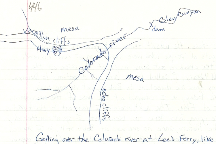
Getting over the Colorado River at Lee’s Ferry, like so many other travelers, is one of the few options available for me to move through this region. The Grand Canyon of the Colorado is a major obstacle to movement for most land creatures. It’s hard to say how this barrier can also be seen as a connector. Unlike an ocean or other large body of water, this River is one of the wildest and roughest stretches in the world. Then there is the challenge of actually getting to the water. Vertical cliffs guard much of the river, and of course, to the west the canyon is 5,000 feet + deep. The water itself is undrinkable without much effort (three filterings) because of the huge amount of ultrafine silt suspended in it. For 190 miles to the west there is no other bridge across until you reach Hoover dam. There are not too many places in the lower 48 states that have a 190 mile area you can’t cross by car. This makes the Grand Canyon pretty inconvenient. The Navajo nation, to its east, is also pretty inconvenient. Southeast Utah as well, few roads, lots of bad roads, lots of deep, steep canyons, and very few people/services. This area, along with the Colorado massif, is what makes for the big hole of low population between the four cities of the four states of the four corners: Salt Lake City, Utah; Phoenix, Arizona; Albuquerque, New Mexico; and Denver, Colorado.
So, crossing the Colorado River, still a big deal even in the late 20th century, and I suspect it will be until we are no longer creatures of the land, but of the air. Highway 89 continues along the edge of the great mesa, heading back to the west now. This edge is now defined by the Vermillion Cliffs. This is the new home of the relocated California condors. The Condor is the Thunderbird, one of the great protectors of life on earth. Like the sea turtle, the bison, the clam, the copper, and others; the Condor is one of the beings that holds life together here in North America. Scanning the cliffs for condors and not seeing any, but photographing the cliffs anyway, I continued up onto the mesa into the Kaibab National Forest to camp. Finding a good camp, I walked about in fields of blooming flowers. There is nice Indian tea, (Ephedra) growing here, so I picked some of that and enjoyed the beautiful forest. Continuing the next day to Jacob Lake, I checked out the Forest Service office and bought a map of the four corners area.
4444444444444444444444444444444444444444444444444
On the way to Freedonia, Utah, is an overlook as you come off the Kaibab plateau and start to descend into the Kanab Creek drainage. From the overlook I could see the better part of Southwest Utah. The Grand Staircase was laid out before me, more Vermillion Cliffs with White cliffs above and Pink cliffs above them. The mountains above Escalante, Bryce, Cedar Breaks, and Zion. To take it all in and comprehend the vastness from just this one spot would take an enormous mind, and heart. One as large, I imagine, as this whole scene itself. It always amazes me, what we can see, what we are allowed to see of this creation. Even without our microscopes and telescopes and special equipment, just with our eyes, certainly no better and usually much worse than our animal relatives eyes; yet we don’t catch them staring into the stars, or the sunset, or out across vast reaches like this one. Why can we see so much more than we can have, can touch, can do anything with? Even with all our capacity for learning and ability to preserve that knowledge with film, writing, and painting, it seems we have an equally great (capacity?) for forgetting, ignoring, and destroying. From these expansive thoughts, I come slowly down, down into Freedonia, back to the world of humans.
A brief stop at the Forest Service station there, where they gave me a bird poster, and I was on to Kanab, Utah. In Kanab, I stopped for a little food, then went up to Glendale and got gas. Glendale is on the Virgin River and is in the green and red zone of Utah – the green is from water, the green grass and willows and trees that seem supernaturally green because of the lack of any other green color for hundreds of miles. The red is from the red rocks of the cliffs and hills around the water. This stunning combination makes for the most beautiful oasis conditions in the West. The populations of these little towns is just in the several hundreds, and probably hasn’t changed much, nor will change much in the future. The reality of living here is much more limited than one could imagine by driving through. Very little water resource here, far from any city, few paid or paying professions, and in this particular County of Kanab, an old-fashioned, “backwoods” type of Mormonism that allows polygamy and the iron law of the hierarchical male church. The population of the entire county is probably less than 5,000 people, with most of that in one town, Kanab. So this is one small town County.
Leaving the Virgin River country, I head west on Highway 14 to Cedar City. Once up in the mountains again, I find I’m leaving those thoughts of humanity behind again and entering the vastness of nature once more. I camp up near Mammoth Cave, a series of lava tubes in Dixie National Forest. The next day, continuing up to Cedar Breaks National Monument, I get some good photos up at 10,000 foot elevation. On the way down, I explore for a camp and get the car stuck in the mud. After digging out, I decide to go down to a lower elevation to camp. A few miles back down Highway 14 to the west is an overlook of Zion National Park, and a forest road there led to a nice camp in the aspens.
The next day I went down to Cedar City after my morning run. Time for laundry and food shopping and a shave. The town of Parawan is just up the road, and since this is where the Alpine Hotshots spent their first years, in a motel, I decided to try and find it. It was much easier to find their old motel than I thought, of course everyone in town knew where the Hotshot crews stayed, so I found the “Crimson Hills” and met the new managers, Cowan and his wife. After lunch at the café it was back to the road for a long ride in the car. 35 miles up I-15 is the town of Beaver, and at this point I was to leave the relative lushness of the Tushar Mountains and head west-northwest across the incredible desert of Western Utah. It’s called “basin and Range” topography, but it’s more like “flat desert and steep desert” topography. I was headed for the westernmost edge of this particular loop of the spiral, and that ran along the Nevada/Utah border. Not a particularly thrilling place when you look at it on a large map of the US, but again, when you look up close, there are all kinds of interesting places. Just over the border, in Nevada, I see there is a relatively new National Park, the Great Basin National Park. It is right on my way, so I brace for the hundred mile journey across the Utah desert, to head for: the Nevada desert. What was I doing? At times like this it was hard to know, but it was also amazing how quickly I could leave one vastness for another. I left a series of small, quaint, lovely towns for an endless desert. How many people intentionally went this way? Un-intentionally? If you added up both numbers, you would still end up with a negligible number. So I struck out for Minersville, and Milford, and after that it’s about 70 miles to the next town of Garrison and Border. But along the way is the Wa-Wa Valley, the ghost town of old Frisco, and after crossing the chain of Wa-Wa Mountains, not much of anything, even the desert range experimental station didn’t leave much of an impression. Seeing the Wheeler Peak range in the distance though was a change from the Utah desert to some serious mountains in Nevada. Wheeler Peak tops 13,000 feet and draws the eye like a beacon to it. Finally I got to the Nevada border, crossed into Baker and went to the National Park visitor center. I looked at their books and hiked up and around to the water source, a spring, for the Park service village. The sage looked good enough to eat here, so I picked some and then drove up to the Baker Creek trailhead and campground. The weather was brewing a bit, windy with sprinkles, so I stayed in camp, made dinner and spent the night.
In the morning I packed my backpack and started walking up to Baker Lake, which is above tree line. There are bristlecone pines here, so treeline is very high, they don’t start growing until you reach 10,000 feet. I walked up as far as the snow line, and then came back down, a 12 mile round-trip. It was now 1 PM, so I made some lunch, then went back to the visitors center and booked a cave tour of the Lehman caves. After the tour I got a plant list and studied plants, went for a walk near upper Lehman trailhead and generally hung out until the campground program started. The Ranger, Ed, was giving a talk on wildfire. We talked a bit before the program, and he let me speak about my experiences at Sequoia National Park with prescribed fire. That night I camped in a light rain at Shoshone Creek.
After breakfast I drove back into Utah and head to the post office at Garrison. There I got to talking with a lady who told me about this Christian community over at Eskelle Valley, I should go over and check it out. So I drove over there, and saw this big compound, green grass everywhere, dairy cattle, a bustling operation. I went into the office and sat down. Eventually somebody came over to see what I wanted. Everybody there had their hair cut short and wore overalls. I had seen this before in California at a place called Synanon. Anyway, they were nice enough and explained their intentional community and that they interacted with the surrounding towns as needed, but seemed fairly self-sufficient and happy. Heading back into Nevada, I joined up with the big Interstate 50, the “loneliest highway”. If that was true, then what was that little road I was just on? I was headed for Ely, a city, what was lonely about that? Anyway, I went over Sacramento Pass and Connors pass and down into the town of Ely, which is still up at 6,400 feet. The Schell Creek range is now to the east and the Egan range to the west. These are not the desert hills of Utah, they have trees on them and are proper mountains. Nevada has much more water, mostly underground than people realize. But now Las Vegas does realize, and wants to pump that water downstate from all over northern Nevada. The camping around Ely is fantastic, and in three different locations. After seeing the Armageddon board game at a store, I was ready to get out of town and back into the hills where I belong. The creeks were full of water, the Wytheia was in bloom and I ran the trails and lived. This was pretty much the westernmost edge of the spiral loop, so now I would head North and start the long, slow curve back to the East.
>>>>>>>>>>>>>>>>>>>>>>>>>>>>>>>>>>>>>>>>>>>
The creeks were full, the sky cloudy, and the air calm. June was turning out to be a great month to be here in Nevada. I headed north on Highway 93 up to Duck Creek Valley, then up and over the Antelope Range and the Goshute Mountains. From Whitehorse pass in the Goshute Mountains, you look Northeast out over the Nevada/ Utah border and the Bonneville Salt Flats in the distance. Coming down off the pass, I stopped in Wendover and mailed some cards to friends before hitting the big I-80 interstate. The section of I-80 from Wendover east to Knolls has got to be one of the straightest and most cardinal directionally aligned sections of highway in the country. It runs due East and West for 40 miles in a straight line. In comparison, the Bonneville Speedway runs about 12 miles in a straight line, on a Northeast/ Southwest direction. My route, however, was the other way, west on I-80 toward Wells, Nevada. The historic California Trail was about 40 miles away, following Goose Creek and into Idaho. Highway 233 turns into Highway 30 in Utah, skirts the Grouse Creek Mountains, and hugs their shape through the town of Rosette up to the intersection with Highway 42. I took 42 which heads North West, to be close to the mountains and a small piece of the Sawtooth National Forest to find a camp for the night. I got off the highway and followed a dirt road which ran right along the Utah/Idaho border. I camped just over the fence on the Idaho side. Not really in the mountains, but the lack of any humans out here made the sagebrush plains quite private.
<<<<<<<<<<<<<<<<<<<<<<<<<<<<<<<<<<<<<<<<<<<<<<
The morning brought me back to the road, I had a long, winding way to go today through unfamiliar territory. Heading northeast across the southeast corner of Idaho is not a smooth route following roads, unless you follow the Snake River Valley. I wanted to avoid that freeway farmed area and again stick to the mountains. This complicated boundary of the Snake River has numerous Northwest /Southeast valleys which lead to the snake, but also connect with isolated Bear Lake in the southeast corner of the state. The Bear River encircles the northern end of the Wasatch range and ends up in the great Salt Lake.
Getting back to Highway 30 going east was easy, and I crossed I- 84 and continued on Highway 37 into Idaho, across a section of the Curlew National Grasslands to Holbrook. From there a turn to the east on Highway 38 lead me to Malad City. There I stopped and visited for a while with a history teacher before heading east over the hills to Preston, on the Bear River. Following the Bear River up to Soda Springs is a beautiful little back road, and since Ely, Nevada, the sky had been cloudy and raining off and on. As the mountains grew taller going north, the rain increased. I crossed the border from Idaho into Wyoming at Freedom, and went north along the border to Alpine on Highway 89. Just before Alpine, the road crosses the Snake River, which is backed up by another dam. The headwaters of the Snake is in Yellowstone National Park, and these streams come together in Jackson Hole, a gigantic meadow at the base of the Tetons. At Alpine I headed back into Idaho and followed along the Palisade reservoir up to Swan River. From there I headed up over Pine Creek Pass into a beautiful little Valley that sits just west of the Tetons, as Jackson Hole sits to the east of them. Here are the towns of Driggs and Victor, which is where the people who work in the Jackson area have to live, as real estate prices hadn’t hit the heights yet in Idaho, as they had in Jackson Hole, Wyoming. After hanging out a bit in Victor and Driggs, seeing all the new houses and real estate development beginning here, I continued North in the rain to a camp along Warm Creek near Ashton. I gave a ride to a guy here, whose truck had been stuck when the side of the road caved in from all the rain.
The next morning the rain let up, and in driving slowly along the Henry’s Fork of the Snake, I came across a set of incredible waterfalls – Mesa Falls. There is a big parking lot and paved trail out to overlooks, but even so, the place seemed primeval; the volume of sound and water was such that there was nothing else for the senses but the thunder of a huge river falling, and falling, ever and ever. Going up to the upper set of falls, I saw a pair of Osprey. Henry’s Fork is the continuation of the Snake River in its Northeast trend: see map.
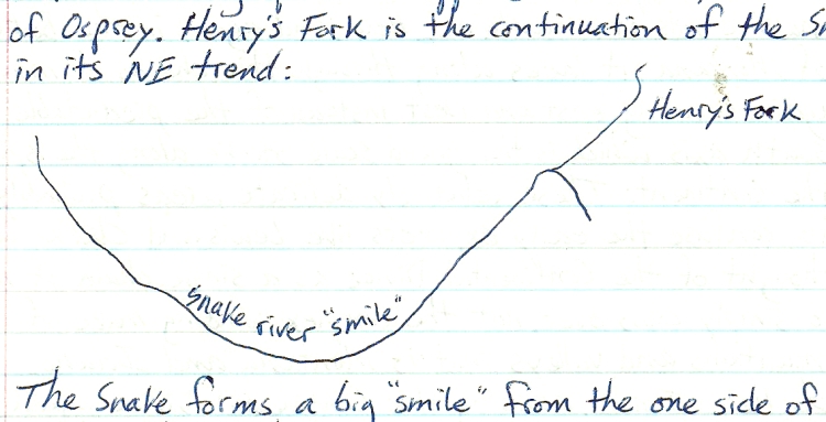
The snake forms a big “smile” from the one side of Idaho to the other. There were some Forest Service folks there at Mesa Falls, so I visited with them before heading up to Island Park. At the visitors center there I got some maps and posters and looked up some wildflowers I had been seeing. This country was so wet and green, and I had been in the desert so long, that it really was quite surprising to see so much water, green grass, wildflowers, lakes, rivers and wildlife. Moose were crossing the road, not gracefully, and gave me concern for them as well as for me and other drivers. I was approaching the Continental Divide again, and Yellowstone National Park, both high points in many ways, but with all the rain I wasn’t inclined to hang around too much. As beautiful and lush as this place is, I still had the same rhythm of movement, passing through, observing what I could, seeing what is here, but also how it is connected to the previous and next place.
This is the Targhee National Forest, which covers these mountains that really are a narrow East/West link in the Continental Divide, the Targhee being on the Idaho side, and the Beaverhead National Forest being on the Montana side, but the Continental Divide does have several places like this where it doesn’t follow the most massive set of mountains. Here, and again in the Butte area of Montana, it laces along through thin chains of mountains – again running east and west instead of the predictable North/South axis which is the grand scale stroke along the spine of the continent. These relatively delicate areas probably helped to confuse the early explorers like Lewis and Clark, who thought of the Continental divide as a single chain of mountains to simply cross over, not the complex, winding maze of mountains and valleys that is Montana and Idaho.
So here I am, crossing the Continental Divide again, this time at Targhee pass. In crossing the pass, I enter Montana, and then a few more miles to West Yellowstone, an entry town to the National Park. A tiny strip of the park is in Idaho, but that state doesn’t have much of an access or any border town. I walk the town, got a little food, did some letter writing, and felt the bustle and torrent of the tourist trade in this tiny spot which see so many millions of people come through. I wanted to stay here and see the park, explore and live in this beautiful, green, wet place but already I had to keep moving to my summer place of work. It’s hard to enjoy something quickly, there’s a certain pace to enjoyment, and to learning. So I went to slowly as I could.
Moving to my next camp, I drove north on highway 191 toward Bozeman, down canyon to Big Sky, a small town on the Gallatin River, near the Lee Metcalf wilderness. There I visited with a local kid from Pocatello, Idaho and had some lunch. I continued down Canyon to storm Castle Peak, and camped there alongside a Creek that was just bursting with water. The rain had let up here, but the runoff was tremendous this year, and there may be flooding further down on the Yellowstone or Missouri rivers.
After my morning run, I went down to Bozeman and check out their Museum store, looked at their books, saw an interesting one called “Uncommon Ground”. A Forest Service research station (one of them for the Rocky Mountain region) is here, so I picked up some more info and resource material here, then finally drove out to Livingston to check out the bookstores there. I was looking for plant texts, and didn’t find much, but there were some nice baskets. I had hit the I-90 at Bozeman, and at Livingston, the Yellowstone River comes down from the park. I-90/94 follows the Yellowstone all the way across Montana, nearly to North Dakota, where it finally turns off to the east at Glendive, where the Yellowstone river continues on its Northeastward journey to meet the Missouri river just over the state line in North Dakota. About 40 miles past Livingston, I turned off the interstate to find a camp up toward the Beartooth wilderness, which is the northern buffer to Yellowstone Park. Taking a small road toward Absarokee and Nye, I found the Stillwater River and camped along this torrent of water. The rains had begun again and the rivers were rising. The next morning I drove back out to Columbus on flooded roads. The Yellowstone was now going full bore, and even though it and the Missouri River are dammed up in several places, this year there would be no holding them back. At Columbus I got back on the I- 90 and cruised through Billings, then kept following the Yellowstone River, using I-94, across the plains of Eastern Montana. Just stopping once for gas in Terry, I kept following the River past Glendive, where the I-94 turns off to the east, and took Highway 16 up to Sydney. After Sydney I took small roads around the confluence of the Yellowstone and Missouri rivers, crossed over to the north side of the Missouri, and stopped in at the Fort Union historic trading post. I was back into familiar country now, where I had been in 1995 when I first started scouting out this area on my way up to Canada.
******** ********* ********** *********
Stopping in at the Fort Union trading post, which is stocked with items similar to those traded in the 1800s, I bought some green pigment, yellow (greasy) beads, tobacco and a map. In visiting with the Ranger about local history, I found out there was a rendezvous starting next weekend. I also heard that the river here would be in flood stage tomorrow, no surprise there. I decided to keep moving and went up through Williston back to the Writing Rock historic site, where I had visited in’ 95. I just love this area, near the borders of North Dakota, Montana, and Canada; it just has the feeling of one of the most remote, forgotten, and unpopulated places I’ve been, as well as being beautiful with its rich black soil, rolling rounded ridges, and moist cool air. It was warm and calm, again I’m the only one there, and now I start using my tent as I’m back in the mosquito zone.
The next morning after my run, I spend hours in prayer, connecting with this area, and the way it is connected to the land, radiating out in all directions. This is a high spot in a vast sea of undulating ridges. To be able to see out in all directions like this is indeed a special thing. Even though there is “nothing here”, that makes it all the more authentic to me. A place like this, existing on its own, like a rarely visited island in the sea, its value is hard to describe but is undeniably real.
Leaving this place, I went north a bit up to Highway 5, the northernmost East-West highway across North Dakota, and headed east toward the Turtle Mountain Ojibway reservation. This is the northern edge of this loop of the spiral as well, and I follow along the Canadian border like this all the way across North Dakota. From the solid wheat fields of western North Dakota, I rode into the farmland of central North Dakota through the little towns of Bowbells, Mohall, Bottineau and Dunseith. Coming into Belcourt, I stopped at La Dotts – gas and food, and met the sister of the owner. I asked about camping in the area, and she said the town lets people camp in the park (in the middle of town). So that’s what I did, now I really felt like I was on public land! The next day I checked out the Anish’nabe village, just north of Belcourt. This reservation felt more like Canada than the US, where Indians can be Indians, and are more relaxed and into their culture and are not trying to hide it, or need to. The village was the reconstruction of a traditional village, but it had not been kept up and was being let to ruin. There is a big earth lodge there and several longhouses and other structures. I met a guy there who was a college student up from Watertown who knew some of the history of the place. He told me how the place was built, but then left to fall to ruin for some reason, I can’t remember now.
After going back to the highway and East through Rola, I continued east across North Dakota, through Langdon and Cavalier into Pembina County. Jogging north on I-29, I went up Pembina and visited their museum. Now I was on the border of North Dakota, Minnesota and Canada, which is defined by the Red River of the North. This river flows up from the south, forming the Minnesota/North Dakota border before crossing into Canada and finally into Lake Winnipeg. This is flat country – all of Eastern North Dakota, Western Minnesota and southern Manitoba is an ancient lake bottom. The recent floods of the past few years had left a watermark high on all the buildings in town. From southern North Dakota to the Canadian border, the Red River drops less than 200 feet, a crow flight of a little over 200 miles. So at less than 1 foot per mile of drop, you can see this is a slow, winding river, barely flowing at all, yet gathering waters from a vast area. So again, you can see how the ancient lake comes back to life rather easily. After lunch in Pembina, I headed down to Cass Lake, Minnesota via highways 75, 11 and 59 to Highway 1 at Thief River Falls. Highway 59 follows a “ridge” or rim of the ancient lake, which separates it from the boggy lakes to the east – Thief Lake and Red Lakes. Highway 1 runs east/west across northern Minnesota, so I followed it east to the Red Lake Reservation, where it jogs south around the southern Red Lake. Just before the town of Red Lake I turned south on Highway 89 down to Bemidji. This was familiar territory again, and I took Highway 2 over to Cass Lake and then down the east side of Pike Bay to Michael’s cabin. From there I called Michael and found out he is coming up in late July, this being the middle of June. Here I spent the night, to head up to Ely, Minnesota tomorrow.
Chapter Fifteen: Summer in Ely Pg. 461
This loop of the spiral came down from Pembina, through upper Red Lake and curves down through the Duluth area. This being summer, and time for me to make money again, I would head up to Ely from Grand Rapids, following the Iron Range back to where I worked last summer at Silver Rapids resort. For the first few days back in Ely, I re-connected with friends and started gardening again right away. Helping Franna plant potatoes and tomatoes, lettuce, onions, parsley, carrots, basil, broccoli, cabbage and flowers was lots of fun. She had garden-variety Angelica growing too, and the rhubarb grows like a weed in everyone’s garden. The next day I helped Rosie plant her garden, mostly tomatoes peppers and basil. The rest of the summer I helped water and tend these gardens, as well as others around town. It was a hot and dry summer, and we mulched the hospital garden heavily with a foot of straw. Also, before starting at Silver Rapids, I went over to Grand Marais with Carolyn. We camped up on the Gunflint trail and hiked out toward Rose Lake, saw W. Bearskin Lk., and Moss and Duncan Lks. We camped at the Caribou Rock overlook, and the next day took in some of Grand Marais and the beach before going back to Ely.
Working at Silver Rapids again was fun, seeing some of the same people, renting boats and fixing things. The daily routine set in, and I worked through July, gardening and canoeing in between shifts (usually 7 AM to 4 PM). I also had a house-sitting gig at the Matson’s, who built their off- the- grid log home north of Ely. I also worked with Art Matson a couple of times in town on odd jobs, it’s a small world there in Ely. Picnic in the Park is a town event, and I made lots of connections there, including another caretaking gig at Tofte Lake. When I ran into Lee, a young man who worked at Silver Rapids last year and asked if he had seen Jeff Wolf, he said yes, he sees him every day, “he has been living with my mom and me for the past six months”. Wow, small town. I started caretaking, cleaning cabins and doing maintenance work at Tofte Lake while also working down the road at Silver Rapids. It didn’t rain for almost the entire month of July. The June berries and raspberries were still edible however, so I could always spend some time in the afternoon berry picking.
Michael Gordon was up at his cabin in Cass Lake, so I went down there with Carolyn to visit. His sister Sandy was there with the kids, their parents, and relatives from Iowa. It’s the Midwestern thing to do in the summer, go up to the lake. We never caught fish or anything, we would just go out on the lake and swim from the boat. We did art projects with the kids and went for some hikes around the lake. Through August I worked a lot at Silver Rapids and Tofte Lake, and the last day of August was when Princess Diana was killed. I managed to save about $1,000 so that I could continue traveling by mid-September. Before I left Ely, I did try to go wild rice gathering, but the day was too windy, and after that the ricing was over. I was to go out with Art Madsen, and after we scrubbed the trip, we went back to his place for breakfast. Later that day it started to rain, so we did some folk dancing in town, I had lunch with his wife and kids, then got some interior painting done on his rental. The next day I went hiking with Jason around the small lake (6 miles) in the clear sun of another windy fall day.
Chapter 16: Mississippi river to the 4 Corners
The following morning I head out for Wisconsin via Duluth, stopping at the Laurentian Divide for lunch. This is the north-eastern Continental Divide, separating the waters that drain into the Gulf of Mexico from those that drain into the North Atlantic Ocean via the St. Laurent Seaway. This divide nearly surrounds the Great Lakes, and that night, after a brief tour of Duluth, I would camp near the divide again outside of Holyoke, Minnesota on the Nemidji River. As the rain fell that night, I could know that some was going north to Lake Superior, some south to the Mississippi River. I was heading back down the spiral again, to the southeast. The route I was following now cut diagonally across Wisconsin, to the Illinois/Indiana border, south along the Mississippi River to northern Louisiana, where it then headed West in a dipping arc across Texas and headed through New Mexico to the four corners. It would be November before I would make any money again, so I stretched out across the next two months and thousands of miles from Minnesota to New Mexico.
Having the whole state of Wisconsin before me, the exciting possibilities and potential was tempered by this limited amount of time and money. The headwaters of the St. Croix River meet the Lake Superior watershed near Hawthorn, Wisconsin, and this is only about 10 miles south of the lake shore. The Great Lakes, for their awesome size, have a fairly narrow strip of land around them that feeds water into their bodies. There are some exceptions, some exceptional areas, such as the state of Michigan, which feeds either Lake Michigan or Lake Huron. So now I was entering the Mississippi watershed again, via one of its gems, the St. Croix River. The River isn’t that long, and forms some of the border between Wisconsin and Minnesota before coming into the Mississippi River near the Twin Cities. It’s exceptional in its wildness, it’s many branching tributaries, and the vast network of small lakes that form its headwaters. The St. Croix is just the first of three major tributaries to the Mississippi which form most of the state of Wisconsin : those being the St. Croix, the Chippewa, and the Wisconsin. The two other major rivers of eastern Wisconsin, the Menominee and the Winnebago, both feed Lake Michigan via Green Bay. I stopped briefly in the town of Hayward, long enough to see that there is a major cross-country ski event every year between Hayward and Cable, another small town 17 miles to the north. Hayward is also the major off reservation town for the Lac Court Orielles Indians. Spooner is another reservation town a little further S. down Hwy. 63. Southeast of Hayward I crossed through the reservation proper, which surrounds two large lakes in the Chippewa River watershed. As I moved slowly along in this land of lakes and woods, I thought of my summers in Ely and what kind of occupations one could find here. The Chequamegon National Forest hopscotches down from the shores of Lake Superior through north-central Wisconsin, and I was skirting the edges of it as I zig-zagged down to Ladysmith and Hawkins, where I went south to Hannibal and then finally entered the forest to camp east of Hannibal. Now I was near the high point of Wisconsin (Tim’s Hill) at 1,952 feet, in between the Chippewa and Wisconsin watersheds. That leaves a 1,300 foot drop to the shores of Lake Superior which is at about 600 foot elevation. There are numerous downhill ski areas along this highpoint ridge, especially between the Wisconsin River and Lake Superior watersheds. Small cross-country and even downhill ski areas dot the entire state, even into Iowa and Illinois along the bluffs above the Mississippi River.
The thought of going into Chicago did enter my mind, but when I couldn’t get a hold of a contact there, I decided to go around the city. For now my mind was on the car, wondering if I was going to make it across Wisconsin. It was making some strange noises and not running well. I limped on in to Wausau and bought some wrenches to tighten up some things, and that must’ve helped, more than me worrying about the car anyway. My next stop was to see Jeff Wolf’s dad, Ed in Wild Rose. This is about as far east as I would get in Wisconsin, even though Lake Winnebago and Green Bay and especially the Kewaunee Peninsula up to Egg Harbour all looked intriguing. I had a nice visit and spent the night there at Eds, and we did visit a friend of his, Butch and his wife, who was going out to Cortez, Colorado arrowhead hunting. He had a huge collection of arrowheads and other natural history in his house and yard. He had a big wood yard too with lots of milled lumber.
The next day Sunday, I drove out through Wautoma, back to freeway 61 and south to Portage, then west over to the Wisconsin River Dells to see what Dells were. I assumed they were rocky bluffs, as these were prominent in the town. Crossing the river and going south through Baraboo, you cut off a big elbow of the river that sticks out to the east before running west southwest again to its final merging with the Mississippi River at Prairie-du-Chien. I crossed again at Prairie-du-Sac and continued south into the city of Madison. It was a beautiful sunny day, and still early, so I toured the city by car, driving around the lakes which dominate it, finding the Arboretum, which isn’t hard for it takes up half the city, and took a brief tour there. They have restored some tallgrass Prairie Meadows, a huge crabapple collection, and a re-creation of five eco-zones. After lunch there, I walked the grounds and picked some chestnuts, black cherries and wild plums. I drove out to a nearby county park to have dinner and rest, and found that I could camp right in the city. The next day I checked out the university campus, saw where the museums are, then ran back to the Arboretum and got some studying done in their library as it started to rain. What a concept, a huge Arboretum within the city ! That night I decided to stay in a motel and spend one more day exploring Madison.
The next morning I went downtown and hit the state Historical Museum. They had a display there about a couple who had made a traditional Ojibway long house and lived in it through the winter in northern Wisconsin. The University’s geology Museum was a short walk away, so I went over there and checked out their fossil and stromatolite collection. They also have a huge outdoor globe, 20 feet high.
I headed out of town before it got too late, I still needed to find a new camp, so I went down I-90 to Illinois and camped outside of Rockford on the Rock River. The days in Madison were memorable, the scale of the Arboretum – on par with the city itself, and the efforts to restore a patch of tallgrass prairie which include burning the grass every year. A fire rake was invented for the task of working with the tall,burning grass. A college town, yes, but with more of a vision than most, and with plenty of opportunities for applied research in the ecological restoration field.
&&&&&&&&&&&&&&&&&&&&&&&&&&&&&&&&&&&&&&
I knew I was missing some great museums in Chicago, but not having a place to stay there was a big deterrent, and I didn’t feel the energy to deal with such a big city. From Rockford I went Southeast to DeKalb, which felt like it had some positive things going for it. Spending the morning there, I did some exploring on foot and felt at ease there. I stayed and did some writing before braving the tangle of freeways that squeezed around the south end of Lake Michigan. I would try to get to Indiana Dunes State Park for the night, so I picked my way through the maze of highways, avoiding the toll routes, ending up on I-90 for a while in heavy truck traffic before turning off in Gary, Indiana. What a scary rust pot that is, very post-apocalyptic, gang ridden, “abandon all hope ye who enter here” type of place. Those are the places I really pray that the car keeps running. I made it through the gauntlet and into the incredible contrast of a large, wooded State Park that has miles of beautiful sandy dunes along the shore of Lake Michigan. From a high point I could see the factories, the sprawl of Chicago, and a giant tower that belched smoke and fire – it looked like a thing that just burns 24 hours a day, every day, on the shore of this beautiful Lake. Lake Michigan really is beautiful, when you can see it. The land is so flat all around it that it’s difficult to get a big view, but here at the dunes were some high points and observation towers. I ran along the beach encamped and read books at the visitor center, and oasis of natural life here poised on the edge of one of the biggest natural lakes, but also surrounded by subdivisions, endless farmland, horrific industrial infrastructure with its permanent fire, a multi-stranded belt of interstate highways, and all of this swallowed up to the West by one of the most densely sprawling city blobs in the country. Any one of these things would be a huge contrast and barrier to the natural functioning of this relatively pristine area, but to have all of these together is absurdly, surreally overwhelming.
After spending the night there, I got in one more run along the beach in the morning before heading out to travel the length of Indiana. In traveling the Midwest, I would look for state parks, or bits of national forest land, or even a green triangle on the map showing a campsite. Sometimes, as is the case in northern Indiana, it’s a long way between these camps. Northern Indiana is surprisingly unpopulated. The towns are minuscule, the farmland fast, the roads long and straight. It was hard to stay awake. Kind of like the Central Valley of California, my reference for endless agriculture.
At Lafayette, Highway 43 crosses the Wabash River, the major river of Indiana along with the Ohio. The Wabash forms the squiggly southwestern border with Illinois, the Ohio forms the even more rippled southern border with Kentucky. The Wabash is amazing in the reach of its tributaries, almost the entire state, along with a lot of Illinois drains into it. North of Lafayette, the Tippecanoe tributary comes from the northeastern Indiana into the Wabash. This confluence is where Prophets-town, the stronghold of Tecumseh and his brother, the prophet, was located. From the time the Fort Wayne treaty was signed (1809), ceeding 3,000,000 acres to the US government, Tecumseh and his brother Tenskwatawa, tried to rally every tribe in the nation against the enforcement of that treaty, or any other sale of land by an individual tribe or chief.
This land may be difficult to drive through due to its flat, monotonous, vast nature, but it is a place of space, or at least it was. Open spaces, vast, seemingly unending open spaces for people to go, to live, to try things out – growing, hunting, raising children. As much as we need places like this, we also need to be connected, to have social contact, and not feel isolated, abandoned or ignored. With the collapse of the small family farm and the takeover of agribusiness, the population density has actually decreased in the Midwest and rural West. This leaves the remaining families vulnerable to that isolated, abandoned and ignored feeling. Maybe this is part of what makes it difficult to drive through “the country” these days. That, and knowing that this was once a functioning ecosystem, capable of supporting a wide variety of large mammals, including humans.
The cost of what we grow, it used to be that the price of a bushel of wheat was equal to the price of a barrel of oil, has changed drastically in the past few years (’07 to ‘09), but the cost in gallons of gas/ bushel of wheat has not changed that much. When oil was cheap, we thought we could afford to do a lot of things, but it wasn’t seen as a temporary condition, that cheap oil, but as a permanent one. Therefore some permanent infrastructure, and practices, and culture and beliefs were built upon that foundation. I would say that life only gets “easier” when we realize how much work it actually takes. Otherwise the work surprises us, and that isn’t easy or fun. Knowing how much work it takes to say, feed oneself, may seem like a no-brainer, but we can forget, or get distracted from that reality, and then be caught off balance when we’re reminded how much our food is actually worth. When you don’t have to do the work, you forget its value. This is especially difficult when work is first translated into dollars, then dollars are used to buy food, or what have you. Not all work earns the same dollars, sometimes even the same work earns different amounts of dollars, and sometimes work earns no dollars at all. Besides the value of work, there’s the value of rest, of thinking clear thoughts, of daydreaming, of imagining and any number of other things that are “not work”. Money may not have always been with us, but it has been for the past thousands of years, and doesn’t look like it’s going away anytime soon. Life may have been simpler, more clear, even more rewarding without money, but it’s complications are here to stay, and it seems like the more we study “the economy” nowadays the less we really know for sure; clear, simple choices are fewer, and “rewarding” becomes a loaded commercial term.
***** ********* *******
I stopped at a roadside stand and buy three dollars worth of peaches and apples. The people are very nice, but the isolated, desperate feeling is palpable. I continue south through Lafayette, down Highway 231 through Crawfordsville, and go far around Indianapolis, but it’s tentacles of interstates seem to dominate most of Indiana. As I get south of Indianapolis, the State Parks start to appear, so I head for McCormick’s Creek near Spencer. It’s a deluxe place by western standards – showers, flush toilets, they have water here, and money for maintenance. For $15, I stay two nights, so after a relaxing first night, I spend the next day exploring the state Park, walking and running the trails, picking cedar branches, eating and resting, studying my maps and writing in my log.
After breakfast the next day, I head down Highway 46 to Bloomington, and do a little shopping in this university town. Out of Bloomington I get on route 37 and go south. I’m in southern Indiana now, going through Hoosier National Forest and getting into the hilly country that tortures the path of the Ohio River as it tries to find the Mississippi to the southwest. Driving along, I saw a place called “Roots, Leaves and Berries” so I stopped in and met Ron Bolin. People came from all over the place to Bedford, to this shop to get their herbal remedies and see a Naturopathic doctor. It was quite the subterranean scene, people coming in with a secretive, religious faith; and this seems to be the only or last place to get such remedies. Herbal remedy stores are common in California, even Arizona and Colorado, and of course there are the “Remidios” of New Mexico, but to see one in the Midwest was a rare thing indeed.
Continuing along, through the hilly country south to the Ohio River, I was back to that wild country that was at the same time “oh so tame”. This Ohio River Valley is such a unique place, with a contradictory vibe. At once rural, forgotten and lawlessly wild; and at the same time settled, farmed and owned for generations, civilized, paved roads and fences, modern conveniences. I cruised southwest along the Indiana side of the river, with Kentucky to the other side of the river. Tell City was the last town of any size (small) in Indiana before finally going across the river into Kentucky at Owensburg. They had maps for sale, so I got my Kentucky map, then started looking for a place to camp. I happened upon a campground near the river called Diamond Lakes, just as it was starting to get dark, so I went in and it was actually kind of nice, relaxed, comfortable, for only $10. Not bad for a private campground with all kinds of tourist amenities. After a nice run along the river and breakfast out the next morning, I picked some cedar branches for smudge and headed out through Marion and Paducah, following the Ohio River still, but on the Kentucky side, slowly making my way down to what I thought was a famous confluence (Ohio and Mississippi) and town – Cairo, Illinois. Studying and absorbing the landscape of this country which was so foreign to me, much different than the farmland across the Midwest (Dakotas, Iowa, Illinois, Indiana, etc.) or even the Ohio River Valley from which I just came, it has a different feel entirely. It was open, not tightly confined by hills and twists, but had a more industrial rather than agricultural feel. The clincher though was actually crossing the river into Illinois, getting off the highway, and driving through what was left of Cairo. The town felt totally abandoned, and also like it was closed, like I shouldn’t be there. Warehouses were everywhere, and it was like the company had closed shop and put out the no trespassing signs, only there weren’t any signs, or people. An eerie place, not what I had expected or hoped for.
The elevation here is only 316 feet above sea level, with thousands of River miles to go before reaching the sea, you can see how low and slow is the Mississippi from here on down. Nearby Mound City, Illinois was equally deserted, and I didn’t see any mounds or state parks are monuments or anything. This place had a huge concentration of “mound builder” culture burial mounds, as did the city of St. Louis, which have all but been leveled after having been looted of their goods. A practical reason for constructing such a thing would be to raise the burial place (or living place) of the leadership above the floodwaters of these great rivers. Practical only in the sense that, practically speaking, these sites could have been located on top of natural hills nearby, but weren’t. The oldest ones however, began over 5000 BC, are located in Louisiana, where there aren’t any natural hills nearby. Maybe the tradition of building, or even better, the proximity to the river, was the important thing here , rather than what we think of as a “ practical reason”.
I had entered the zone of convergence, and found it abandoned. In the whole tri-state area here where Kentucky meets Illinois and Missouri, there are practically no towns near the river, and not even a bridge directly from Kentucky into Missouri all along their 90 mile mutual border. Add another 70 miles of Kentucky/Illinois border and you have the confluence of four major rivers in this tight region: the Mississippi, the Ohio, the Tennessee, and the Cumberland. Along the way from Owensboro to Paducah, Kentucky, I saw lots of ads for the “Land Between the Lakes”, a State Park situated on a narrow strip of land that was left between reservoirs of the Tennessee and Cumberland rivers, which had been damned just before their confluence with the Ohio River. The Tennessee and Cumberland almost join together, but parallel each other for the last 60 miles or so before joining the Ohio, with a strip of land between them less than 10 miles wide. Paducah is just downriver from their confluence with the Ohio, a depressing little post-industrial town, run down and sharing that neglected, abandoned feeling with Cairo, but with a population that probably feels “stuck there”.
Lakes, man-made or natural, are the magnets for people in the Midwest and the South. They are kind of like the mall, the National Park, and cultural entertainment all wrapped into one place. The Mississippi River however, even though its lock and dam system creates “ponds” or long, flat stretches of water between the dams, is so heavily traveled with barge traffic that it’s not used as much as the lakes and reservoirs on its tributaries. This makes the river (Mississippi) an odd combination of being an incredible, undeniable landmark, with little traffic or “destination” activity.
From Cairo, I made my way south, along the “River Road” that tried to follow along the river, but usually made so many right angle turns that it was seldom near the river. A handful of small towns dared to sit next to the river, but the interstates and larger towns kept their distance, the exceptions being St. Louis, and Memphis on the middle Mississippi. After following along on small roads through the rest of Kentucky, I entered Tennessee and continued on the River Road, which at this point went between the present day River and an old ox bow that is called Reelfoot Lake. It’s quite long, and with its convoluted shoreline it defines an old River course that is some 20 miles away from the present day River bed. Picking my way south, the roads made one final effort to stay close to the river, passing under I-155 as it bridged across to Missouri. This is one of only three bridges across Ol’ Miss in Tennessee, the other two being in Memphis. I-55 on the other side of the river, going North/South through Arkansas and Missouri, is one interstate that is the most devoid of cities until it crosses the river at Memphis and again 280 miles north in St. Louis. I had one final stretch along Highway 188 next to the river, and then, south of Moss Island wildlife preserve, the road gives up on the river and you have to go out to Highway 51 and follow that scenic route down to Memphis.
There are roads that go back to the river to towns like Ashport, Gold Dust, Fulton, Gilt Edge, and Drummonds, but they dead-end out there, then you have to come back to Highway 51, or nearly so, before you can continue south. So I just stayed on Highway 51 and entered slowly into Memphis after camping for the night at a state park near the river. Memphis was a big city by my standards, and I wanted to check it out, but I also didn’t want to get stuck in some weird area of town. I entered along the river, which seems like the tenderloin district, but as I explored downtown, it all felt that way. I parked the car for five dollars and walked downtown, which in broad daylight seemed safe enough, but again, that deserted, abandoned feeling. Maybe it came alive at night, but alive with what?
The stretch of the Mississippi I just traveled in Tennessee is 120 miles as the crow flies, but 220 miles by River. Even though it’s almost twice as long to go by River, it’s still the most efficient way to move cargo through this region of the country. The way to get back upriver from Natchez, Mississippi, was called the Natchez Trace. East of Memphis you could catch the Tennessee River going north and start floating downstream again. This place is called Shiloh, Tennessee. Humm, seems like it was an important spot. Now we don’t use the Natchez Trace anymore, we found a more efficient way to get back upstream – highways? No, the canal was made between the Tombigbee and Tennessee rivers so that barges can come up from the Gulf of Mexico, relieving traffic on the Mississippi, which can also go upstream now due to the system of locks and dams. So it’s still all about water transport – a barge can float much more than a truck or even a train can carry and move it with less fuel and less maintenance costs. It’s the highway or railway that doesn’t have to be repaired, or even built for that matter, but it’s the reduced friction of water that makes it really efficient.
Back in Memphis, I was looking at the river and could see the giant Pyramid, and the River Park. I thought “Great, the city has really valued the river and made it accessible to the public”. Almost, there is an entry fee to the park, one that I didn’t want to pay, too much hype and “built environment” surrounded again by rundown industrial cityscape. 10 years later and the Pyramid is a 32 story, $65 million white elephant that has as its financial savior, what else, a bass fishing pro shop. The Mud Island River Park still hasn’t changed its name and hasn’t grown into the regional attraction the city hoped for, but good try, kind of.
After checking out Beal Street and having lunch, I finally had had enough of downtown and aimed my car at the botanic Gardens. The traffic was heavy, and Memphis has a big loop freeway around it, but once in the sanctuary of the botanical gardens I could feel the peace and quiet and beauty of the natural world again. I could do tai chi there at the Arboretum, and after a nice spell in the woods, I headed out of town, noticing how my state of mental clarity and connection improved as I headed further and further away from Memphis. I didn’t like finding a place like Memphis, I thought I could find the good qualities of a place, and I did find some, but was overwhelmed by the overall vibe of the place, which just made me want to leave. Following along the Mississippi was easy enough, in theory, but the reality is that the land has been abused, the people exploited, and its fertility squandered. It is not easy to see or access, it is now used mainly as a highway for barges and the sewer for agribusiness and industry. The riparian woodland has been reduced to a strip along its levied banks. Not allowed to function as a River anymore, it’s natural function and benefits have been all but lost. Its potential is still there however, and some day humanity may learn again how to live with this awesome, nurturing force of nature. The Mississippi River Valley is so wide it’s hard to see just where its edges are, but these are the places for agriculture, gradually moving up and away from the floodplain.
++++++++++++++++++++++++++++++++++++++++++++++++++
Taking Highway 78 out of Memphis, I headed for Holly Springs, Mississippi, where I got a little food and went up into the nearby Holly National Forest to camp. I was back in Mississippi, it felt good, not by trying, but it just did. There is something about this state, for all its reputation and exploitation, there is just a good ground feeling here. I could relax and have a nice camp in the woods. Surprising how easy it is sometimes, to just be, without fear or weirdness or being rushed for time. There are places you want to stay, linger, come back to. Places where you think, “it would be so easy to live here”, or better, to realize you are living, here. It might not be here like this again, on another time, another day, so better to enjoy this time and not long for it when you leave. After spending the night, I headed down to Oxford via Highway 7 and explored the University of Mississippi (Ol’ Miss) for a while, having lunch in her cafés, reading her books on science, astrology, and English. From Oxford, I took Highway 6 over to Clarksdale, then over to the river at Rosedale. There is a State Park there called “Great River” right on the banks of the Mississippi with a 70 foot observation tower and lots of hiking trails. The head Ranger there was very friendly and welcoming and had grown up near here in Vicksburg. At eight dollars a night, I decided to spend two nights here, caught up on some writing, ran the trails and rested up. It was now the beginning of October, and I would spend most of this month traveling back to New Mexico and Colorado.
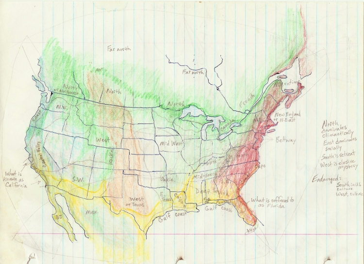 “Cultural regions”
Heading out from the state Park I cruised along the river for one last stretch down to Greenville. This side of the river is known as the Mississippi Delta, all the way up to Memphis. Geologically speaking, it’s where there was a valley between the Appalachian and Ozark Mountains that then filled with sediment over time. This “embayment” as it’s also called, reaches all the way up to Cairo. It’s hard to imagine a Delta this big, reaching all the way from the Gulf of Mexico up along the borders of Louisiana, Mississippi, Arkansas, Missouri, Tennessee and Kentucky, to the southern tip of Illinois. You would think with that much bottomland farming country we would have plenty of food, a rich agriculture, but then reality strikes. Quality food is expensive, farmers can’t make a living, and the topsoil washes into the Gulf of Mexico. I don’t know what is left here, there are fields and small towns full of black skinned people, but I don’t know what is left of actual farming and farmers.
Bayous * * *
At Greenville I cross the river and head west into Arkansas, and even though I’m leaving the Mississippi River and Delta, the transition to the bayous and parallel rivers of southern Arkansas and northern Louisiana is a subtle shift. The elevation doesn’t seem to change it all, flat, flat and flatter, but the land-use does change from agricultural fields to swamp and bayou with trees and meadows. I stay on Highway 82 and had for El Dorado, but stop at the Felsenthal wildlife refuge to camp. The next morning I discover the town of El Dorado to be one of the most depressing feeling towns I’ve ever been in, the streets are dilapidated and the buildings run down, but it was more the atmosphere of suicide and depression that hung in the air like a sick, dirty blanket. I did manage to get some breakfast; the ill feeling of the town was so intense that I was mostly stunned by the reality of it, more than getting bogged down in it myself. “What happened here?” Was a question that went unanswered as I quickly exited to the Southwest via Highway 167 to Highway 9 (in Louisiana) and onto Shreveport. After getting on to I-20, I just went right through Shreveport and into Texas. This border is just a north-south line drawn between the Red River to the North, and the Sabine River to the south. This line also forms some of the Texas/Arkansas border, with the Red River forming the rest of it on west from Texarkana. The Red flows right through Shreveport, and is one of the few Western rivers to make it all the way to the Mississippi with one name, and the southernmost one to do so. About 45 miles south of where I-20 crosses into Texas, the Sabine River forms the rest of the border between Texas and Louisiana before entering the Gulf along with the Neches River at Sabine Pass.
This is where Texas was spared the misery of being invaded by the North in the Civil War. The North had tried to build a railroad to Texas, but dealing with swamps of Louisiana slowed them down so much they decided to invade by sea. The ships headed for Sabine Pass, but upon seeing all the activity around the fort there, decided to abort their invasion. The Fort didn’t have that many men or gunpowder, but their deception saved Texas from being involved in the Civil War.
I had wanted to spend some time in Nacogdoches, learn some of its history and flavor, so I took Highway 59 down there and spent the day in the school library and bookstore studying maps, plants of the area, some textbooks, and an interesting writing exemplar. Before driving out to camp at nearby Sam Rayburn Reservoir, I called Bob Brown down in Beaumont and we arranged a time to meet. The next day, after a nice camp by the lake and some tai chi, I headed down to Bob’s. We went over and met his dad, who had retired from a career with Dow Chemical, and was helping Bob build his house just outside of town in 15 acres of woods. I decided to stay a couple of weeks and help them with some house construction. He already had a three-story structure built out of wood, with substantial framing, but needed to put on the siding, again wood that he would ship-lap himself with the router. The windows were large awnings that, covered in metal shutters, could be lowered down in case of a hurricane. Six years later, hurricane Rita would pass right over Beaumont. The ship-lap siding would then be covered with tar paper, and then with corrugated metal roofing. It was an old Southern design, to keep the moisture off the wood and keep the inside well ventilated. Wood left on the ground rots in several weeks, and in months there is nothing left. East Texas is a unique place, as wet as Louisiana, but with more elevation, it supports a huge diversity of trees and plant life.
Between days of helping Bob with his house, we got some visiting in with his local friends and saw some of the coast at Sea Rim State Park and Sabine Pass. I went out to Lamar college to study maps and we went to a public meeting about the highway 96 expansion for hurricane evacuation. In a way, sometimes man and his power, machines, and endurance – can deal with, subdue or outright destroy any natural barrier, disease, or process; but then in another way nature catches back up with man when his money and interest fades, economic tides turn or environmental damage turns out to take more money and time to fix that he is willing to spend, but must spend anyway.
We went to an art show at Lamar college which I still remember well, the artist was so unique, and the work so simple that it took me a while to see the depth of it. He burned candles under his “canvas” in a grid pattern, so the background was white, with these soot spots spaced out into a grid pattern. In the middle of each soot spot he placed a white dot. After staring at these pieces for about 15 minutes, I began to notice the three dimensionality of them, and then the infinite dimensionality of them, like they were being born out of deep space. The artist also did pieces with burnt matches, and had other techniques, but I haven’t seen anything like them before or since. After a few more days of work, we went to see the film “Seven Years in Tibet”, and then the next day I prepared to go back on the road. I went back up Highway 96 to that same reservoir north of Jasper to camp. I wanted to hit the bookstore in Nacogdoches again, so the next day I went there, bought a book, did some food shopping and then camped in the nearby Crockett National Forest to the west of town, via Alto. I camped at Radcliffe Lake, and this late in October there was no one else around. This small section of forest, less than 800 mi.², and three more of similar size close by, form the entire sum of national forest lands in Texas. The Neches river forms the eastern boundary of this section, and only 40 miles west, past the town of Crockett, the Trinity River follows a parallel course, coming out in Galveston Bay. The Sabine, Neches and Trinity rivers drain all of East Texas, except for the extreme north which is in the Red River drainage. Dallas-Fort Worth drinks the headwaters of the multi-branched Trinity, but Houston lies in its own small drainage (San Jacinto).
* * *
After writing some letters, I head back up to Highway 294 and go west toward the southernmost part of this loop of the spiral near Waco. I crossed the Trinity River between Elkhart and Buffalo, where I cross into the Brazos drainage. The Brazos is an incredible river, starting in New Mexico near Clovis, it provides water for Lubbock and Abilene, goes through the middle of Waco, and provides water for Fort Hood, Kileen, Temple, College Station and numerous other small towns before emptying into the Gulf just south of Houston. For a small river that almost became a tributary of the Red, it follows a tortured but persistent route diagonally across the whole state of Texas, 850 miles, which must be nearly double that in River miles, plus its tributaries, adds up to an incredible river system. This is just one of many rivers in Texas, which is not generally thought of as a “wet” state. About half the state is wet though, and can be extremely so, but the other half is relatively dry to extremely so, at least on the surface. The subsurface water in the western half of the state is substantial, but has been pumped out at quite a rate to irrigate farms. The Brazos was named “Los Brazos de Dios”, “the arms of God” as its branches reached out and embraced many towns whose salvation was the water it provided.
 “Vegetation Provinces”
Once in Waco I realized that this is the home of Baylor University, so I went in to their library and studied plants for a while, some Texas history, maps, etc. One book in particular was valuable for its maps of native vegetation countrywide, and a shaded breakdown of the percent of native vegetation remaining county by county. Of course Iowa was the state with the least native vegetation remaining, but it didn’t really show the impacts of cattle grazing and logging in the West or logging in the East. Few people realize that the “natural” areas of this country look and live nothing like they did 200 years ago. A nice park runs along the Brazos in Waco, and for a busy city it was tolerable enough, but I had to go west over to Gatesville to camp. The next day I came back to Waco, I needed to buy two new tires for the car and get the brakes inspected. I spent more time at Baylor, studying pollinators in the library, visiting their Museum and Environmental Ed. center. I drove out to Gatesville again and parked by the Leon River, a tributary of the Brazos, and had lunch. There I met the fellow who told me about a place to camp called Colorado Bend State Park. It was on my route, a slight detour, and well worth the exploration along the Colorado River of Texas. Taking Highway 84 to Goldthwaite, I turned south on Highway 183 and dropped off of the plains down into the Colorado River Canyon. The Pecan orchards and meadows along the winding river, shady and calm, another world from the exposed, open plains above, it was a beautiful place. Camping along the river, doing tai chi, eating dinner, a very restful place. In the morning, more tai chi, a run down to Spicewood Springs and back.
I was upstream of Austin here, and after Lake Buchanan the river entered a twisting gorge with the city of Austin at its mouth. Fort Hood was just to the east of here sprawling across canyons of its own, and between Fort Hood and Waco, a little town called Crawford. But that was all in the Brazos drainage, I’m in the Colorado River drainage now, and after buying some pecans in Bend, I continued driving upriver, coming out of the canyon and back into the plains at Brownwood. Now a large expanse of level land was before me, the part of Texas nobody likes to cross. I took a small road, Highway 153, and followed it between San Angelo and Abilene, paralleling the Colorado River as it slowly rose to the northwest. Crossing I-20 at Sweetwater, I danced along the divide between the Colorado and Brazos rivers, and then at Snyder headed west to La Mesa, running into the Llano Estacado, cutting across the northernmost tributary of the Colorado, climbing up onto the high plain and heading northwest again at La Mesa. Here I decided to camp, it was sufficiently desolate and isolated. The night was clear and warm, but I could see a storm coming on the horizon.
In the morning I crossed the divide one last time into the Brazos drainage, stopping in Brownfields to go for a run, then have breakfast. I had just about crossed Texas and could smell New Mexico on the horizon. The roads were straight and small now, and after going north up to Levelland, I turned on Highway 114 and headed west. Stopping for gas in Whiteface, which is south of Needmore and Circleback, I continued through the last town in Texas, Morton, before entering New Mexico. The border here is not geographically defined, except to say that it bisects a high, sparsely populated plain. The border here does roughly divide the Pecos River drainage from the Colorado and Brazos and Red rivers, but as flat as it is it’s hard to see where a “divide” actually is. This is also pothole and sinkhole country, with salt lakes and salty rivers and perennial streams.
South of the town of Milnesand is one of the last remaining populations of prairie chickens in the country. This is one of the lowest human population densities in the country as well, may be a connection there. South of here, even though the human density is still low, is the Permian basin, one of the biggest oil and gas fields in the country. With support towns like Midland, Odessa, Hobbs, and Jal, the Basin (underground) has a culture unlike that of the surrounding farming and ranching towns. The Permian basin was formed from part of a large complex of ancient coral reefs that were subducted and buried deep underground. The pressure from the rocks above squeezes the oil and gas out of the algea fossils, the oil and gas then rises upward and collects in underground caverns which are then drilled and pumped out.
As I made my way around Portales on Highway 114 and 330, I passed Blackwater draw where the first “Clovis” style spear points were discovered. These points date back 10,000 years and baffled archaeologists who believed in the “progress” of man. How could the best technical skill have existed so long ago? These spear points were used to hunt mastodon and woolly mammoth as well as ancient buffalo. Connecting with Highway 60, I head west into the Pecos drainage proper and stop at the Fort Sumner state monument. I spoke with the Ranger there for a while, hearing his description of how the Navajo nation was held to there until they all almost died. The water is salty here too and the land is hard and dry. After getting gas in Fort Sumner I crossed the Pecos River and continued west on Highway 60. North of here where the Pecos crosses I-40 is a series of lakes and sinkholes one of which is called the Blue Hole. Scuba divers practice here in these “bottomless” holes which have filled with water. If the country around Portales and Clovis is unpopulated, then west of Fort Sumner is completely devoid of human settlement. Highway 60 cuts across the middle of New Mexico, and other than the towns of Socorro and Clovis, it’s almost completely deserted. At 25 miles west of the Pecos, I began to leave its Valley and climb again onto an even higher plain, drier, almost featureless, you arrive at the middle of nowhere. From the middle, it’s just as far to get back to somewhere, and after going north on Highway 285 I arrived at Clines Corners on I-40, just barely somewhere. This is another high plateau of land between the salty Pecos and another salty, closed basin, the Estancia Valley.
I was moving inward on the spiral now to the point where I had left the ocean, and the Great Lakes, and would now spiral inward into the heartland of the central Rockies, the four corners, and the Midwest west of the Mississippi River. I may have left the ocean for now, but New Mexico sure had a lot of salt water, on the surface and oceans of it underground. This loop of the spiral goes diagonally across New Mexico, through Albuquerque and through the four corners of New Mexico/Colorado/Utah/Arizona. For now I would be stopping in Albuquerque for a while, spending the winter, working up enough money to continue, and possibly finish traveling the spiral journey into Western Kansas. From Clines Corners, I took I-40 into Albuquerque, crossing the Estancia Valley, then cutting through the Sandia/Manzano Mountains at Tijeras (scissors), and entering the Rio Grande Valley, back into Albuquerque.
Chapter Seventeen: Winter work, Colorado/New Mexico
After spending just a couple of days with Anne and the kids, I headed up north to visit and work in Del Norte and Estes Park, Colorado. First I spent 10 days working with Wes and Frank on Christie and Edie’s houses, both just getting underway with framing after working all summer on prep and foundation/plumbing work. I met Wes’s wife Kathy and one of his daughters, Alisha. I still had stuff in boxes stored at Christie’s old place in South Fork, but Edie was determined to move into her new, small place as soon as Frank could get it livable. By the second week of November I was ready to head north up to Estes via Princeton Hot Springs. Stopping there for the night was always a great relaxing retreat. I camped up the road in the deserted campground in the snow. The next day I headed up Highway 285 through Fairplay, across South Park, and down into Evergreen. I decided to look up Marco there, and sure enough, he still lived there and invited me out to lunch. He was doing well financially with his company AXE, but still was looking for that women in his future.
After lunch I continued up through Boulder to Estes Park and Linda’s house. Right away we went up to the Kent’s house and had dinner with them and the Donohue’s and Bill Brown. I played with Owen and Pete on the floor, and was amazed at Owen’s strength and spirit and how genuinely Pete liked him and treated him. Over the next few days I started a shelf building project for Michael and Carol at their place in town, while at the same time getting reacquainted with Toby, who had undergone some profound changes.
After working and visiting for another 10 days in Estes Park, I headed back down to Del Norte to work with Frank and Wes again for another two weeks. On the way through Denver I stopped at the USGS’s headquarters and inquired about their maps. They have an incredible store of them, and I came away with an elevation map of the West and a surface water map of the whole country. Back in Del Norte I work with Frank on Edie’s house. It’s cold, and the work is not very aerobic. Frank is used to working by himself, and doesn’t quite know how to keep me busy. We all have Thanksgiving together over at Wes’s house and do some sledding. After a day of shopping for truck tools and parts, and food in Alamosa, I take a couple of days off to work on the International truck and go skiing. Driving up the middle fork as far as I could, I would park and then ski up the trail. The first day I got a mile in, the second day, 2 miles.
It was now December 1st, and the snowy days prevented Frank from working on Edie’s house. I kept Wes company over at Christie’s while he worked on the electrical there. On the third, the sun came out and I started preparing to hitch the trailer and make the run over Wolf Creek Pass and down to the Farmington area. The next day was sunny as well, so the time came to haul the trailer down to warmer, less snowy climes. The trip over the pass with the ‘62 International and Nomad trailer was memorable, especially seeing the big rig trucks trying to make it up from the Pagosa side and spinning their tires, stopping in the middle of the road to put their chains on.
This all felt rather epic, moving around like this in the middle of the winter, and again I felt blessed to have work and functionality, to be able to keep doing what I wanted to do. Slowly I made my way down out of the mountains to Bloomfield, New Mexico where my sister Margo and her husband Sandy were renting a trailer. Staying there, visiting with them for about nine days was good, I got to rest and read, cook good food, catch up on my organizing and repairs and generally take a breather from all the traveling and working. My other sister Niki was over in Prescott, Arizona with her boyfriend Louis, so I decided to go over there for a week or so and visit them. Driving over to Arizona via Crownpoint is a long journey through some of the least populated country in the U.S.. Navaho land is interesting in its vastness, the history of the land laid bare and exposed, and the feeling that the changes wrought by human history hang in the air for generations.
Arriving in Prescott that evening, I was just in time to go to a dance with Niki and Louis, it was the big blowout for the end of the school semester before winter break. We danced and had a good time, and visited with Andy and Anastacia. I got to spend a few days visiting with Niki, going for walks, going to the wildlife zoo, while Lewis had to work and do school work. Andy and Anastacia had just had their first baby, so we visited and had dinner with them and their friends. Niki and Lewis were leaving for a trip to California to visit his relatives, so I stayed on a couple more days, shopping and resting before heading back to Margo’s in Bloomfield.
When I got back there, the well casing had cracked on the gas well, so they had no gas, heat, hot water, stove, etc. Margo had had enough of this place, so we started looking in earnest for another rental. Sandy was working every day, so we went out and looked all over at the available rentals, this being Christmas week. We find a place rather quickly near Farmington on a mesa top overlooking the San Juan River. It’s a nice upstairs apartment, and there is room in the huge parking lot to park my trailer. The Lambs are the landlords, probably of the famous Gov.’s family. We start moving stuff over and get moved in by the 27th, staying with Teddy and Alice in the meantime. After moving my trailer over there and getting the new house set up, I pack up again for Colorado and head back up to Estes Park via Wolf Creek Pass and South Fork. After a night with Wes and Kathy, I drive up Hwy. 285 to Fairplay, but blowing snow has closed it to Denver, so I have to go up over Hoosier pass through Breckenridge to I-70 and then down to Golden, Boulder, and up to Estes Park. Once there, I stay with Michael and Carol again, helping out with Toby over at Kathy’s house, and preparing for new year, 1998.
We stayed up till midnight, Kathy, Toby, Erin and me, toasting in the new year. The next day was a beautiful calm, clear day. A big party of friends had decided to climb up to Twin Sisters peaks, so I went with them, lunching on beans and corn bread up on top of these 12,000 foot peaks. For the next week I enjoy the company of the many friends and extended family all over town, skiing, hiking, sledding, cooking and visiting. For the second week, I start to work again, finishing the sheet rock in Kathy’s basement, and doing small repairs, but mainly continuing the socializing of the week before. I slowly prepare for my trip back down south again, to Albuquerque this time to stay with Anne Dunbar, Kathy’s sister, and work for her and Janet, plus Arno and others, building up my financial and physical reserves so that I could continue my journey this coming spring.
Not having a permanent job and house has given me a great flexibility in being able to travel, visit, and take “days off” when I want, but it also is uncomfortable not having a steady income, a house to call your own, and living “on the road”. I feel fortunate to be able to make these decisions about my life and that, so far, it has worked out to a balance which has allowed me to do what I want. “Doing what I want” involves a great discipline on my part, being very careful how I spend money, but also being generous with what I have. It involves being ready to work and accepting those opportunities without obsessing over doing more, or not having enough. There is always that balance of craving the rest and time off when you are in the middle of work, work, work day after day; and craving the money when you have had no work day after day.
I take I- 25 this time, down through Denver, Colorado Springs, and Trinidad. Raton pass is clear of snow, so I go over and into New Mexico. The freeway is straight and boring down this way, but the lack of people make the vast plains stand out along the base of the Sangre de Cristo Mountains. The freeway follows this chain of mountains south, and as they end, it makes its way around the southern end of the diminishing chain to the west. Skirting Santa Fe, I – 25 then heads Southwest to the Rio Grande Valley where it follows the river south into Albuquerque.
Anne’s two kids, Brooke and Adam are there to welcome me, and we all go out to dinner at the Frontier restaurant. For the next two months I work at Anne’s and Janet’s and Arno’s, repairing, painting and fixing up their homes.
One of the memorable events for Anne’s neighbor, Arno, was the tree limbing job I did for both he and Anne that January. I rented a 30 foot extension ladder and climbed up the long, bouncy length of it with my small chainsaw. It must’ve scared Arno something fierce to see me up there cutting so high off the ground, because he always mentioned that day when we got to reminiscing years later. This is also the time when Anne and I ordered the Manchurian mushroom tea by mail. When it arrived we made a pact to drink it together; it was quite the leap of faith to trust our flat, brown, squishy mail order friend, but we did, and still make and drink the tea ever since. At the end of January was Chinese new year, and since it was “my” year, Tiger, I wanted to go to the Dragon/Tiger dances over at Tal Lin market. Adam went with me, we fed the Tiger and Dragon and bought some fish for dinner.
During this time I meet Laura Robbins again and started a long relationship with her. The next week is when Anne finally set Laura and I up for good, and this started another Chapter in my life. She pretended to ask Laura out to the movies, but when Laura came over to pick her up, she said, “Oh, I don’t feel good, I don’t want to go out, but Peter is here, maybe he would go with you”. The saps, we were so blind, we didn’t get it at all till she told us later. Anyway, that set Laura and I on a course that we follow even today, 12 years later. That week I went up to Laura’s house, met her daughter Oli (16 yrs. old), and went on a walk with her out to Tejon. Tejon is the ghost town, now on Diamond Tail Ranch, that used to be the original town before everyone was evicted and moved to the present day location of Placitas. This was also the week I started work at Janet’s on the famous soji screen repair that she will never forget. Quite a memorable week, all around. The next week I turned 36, and Janet and Laura meet, realizing that they knew each other years ago.
Later that month, Anne has an idea to go to Carrizozo on a Saturday to check out some houses there for sale. She thought it would be nice to buy a cheap fixer upper for her kids to work on, and they all loved that area of New Mexico, so we went down there to check out the real estate deal: three houses for $20,000. One of the houses was minus a roof over part of it, and had been abandoned for some time. The “adobe” house advertised by the realtor, turned out to be walls of wood, less than a 2 x 4 thick, stuccoed on the outside. The realtor bought us lunch, but that was the end of that deal, and we headed back with another memorable story.
Even though I had been working almost daily for Janet, painting her house interior, re-doing her kitchen cabinets, and repairing things all over her house, I still had time to go up to Placitas and start visiting Laura. Not long after we first met, she asked me to house it for her while she and Oli went up to check out UC Boulder. So right after my 36th birthday, I went up to her house for the weekend to housesit and feed the fuzzy Tibetan terrier, Abu. It was a beautiful time, with fresh snow and the quiet that I had missed staying in Albuquerque at Anne’s.
During the next month I started staying up at Laura’s for a night or two here and there, and then there was the famous “trip to the airport” when I took Anne and Laura to the airport for their trip to Mexico with some Bosque School kids. They had to leave early, so in the morning darkness I said, “ Hey, let’s take the Mercury, it’s big and we can all fit in comfortably with the luggage.” That year the Mercury Montclair was in its “Huichol yarn art” phase. Being an “art car” that had been the “Pinto Bean and rhinestone” car the year before, but this year had been decorated with patches of yarn art, done in psychedelic colors by the Bosque School kids. Driving to the airport at 5 AM there isn’t another car on the road, but as we trundle down University Avenue a cop comes whipping off a side street after us. Of course all he could see was this highly unusual car going by, so with nothing else to do, he took off after us. After he had us pulled over, Anne realized she hadn’t put the new registration stickers on the license plate. She jumps out of the car (I’m driving), and proceeds to launch into a passionate explanation of where her stickers are, (at home, four blocks away) and that they can’t be late to the airport because there are 15 school kids waiting for them (Laura has joined in at this point, and now I think both of them are out of the car) to take them to Mexico. I’m sitting there in the drivers seat, realizing that I have forgotten to bring my drivers license, having left it in my car. While I’m fretting about that, I’m also aware that Anne and Laura have violated the order of being pulled over and subsequently being told what to do by the officer (stay in the car, get out of the car, etc.) but by the looks of things he didn’t stand much of a chance. They had him so hemmed in back there that he never even made it to me, the driver! Well, that never happens, I thought. I still had to get to the airport, and back to Anne’s with this unregistered car, without my license. That was a long 15 minute drive, but I made it to the airport and back without further incident.
For the next few weeks I continued working, getting in hikes and visits with Laura on the weekends, one of which was up to Tent Rocks where we spent the night in the forest up the road at snow line. Right after getting back to Laura’s in Placitas, I headed out again, leaving for about a month this time, back up to Colorado. I had agreed to housesit for Kathy and René up in Estes Park, so once again I made my way back up there, via Farmington this time.
After visiting Margo and checking on the trailer, organizing my stuff again from car to trailer and back again, I go up and over Wolf Creek Pass to South Fork. I spend a couple of days visiting Wes and Kathy, Christi and Edie, there in Del Norte before heading up Highway 285 once again to Morrison, Golden, Boulder and Estes Park. I got some work right away doing a furniture refinishing job for Seamus Alexander and moved in to my house-sit at Kathy and René’s for 10 days. Another great visit with all the friends and family there skiing, hiking, helping out at Carol and Michael’s and then the McGill’s, and just before I left to go back south again I went to Boulder to see Linda singing in her choir for Easter. Kate and Harry were there with Owen, so that was a memorable event as well.
From Ward, I head south on the 285 route again, down to Christi and Edie’s, staying with them for a couple of days. I take my boxes out of storage in South Fork this time and head over the pass at Wolf Creek and go west over to Durango. Checking out the town and visitor center to get a sense of what is here, I then head over to Hesperus to see what that place is like before heading down to Farmington. Margo is going to have a birthday tipi meeting at Sandy’s dad’s place, so we start preparing for that. In calling Laura, I found out that she can come up for some of Margo’s party, so we planned to meet there. After getting firewood with Sandy and Ronald, we take it over to his dad’s and set up the tipi. Laura comes up, she helps cook, and bonds with the ladies. We all eat and visit for hours, meeting lots of people and sharing good times. Laura and I stay in my trailer back in Farmington, (we see a giant, green meteor streaking low alongside us as we drove into Farmington) then come back out and have brunch with everyone back at the tipi. I help break it down before we have to leave and head back to Placitas.
For the next two months I stay mostly at Laura’s now, occasionally staying with Anne, still working down there, but also working at Laura’s now. I meet Noah and his dad Cody who is Evey’s son, Evey and Daisy being the two sisters who are Laura’s best friends, her neighbors, and the namesake of Dos Hermanitas, the street they all live on. For Laura’s birthday, we go up to Heron Lake and camp for a few days along the lake shore. She loves it there, it’s a big reservoir on the Chama River, actually formed from Colorado River water that is pumped over the Continental Divide into New Mexico. Near Tierra Amarilla where large Spanish land grants hang on between US federal lands, the Heron Lake area sits in beauty with lots of water flowing in, big green meadows, and surrounded by forested mountains. This was the first time I had been up in this area, which is between my usual routes to Colorado.
My last month at Laura’s before heading back out on the spiral journey was full – with work, with meeting new people, and adventures. Laura went with me to nearby Tunnel Springs on Sandia Mountain to renew my feathers and other sacred things, starting a tradition we still follow every year. The same day we went on a plant walk in the newly formed Placitas open space and met Bill Dunmire, botanist, retired National Park superintendent, and author. On the way home from that informative and fun hike, we stopped at another spring along Las Huertas Creek and picked some mint which we transplanted into the yard. It still grows today, getting enough water from the drip irrigation system to survive. Also on that same auspicious day, May 9, 1998, Cody Jones started backhoe work on his new addition to his house next door. Daisy was doing the studio tour that year (Mother’s Day weekend), and that evening we all went to dinner with the Jones clan, including Karl and Carla (Evey and Daisy’s parents) at the Range Café in Bernalillo. The next day I started planning a portal for the back (East) side of the house, and a wall that would encircle most of the house to protect it and the plants in the yard from the intense windstorms that lash and scour the ground here. I finished the portal in a month, but the wall continues to be an enormous project 12 years later (about halfway completed). We had Abu’s fur cut short for the summer, but soon after that he was attacked by another dog or a coyote and had puncture wounds and internal injuries. Daisy found him at her house, obviously hurt, but just barely bleeding and not moving very much. We took him to the vet and he had to stay in hospital for several days. When he got home, I helped nurse him back to health, which helped us bond. He was such a one-person dog, and Laura was his person, so it took something this intense for him to open up to another person (besides Oli). It still took a long time for him to listen to us and not run off by himself at dusk. I had to make a pen for him in the backyard so he wouldn’t run off by himself, which he wanted to do even after such a life-threatening injury. He was fearless and had a mind of his own and would even take over Laura’s mind as well when it came to getting some of her food. During this time I also built a wedging table for Laura’s art class at Bosque School, and went out to her aid on a camping trip with the kids at Cottonwood Gulch when they were short on adult supervision. I don’t know that I helped all that much in that case, but it was a good excuse for me to see some new country, including the Zuni Mountains, Mount Taylor and environs.
Chapter Eighteen: Four Corners to the Bighorn Mts.
June came around and it was still cold and windy in Placitas, but I was planning on getting back on the trail, school was out for the summer, Anne and Adam were going to Turkey, and Laura was going back to New York to visit her parents. So after finishing up my various jobs and collecting final checks, I began to pack my car yet again for living on the road. As I was packing and finishing up the portal at Laura’s, I started to come down with a viral lung infection. I decided to head out anyway, and just go out to Farmington, which was on my way, and stay at Margo’s until I felt better. The infection turned out to be an intense virus, I stayed in bed in my trailer for two days. My dreams were fitful when I had them, the kind of sickness where you can’t think when you’re awake and you just want to sleep. After two days I was up for short trip to Hesperus Mountain to finish renewing some of my things that I didn’t have with me at Tunnel Springs. I went up there for the day and came back to Margo’s, kind of a test run to see how I felt – I was still very weak, but felt like I was over the worst part. I continued steaming my lungs with Yerba Santa for several more days and drinking its tea. The next day I did a little shopping in Farmington and was ready to hit the road.
Now I’m picking up where I left off eight months ago, in Albuquerque and the Rio Grande Valley, where this loop of the spiral cuts across this ancient Rift Valley, where I’ve spent a few winters now, preparing and resting so that I could continue traveling the spiral path. The elevation along this stretch of the Rio Grande is around 5,000 feet which is fairly warm and mild in winter, compared to the lands just east and west of the river, which rise up above 10,000 feet to the east and averaging close to 7,000 feet up on the West Mesa. In fact, from just north of Albuquerque and all along the Rio Grande Valley, south to Las Cruces, is some of the most temperate land this close to the continental divide in the whole country. There are some places in Arizona that come close, but for year-round moderation the Rio Grande Valley, especially north of Albuquerque from Alcalde to Santa Domingo, is relatively warm in the winter, cool in the summer, and has a year-round river flowing its length.
 Summer coolness (green) & Winter warmth (red)
Following the spiral to the northwest from Albuquerque to the four corners, I take I-25 N. to Bernalillo, then Highway 550 NW. through San Ysidro, Cuba, across the southern end of the Jicarilla Apache Reservation, and then through the “checkerboard” lands (alternating between Navajo and BLM and New Mexico State lands) to Bloomfield and the San Juan River Valley. All along this route I parallel the Anasazi trails around Chaco Canyon and numerous outliers surrounding it, all scattered amongst random patches of badlands and vast stretches of sage covered sandy plains. The highway skirts the edge of the Jemez Mountains between Santa Anna’s old Pueblo site and Cuba, then turns West and crosses the continental divide just before the Apache Reservation boundary. Now I’m in the Colorado River drainage, and will be all through Utah and even up into Wyoming until I cross back over the divide at South Pass.
The Colorado River drainage is one of the biggies of North America, but unique in that there is relatively little rainfall across its vast region, coupled with erosive soil and stone, prone to flash flooding, all of which combine to create a river which is carved deeply into the sandstone landscape, full of silt and sediment to the point of non-potability. Even the total amount of water in the river relative to the vast, perpetually dry land around it yields only a slim green edge along its narrow floodplain. So for all the thousands of miles of territory this River drains, it yields very little arable land. The first white surveyor, J. Wesley Powell, cautioned against any meaningful development (farming, cities) along or amongst the Colorado’s far-flung tributaries. He could see from the start that it just didn’t add up to enough water.
I was excited to be back on the road again, especially in this part of the country. I wanted to take my time and really soak up this four corners area because I knew I would be moving through it and onto the next area soon enough. Once I left the relatively populated San Juan River Valley between Bloomfield and Shiprock, it was going to be a whole different feeling. There are so few people in this area to the northwest of Shiprock (almost every direction, actually) that it feels like just you and the land. A very quiet and still land it can be, save for the big windstorms that can turn the whole sky to brown dust. Early June is spring-like this year, it’s been cold and windy until now, and now that I’ve rested up enough at Margo’s to get through the worst of my sickness, I took the highway out to Shiprock to start traveling again. From Shiprock I went north on Highway 666 into Colorado, then west on Highway 162 the actual Four Corners Monument. I hadn’t been here since I was about 12 years old on a family vacation. It hadn’t changed much, the selling stalls had been institutionalized around the perimeter, but it’s a fairly unpopulated area, on a mesa to the southwest of the San Juan River, which barely nips Colorado on its way from New Mexico to Utah. I headed into Arizona, down to Teec Nos Pos, then west on Highway 162 Mexican Water. Finishing up my travels in Arizona, I went north on Highway 191 up to Bluff, Utah. Crossing the San Juan River again, I went into Bluff and met some river rafters. We talked for a while and they told me about petroglyphs nearby, so I went over to see them before continuing on Highway 163, following the San Juan to the West and into the amazing red rock country of Southeast Utah.
UUUUUUUUUUUUUUUUUUUUUUUUUUUUUUUUUUUUUUUUU
As you approach the town of Mexican Hat, the landscape becomes so unbelievably twisted and colorful that it’s almost laughable. That a place, the land, the earth that we are used to being brown, flat, below our feet, tame and trodden down, could be so audaciously, comically colored, popping up in gravity defying ridges and slabs, and on such a scale us to smack us down, especially as individuals, to our proper size, as ants, limited severely by our tiny-ness. This is country where, if the car breaks down, oh well – it’s so beautiful that you feel you could just live on the visual experience, but of course there is the awful reality of why there is no one living here. The collision of climate and beauty is palpably fatal here, which also gives a sense of cheating death just by being witness to this place. If not for our machines, our electricity, gasoline, the water and food we carry with us… we are made aware of how artificial we are in a place like this. Artificial, not meaning fake or hollow, but like the word artifact, man-made. There isn’t much to fall back on in a place like this; and, ironically, the closer you are to the San Juan River, the more difficult survival may be. There are some places to camp along the river where freshwater comes in as streams or springs, but for long stretches there is nothing but dizzying walls of rock, dry and slippery with fine sand, the river itself un-potable with its huge load of fine silt and red clay. Just past Mexican Hat, a spur road takes you to the edge of the gorge the San Juan River has cut down into the soft sandstone. Called “The Gooseneck’s”, it is a well photographed feature of the Southwest, the river doubles back on itself twice, leaving impossibly high and thin peninsulas of rock pointing in opposite directions; a grand, delicate, inconceivably old process that again, we are somehow allowed to witness. I don’t know if the 6 miles side-trip to the end of this “dead end” road could be called “worth it” to see the Gooseneck’s. Like the Grand Canyon, it hints at the useless nature of our roads, which go to places we don’t really want to be, the road-less areas being the real places to go live. What a museum the Grand Canyon is in this respect. People don’t live in museums, they visit them, to see how people lived. Now we have museums that are called “living museums”, to impress upon people that the land, or that people, were actually, at one point, alive. That history is not the record of the dead, but of the living, is a concept worth pursuing.
Another thing about the San Juan River is that it defines the northern boundary of the Navajo reservation in much of southern Utah. Filled with awe and wonder, I look for a nearby place to camp in the Valley of the Gods. Following a dirt road out into the Valley, I pass a B&B, go a little further out into the middle of nowhere and camp down. It is such a beautiful, calm, easy place to be that I just want to stay here. The next day I stop in at the B&B and get their info in case Laura and I want to come up and stay some time.
I can see that Highway 261 goes straight toward a wall of cliffs in the distance, but can’t really tell how this road I’m on is going to deal with such an obstacle. As I approach, and the road narrows, it’s hard to believe that a frontal assault is possible on such vertical cliffs, but the road indeed digs its way through in a spectacular switchback called the “Moki Dugway”. I stop at the top for a last look back into the Valley of the Gods and the spectacular formations around Mexican Hat. Now I’m up on a mesa that seems to be the center of the Piñon/Juniper homeland, it’s so thick with the biggest trees of this kind I’ve seen. Going through about 10 miles of these trees, and then another 5+ miles takes me up to the Kane Gulch BLM ranger station and the entrance to the Grand Gulch primitive area. There were some firefighters there, so I talked with them a bit, and the signs were up all over the place about those guys who just shot up and killed a policewoman over in Cortez, Colorado. They had found two of the three dead already, survivalist types, but this one was on the loose somewhere in the Four Corners area. They wouldn’t find his body till years later, on top of a lonely mesa. Anyway, I wasn’t worried about such stuff and set off alone down the trail into Grand Gulch. The canyon is beautiful and green with cottonwoods and willows, sheer rock walls stained with brown age, water flowing in a little creek along the bottom, and ruins all along the way. I got down to Junction House ruins and then came back up to the car, deciding to go up to Bear’s Ears on Forest Service land to camp. I found a nice camp along a dirt road that looked down in to the Grand Gulch/Natural Bridges area. The next two days I spent exploring and loafing around Natural Bridges. It’s a great little National Monument, and there was no one around, so I could really take my time and enjoy the solitude and beauty of the canyon. The white sandstone bands, green bands of trees, and pools of water under the bridges of stone made peaceful setting. I had time to rest, study my maps, feel the connection to this place and its connections to the land around it, and just be for a while in this great spot. I saw a S.U.W.A. paper at the V.C .and learned about the work and challenges of the Southern Utah Wilderness Alliance.
I had been creeping along, not wanting to move from this area, but the next step from here was to go down to the Colorado River, which is now Lake Powell, and cross it at Hite Marina. This was not my favorite type of area, a dammed up River, so after getting gas and a new tarp, I crossed the bridge and started up a side wash, but saw a nice swimming hole, so stopped for a dip. The desert to the west of here is profound. I took Highway 95 up to Hanksville, the road to the Henry’s mountains being washed out. It being Sunday, the BLM office at Hanksville was closed, so I walked around town a bit before heading west on Highway 24 to Capital Reef National Park.
The spiral path keeps heading seriously north at this point, and I’m just about at the furthest west of this part of this loop. Instead of diving in to the San Rafael swell at this point, (the roads don’t follow a nice path in from here) I decide to go over to Capital Reef and the Fish Lake National Forest to its west. The road in to the Park follows Fremont Creek, and as the sandstone mountains rise up around me, the valley becomes rich with green, finally breaking into a full-fledged orchard at the visitor center. From here I use the phone and talk to Laura, we have a good visit, it’s the longest day of the year, and it’s a good thing because I haven’t found a camp yet. Leaving the park I continue on Highway 24 into a series of little towns in one of those idyllic little valleys of green tucked into the mountains of Utah. I drive through the towns of Torrey, Bicknell, and camp at Sunglow (sounds pretty English to me). It’s still light, and I get a hike in before dark, up the nearby canyon. My radio picks up KFI, and old, powerful AM station from Los Angeles. It’s been a long day, the longest of the year, and I’m kind of glad to be across the desert and back into the mountains.
^^^^^^^^^^ ^^^^^^^^^^^^ ^^^^^^^^^
In the morning, I make an early start into town for breakfast, but I am too early for the Rabbit Valley Café, so go shopping for food first and manage to find about seven dollars worth before going back to the café to eat. Wanting to explore more of Capital Reef National Park, I go up north on 72 to Fremont Pass and get a great view of the San Rafael Desert and the north end of the park. Driving back down south to the turn for Cathedral Valley, I go down into the park and see the sculpted sandstone towers that look like ancient monoliths. There are some things that animals, plants, nature in general, cares little about – great sandstone towers being one of them. Except for maybe raptors nesting and using them for observation/hunting perches, there is little living on them. For humans however, they are a beautiful thing, a sacred place, a marvel of nature’s forces and processes standing bare for us to see. Sand is not that interesting, but made into a tower it becomes fascinating. After hiking around for a few miles, I drive back up to the forest and find Elkhorn camp. It’s very windy that night as I sleep up on this ridgetop. The next day I decide to stay up here and explore the forest. I end up on top of Hen’s Hole mountain, which gives me spectacular views in all directions: down into Capital Reef, San Rafael swell, the mountains to the west, including Brian Head to the southwest. I make my way back down the ridge to the road and walked back to camp, ready for a rest and a nap before dinner. As beautiful as this area is, the forest has been brutally logged. In fact, it is the worst looking logging operation I’ve ever seen, with ripped up trees and slash everywhere, no erosion controls, and huge wildfire risks. Hen’s Hole mountain was completely burned in a previous fire.
^^^^^^^^^^
The next day was windy again, and I packed up to head north, having reached the furthest western turn of this loop. Taking Highway 72, I went over Fremont Pass again, down into Fremont Junction and then up to Emery. These towns begin another string of “perfect locations” along the base of the mountains where the water comes out, the land flattens, and, with the desert just to the east, the “perfect zone” is kept to a narrow strip close to the mountains. Creek after creek comes down into Muddy Creek, a long river which changes names and becomes the Dirty Devil River before meeting with the Colorado at Hite Marina. North of Muddy Creek the San Rafael and Price rivers gather the mountain’s creeks and head bravely eastward across the San Rafael Desert and into the Green River. North of that, the Tavaputs plateau comes out from the mountains, creating Desolation Canyon on the Green River and capping off the great deserts of southeastern Utah.
After the little towns of Emery and Moore, I stopped in Ferron to check out the Mill Site State Park, which is basically a reservoir on Ferron Creek. After checking out the Forest Service office there, reading and looking at maps, I decide to go up to Castle Dale, which is like the hub of this area, and check out the Museum of the San Rafael. There I find out about the rich density of petroglyphs in this region (continuing the general richness of the entire Southeast Utah) the most famous being the ones along Buckhorn Canyon, just east of Castle Dale. Since there is camping out there, I decide to head out and spend the night in the San Rafael Swell.
Near Castle Dale was a recent find of an entire mammoth, buried and perfectly preserved. When they dug it up and exposed it to the air, it started to decompose, so they quickly made plaster casts of all the body parts, trying to preserve what they could. Some of the parts made it into refrigeration, but that was problematic for the long term. Amazing to me that such a find, a whole mammoth from thousands of years ago, as sensational as it is, can wither away from lack of funding, lack of interest, lack of long-term preservation, and general lack of caring about such things. I can see why so many archaeological finds are left in the ground, it seems to be the safest place for them, after all.
After getting some food and mailing off a roll of film for developing, I drive out to the San Rafael swell, a blistered up area to the east, in the hard desert, but with creeks and washes radiating out from it in all directions. I drive up to the “Wedge” and take pictures of the land, then go down into Buckhorn wash to see the petroglyphs. The way the morning light hits them is usually the best way to see them come alive, so I spend the night down by the San Rafael River and come back to them in the morning. This is such a wonderful place to be alone, with the history and the presence of the place — this ancient place of rock, water, bighorn sheep and deep night sky. In the morning I ran out to the rock art panels for sunrise, praying there with them for the people and animals, for the meaning of our lives.
**** *** **** * **** *** * ** *
What is it that life gives us? What did life give people in the past, and what does it give us now, do we know the difference? Can we know, or is that time inaccessible? The rock art is such a connection, tangible, palpable, through the ages, but only yesterday to the rocks themselves. I drove back to Castle Dale and spent time at the Museum, reading about water, the elements, and studying geologic history. In the evening I drove up to Huntington and found a camp along the middle fork of Huntington Creek. Driving back down to Huntington that evening, I called Laura and was able to visit with her on the phone for a while. After spending one night at this camp, I moved my camp up further into Mill Creek Canyon and decided to explore the mountains to the west. So the next day I hiked up to the ridge tops where I could see San Pete country to the west, and the Tavaputs plateau to the northeast. After hiking back down to camp and eating, I had time to study my maps before going to sleep. The next day I head back down to Huntington, then north up Highway 10 to Price and the little towns around it: Carbondale, Spring Glen, Helper, and Castle Gate. Small towns with obvious money from mining; beautiful tree-lined streets, kids playing in the public pool, another idyllic Utah town. I stayed in town most of the day, doing laundry, going to museums (the College of Eastern Utah is here) and studying minerals in the museum bookstore. That museum specializes in early man and dinosaurs. After catching the new Disney movie “Mulan”, I head out to the next rock art area in “9 mile Canyon” to camp. Finding a place to camp in Argyle Canyon, I bed down for the night, ready to explore another rich area of rock art in the morning.
9 mile Creek, flowing along the county line between Duchesne and Carbon counties before entering Uintah county and the Green River at Desolation Canyon, is one of the densest concentrations of rock art remaining in the Southwest US. There are numerous side canyons: Horsemen, Tear, Daddy and Cottonwood, all important sites along the main canyon of 9 mile Creek. Again, it was hard to imagine life along this rocky canyon, but from all the bighorn sheep pecked into the walls, it was obviously a much different time. From where I finally turned around to head back to Argyle Canyon, I was only a little over 10 miles from the Green River and its deeply carved world. The rock art area had a good feeling, the panels themselves are always amazing, so present, so alive in a world that can seem so rocky, bare, and silent. I was north of the Tavaputs plateau now, on the last “step” of the desert before reaching the first forested ridge of the Ashley National Forest and the end of the desert.
I was getting used to having all these places to myself, I hardly ever saw another car, another person. Following the long, rough road back up Argyle Canyon to Avantiquin camp, I ended another day, but also finished several weeks of time crossing the amazing deserts of Southeast Utah. The Avantiquin camp, not only a high point physically, is such a peaceful place. I walked out the dirt road following the ridge and it just got better and better. Again, the quality of this experience was so heightened by the quiet and solace of being alone. Sometimes it’s good to be in these places alone, not that I could plan for that in these public places, but when it happens I just wanted it to go on and on. This was another place I didn’t want to leave, I was so comfortable here, and the views – the Wasatch Range to the northwest, the Uinta Range to the north- northeast, and an area of about 300 mi.² visible all around me. Taking one moment at a time, giving myself time, I stayed and enjoyed the area for another full day, reading, walking, eating, and sleeping.
This trip was not a vacation, I was not going to get someplace else, this was my life, and most of the time I focused on living it. So much of the time we say, “What are you doing?”, and the reply is: “I’m working”, or “I’m going to school”; and that’s fine to have the easy, pat answers, but it should also be fine to say “I’m living here”. I think that is not understood, because people don’t just live anymore, and have become so busy working, driving, shopping, and dealing with one crisis after the next, that they don’t really know when the living starts. I think a lot of people don’t really consider “just living” an option, that it would get you nowhere, be too boring, depressing, or not practical. Of course these thoughts are mainly from people who haven’t experienced “just living” in a long time. It can be the most exciting, engaging, spirit lifting, empowering experience ever, or it can be totally routine, unglamorous and necessary, but it is always yours and it is always a miracle – that we can do anything at all, or get anywhere in particular. It is all an incredible gift, even though it may be incredibly confusing as to how that could be, but when we enjoy it we start to get a sense of how to live, “just live”. Our attention is so important, one of the only things we truly have. When we can use it in a conscious way, a decisive way, then we can have a chance to remember, to see just how much we have in our storehouse, and what we want to put in our storehouse, and what we want to take out. All this is possible when we have our own attention, and mostly impossible when we don’t.
So this I consider a valuable revelation, that we even have this thing called “our attention”, and the preciousness of being able to direct it. Some would call it “controlling your life” or “being in control” and to some extent I guess it is – like being able to drive away in your own car and follow a spiral path around North America. But in my case the control part is just the beginning, and for me, doesn’t last very long. To travel and live the way I’ve been doing takes some control and focus on my part, but at least as equally, it also requires my flexibility, letting go of control and being open to the places and people around me. As important as it is to have my own attention, it’s equally important to be open to the possibilities of where and who is around me that I’m not aware of yet. I don’t worry about it, I just keep my ears and eyes open and my attention available for others. I am easily swayed by beauty and wonder. Sometimes it doesn’t seem to exist at all in the world, and other times it is overwhelmingly abundant. I know this difference lies mostly between my own two ears, but is also a function of being a tiny individual on a very large planet. Sometimes we physically have to move ourselves into or out of our physical surroundings in order to change our mental state and attitudes. I was very aware of how my mental state changed and was affected by my changing locations. In fact, I became aware of physical locations where it became possible, or maybe much easier, to have certain thoughts and feelings I had not experienced before, nor even knew existed. Coming back into a town after having spent several days in the mountains was almost like having your memory erased, or at least having thoughts imposed upon you which you would rather not have. Although I dreaded this return sometimes, I also didn’t worry about it too much, for this is how the world is, and it is also how the mountains are as well. Knowing that there is more than the town reality is a blessing that most country people have.
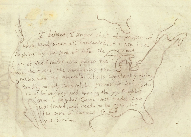 PeopleLovePeopleLovePeopleLoveLifePeopleLovePeopleLove
So with that knowledge, I drive down the Left Fork of Indian Canyon into the town of Duchesne. There I check out the Forest Service Visitor Ctr., have some breakfast, gas up the car, do some reading and get posters from the visitors center, and decide to head over to the town of Roosevelt. These are the bigger towns in this wide valley full of small ag towns in the well watered lowlands south of the Uintah Mountains. While these towns sit on their own connected rectangles of private land, they are surrounded by Indian lands of the Uintah and Ouray tribes. Roosevelt had a nice library, so I stayed there, had lunch and studied chemistry, the cosmos, water, the elements and the rocks. I was able to reach Laura by phone, so we had a nice visit, and then I headed up north out of town toward the Ashley National Forest, up the Uintah River, and camped near the U-Bar Ranch. This was a nice spot along the river, so I spent the next day cleaning up, resting, reading, writing, and went for a short walk just to check out the trailhead up Uintah Creek. It looked inviting, so the next day I trekked 9 miles up the canyon into a big bowl below the High Line trail which leads to Kings Peak (high point in Utah at 13,528 feet) about 6 miles to the west. Having lunch and soaking in the creek, I rested and enjoyed being up at this elevation on a hot July 2. Going back down the way I came up, I crossed Rock Creek Bridge and passed through a huge blowdown of trees that had happened two years ago. Back down at my camp I decided to check out the U- Bar Ranch and met the owners, Bruce and his wife. They were really nice, and I came back again the next day to visit and have tea with them. After stocking up on fresh water, I head back down to Roosevelt and call Laura again. We make plans to meet in Dinosaur National Monument on Sunday, two days from now.
At this point I take Highway 40 an easy 30 miles over to Vernal and explore the town, do a little shopping, have lunch in the park, pay some bills, and enjoy this little oasis on Ashley Creek near the edge of the desert. I take Taylor Mountain Road up to find a camp, and meet some mountain bikers who are also exploring the area. After hiking over and up onto a red mesa to the east, I go back to camp to eat and rest. Early the next morning the rain clouds are threatening, so I pack up and drive up the road to a campground where I have breakfast, relax and read/study the elements (iron, hydrogen etc.) again, enjoying the element of sunshine as the clouds break. There are some trails about 10 miles away in East Park, so I drive over there and hike up the High Line trail, this time reaching a summit where I can see to the north into Wyoming, and the Flaming Gorge reservoir. Coming back the way I came, hiking down the Trout Creek drainage, I get back to my car and take the dirt road switchbacks down to the pavement of Highway 191. I head south back through Vernal and then go the 15 miles east over to Dinosaur National Monument where I check out the camping situation and the visitor center. There is a big ongoing dinosaur dig covered by its own building near the visitor center. I use the pay phone and give Laura a call; she left a message on her machine that she is already here!
We meet up at the Green River campground and have a nice reunion there. Laura has brought Abu, the famous Tibetan terrier, but he isn’t allowed in the dinosaur dig building, so Laura goes in by herself and I stay out with Abu. He is so well behaved and has such a regal air on his leash, plus his white feet (and socks on the front) he made one admirer say, “He must come from a good family with those white shoes”. We stayed there along the Green River for a couple of days resting, walking along the river, visiting with the numerous river rafters coming through and enjoying the rich density of petroglyphs. We camped up at Rainbow Park two nights, but it was buggy along the river. Finally we broke camp early on the seventh and after breakfast in Vernal, we head up into the Uintah Mountains.
We head for the camps on the north side of the Uintah Mountains, following Highway 44 into the Sheep Creek drainage. Before we reach our camp we see a Rendezvous packer on horseback with another horse in tow, he seemed to be seething mad about something, and had just crossed the road and was making his way west. We found a beautiful camp along Beaver Creek before reaching an official campground. On the Wyoming map is a marker on the Henry’s Fork of the Green River, west of here, where the first “Mountain Man” rendezvous took place in 1825. Laura wasn’t feeling good, so I took a short walk up to Brownie Lake before making her some Yerba Santa tea that I carried with me for lung infections. By the next day it was clear that she had the same intense lung infection that I had suffered just before leaving her place in June. After spending a quiet day in camp, the next day we ventured out by car up to Spirit Lake and filled our water jugs. The rain showers had been off and on for the past several days and continued for several more. It was beautiful up there, but buggy, so we went back to our camp and had a short walk before dinner.
OOOOOOOOOOOOOOOOOOOOOOOOOOOOOOOOOOOOOOOOOO
The next day we broke camp and headed down Sheep Creek through an amazing geologic area where all the layers that haven’t yet worn away are left intact and exposed in nice clean levels that are labeled as you drive down through the canyon. When a mountain pushes up all the layers that have been lying flat, and then their edges are exposed by erosion and weathering, you can end up (theoretically) with a beautiful, clean record of all those layers exposed to see. Of course this seldom happens in nature, so this is a rare place to see things in such order and neatness. We head down to Manila and the Forest Service office where we check out the map supply and learn about Flaming Gorge N.R.A. camping scene. Laura grabs a shower at the local KOA and then we have a picnic lunch. As we drive out to explore the western side of Flaming Gorge, we see eagles flying overhead. We find a nice camp and are treated to a beautiful sunset as the storm clouds clear. It’s so great to have Laura with me now, I wish she were feeling better, but I know the Yerba Santa tea is helping her through the worst of it, and with enough rest and down time she will recover. Each of these areas were traveling through is so beautiful, such a destination in themselves, but to hit one right after the next is thrilling. Most of this route through Wyoming is new for me, and all new for Laura, so we head out together to explore and live this journey, and sharing it is new for us as well.
The following morning, after breakfast and a walk, we make the dreaded trip down the I-80 cordidor through the bizarre little towns of Green River and Rock Springs. The names sound pretty enough, but only serve to intensify the disparity of their ugly reality. Anyway, we didn’t dwell on these places, unfortunately they were just food and fuel stops and had long ago trampled any subtle beauty and fragile ways of life into the quick dust and solid mobile home siding of oil and gas money and the important ribbon of concrete through-way that is I-80. The Green River comes down out of the north from the pure mountains in central Wyoming, the Bridger-Teton National Forest, into the edge of the Red Desert. Most of this river’s length through Wyoming is dammed up lake, but after the Flaming Gorge dam and northern Utah, it runs free all the way down to Canyonlands National Park where it meets the Colorado River. The stretch through Wyoming must have been beaver paradise as this became trapper central, and the Rocky Mountain Fur Company was formed here. Even though the Continental Divide runs just east of here, surrounding the big sand trap that is the Red Desert, there are no big mountain passes, the Rockies are rubbed flat and scattered. Even the famous South Pass is only 7,550 feet, and where I-80 crosses the Red Desert the Divide is only 6,700 feet.
=====================++++++++++=====================
So we crossed this rolling stretch of grasslands and Badlands, this weird idea of the Continental divide, where we were still on the west side, where the Snake and the Green rivers ran very separate courses that both flow to the Pacific, and once over South Pass all water would flow downhill to the Gulf of Mexico.
The Pacific Northwest, Hudson’s Bay, the Gulf of California and the Gulf of Mexico. All hugely disparate places, thousands of miles, different cultures, climates, all far apart, yet all tied by the waters, rainfall, snowpack and deep springs between central Wyoming and northern Montana. The mother Mountains, or may be more correctly, the father Mountains (they are not the kind and gentle variety) the northern Rockies, the source of so much of the continent’s fresh water. Their grace is sustained by a low human population on all sides, especially in the US. The greatest impact now being the tar sand mining west of Calgary, Alberta. Not that there isn’t huge impact in the US: both Idaho and Montana were founded as mining claims, and Wyoming has one of the largest oil and gas drilling complexes in the country. But their feeling is still one of pristine beauty and cleanliness, hard to imagine their purity before the onslaught.
We approached South Pass in a stiff breeze, so as we stopped for lunch I dug out the small kite and we tested it on a Continental Divide wind. The little nylon kite held up well and gave us some joy in this otherwise hard to deal with wind. We visited South Pass City historic area and met an old blacksmith there who seemed very comfortable in the deserted town. We went through the little sidetrack to Atlantic City (we were now on the east side of the divide) and then back on Highway 28 to the small town of Lander. It’s a famous town though, being the main town for the Wind River mountain range, whose beauty and wildness is legendary among backcountry hikers, horseman, fishermen, hunters, and, increasingly, photographers. We met a young Indian lad in town though with a different perspective, he looked kind of street worn and homeless, suffering some mental/emotional debility, but being good listeners we did hear him out. He told us of the murders, the disappearances, the strange and awful happenings in the Wind River mountains, and begged us to pray and beware.
So we drive up Highway 131, up Popo Aggie Creek to the mountains, up the switchbacks after the pavement ends and find a camp on one of the corners. So much for the small forest roads that nobody travels – this one felt like I-80 had been diverted up the mountain, nonstop traffic! The reality is that this is the only road going up into the mountains on this whole end of the Wind River range. Not only that, it’s a convenient loop, which is always attractive to the motoring public.
We camped there at Fossil mountain and in the morning Laura was at an all-time low of energy, so I went out by car up to a trailhead to check it out, then came back to camp. I took short walks around the camp, keeping an eye on the sicky. The next day we decided to bag it and head for a motel in Lander. We checked into the Silver Spur, and by the end of the day Laura was feeling much better for being indoors. The next day too we took it slow and bopped around town, shopping, checking things out, asking about the route between here and Thermopolis. There was a hot spring there, so that sounded good to us both, but we would take it slow and spend the night halfway there at Boysen State Park.
This is where some now famous stories took place, like the time we let Abu out of the car and he took off down the road after a bunny. The rabbit was doing his evasive maneuvers, back-and-forth zigzags and Abu was staying with him as we were screaming for him to come back. Suddenly the rabbit took one of those 90° left turns at top speed that they are so well designed to do. The dog tried it, his body turned 90° left, but his feet kept going straight. He did about five or six rolls before popping back up on his feet, now at a standstill. He shook himself off and came trotting back to us; now in stitches we tried not to embarrass him further with our laughter, but he was happy– it was a good chase for a little lapdog.
The next morning another memorable wildlife story happened suddenly as we watched the early wake-up of a large flock of birds from their roost in the trees along the Wind River. They were wheeling gracefully around and between each other as large flocks do, with us mesmerized by their nonchalant skill. The air was ripped in half as one of the flock exploded into a ball of feathers. Peregrine falcon. Nobody saw it coming, we barely saw it going with its kill, so shocked where we all, us and the flock of birds.
The Wind River canyon cuts through the Owl Creek mountains, and along Highway 20 to Thermopolis we find another roadside geology course similar to the Sheep Creek area in Utah. As the Wind River exits this canyon to the north, it becomes renamed as the Big Horn river and flows north through the Big Horn basin and out of Wyoming, into Montana, and joins eventually with the Yellowstone River. The roadside geology course starts north of the Boysen dam, which backs up the Wind River for most of its length. Just north of the dam, the road goes through three tunnels which are bored through some of the oldest rocks on Earth, the Precambrian granites, gniess and schist. Out of the tunnels and you jump over 2 billion years of erosion into the Cambrian sandstone, shale, limestone and dolomite. Following these layers, the next eras of the Paleozoic (250 million years worth of limestone, shales and cross bedded sandstones) and Mesozoic (170 million years worth of Triassic, Jurassic and Cretaceous layers of bright red siltstone, shale, limestone, gypsum, sandstone, shale, limestone, shale/sandstone, sandstone, shale/sandstone, shale, sandstone, shale, sandstone, shale/coal, sandstone) were piled neatly up with top layers of the Cenozoic era (the last 66 million years worth of sandstone, conglomerate/coal, sandstone/shale and volcanics) finishing off the layer cake with good representation from all four geologic eras.
Laura wasn’t feeling very well today and I hoped the hot springs at Thermopolis would help her heal. We stopped there for lunch and a soak at their public pools, which were nice, but fairly busy. We became noodles and rested there in the glow of the underworld for a while. We continued down river to Worland, a drop of 1,300 feet since Lander, down to a low 4,000 feet before heading east and up into the Big Horn Mountains. We went up Highway 16 to Ten Sleep and had dinner in a restaurant there before camping along Ten Sleep Creek for the night. It’s a stunning canyon, with colored rock walls dripping in spires and towers, twisting and turning up into beautifully forested mountainsides. We had one more day together before Laura had to drive back to New Mexico, so the next morning we spent in gratitude for each other, for this time we had together. We broke camp and went up the road to find Ten Sleep Lake, but missed the turn and ended up at Meadowlark Lake where we stopped at the resort there and asked directions. It was back at Deer Park Lodge were we missed the turn, so we go back and turn up that creek, which was so nice we stopped to picnic there along the creek. After lunch we headed up to the trailhead and walked with Abu for an hour up to the waterfall. We were just getting a taste of the Big Horn Mountains and the ease, the openness and accessibility to them. We came back to camp at an old granite pit, it was a good place to get the cars off the road.
Laura was leaving tomorrow and I had to think about finding some work for the summer. I hadn’t really wanted to think/worry about it, and I really hadn’t which was kind of amazing. There was the Meadowlark resort which we had kind of happened across, but I didn’t even really want to think about it yet. I was pretty focused on making sure Laura was going to be okay driving all that way back while still dealing with this viral lung infection. She was doing much better, but wasn’t over it completely yet.
The next morning came and we had to part ways for a time, so she started off in the morning and had her own adventure driving home with Abu. I started gathering myself together, resting up in camp, walking to the creek, and finding some fresh pine pitch, and put some away in a can for future use. I went back up to the trailhead where we were yesterday and, after lunch, pushed up the trail 6 miles to Mirror and Twin Lakes. Even from here I felt still on the edge of the massive Big Horn granite peaks, but it was a good hike and I needed to walk. Camping at the gravel pit again, I explored some more of the area the next day and did a run up Sitting Bull Canyon.
Chapter Nineteen: Meadowlark summer Pg. 520
After writing to my sister Nicky, I went down to check out Meadowlark Lake resort and see about getting some work there. After speaking with Dean Cox, the owner, and his wife Karen, they both agreed on hiring me as a prep cook/dishwasher and maintenance man. They introduced me to some of the restaurant staff and fed me dinner. There were some musicians there from the Black Hills, so I stayed and listened to music for a while before heading back to my camp for the night. I did get to call Laura and she made it home – she had quite the journey is it became very hot on her way home, but she kept the windows up as to not get a chill. She had a fever, and the heat in the car made her sweat all the way home. By the time she got home, the fever had broken and she was feeling all better, it was the last stage of her sickness and she was able to sweat it all out.
For the next month and a half I worked at the resort, which was good work and people for the most part, but it was also a challenge to my sanity and peace that I had been living and was now used to – a different reality, but not so far away, fortunately. I was so happy to have paid work now, to be able to make some money into the fall, and then continue my journey on the spiral as it wound tighter into the center of North America. I still had a long, long way to go through mostly unfamiliar territory, and I still wasn’t that comfortable talking about what I was doing. Not because I was embarrassed about it, but mainly I found it difficult to hold anyone’s interest in the reason why, in the connections between places. They would mostly fall into “where are you going next”, and the destination aspect of travel. Which is fine, and it was my own lack of skill in describing what I was doing and being able to communicate clearly about it that also made it difficult to talk about and for people to relate to it. The owner of the resort, Dean, was the person I could relate to the best, but he was my boss and there was always a little distance there, and he just didn’t have a lot of time to talk. He and Karen were busy running every aspect of the resort, the restaurant, the housekeeping cabins, the boat and fishing dock, maintaining everything, including the ski lift in the winter, and I can’t imagine the paperwork and bookkeeping involved, let alone all the interpersonal issues between the staff, of which there were many, as usual.
There were two main cooks, Eric and the senior cook, John. John had no issues with anyone, he was content in his life and just did his job, enjoyed it as much as possible and kept to his own life. He was a tough, capable fellow though and had lots of stories of his work around Wyoming and construction trades. We got to talking about the wind one day and how most folks in the country (I mean the cities of the USA ) don’t realize the level of wind in Wyoming. John would say that we routinely get hurricane force winds (74 mph plus) sustained for hours at a time and Wyoming, yet no one calls them hurricanes. I said I know, and the weather men don’t even use the word “windy” in Wyoming, they just say, “it’s going to be breezy today”. We had both been in situations where the wind was that strong and had gusted up to 100 mph. Rocky Mountains = severe weather.
After just five days of work in the kitchen, I cut my finger badly on the cover of the ice machine of all things. I caught my finger on the edge of the lid, my pinky finger, and just ripped it open along the inside edge. This freak accident was well taken care of by the owners and other workers, but it really pissed off the other cook, Eric. I couldn’t do dishes anymore and prep cook, so I ended up on light duty for a while down at the boathouse. Renting boats and tackle, cleaning the shop, and doing small maintenance jobs for the next couple of weeks kept me at some distance from Eric, but we all lived and ate meals together, so I had to deal with his anger as well. Sometimes I slept in my room upstairs above the restaurant, and mostly I took the car across the street and up a short dirt road into the forest to camp at a nice spot in the quiet woods. After just a couple of weeks of work, another big shock, this time rocks the whole Meadowlark resort staff in owner’s world, the big safe where all the payroll is kept is stolen, whole, right out of the building in the middle of the night with nobody waking up in hearing a sound, not even Eric, who is sleeping right over the driveway where it was loaded onto a truck. This is quite a slap in the face for the owners and even the longtime workers who have a sense of ownership in the place. It was an amazing theft, and would have been completely mysterious had the robber not also taken the tip jar which was hidden in a secret place upstairs in the restaurant. For the longtime workers, this pointed directly at a guy who used to work there. The police were all over the place that morning, looking at everyone’s shoes, wanting fingerprints, etc. and had set up a roadblock on the highway to Worland. But even that morning the guys who worked there figured out who did it and where he probably went, which was the other direction, east toward Buffalo, Wyoming. In fact, it burned in them so much over the next several days, especially when the police didn’t want to follow their lead into South Dakota, that a group of them drove over to the guy’s house, just to visit.
$$$$$$$$$$$$$$$$$$$$$$$$$$$$$$$$$$$$$$$$$$$$$$$$$
Amazingly enough, not only was he home, the safe was there in the garage, empty, as well as other evidence of the crime in his living room. The guys didn’t say anything about the robbery, they just sat and visited and were amazed at this dumb guy. Of course they told the police where to look, they told Dean and Karen, they told everybody who worked there, because we were all suspects, and here they had solved the whole thing. Dean and Karen didn’t talk about it much, but I think by the time I had left the guy had been extradited or was caught on another charge, anyway he couldn’t last long with those brains. Another example of real police work, the lack thereof by the real police.
My finger was healing up, and after another week I started helping Dean construct a fence across the street to enclose their new sewer system, but also continued to work at the boat dock. On my days off I went hiking, boating on the lake, and shopping/exploring the towns of Buffalo and Worland. One of these days off, after getting the stitches out of my finger down in Buffalo the day before, I hiked from the Lodge up to the East 10 Sleep lakes and back. These lakes are on the east side of Big Horn Mountain, but still down in the forested part, below the tree-line and the world of bare granite. There is an old burn just north of the Lodge where the grasses have come back in thick, and one day I saw a Shepard driving a big flock of sheep through the area. This was one of the reasons, besides keeping people out, that we had to fence off the new sewage treatment area.
I went down to Worland several times and actually ended up liking it more and more. There were some good bookstores/library there, and that is where I found a book on EeWaKee , the healing Clay which is found at a spot near 10 Sleep Creek. There is a family business located in Worland which sells the clay, in various forms from soap to raw powder, so I went over and met the daughter who was making soap. We had a nice visit and she told me where the mine was that their family owned. The entrance to the underground part is sealed off, but there is plenty of rock and clay around on the surface with a small stream running by. This is a sacred healing place, long recognized by the Shoshone and other Indians in the area. Animals who have been injured come down and roll and wade in the muddy water. It’s a beautiful spot, and made a lasting impression. I still use the powder every day for a toothpaste, mixed with baking soda. There is so much hurt and pain in toxic in the world, it really is a blessing to find a balm, a healing substance in the world, just sitting there, available and out in the open, an every day miracle. Like a hot spring or a medicine plant, these blessings are available, but they must be cared for, remembered, and used! There is so much help available to people here, but it seems to be little used, even ignored.
It was getting to be late August and the choke cherries were getting ripe, so I went out several times picking baskets full of them, then pounding them into a mash, with the seeds, and drying it out into little cakes. This I would later combine with pounded buffalo jerky and some Buffalo tallow to make pemmican for eating while I traveled. The chokecherry seeds add a good flavor to the fruit, and when they are broken up small you don’t really have to chew them. I made some for Dean before I left, without the fat, which he liked very much and had not had before.
Also in Worland I ran into Steve Richard several times and, following up on the coincidence, got to meet his family and have dinner with them. He had grown up here, and somehow was always drawn back after trying to leave several times. He has now accepted his life here and is helping recovering alcoholics, mainly it sounds by making and sharing good food together.
By the time I’m ready to pick up my fourth and last check, we have finished the fencing job and shored up some of the sagging cabin porches, repaired the broken canoes and converted the stinky (really you couldn’t get near it) public outhouse to a sawdust toilet with no smell.
Chapter Twenty: Coincidentally, this is living! Buffalo plains and pipestone. Pg. 525
Having packed my car the night before, I saw everyone off from the Meadowlark resort and drove up over the pass to the East to continue my way along the spiral connection. On my third loop of the spiral, I now head for my northernmost top of this loop, which is the middle of the North Dakota/South Dakota border. The northern edge of the Black Hills and Mato Tipi are on the way this time around, so I look forward to visiting these places again. I take my time though, enjoying my last ride through the Big Horn Mountains on Highway 16 down to Buffalo. I stock up on supplies in town, then continue out into the Great Plains on Highway 16 to Ucross, following a fork of the Powder River. . The RBL bison Ranch is a roadside attraction here, and I stopped to check their prices on bison products. A pound of jerky is $30, a great price, so I order a pound to be shipped back to Laura’s place. I buy a small quantity of jerky to pound up and mix with my chokecherry mash. They have buffalo robes tanned with the fur on for $750. I continue on, across this great Buffalo country, crossing the Powder River drainage, through Spotted Horse, and then south to Gillette. Here I need I- 90 for about 30 miles, to drop down to Moorcroft on the Belle Fourche River, (4,200 feet). All this way across northeast Wyoming, and I still haven’t dropped down as low as Worland in the Big Horn basin. Gillette sits up on high ground between the Powder, Little Powder and Belle Fourche rivers at about 4,500 feet. This is all Thunder Basin country, with a huge national grassland by this name to the South, and a smaller unit to the north of Gillette. With names like Lightning Flat, Savageton, and Recluse, you get the idea, lots of rolling grassland, no people. The Little Missouri River squeezes its headwaters in just north of here between the Belle Fourche and Little Powder River headwaters. At Moorcroft, I follow Highway 24 down the Belle Fourche River to Mato Tipi (Devils Tower) and enjoy the peace and beauty there at sunset. It’s a joy to be in this ancient landscape that still has such a palpable connection to the ancient times. The hand of man feels calm and still at this place. I decide to go up into the mountains to camp however, and it’s getting dark as I go through the little logging towns of Hewlett and Alva. I turned south on a dirt forest road and follow the main ridge up toward Bear Lodge Peak. I find it to be a quiet place and not only make camp for the night, but spend the next day as well, taking a break from the road, and resting up here in this, the last of the mountains for a while. I explore my surroundings here a bit, finding a spring down the road a ways, and, seeing all the Oak trees here, look for ripe acorns. I grind up the rest of the chokecherries, and set out the mash to dry in the shade. After going for a run along the road, I come back to camp, set up my tent, make dinner, study my maps and read some of the books I found in Worland. The next morning after breakfast it starts to rain, so I head down to Belle Fourche South Dakota and exit Wyoming at (oddly) its lowest point (3,125 feet). It’s funny that the lowest elevation in Wyoming is its northeast corner, but where the Platte River leaves Wyoming at Torrington it’s almost 1000 feet higher at 4,100 feet. Wyoming is the highest state in the lower 48 when you average its total elevation across the entire state, amazingly higher than Colorado. However, Colorado’s mean elevation is higher (6,800 feet to Wyoming’s 6,700 feet).
My time there in the Bear Lodge Mountains was another timeless one. The necessities of the physical when they coincide with the spirit necessities, are a glimpse into what real living is. There are places we long to return, for theirs was a timeless one. It is our coinciding as well, being prepared to give up on any idea of a stop-gap life, and embracing the one we have. Sometimes it feels like you’re “all in”, even through all the fences and freeways. Humans have always had fences and freeways of some kind, the taboos and habits which wear ruts in our minds, and the fresh life we are required to go out and get lies beyond those ruts. We like our homes though, and we like returning to our dry, soft beds at night, so we’ve always lived in both worlds, needed them both, and have had to find the right balance. There are certain maxims which can still be applied in the modern day, like “the bigger the village, the farther you have to go to get firewood”, and I know there is a corollary to that one to which has to do with fresh food. However, in fact it seems like the really big cities are the places you can find stores of high-quality food, while the small towns suffer with poor quality produce, unless you find a local outlet for farm and garden produce and meats, eggs, etc. Maybe this is a function of the Intermountain West and High Plains, because California, Oregon, Washington, and points east of the Missouri River do seem to have a higher chance of producing local quality foods. Then there is the spiritual food, and going to the store, even if it has great, high-quality local food can still be a rut, a barrier to that all important part of life called “participation”. Having a “hands on” connection to your food brings you closer to the spirit of that plant, or that animal, I think, because I’ve experienced that. Having these relationships, those stories of how and where and when are paths into worlds of spirit. I believe this is what keeps us alive, not so much eating the dense food, but the spirit of life itself, knowing about that, experiencing it, having relationships and hearing stories about the other lives around us. This is why I’m so interested in natural history, what lives here, the geology, the plants and animals and water, and also how people have been able to live in balance with that natural history. This is why I need to live near nature, with my hands in the dirt, my feet in the water, connected in many, many ways to life. Like the local indian tribes, like the frontier settlers, like the modern gardener, ( I have no love of cows or ranching them), who had to know how to feed themselves physically, but also cultivated spiritual food as well through their relationships with life itself. When you can participate in your own history, when you can share it with others, this gives meaning to the life we are given. When we can do things to sustain ourselves, enjoy ourselves, that brings richness to our lives. When we can sustain life for the sake of others, for plants and animals and waters, this brings purpose, I know in my life, and maybe for others too.
With all of this I continue on, riding in my Toyota hatchback out into the Buffalo plains again. I take Highway 85 from Belle Fourche, South Dakota and follow it North to the tiny town of Buffalo. They know from whence they came. From there I go due East to the tiny town of Bison. Again, they know where they live, the plains here between the Grand and Moreau rivers echo with the sounds of thunder. Drums, songs, hooves by the millions, and grass. East of Bison I turn north and go up to the town of Lemmon, near the state line with North Dakota. Before the town is a reservoir on the Grand River, so I pull into the public campground there and pay eight dollars for a campsite and a shower. It’s raining the next morning, and after breakfast in Lemmon, I go over to the museum downtown. It’s closed, but they have a petrified wood Park outside the towers and castle of the museum. The unique thing here is there is petrified grass, which I hear is rare in the world. Sure enough, the grass stems and seed heads are visible in the rock, and they have a lot of it stacked up there. This grassland has been a grassland for a long time, I don’t know if it’s ever been forested.
I continue east on Highway 12 to Macintosh, following the state line in this northern most curve of this loop of the spiral. Where the Missouri River comes in to South Dakota at its top, then the spiral curves gently down again, arcing toward the Mississippi River in eastern Iowa. I follow Highway 12 down the Missouri and cross it where the Grand River confluence is, running over high in the air with a long bridge and coming back to earth again in Mobridge, South Dakota. This is a big event, crossing the Missouri, and I’m glad to have made it thus far. It’s like really crossing something here, to be on this side of the river; the land changes, it’s wetter here, and farmland starts in earnest. I keep heading east to Selby, and through Bowdle to Aberdeen.
~~~~~~~~~~~~~~~~~~~~~~~~~~~~~~~~~~~~~~~~~~~~~~~~~~~
Unlike Wyoming, South Dakota’s water flow is very simple, everything drains into the Missouri River, and it drains out of the southeast corner of the state. Up in the northeast corner of the state however, is Lake Traverse. It’s right on the state line with Minnesota, and just south of the North Dakota border. This is the headwaters of the Minnesota River, which flows south for a ways, forming the dented border of South Dakota with Minnesota for 20 miles or so before heading east into Minnesota to join the Mississippi at Minneapolis. The great Red River of the North also starts at Traverse Lake and flows north, forming the North Dakota/Minnesota border before going to Winnipeg and Lake Winnipeg. Other than that little northeast border, which is a “High Point” (although one of the flattest places on earth) between the Red, Mississippi and Missouri rivers, South Dakota is owned by the Missouri and her tributaries. From Aberdeen I follow the right angle farm roads of this glacially flattened land southeast to Watertown. These small farm towns don’t have that desperate, isolated feeling of the farms lost in central Indiana, they are close to each other and have a quiet Midwest sense, everything being modest, but they do sink into this richest of deep soil, flat, well watered, flooded even, with a flat layer of featureless sky pressed down with wet humidity and held there by a lack of elevational change. The higher, colder, drier air just rides right over from the West and clamps this warm humid air right to the ground. The sense of space is gone here too, after coming down off the high plains, even those limited vistas are gone; now the visibility is 5 miles, maybe 10, but what is there to see but more flat ground?
I cross I-29 at Brookings and take the small road into the southwest corner of Minnesota. There is no change of geography at this border, in fact it defines the middle of this flat farmland as do all the state borders from Kansas City to the Canadian border. I edge down the border of South Dakota to Flandreau, another Indian settlement like Yankton and Vermillion, and then turned east on Highway 34 – 30 into Minnesota and the ancient site of Pipestone.
PPPPPPPPPPPPPPPPPPPPPPPPPPPPPPPPPPPPPPPPPPPPPP
This beautiful slick red stone has been carved and drilled by hand for many centuries. The area around here is a “peace zone”, no fighting allowed, as many tribes made pilgrimage here to gather at the sacred stone at this sacred place. It really is a calm place, more than a park or a natural area, which it is, but people have been touched here, and you can feel the presence of a deep and abiding power of the earth here. I walked the trails again, went to the waterfall; its such a blessing to be here. I camped nearby in Sam club campground for $15 and took a shower, made buffalo stew, called Laura and let her know where I was and how I got here. Listening to the radio, when I could find a good station, was my main form of night time entertainment, and I found some good music tonight as well.
Now I could take my time and enjoy this place, so the next day I went into the visitor center and saw the artwork that was being done, as well as the pipes being made, of this rich red stone. There are streaks of yellow and other matrix around the red stone as well, and sometimes these are incorporated into the work. Walking the grounds, picking some wild plums to eat, seeing the recent quarry activity, is all the more beautiful here in mid-September when the weather is so ideal. I stayed through the morning, visiting the museum in the town of Pipestone as well, then slowly made my way down through this red quartzite country into Northwest Iowa. This was the first time I’d ever been to Iowa, and since leaving Wyoming, I would visit 11 states in the next month and a half.
Chapter Twenty One: Dubuque, Chad, Cherokee Pg. 531
Following the Rock River down from Luvern, I enter Iowa at the town of Rock Rapids and head east on Highway 9 through Sibley and, no surprise, pass the highest point in Iowa (1,670 feet). There is actually a nice view just east of this point, about halfway between Sibley and Spirit Lake. Iowa, like South Dakota, has a very straightforward drainage plan, the western third of the state drains down from the north into the Missouri River, and the eastern two thirds of the state drains down from the north and into the Mississippi River. Of course there is some slight turning west into the Missouri as it is the western border of Iowa, and some turning east into the Mississippi as it is the eastern border of Iowa, but most of the creeks and rivers, of which there are many, rake down from the north across the state, with the low point being of course Keokuk down in the southeast corner. After buzzing along Highway 92 east, across the Missouri/Mississippi drainage divide just east of Spirit Lake (technically the high point of Iowa), and out to Swea City, I came to my calculated spiral path coming down through the southwest corner of Minnesota and Iowa. It’s path nearly reaches the Mississippi in Iowa, but mainly follows the Big River in northern Missouri a ways before turning west again, dipping down to it southern extreme on this loop in southern Oklahoma.
I still hadn’t reached Michael’s parents in Dubuque, where I had planned to visit, so the search begins for a place to camp. Here we are in corn country, and there is mile after mile of it. There is so much, and so solidly planted, that I’m wondering what people eat (I know they don’t eat the corn, that’s for cows and corn syrup); and I’m wondering what the majority of people do, for there are far more people than needed for the planting and harvesting of corn, which is totally mechanized. There are some catalog outlet stores, but where does the money come from to buy shoes and clothes? I know there are great schools in Iowa, the greatest in the country, so they must know what to do, how to make money, how to survive in this sea of corn and soy. Iowa has the smallest percentage of native vegetation of any state. There is a thin line of trees marking where the creeks and streams cross the fields.
I’ve turned south on the 90° grid system of roads, the only deviation from which are the two big rivers at each side of the state which force a road or two to curve and bend from its rigid pattern of squares. Following Highway 169 S. to Humboldt, following the East Fork of the Des Moines River as it makes an uncomplicated run for the city of Des Moines and central Iowa, I turned east at Humboldt and camp along its banks. I could follow the spiral path more closely here but the lure of the Mississippi was strong, and I wanted to visit Michael’s parents in Dubuque. Calling their home that evening though, Sunday night, they still aren’t home, so I leave a message that I’ll be there in town tomorrow. Continuing east on Highway 3 the next morning, I cross I- 35, one of the two freeways that cross Iowa, the other being I-80. They intersect in Des Moines, forming nice, orderly quarters of Iowa. Hampton is the closest town to my drawing of the spiral loop across Iowa, and this is where I stopped for breakfast, hanging out a bit in town, shopping for pens and maps, before continuing east on Highway 3 toward Dubuque. At this point it begins to rain, and it only increases as I approach the little city on the Big River. This is a tri-state area, as Wisconsin and Illinois sit across the river from Dubuque, Iowa. It’s a lead mining area, or it was, and there is lead ore in all three states here by the Big River, with Galena, Illinois about 15 miles down River. As I approach on Highway 20, the land becomes forested and hilly, the tributaries to the Mississippi, like the little Maquoketa river, cut down 450 feet through limestone bluffs which frame the Big River along this section. Effigy mounds depicting birds and animals are common along both sides of the Mississippi River. Dubuque is a handsome little city, doing some business in the tourist trade, no doubt, but also accustomed to a certain level of income, it has managed to maintain its wealth and keep it small size, not spawning additional cities or even extensive suburbs, from the looks of it. Rare for a town to maintain its wealth and autonomy through the 20th century. I visit the Botanic Gardens and walk them alone, as it’s pouring rain here, but everything is beautiful and warm, so I enjoy the greenery and edible plants. Gene Gordon is still not home, so I go out of town a bit and camp at the Swiss Valley, which has its own gardens and nature center. I do get a hold of Michael and Carol on the phone and visit with them, but Michael doesn’t know where his dad is.
I give Dubuque one more day, and after a morning run on the trails at the nature center, I drive up to the Spanish Mines. This is the gravesite of Julian Dubuque and now a large nature preserve where Catfish Creek comes into the Mississippi River. “Mines of Spain” was the name Julian Dubuque gave to his claim, being the first white man in Iowa in 1788, he submitted for a land grant from the Spanish governor in New Orleans in 1797. By then he had already mined, or had persuaded the local Fox Indians to mine, great quantities of lead ore, which he smelted into pigs and took by boat down to St. Louis. This he did until his death, at which time a huge influx of settlers along with competing land claims, poured into the region. So after hiking there, I returned to downtown to do some food shopping and then returned to my camp at Swiss Valley. Swiss Valley is just outside the town of Peosta, named for the Fox chief who was the father-in-law of Julien Dubuque.
Still no word from Gene, so the next day I head south on Highway 151 to Cascade, then down Highway 136 to Onslow, mail a package to Laura, then continue down to Olin on Highway 38 to have breakfast and dry out my tent in the sunny weather. I avoid Davenport and the quad cities and drop south on Highway 38 to Muscatine. I visit the art center there and see that the town was the capital of the “Pearl” shell button production for many years. The shells are freshwater clams from the Mississippi River, and the centers are cut out into rounds and drilled into buttons and other decorative work. They have a beautiful pink pearl-like finish to them and were manufactured for the clothing industry. Now I follow right along the river, absorbing all the sights and sounds of nature, the thin line of trees along the river, sometimes no trees at all as the farmland comes right up to the levy. I head for the Toolesborrow Mounds, an ancient site that survives just yards from the flowing waters.
TTTTTTTTTTTTTTTTTTTTTTTTTTTTTTTTTTTTTTTTTTTTTTTT
While walking around here I meet Chad Pergracke and Rodney Shaw, who are making a go of cleaning up the Mississippi River of its large volume of trash. We get to talking and I tell them what I’m doing, and they invite me over to their boat this evening, over in Oquawka, Illinois. That works out for me, giving me time to check out Burlington, Iowa; so I continue south, along the bluffs now overlooking the river. In Burlington I visit Crapo Park, a botanical exposition of thousands of trees, representing several dozen species. It’s a fairly nice town as well, and besides having a highway bridge, it of course has a railway bridge for the Burlington Northern and Santa Fe across the river as well. I head over to Oquawka, and make dinner with my little camp stove down on the dock. Rod and Chad show up along with Chad’s girlfriend Lisa and their work partner Rachel. We all visit and have dinner and Chad invites me to spend the night on his houseboat.
The next morning over breakfast in Oquawka, Chad tells me about his project, the “Mississippi River restoration and beautification project” as it is officially called, a small nonprofit that he is starting up. They have a couple of years worth of work in already, doing intensive cleanups, sometimes with the sponsorships of river towns, along certain stretches of the Mississippi and its tributaries. I offered to help them out with my labor for a week, even though it’s starting to get late in the year, this could be a great way to get to see the river from a different perspective. Chad is eager for the help and we set off that day by bringing the houseboat (towing with a john boat named “Mullet”) upriver to an island right near Toolesborrow where we met yesterday. This is just upstream from where the Iowa River comes in to the Mississippi. We had a great trip hauling the houseboat, with Capt. Rodney in the john boat with the “lead beagle” out on the bow, nose in the wind. I was able to expound upon the meaning and purpose of me traveling around the country, following a great spiral path. Chad got to ask me some serious questions about the graves of Indians he had seen disturbed (moved) just in his lifetime with all the construction work around the river. I got to hear some of his story, growing up as a “huckleberry” on the river, not knowing or wanting to know a life away from the water. He and his brother became shell divers, and as we motored upriver, he had to point out all the places he found good shell beds. They just had a little air pump with a hose, and one guy would go down with the hose in his mouth and feel for shells on the bottom. Once he found them, he would just start stuffing them into a sack. The water was so murky and muddy, a facemask was useless, so they just worked like this, blind, with a hose in their mouth. Chad loves to kid and joke, and he obviously had done the “ TV interviewer” gag many times.
He would hold a “microphone”, some piece of metal river trash, and proceed to interview himself, or anybody on the boat, but mainly himself. For all his kidding around, he really was serious about what he was doing. He knew he didn’t want to go back to shell diving, partly because his brother was severely injured when he ran across an underwater pipe spewing toxins into the river from a huge chemical plant along the river. For all this too, Chad had a very pragmatic approach in his sponsorships. He would take money from Alcoa, Waste Management, or any other huge corporation, knowing that they had much more money than they were giving, knowing that they were major polluters of the river, but he would ask for money to clean the river and they would always give him some. It’s kind of hard to turn someone down who is pulling boatloads of trash off the river, even if it does seem futile, a drop in the bucket, or hopeless, it is a visible, tangible service he is delivering. Chad’s dream, one of many, was to someday have a tug boat and a barge for hauling trash off the river. Years later when I was reminded of Chad, I looked him up online and sure enough – he had his tug and barge! He had a lot of people working with him too, and more of his dreams were being realized. Even when I was with him for that week in September of ‘98, he had a busy schedule. Next week he had to go down to New Orleans and Atlanta to go to meetings for funding this year and the next three year’s projects. But for now we were towing an old houseboat up to an island in the river. We tied the houseboat to trees on the island, then turned around and all piled in the Mullet and sped her 90 horses back down the river. We stopped for lunch in Kingston, then went back to Oquawka and the vehicles. While I drove back around to Toolesborrow via Burlington, stopping there to stock up on food, Chad goes back up by river to the houseboat. I meet them at the boat dock, we go out to the island, have dinner and a fire and play music. Now I feel like I’m on the river, camping on an island with no one else around but the trees, the birds, and the catfish.
The next morning, Lisa had to go back to work at the mall in Davenport, so after Chad brings her to the dock, he and Rodney and I go upriver to Muscatine (20 miles). We were looking for a good Marina, and they have one there, so we head back down picking trash as we go. We haul eight tires, an old fridge, a blown out steel drum and lots of pieces of trash back down through lock number 17 to the houseboat. We have lunch there with Rachel, and now Chad has to leave for Davenport. We load up the trash into his truck and trailer and he leaves only to return briefly next week before their trip up to Hayward, Wisconsin. Before Chad heads to Davenport however, he makes sure we have money for food and gas, and then shows me a house in Wapello that was partially destroyed by a tornado. He made an offer on the house and ended up buying it for $9,000. It was a kit log house, so it could be disassembled and moved up to Davenport were Chad had some land. Next Monday we would start taking it apart and stacking the material for Chad to re-use.
Back at the houseboat, Rodney isn’t feeling well and is sleeping. Rachel and I make him some dinner anyway, and after he eats he feels well enough to play his guitar and visit awhile. He is really into Joni Mitchell and can play guitar quite well. Saturday morning I take Rod and Rachel to the boat dock and they have to go up to Davenport for a National Wildlife Federation shindig. I stay at the houseboat, catching up on my log, reading “Undaunted Courage” and napping. It’s a hot day on the old River. I go in and call Laura, and we make plans to meet in Las Vegas, New Mexico on the weekend of October 4th. Spending the night alone on the houseboat on an island in the Mississippi River, I know I am traveling, I know I’m connected to this earth.
In the morning, the boat is high and dry. The river has dropped in the night and now the houseboat (tons of her) is barely touching the water. Since I don’t have much else to do, I start digging away the sand from under the boat and then trying to pull her off the island with “Mullet”. We don’t make much progress, but after hours of this, with me thinking all the while the river will come back up, I do have some hope that we will succeed. After lunch and taking a break with my book, I dig some more, and then go over to the boat dock and pick up Rachel. We finally get the houseboat back in the water, then Rachel wants to go waterskiing, so I tow her around the pool for a while. She appreciates my driving, and gets to ski the way she wants to, because Chad and Rodney always try to make her fall by going fast and turning back and forth. We go up to Wapello for dinner, then back to the island for the night. The morning brings a windy cold front and we wait on the boat to hear from Rodney or Chad’s dad, Gary. Since we don’t hear from them, we decide to go up to Jim’s in Wapello and see what’s happening. Everyone is there, tearing the damaged cabin apart, so we join in and help with the salvage. The main job now is to take all the one by six tongue and groove off of the roof beams and load them on the trailer. Rachel is getting pinkeye, so she goes home, and I go with Rod up to his place in Davenport. We spend the night there, and I meet his roommate/girlfriend Julie.
In the morning we go out to breakfast, (these guys don’t like to skip meals) and then drive over to meet Kiki, Chad’s mom. She really encouraged him to do something he really wanted to do, to follow his dreams, of which he has many, and so far, is getting lots of help realizing. We unload all the salvage word at Chad’s land in Davenport, then head down to Wapello to work on tearing off the plywood and foam from the front half of the cabin, and start on more tongue and groove removal. We stay on the houseboat, and Rachel has returned already, feeling better. I finish my book and visit on the phone with the McGill’s in Colorado. The next day we all put in another full day of salvage work, and now Gary has to leave for Hayward, Wisconsin, with Rachel and Chad and Rodney to follow tomorrow. Last night on the island, we stay inside and listen to the rain coming down at night.
The rain clears in the morning so Rachel and I start work on removing the upstairs flooring. The screw gun batteries are dying, so Jim loans us his corded Milwaukee drill, which works much faster. Rod finally arrives and decides to move the houseboat up to Muscatine today with Rachel. I stay and continue making progress on the tear off, getting all the floorboards removed and beams disassembled and pulling all the nails. It’s a long day, they don’t get back till after dark, 8 PM, but Rod is very happy with all I accomplished by myself. We’re not done yet, as we have to load all the wood on the trailer, then load all the houseboat stuff into the van and truck. Rachel drives home to Moline and Rod and I go out to eat at the El Mariachi in Wapello. He pulls the trailer full back to Davenport after we say our farewells (Rachel too) and I camp there at the Toolesborrow put in.
WWWWWWWWWWWWW WWWWWWWWWWWW
After a run in the morning, I hit Wapello again for breakfast, mailing and laundry. Now I’m back on the road again, after a great week of participating in the local world. It’s amazing how it’s possible to just drop in out of the blue like that, but a big part of it is just being available for people. My needs were met, my food paid for, and I got to meet some really great people who are living their lives along the river, who felt an intimate connection with it, even though it has been trashed and levied and locked and dammed.
I don’t know it yet, but I’m in for another long day and night today as I plan on cruising down this west side of the river down into Missouri. Stopping in Burlington again, I soak up more of this town with its beautiful arboretum and art center. Following along the River Road, flowing down to the next tri-state area (Iowa, Illinois and Missouri) I want to stop in that last Iowa town, Keokuk (this was one of Rachel’s favorite towns on the river) and take in some of the flavor and history. There is a huge bridge going across the river here, as in Burlington, a railroad bridge as well. Keokuk had the largest electric generating plant (hydropower) in the world in 1913, and the accompanying lock and dam was enlarged in the 1950s to become the biggest lock on the river. Mark Twain’s mother lived here, and his older brother, Orion Clemens had his publishing house here where Samuel was first published. All that aside, it’s still a nice place. After visiting the museum here, I head south into Missouri. The Des Moines River comes into the Mississippi at Keokuk, and the Sac chief whose name this is, is buried here. Similar to Dubuque in that a white man married a Sac woman and built his cabin here at the bottom of the rapids, on the Iowa side of the river, starting white settlement along this stretch of the river.
It’s a hot and humid day, and I languish in Hannibal, MO, not much interested in all the Mark Twain this and that. It was growing late, and I pulled into a quiet spot along a tributary of the Mississippi, but was rousted by police four hours later, in the middle of the night, for camping there. This began a long drive across Missouri in the dead of night, south to Bowling Green, then west on Highway 54 to Mexico, Missouri, where somewhere along this stretch I passed a car parked at the start of a long, sweeping curve, but it wasn’t really pulled off the road, the driver’s door was right on the edge of the white line, so, being able to see across this big curve ahead, I gave it a wide berth as I passed in case the driver decided to open his door. It was a police car, setting up just such an ambush, forcing me to move into the other (oncoming) lane just before the curve. He pulled me over for it and made me sit in his front seat with him while he checked my record. I was furious, but didn’t let it show, even when he pushed me to say why I went into the other lane. As calmly as I could I explained that his door was so close to the side of the road, that I wasn’t going to risk somebody opening it as I drove by. What a set up. I couldn’t believe a cop would pull a stunt like this to trap somebody. Anyway, I was calm because I knew I was clean and he didn’t really have anything on me, unless he could provoke me into saying something stupid and/or blowing up in anger at him, which he was expecting me to do. I just sat and didn’t argue with him, he could write me a ticket if he wanted to, but when my record came back clean, he just let me go. I really didn’t know what I was going to do when I started off at 1 AM, driving across Missouri, but now I was close to Columbia and decided to just go in and rent a motel. For $37 I got a Motel 6 room and enjoyed the luxury comfort.
The next day, taking it slow with a nice shower and resting in the room after breakfast, I drove out to the MU campus and walked the grounds, enjoying the light of a new day. It was breezy here, and I enjoyed the break from the humidity. Columbia is just north of the Missouri River, close to the middle of the state on I -70. It is a nice campus and I have a good feeling here. Finding the library, I look up the local flora and study the plants of the state for a while. Missouri is the center of diversity for oak trees in the country with dozens of species. Whetting my appetite to go out and see some natural areas, I drive down to Rock Bridge State Park and do a nice three-mile trail run. With over 2,000 acres, this is a nice size Park with a cave system and sinkholes. Included within it is a 750 acre wild area, which is the state’s idea of wilderness. This wilderness system totals about 23,000 acres spread out into parcels (usually at least 1,000 acres at minimum). After lunch I ask about camping nearby and am directed to the Mark Twain National Forest east of Ashland, just south of here. I go and find a camp early, then head back up to Columbia where I can walk the campus and enjoy some more of the atmosphere there near MU. Now I could relax and browse the bookstores, sit in a café and do some writing, and visit the Peace Center and their bookstore. After a visit with Laura on the phone, I head back to my camp in the forest.
The next day I’m on the trail (road) again, crossing the state, following an arc from Hannibal down to the southwest corner with Arkansas and Oklahoma. I cruise through Jefferson City, the capital, but it’s Sunday and everything is closed up; it looks like the city had been evacuated. I continue Southwest on Highway 54 to Osage Beach at Lake of the Ozarks. There are a lot of outlet mall type stores and gift shops there, but I’m looking for some solid utility and local ware. I end up getting a nice chef’s knife for Laura that we still use daily, and a turned oak bowl. The lake is an enormous system of reservoirs in central Missouri, damming up the Osage River, which feeds the Missouri River between Jefferson City and St. Louis. The Missouri and Illinois rivers come into the Mississippi from opposite directions on the north end of what is now the city of St. Louis. There were more mounds from the Mississippian culture here than anywhere along the river. They were all looted and leveled early in the history of the city, except one, now called Sugarloaf mound. The ancient city of Cahokia, abandoned centuries before white explorers reached here, is across the river in Illinois and covers 6 mi.² with 120 mounds.
When the Osage River was dammed up in the 1930s, it was one of the largest man-made lakes in the world, and still is the largest non-flood control one in the US. It wasn’t built for flood control, but for power generation, which goes to St. Louis. The lake is surrounded by private lands and 70,000 homes, many very close to the water as its level changes very little. St. Louis started off as French on both sides of the river, but the Treaty of Paris in 1763 gave the east side of the river to the English. As the capital of upper Louisiana in 1765, it had few people, and was transferred to Spain in 1768. Spanish governors ruled the Mississippi from New Orleans, even after the Treaty of San Ildefonso secretly returned to St. Louis to the French in 1800. But of course all this came to an end with the Louisiana purchase of 1803. Spain ceremoniously returned the territory to France, who then sold it to the Americans. Large riverboats were built to chug upstream against the Mississippi current , but could not get past the rapids north of St. Louis, so this became the terminus and port city second only to New York in the industrial age. For all of its former glory even St. Louis has had to settle into survival mode in the late 20th century, as the other Midwest cities have had to, figuring out a new course in this postindustrial economy.
I continued Southwest down to Springfield, and found it an easy city to navigate. They have preserved some of the original springs from which the city gets its name, and have a great conservation department/nature center. The Missouri state parks are well run and funded, and form part of the system composed of the conservation department, the state parks, and the fish and wildlife department. In talking with the nature center staff, they recommend camping down in the National Forest south of the town of Ozark. The land is mainly forested south of the Lake of the Ozarks, but there are still large areas of prairie as well, especially northwest of Springfield. South of Springfield the land is forested again, as I’m beginning to enter the Ozark Mountains proper. I find a nice camp and settle into my routine of eating, resting, walking and saying special prayers of thanks for the waters and trees which make all this good life possible.
Out of camp the next day I drive south on Highway 65 toward another large glob of reservoirs on the dammed up White River. This is a large, complex river system, this portion of which runs along the Missouri/Arkansas border. The White River drains much of northern Arkansas, but doesn’t join the Arkansas River, it instead flows directly into the Mississippi, its confluence just north of the Arkansas River confluence, across the river from Rosedale, Mississippi.
The infamous Missouri town of Branson is part of the vacationing hysteria on these reservoirs of the White River, and I pass it unknowingly as I go into Arkansas. It was good to be in the forested mountains again, the complexity of unknown landscape. The roads cannot hold a straight line in this part of Arkansas, and I jitterbug along Highway 86 and Highway 21 to Berryville where I then take Highway 23 on a twisty, turning arc to the west, then south toward Huntsville. Five miles north of Huntsville I stopped for lunch at Withrow Springs State Park along War Eagle Creek. There is a small cave to explore here, although it probably connects to the entire state underground, there are so many cave systems throughout the limey Ozarks. This is my second time arcing through Arkansas, last year I nipped the southeast corner, as I’m clipping the northwest one this year. In the middle of the state a freeway, I-30, follows the same curve through Little Rock and is continued by other highways on up to Missouri. Unusual to find a road that parallels this spiral path across a whole state. Unusual too was the highest point in Missouri, not as you might guess, in the northwest where the waters flow into the state, or even near the Arkansas State line where I noticed the change to higher terrain forests. Missouri’s high point is in an odd location, but it is the igneous root of the Ozark Plateau. In iron County, closer to the Mississippi River than you would think, is Missouri’s high point, in Taum Sauk Mountain State Park in the St. Francois Mountains at 1,772 feet. The region is full of iron mines, lead and zinc mines as well, as the hydrothermal fluids mineralized the igneous rocks above. The area in Arkansas of the Boston Mountains, between the Arkansas and White rivers north of Russellville, is the highest in the state at 2,500 ‘+. This part of the plateau is younger, and wasn’t eroded as much as the older plateau to the North.
TTT TTT TTT TTT TTT TTT TTT TTT TTT TTT TTT TTT TTT TTT
From Huntsville, I take Highway 74 over to Fayetteville and find the University of Arkansas (Razorbacks) bookstore. There I see the “tapestry of time and terrain” map that I’ve been seeing other places as well, but this time I buy it. It’s a great map of the country showing relief as well as the major geologic layers depicted as bright colors. On my map of Arkansas I see a State Park to the south of here, Devil’s Den, on the edge of the Ozark National Forest and also on the watershed boundary between the White and Arkansas rivers. I take Highway 71 S. and then the torturous Highway 74 W. over to the deep hole along Lee creek that is now Devil’s Den State Park. Another 2,200 acre park, it’s chock-full of all the amenities, but it is such a wild place, and this time of year (past Labor Day) is quiet anyway. The next day I had time to walk the trails and explore the visitor center as well. I bought a plant list for the Park which is just amazing in its natural diversity (over 600 species).
I headed west, back on the road, out of the park to Prairie Grove for breakfast. I would make my way into Oklahoma today, visiting in Stilwell and Tahlequa, the Cherokee homeland in Oklahoma. After being removed from North Carolina to here in the 1830s, the Cherokee suffered again with loss after the Civil War, siding with the South, the US government nullified all previous treaties and land claims, leaving the tribe on their own. The land the tribe has now they have had to buy out right and have done so mostly in Cherokee and Adair counties. The tribe is bequeathed a lot of land as well; if a person has no heirs to inherit land, usually it will be donated to the tribe. After leaving the Devil’s Den area I entered the Arkansas River drainage, which covers most of Oklahoma except for the southern half to quarter which drains into the Red River, which defines Oklahoma’s southern state line with Texas.
Chapter Twenty Two: Red River; Boggy Station to Palo Duro
It was still hot and humid and I felt like moving, so after visiting a bit at the museum at Tahlequa, I headed south west again along Tenkiller Lake to cross the Arkansas River at Gore. I picked up some road stand veggies and crossed the Arkansas River on Highway 64. The Arkansas is an amazing River, like the Missouri, starting high in the Rockies and coming out onto the plains, not that big a river, but it manages to cross half of Colorado, most of Kansas, all of Oklahoma (its tributaries), all of Arkansas and make it to the Mississippi River. Going west on Highway 64 I would swing south again on Highway 69 heading across the dammed up Canadian River. This is all old Caddoan Mississippi culture land, the southeast part of Oklahoma where the Ouachita Mountains poke into the state from the east. The Spiro mounds are east of here, near the Arkansas border – the most studied of all the “Moundbuilder” culture mounds. This is the western edge of the “Moundbuilder” culture area, west of here is the darkening land where the spirits of the dead go. Spiro mounds contained many hundreds of burials, and much material wealth placed with the bodies that was broken into and mostly looted in the 1930s. Now I was leaving this area too and moving along southwest to McAllister, and just south of there would cross the divide between the Arkansas and Red River watersheds.
Where I crossed the Arkansas River at Gore, the elevation was only about 550 feet; hard to believe this far from the Gulf Coast. I continued down Highway 69 to Atoka where I finally start going west in earnest. Highway 7 leads to Boggy Depot State Park, and I pay the six dollars to camp there for the night. The heat and humidity also start to break here, and it’s a quiet little place with a good feeling. The principal chief of the Choctaw lived here and suggested the name Oklahoma (red people) as a name for the state in 1866. The name was finally adopted by the state legislature in 1907. I was on my way west now, and it felt good to be going back into a dry climate after even so short a time in the humid Midwest.
The next town to the west on the Washita River, named after the beloved Chickasaw chief, Tishomingo, was his nation’s capital in 1856 until statehood. The Washita River is backed up downstream from here, all the way from the Red River from a dam where Highway 69 crosses it into Texas, about 40 miles away. This is the last of the really huge reservoirs, and as I continue west to Ardmore, the elevation climbs to over 800 feet. Here at Ardmore I cross I-35 and continue due west now on Highway 70. Just west of Ringling, there is a definite change from the wetter, greener part of the country to the drier, higher plains. I’ve crossed the boundary, even though it’s still under 1,000 foot elevation, into the next region. I’m paralleling the Red River on my straight highway, while the river follows a lazy winding path of a flat valley bottom wanderer. Here, just before Warika, I crossed the Chisholm Trail where Texas cattlemen pushed their herds north from Texas to Abilene, Kansas. For about 20 years the trail was in use, averaging about 300,000 cattle, 7,000 horses, and 1,000 men per year in stages of about 3,000 cattle at a time, from spring until fall, moving 5 to 10 miles per day. The Dodge City trail moved an equal number of cattle from Texas as well, probably peaking in early 1880s. West of here the highway nearly touches the Red River, and now I’m on the lowest dip in this loop of the spiral, ready to arc now to the Northwest as I cross the midline of the country again. It’s not a momentous place here, just a very plain and ordinary place, but it rings with the power of vastness, of openness. Life here is lived close to the ground. These were prime Buffalo Prairies, and the Texas cattle grew fat on those centuries of bison/grass evolution and balance. The railroads were coming, and ended the great cattle drives just as they ended the great bison herds. Nowadays the highway 81 corridor follows almost exactly the Chisholm Trail, in stark contrast to the Dodge City trail, a little further west, which was not followed by any modern roads or highways.
It’s just amazing how much there is to every place, its geologic history, it’s plants, animals and human history; how it was and how it continues to be, any thread of which you could follow for a lifetime. I’m keeping a wide gaze and I see what is here, but at the same time know that there is so much more I missing. Maybe not so much missing, but when you focus on one area, and focus you must (like driving a car, or walking), another area recedes or goes out of focus. Humans are amazing though in that they can have the radio on while driving, or notice a sunset, or the stars, and yet still cook dinner. My point really is that we can be aware of things that don’t have much to do with our day-to-day survival, even be obsessed with vast amounts of information that have nothing to do with our survival. This has led us to discover some amazing things about our world, and it has also led to situational comedy TV. Sometimes things lead to important discoveries that save or improve human lives, and sometimes to a dead end. Sometimes that important knowledge and skill lives on and sometimes it dies out or is lost, dead-end again. But nature doesn’t save things or preserve things “forever as they are”, but instead recycles things, changes them, “creates anew” and continues through rebuilding the flattened mountains. So if you can enjoy life, why not do so? If you can do things (or not do things) to engage with nature cycles, share in her bounty without upsetting her balance, why not do so? There is nothing wrong with humans living on earth, as long as we don’t think were the only ones living on earth. We have a place on earth, a place in the scheme of things, in the balance, and I think that place has been greatly exceeded. This is to the detriment of many other species, much life, including, ultimately, our own lives.
I continue on along the northern side of the Red River, crossing I-44 and staying on Highway 70 to Davidson. Jogging North to Frederick which is up to 1,300 feet, and then crossing the North Fork of the Red River, I come up to where the Dodge city cattle drive trail comes up from Texas, across the Red River at Doan’s crossing and up through Oklahoma to Kansas. I pull in to Altus and have lunch there, also visiting the museum of the Western Prairie. It’s a hard place, Altus, just enough water to keep itself alive, as Fort Sill to the east of here is a big draw. Even though we’re between two forks of the Red River here, the river is getting smaller and the land is high and getting drier. The heat must be beyond belief here in the summer.
As I slowly trend northwest, so does the Red River, and at the Texas border it becomes the Prairie Dog Town Fork of the Red River. With the Salt Fork just north of my route, and the North Fork just north of that, I’m entering into the headwaters of the Red River. These forks all bury themselves into that remnant of the high plains, the Llano Estacado, around Amarillo, Texas. From Amarillo I turned south for 14 miles down to Palo Duro Creek, which is what the Prairie Dog Town Fork of the Red River is now called as it carves Palo Duro Canyon out of the Llano Estacado. This geologic layer of the Great Plains, the Ogalalah formation, was deposited over 5 million years ago, on top of previous layers going back to around 65 million years ago. So, relatively young in the deposition game. Most of this layer has been washed away by the rivers that came crashing down off the sudden, dramatic uplift of the heretofore gently rising Rocky Mountains. This sudden, high uplift began between two and 5 million years ago, and instead of depositing sediment in a broad sheet as the rivers had for 60 million years, they now cut down into and washed away many of those carefully accumulated layers, how rash. Anyway, we are left with some remnants of land which are 5 million years old, one of them being the Llano Estacado, a level plain that stretches for miles across eastern New Mexico and Western Texas.
Palo Duro Canyon is an ancient habitation for people as well, with ancestral bison being hunted on the plains here by people 10,000 years ago, and through to more historically contemporary times as well with the Apache, Comanche and Kiowa. I pulled into Palo Duro State Park for the night at $13, and found myself in Texas yet again. For four years I’ve been crossing this state, it takes up a lot of the country, and even though it’s just the Panhandle this time, it’s amazing how much territory this state covers. It’s a beautifully cool and breezy night, a storm front is approaching from the west and I’m glad to be back in my “comfortable country”. I wonder how these ancient people were connected to the ones of the Moundbuilder cultures, and if they traveled this route as well, following the Red River to its source? Or from here to its mouth on the Mississippi?
Chapter Twenty Three: Alibates, fourth loop, Niobrara Pg. 551
The next morning, after checking out the Museum in the canyon, it’s time to travel west again, back up to Amarillo, which sits on the edge of the staked plain, overlooking the Canadian River drainage to the north. The Alibates Flint quarries site is located down there, along what is now the Lake Meredith recreation area. This is where a beautiful and unusually colored flint has been mined for, again, thousands of years. An important component of the spear, atlatal or arrow is the sharp stone tip which cuts its way through the animal’s tough hide and into the heart. Also used for utilitarian and ceremonial knives, as well as awls and drills, this tough, waxy looking flint was traded far and wide from here for millennia.
Now on I-40 going west, the freeway drops off the edge of the high plain just before entering New Mexico. Already the plain is tilted up to 3,900 feet at this point, but for now I cross the Canadian River Valley, turning off of I- 40 at Tucumcari, New Mexico and go northwest on Highway 104. This route is one of the least traveled modern-day routes, but these river bottoms coming out of the southern Rockies are important travel corridors for those on foot, two and four-legged. The little town of Conchas, right at Conchas Lake, gets some tourist traffic from boaters and fisherman going to this reservoir and State Park. This time of year, with the dark storm clouds pouring rain and lightning gave the whole area a primeval feeling. Our skimpy attempt at civilization, the reservoir, electric lights, paved roads, and buildings and cars, all faded from existence before the rock layers, exposed 5 million years ago, formed with fossils of Moropus, giant rhinoceros, camels, horses, and saber tooth cats. The land was still active with its ancient power of darkness, lightning, fast water and sheer walls of rock. Staying in my camp, I felt safe, but small all night in the presence of the primordial elements.
Continuing on Highway 104 in the morning, I cross the Conchas River at Variadero and stop there to give my thanks for such a blessing as a river full of water. I then make my way towards Las Vegas, New Mexico, and hit the escarpment of the high plains again, the road climbing up on top of the rolling plain. From here you would think you were out in the middle of Kansas, not a stone’s throw from the Rocky Mountains. The plain looks endless, but is only about 30 or 40 miles wide. Las Vegas itself is at the western edge of it, but sits not on the plain, but in a nice bowl of well watered grasses where the Gallinas River has channeled out its own world below that of the plains to the east. Coming into town I stop at the Chamber of Commerce to look at maps, then make myself some breakfast. I walked the Plaza and window shop the antiques and bookstores, then call Laura to let her know I’m in town and to meet me at the Museum. Meanwhile, I check out Story Lake State Park, the Armand Hammer United World College, and then drive up the canyon of Gallinas Creek to have a picnic lunch. It’s late in the year, October 2nd, so the camping is wide open – nobody around. I drive back into town and go to the museum, Laura is there! We have a happy reunion and go out to dinner at Bridge Street. It’s a beautifully warm night, and we go up into the forest to camp.
SSSSSSSSSSSSSSSSSSSSSSSSSSSSSSSSSSSSSSSSSSSSSSSSSSSS
We make a short trip to town in the morning, the college is closed on weekends, so we go up to Taylor Mesa, which is windy but enjoyable. Back at camp we make a fire, something I don’t do when I’m by myself, and share shish kebabs with our one other camping neighbor. It looks like rain tonight, so we tarp the tent, but just get wind with little rain. We slept in the next morning and had a lazy rest day in camp, making a fire, going for short walks and visiting. This is where we saw the most beautiful gray squirrel in the world, it looked like the “picture-perfect poster model of an ideal squirrel”. We saw him several times as he lived near our campground, but he amazed us both with his fluffy tail and soft, shining fur. It was good to have the company of Laura and talk about what I had been doing since we parted in Wyoming this summer. The next day we went into town again and checked out the college as a possibility for her daughter Oli. We met a Czech art student there and visited with her, and went into the Dawn Light sanctuary, an incredible building designed by the inspiration of sunlight. This is such a peaceful place at the base of Hermit Peak, here, along the creek, with its natural hot springs, and the college, and the old Italian and Spanish town of Las Vegas.
Laura has to go back home today, so we part ways again and I drive north on up to Mora. This small town is almost swallowed up in the tall grassy meadows all around it fed by natural and man-made ditches of water; this valley looks so ideal for human life. The Mora River runs down out of the mountains here, and there is a pass up over to Penasco, but I go further North to the next pass and camp west of Angel Fire. The nights are clear and cold up here and now I’m entering the Rocky Mountains proper. This arc sweeps up through the center of the mountains of Colorado, and when I get to southern Colorado I’ll have completed another turn of the spiral and be on my fourth loop.
In the morning I walk for awhile, thankful for these timbered mountains, the source of so much of our clean, fresh water. I take hwy. 64 down to Taos and explore downtown a bit, walking to bookstores and galleries. I pick up a book on rock hounding in the SW and do some food shopping as well. Taos is poised on the western edge of the Sangre de Cristo Mts., green in its meadows, fed by mountain streams, cooled by its high elevation, but just to the west the land drops away into sage covered fields which plunge down volcanic cliffs to the Rio Grande, a 1,000 ft. below. There are more mountains on the west side of this Rio Grande “valley”, but its not so much a valley as a high, dry plain covered with bunch grasses and mainly sagebrush. Hwy. 64 continues west across this description with a high bridge over the Rio Grande. At Tres Piedras hwy. 285 takes me north and across the border into Colorado. Now the Rio Grande “valley” spreads wide, called the San Louis Valley, and swallows not only the tiny ditch that is the Rio Grande, but all the water and snow-melt that runs into this high elevation basin. Artesian springs and wetlands used to abound here, but the Dust Bowl days brought waves of farmers out here in the 1930’s and 40’s who eventually dug drainage ditches and “improved” the valley for agriculture. The main crops are hay and potatoes now, the trade-off for wetlands which supported 100’s of thousands of migratory birds as well as elk, bears, wolves, deer, and mice. There are small areas of wetlands left, and I head for one of them on the west side of the valley at Monte Vista.
MVMVMVMVMVMVMVMVMVMVMVMVMVMVMVM page 555
These aren’t natural wetlands anymore, but man-made ones with large ponds filled with water from the wells and the system of ditches which crisscross the Valley. After stopping to take a break and look for sandhill cranes, I continue on up to Del Norte and stop in to visit friends.
Frank is working on building his house and has his horse corrals and sheds built. His waterline is dug and the foundation is laid out. He gives me a tour of the doings, then I go across the street to visit Christie and Edie. Christie is still working on her place, but Edie is all moved in and pretty much finished. We all go out for pizza dinner with a couple of other friends of theirs also visiting from out of town on their way to the Folk Fest in Evansville, Indiana. It’s times like this that I usually get about 15 seconds to explain what I’m doing and why, but at least I’m not holding anything back about it anymore like I was at the beginning when it all seemed so tenuous. I still need time to think about how to answer those questions. For me, this is an opportunity to follow mountain chains, to follow rivers, to follow these features and then follow the plains that connect them to other mountain ranges, other rivers. It’s an opportunity for me to meet people who are living along these routes today, and learn how people lived here in the past. It’s a way to experience how the country is connected to itself and to its people. The spiral is also a way to move and be moved across the country, around the country. It’s something I love to do.
After spending the night with Christie and Edie, I did some work for them the next day, and visited Frank and Judy again as well. They were setting up the batter boards for the foundation and pulling the string lines. That evening I also went over to visit Wes and Kathy at their new place in La Garita. Wes had built a two-story house on his 40+ acre lot, and they all seemed pretty happy with the new place. I spent the night back over at Christie’s, and then, after another day of work on her house I was ready to head north again, following this fourth turn of the spiral.
444444444444444444444444 4444444444444444444
I had made this trip north on Highway 285 so many times before, but now it held a new focus and I traveled up to Princeton Hot Springs with new eyes. Going through the town of Saguache with its quaint houses and defunct lumber mill, it holds the key place in the Valley, the northwest corner, where Saguache Creek comes down out of the forest and Highway 114 goes over North pass to Gunnison. I follow the edge of the Valley around to its head up to Villa Grove, another area worth exploring off the highway as the mountain’s skirts start to swallow up the creeks and lowlands. The road climbs up out of the Valley now, up to Poncha pass. At just over 9,000 feet, this is a minor pass for Colorado, just a little hill really, but high enough for a beautiful aspen grove on the north side.
The forest is quickly left behind though as the road drops down through a steep canyon in to Poncha Springs and then crosses the South fork of the Arkansas River. All the waters draining east from Colorado make it to the Mississippi via either the Missouri or the Arkansas River. The Arkansas is Colorado’s direct link to the Mississippi, where the Missouri is fed by the Platte, and in eastern Colorado by the Republican River. The Rio Grande also flows out of Colorado to the south, the state’s direct link with the “West Coast” of the Gulf of Mexico. Ironically, even though the “Continental Divide” is probably most famous in Colorado, the waters from Colorado flow neither to the East Coast or the West Coast, but to the southern “Gulfs”, the Gulf of Mexico and the Gulf of California. The Continental Divide that makes the most sense to me is the triple divide between Minnesota and Montana. There is an Arctic Ocean, Atlantic Ocean, Gulf of Mexico divide in Minnesota, and then that Arctic/Gulf of Mexico divide stretches across the middle of the continent on an east-west line to Montana, where there is another triple divide, this time with the Pacific Ocean and the aforementioned ocean/gulf divide. The idea of the West Coast and the East Coast is so strong in this country, that we need some way of defining and separating them (even though the idea of the coast itself seems to work just fine) or moreover, separating two halves of the country East and West. The Mississippi River has worked as a dividing line between East and West for a long time, and climacticly as well as population wise this still works to an extent. But what about the Midwest? That ambiguous term seems so easy when you use it, but really has no defined boundaries, let alone physical boundaries. Ohio is in the Midwest, as is South Dakota, Kansas and Missouri. Oklahoma is very midwestern in a lot of ways, but is also southern and “Okie”, as well is just plain Western. Texas swallows up half the Midwest geographically, but it’s not in the Midwest, it’s in Texas; its own part of the country geographically, culturally and linguistically, as well as other categories, (the most categories of any state I’m sure). So there you have it, dividing up the country, whether it’s geographically, by climate, population, culture or other factor is always tricky, and is seldom totally accurate, but we love to do it. It’s a way of organizing something that is so vast, so unknowable in so many ways, that it gives us the thing we crave – a reference point, a handle, a framework, a guideline, a place to stand, maybe even a place to start to understand.
This is where crossing a fork of the Arkansas River can take me, but for now it’s just taking me north on Highway 285 along the main fork of the Arkansas, up to Nathrop where I turn up Chalk Creek to the west, facing full on the awesome Collegiate range of 14,000 foot peaks. There are a couple of 12,000 foot passes over this range, but nothing you would want to do in the winter, even the summer can be scary. I’m not going over any passes here, just up to the Hot Springs at the base of Mount Princeton, one of my favorite soaking spots. I camp just up the road in the deserted Forest Service campground and get in some quality time in hot pools next to the icy Chalk Creek. The next day I continue up Highway 285 to Leadville and stop in there to explore the town and check out the mining museum. I buy a two dollar and 50 cent chunk of float copper and realize that so much ore and money were sucked out of here so fast that it left a vacuum that is still howling. Leadville is at the head of the Arkansas River, but just 10 miles away is Quandary Peak. A triple divide where headwaters of the Arkansas, Platte and Colorado rivers all take off in different directions. All these mountain peaks have been riddled with mines and prospecting digs; it was the second gold rush after California. Gold, silver, lead, molly, tungsten and a variety of other metals and minerals were hauled out of here leaving these mountains relatively hollow in places. It also generated a huge amount of toxic runoff as the natural water hit the unnaturally exposed minerals.
The Continental divide is pushed over to the east, about 40 miles from its main North/South line as it joins the chain of “front Range” mountains for about 60 miles. The “bay” that is formed on the west side of the divide is drained by the headwaters of the Colorado River.
From Leadville I go up and over Fremont Pass on Highway 91 and into this headwaters of the Colorado River. This is ski area central, and the various bowls and edges of the mountains are claimed by Breckenridge, Keystone, Copper Mountain, Vail and Aspen. Instead of mining claims, now powdery snow claims. These mountains are beautiful and powerful, and people have been trying to find ways to live here for a very long time. An ancient human burial was discovered in a cave near here and gave the first proof that a human actually lived, not just visited, in these mountains. The proof was in the development of the shin bones that indicated a life lived in steep terrain. It’s a hard life up here, the winters of course, lock up a lot of resources in snow and ice. The summer sun is cruel in its radiation and UV levels. There are no easy ways to get around up here, even the river valleys don’t last long before becoming twisted, cliffy, torturous canyons. I – 70 follows such a canyon of the Colorado River and took feats of engineering to raise and carve the highway into the steep, narrow chute of a canyon. Now, where I – 70 goes over Vail Pass, it’s being studied for a first-ever overpass for wildlife, as thousands of animals die yearly trying to cross at this spot. I join I – 70 east of Vail Pass and follow it northeast through Frisco and Silverthorne, turning there to continue north on Highway 9, 38 miles to the main fork of the Colorado River at Kremling.
This is BLM country, sage covered flats and grassy hills cut up with cattle grazing. Still in the high mountains, but this gentler western slope of the Rockies supports grassland at any opportune break in the mountain chains. Another large BLM grassy area is just over the low connecting mountains which form the Continental divide just north of here, around the town of Walden. This is the headwaters of the North Fork of the Platte River. I turned east at this point however, already having reached my westernmost point of this loop, and head for the higher Milner pass over the “front Range”.
LLLLLLLLLLLLLLLLLLLLLLLLLLLLLLLLLLLLLLLLLLLLLLLLL
Following the Colorado River up from Kremling via Highway 40 to Highway 34, I go through Granby and along the two lakes to Grand Lake where I call ahead to the McGill’s where I will stay the night tonight in Estes Park. Back in the deep forest now, this is also the entrance to Rocky Mountain National Park, and I follow the North Fork of the Colorado River almost to its source before the road switchbacks up and over Milner pass. It’s miles of tundra up here, above tree line, and I cross the Continental divide a final time for the spiral journey. Now I will be east of the divide for the rest of the looping spirals, following them through Wyoming, Nebraska, Kansas, Missouri, Oklahoma, and into a tightening spiral from Eastern Colorado and back into Nebraska to come to a still point in northwest Kansas. I still have quite a ways to go on this fourth turn of the spiral, and it’s approaching mid-October, so I’m feeling the end of my traveling season, as well as the end of this amazing, long, beautiful journey that I love.
Having the support of my family and friends, new and old, has been such a relief of the burden and exhaustion of travel, such a blessing of warm hearts and receptive ears to listen when I have stories to share and such generosity in sharing room, food and work with me as I traveled through their lives, their places, their time. Even though this place is, again, a familiar one, I can see it with new eyes as I come from the West this time, entering Estes Park from Milner pass, coming down through all the elevational changes, through the pristine beauty of the National Park, herds of elk preparing for winter, herds of deer as well, Big Horn sheep, bears, Moose (on the west side by Grand Lake) and beaver, all preparing for the winter to come.
While in Estes Park I see old friends, Mike, Paul F., and Toby and Kathy of course, who I stay with and visit Mitch and Sherry and hike at their home, at MacGregor Ranch. I see Red and Tom and Kym (who is now pregnant) and Michael and Carol. After spending a couple of nights and visiting with everyone, I was ready to keep going along my route to the Northeast.
NNNNNNNNNNNNNNNEEEEEEEEEEEEEEEENNNNNNNNNN
The route down out of the mountains on this eastern slope of the Rockies is also steep and full of narrow canyons, but the navigation for people is actually a little easier on this side, if only that there is less mountainous country to cross. I follow Highway 34 down to Loveland and go the standard way up to Fort Collins. All the creeks in this area funnel into the South Fork of the Platte River, but then so do all of the front range creeks draining east. The amazing South Fork of the Platte has its headwaters just over Mosquito Pass from Leadville! This tiny Creek makes its way with its tiny Creek brothers, across the vast, high plain of South Park down long, twisting canyons from as far away south as Colorado Springs (latitude) flowing north, right through the heart of Denver. Continuing north from Denver to Greeley, it finally makes its turn to the east after coming North for nearly 100 miles from the southern edge of South Park. The creeks that feed it southeast of Denver are equally amazing, flowing north, again from nearly as far south as Colorado Springs, across 70 miles of hilly plains to finally reach the South Fork of the Platte at places between Greeley and Fort Morgan. Cherry Creek being the most famous, as it gets a mall named after it in Denver, Box Elder being the longest, but Kiowa, Bijou , Deer Trail, Beaver and Badger creeks all being very long, and very small themselves. The old, sunken soils along the South Platte through the Denver area, through the Colorado Piedmont, are many layers of Tertiary age sediments, going back 65 million years. The younger (2 million-year-old) Ogallala caprock was worn away by all the water flow off the Front Range, with the result of Denver being almost 2,000 feet lower than the northern and southern edges of this basin formed by the South Platte. Windblown sand and loess has settled over the basin for millennia, building up soft layers of soil thus creating a rich, well watered farmland set down below the harsh, dry winds of the high plains. Nearly 75 miles north to south and 40 miles east to west, the Colorado Piedmont has transitioned from ideal farmland into ideal real estate in the last part of the 20th century.
I move up out of the Piedmont from its north end, climbing up onto the younger Ogallala caprock of the high plains and into Wyoming. I camp out here in Cheyenne at Jill’s house, setting up tent in her yard. I helped Tim get a load of compost, and meet his coworker who is moving to Seattle. Another great dinner with friends as we visit and catch up on news. The next day I see Jill and Tim and the kids off, but get a last minute tour of Jill’s mom’s new house before I go. Her husband Pete is a good storyteller and is well loved in the family. Leaving Cheyenne, I keep going north up Highway 85, crossing from the South Platte drainage into the North Platte drainage, following the land down again to the bottomlands of Torrington, Wyoming. Down to 4,000 feet here, I cross into Nebraska on Highway 26 and realized that Nebraska’s high point is nearly in Colorado. It’s highpoint is actually that remnant of the high plains which separates the two forks of the Platte River. At 5,424 feet it gives Nebraska some surprising status of being over a mile high, even if it is just a bit on the border with Colorado.
Just over the border into Nebraska is the town of Morrill, where Horse Creek comes into the North Platte River. In 1851, a Council was called at Fort Laramie, Wyoming which brought tribes in for miles from all over the Great Plains. It’s estimated that between 10 and 60,000 Indians came into the area. Horses were estimated at 20 to 30,000. This put so much pressure on the grass and water around the Fort that the Council was moved 30 miles east to Horse Creek. The treaty was signed to guarantee military protection for the Indians and pay each tribe $50,000 in goods per year for the next 50 years. Surprise, surprise the treaty was never ratified, and besides, gold had been discovered in California. Conflicts with the increasing traffic of settlers and miners coming through led to armed conflict in 1854, leading to a generation of “Indian wars”. Indian territory became drastically reduced in 1854 with the creation of the Nebraska and Kansas territories and again in 1861 with the transformation of Indian territories into the Dakota Territories. In 1865, 14 years after the Horse Creek treaty was signed, there was a battle here in the same place which galvanized the Lakota Indian tribes into a united front against the U.S. Army. Gold was illegally discovered (an illegal expedition into Indian territory) in the Black Hills by an expedition led by G.A. Custer in 1874. Two years later he led the famous battle as a general, his victory would clinch his position as a presidential candidate, it was the nation’s Centennial after all, though when it was over the Indians would refer to it as “the battle of greasy grass”. The Indians won that battle, but the Industrial Revolution was underway, and the whole world was being turned upside down.
These small, quiet places in the middle of the country where nobody lives, people fought bitterly for their rights here. Now, I prepared to cross Northwest Nebraska, and be open to what that means. There is some agriculture along the Platte River Valley, the turning north on Highway 29 the grassy plains take over. It was the Platte River Valley that settlers used to get across most of Nebraska and Wyoming on their way to Oregon, Utah and California.
Life on the plains is not much good for large mammals, such as ourselves, without access to the rivers and streams which flow through. It’s about 30 miles from the North Platte up to the next stream, the Niobrara. It starts as a small stream in Eastern Wyoming, the Niobrara, and flows in that small way across the whole of Nebraska, into the Missouri River. Eastern Wyoming has its stone quarry sites as well, which go back to antiquity, with bison “bone beds” and stone knives being found all over this area.
AAAAAAAAAAAAAAAAAAAAAAAAAAAAAAAAAAAAAAAAAAA
I arrive at agate fossil beds national Monument, back again after three years, having now followed spiraling loops to arrive here, but this time following along the loops instead of cutting across them as I did on that exploratory trip in 1995. After touring the visitor center again, the gifts from Red Cloud’s family on display there are truly stunning, I follow the Niobrara downstream on a dirt road to Marsland. Here I turn north on Highway 2 and go up to Crawford, the site of Fort Robinson, and follow the White River on Highway 20 to Chadron. I camp for the night here at the trailer park for six dollars and go over to the college to check out the campus and make some phone calls.
Sioux County, just west of Crawford, has the town of Harrison as its county seat (population 290) and the only incorporated town in the county – which is two times the size of poor old Rhode Island. This makes Chadron quite the city at a population of 5,000, and even though it’s in extreme northern Nebraska, it’s still 100 miles closer to Denver than Omaha, Nebraska.
The next day I continued east on Highway 20 following this northern arc of the fourth loop along the Nebraska/South Dakota border. I was in one of the most unpopulated, but also most open areas of the country. The exposed heart of the country, lies unprotected, beating still, welcoming still, it’s vastness, it’s openness being it’s only protection. Individualism is swallowed up, civilization passes it over, not enough water, people, oil, or whatever it is that civilization feeds upon. I go through Hay Springs, Rushville, Clinton, and stop in Gordon for breakfast. Hundreds of miles of this empty, fascinating country lay all around me, I move through it, feeling the mild October sun, enjoying every bunch of grass. I follow the Pine Ridge between the White and Niobrara rivers, the Pine Ridge and Rosebud reservations just over the border in South Dakota. It’s 138 miles from Chadron to Valentine, and the towns only get smaller in all directions from here. The small town of Valentine sits on the edge of the vast Nebraska sandhills which spread out continuously over 20,000 mi.² to the south of here. That’s a lot of sand. The land is not farmed, even though there is a lot of groundwater, but if the grasses are removed, the sand starts to blow away, topsoil gone in a day. So instead, the preferred method of exploitation is cattle grazing. There is a small herd of bison (400 head) kept on the Fort Niobrara refuge along with 60 Elk and a few hundred Texas Longhorn cattle. In the early 1990s, a 70 mile stretch of the Niobrara east of Valentine was designated a national scenic river. The entire 300 mile length of the Niobrara is free-flowing, an un-dammed heaven. This section of river also straddles the hundredth meridian of longitude, which is near the North/South line I’ve been using as my guide for the middle of the country as well. It’s a climactic divide as well; the dry, windy West meeting the still, humid East. The river biology that has been studied here has revealed this to be a North/South divide climacticly as well so that: 83 Eastern deciduous plant species (Elms, walnuts, oaks, etc.) 42 northern species (Birch, Aspen, ferns, mosses) 47 Western species (ponderosa pine, service berry, Juniper) all reach their range limits here, as well as it being a hybridization zone for Eastern/Western species of Orioles, buntings and flickers. This tells me I’m getting close to that center point of the country.
At Valentine I take Highway 12 E., which continues to follow the Niobrara, and at Mills the Keya Paha river comes in from South Dakota and joins the Niobrara about 30 miles further East. We’re getting close to the Missouri River now, and I savored the last empty miles, for the population is going to pick up as we enter the eastern, low, farmland part of the state. At the confluence with the Missouri the Niobrara makes a sharp turn to the north for the last 5 miles before joining with the wide Muddy. Niobrara State Park is at the mouth, covering about 1,200 acres, and adjacent to the 4,500 acre Brazil Creek wildlife management area. So there is a chunk of natural area here in this hilly, tree dotted terrain. I picked up a nice survey report on the geology of the area for seven dollars which included some of the human as well as natural history of the area, as well as the recent flood changes of the Niobrara River.
The Omaha tribe lived along the Missouri here and learned the method of building earth lodges from the Arikaree tribe upriver. The Ponca split from the Omaha and were living along the Niobrara around 1730. Historically, they lived along Brazile Creek from 1775 to 1830 when they left village life to follow the bison herds full time. After losing their land to the Lakota and being moved to Oklahoma, several dozen Ponca staged a remarkable come back to Nebraska to bury their chief’s son. Standing Bear’s son was buried there, but only after his father stood trial in Oklahoma and won the case, setting a precedent for Indians to have full rights before the law. They also won the right to return to Nebraska and formed the northern Ponca in 1881. The tribe was nearly terminated in the mid-1960s, but after gaining state recognition in 1988 and federal in 1989, the northern Ponca had its status renewed and is now headquartered in Niobrara. Mormon settlers came through in the 1840s, and the town of Niobrara was founded by other white settlers in 1856.
About 100 years later, an earthen dam was built on the Missouri downstream from here called Gavin’s Point dam. So now the water table is higher around the mouth of the Niobrara, and since the Missouri floodwaters have been checked by another dam upstream, the silt and alluvial fan of the Niobrara is pushing out into the channel of the Missouri River. These and other changes are occurring on the Niobrara, even though it is not dammed itself.
The river has exposed layers of chalk, and these chalk cliffs are composed of the same age/layer as those of the famous white cliffs of Dover in England. The Niobrara has cut through the Tertiary layers of the Ogallala caprock and two following layers, starting around Valentine, and then into the soft Pierre shale of the Cretaceous, and finally the next Cretaceous layers of Niobrara chalk just at its mouth. This area was also the limit of the continental ice sheets in the last Ice Age, so Nebraska remained almost wholly un-glaciated. The floodwaters of the Missouri have done their own erosion though, peeling back the Ogallala layer of capstone in an ever broadening swath to the South, so that on Nebraska’s southern border with Kansas the Tertiary and Cretaceous layers lay peeled back halfway across the state in broad, representative bands. Also represented at the mouth of the Niobrara is a small layer within the Cretaceous Pierre shale (Crow Creek member). It contains many anomalies, including a sandstone layer with closely spaced, parallel breaks running through the sand grains. This happens when the grains are subjected to high pressure, low temperature impacts. Near the town of Manson, Iowa, about 180 miles to the east, the largest impact crater known in the U.S. caused by a meteor 1 to 2 miles across, fracturing the Earth’s crust to a depth of more than 2 miles. The 20 mile diameter crater has been buried by millions of years of sediment (about one hundred million years worth of sedimentary rock layers) and now appears as flat as the rest of Iowa.
OOOOOOOOOOOOOOOOOOOOøOOOOOOOOOOOOOOOOOOOO
After lunch at the State Park, I continue east on Highway 12, realizing that this is a big planet, and sometimes our most monumentally scaled works, which have huge effects for us as individuals, and for our towns, and our history, are still just puny things on earth and especially on her timescale. The last 10,000 years of geologic history, the Holocene, is barely the beginning of a geologic layer. Meantime, we’ve washed away thousands of years worth of topsoil in the last 100 years, like were going to live to be 1 million years old or something and can afford to waste a few thousand. Or like we can create new topsoil, or new water, which we can do neither on a scale anything close to that of the scale were wasting soil and freshwater. I’m in farmland now, and it shows in my thoughts. As nice as it looks, I know it doesn’t do much for our quality of life, but it does increase the quantity of human life. Holdover from the days the few humans on earth, when we could be wiped out by natural disaster, when we faced harsh environmental conditions and those limited our population. But now we no longer need to increase the quantity of human life, in fact, this could be the thing that threatens our existence more than any “external” factor. It certainly diminishes the quality of life on earth, as a whole, and there is less life due to species extinctions, extripations, invasives, and pavement than any other time in human history. This loss of quality and of nonhuman life is increasing as well, possibly to the point of no return unless we wise up pretty fast.
Chapter Twenty Four: Down the Missouri river, into Kansas, and up the Arkansas
I pull into Ponca State Park for the night and rest up for another long road day tomorrow. I’m arcing southward now, following the Missouri River along the borders of Nebraska, Iowa, Kansas and Missouri.
Early the next morning I leave Ponca and head south along the Missouri River, through the Winnebago and Omaha Indian reservations to the town of Blair. Stopping here for breakfast, I note there is a national wildlife refuge here “De Soto”, and prepare to go through the megalopolis of Omaha, the biggest city, but not the capital of Nebraska. The Platte River comes into the Missouri just south of Omaha, and I plan to stop there, but my first shock comes at the smallness of Omaha and the ease with which I passed through it, it’s modesty an embarrassment to cities everywhere.
Stopping at Plattsmouth, I get out of the car and go down to the river bank, thankful for all that freshwater coming out of Colorado and Wyoming, making it all the way down here to the Missouri River. Rivers are such an ancient thing, and it does us well to respect them, learn from them, keep them alive, as it is they who keep us alive. It’s easy for humans to think of rivers as a conveyance of water, and we can make canals and aqueducts, but again, we can’t make rivers. They are growing, living things which have evolved with the landscape. I stay here by the river for a while and write down my experience, what is going through my being, and it has to do with feeling the fear of being in the world. More specifically, the reality of being present in the world and how that presence may cause others to react in fear, that their space is being taken up, their life being taken up by me. Feeling this fear and facing it with the knowledge that it’s okay to be in the world, that we all have some right to be here, that it’s okay to just be, without having to do or fulfill anything. That is a basis, and from there of course there is a responsibility to take care of that life, to actively participate in it. But to be able to identify a specific fear like this, and not dismiss it, but accept it as real, not to be paralyzed by it, but to look beyond it, I think this is helpful to myself and to others.
This is another benefit that I’ve been realizing of this journey, that by moving to different places, and being open to experiencing what those places evoke, and my thoughts, feelings, and actions, is part of the meaning, the purpose of what I’m doing.
From Plattsmouth I continue driving down along the Missouri River on Highway 75, through Nebraska City down to Auburn and then over to Brownville on Highway 136. At Nebraska City I pass out of the Platte watershed again and into several small watersheds that drain directly into the Missouri River between the Platte and the Arkansas rivers. The first is the Little Nemaha, and its mouth is just South of Brownville at the town of Nemaha. For a tiny town of just a couple hundred people, Brownville has an amazing cultural draw. There is a river boat museum of the Missouri River tied up permanently there, but there is also a concert series, writer’s workshop and wine festival and at least three bookstores, pretty intense for Nebraska.
Going South I meet up with Highway 73 again and cross the big Nemaha River at Falls City before crossing into Kansas.
KKKKKKKKKKKKKKKKKKKKKKKKKKKKKKKKKKKKKKKKKKKK
This is my first time in Kansas, all the times crossing the country I’ve managed to miss it, and now that I have it totally surrounded, I’m ready to enter this the last of the spaces, the last of the borders I had yet to explore. Every state, no matter how flat, and there a lot of them, most of them flatter than Kansas, has its own flavor, a feeling unique and yet fairly prevalent throughout. Kansas is different than Nebraska – it has more people, feels more controlled in a way, yet is very open and natural in its landscape. The feeling is not as wild as Nebraska or Oklahoma’s western parts, but it does have a unique flavor of wildness in its western hills, a vastness that doesn’t overwhelm, but hides from you, revealing itself gloriously after concerted efforts to find the proper coincidence of day and road and absence of close horizon. For now, however, I’m entering the eastern farmland, the horizon is close, the view is not great. This is the prairie, the fabled farmland, and if it weren’t for summer and winter, it would be ideal. That’s the problem with the low, wet, fertile middle of the country, it’s not moderate. You need to oceans for that, that is why the Southeast and California, even Oregon and Washington, are the most fertile and the most moderate. Special places indeed, representing only a small percent of the country’s area, and highly susceptible to being paved over with large quantities of people. People tend to gravitate toward the ideal, which is not always the best thing for the ideal itself.
The population center (as averaged geographically) of the country has shifted westward and southward since its beginning and has moved from the Beltway down to Missouri on an arc headed for Texas.
All of the arcs I drawn my maps seem to go through Kansas City, so I plan to go into a city this time and visit Sue, an old friend of Anne Dunbar’s. Coming into Kansas in the northeast corner, I noticed some small reservations of Sac and Fox, Kickapoo and Pottawatomie who all moved down here from the north, Iowa and the Great Lakes. Haskell Indian Nation University is located in Lawrence, as well as the University of Kansas, and I’ve heard it’s an interesting town so I head for there as a staging area before Kansas City. Passing through the towns of Horton, Nortonville, and Oskaloosa, I follow the Delaware River (of Kansas fame) south to its confluence with the Kansas River.
The Kansas River gathers all the water from the northern half of the state, just about everything that doesn’t flow into the Platte or Arkansas. With their headwaters on the eastern plains of Colorado, these narrow little rivers like the Solomon and the Republican join the Saline and the Little Blue along with others from eastern Kansas. Flowing into the Kansas River “midline” from both the North (Delaware river) and South (Cygnes river) the Kansas River funnels waters from near its mouth in Kansas City, as well as from the West, across the middle of the state from Topeka, Manhattan (Little Blue river), Junction city (Smokey Hill and Republican rivers), Solomon (Solomon river), and Salina where the Saline and Smokey Hill rivers extend its almost due westward line all the way across the state.
I – 70 is the major interstate which runs east/west right through the middle of Kansas, as it does through Colorado. I cross it just before entering Lawrence. Breezing the downtown and visitor center, I pick up maps of town, then head out to Clinton Lake to camp. Finding a free campsite at Rock Point is nice, so I curl up there, have dinner and study my maps. The night is windy, and I pack up early the next morning and head into Lawrence. From the visitor center I call Sue, and she can meet me this afternoon. This gives me a chance to enjoy Lawrence a bit, so I go out to breakfast, then head over to the natural history Museum on the KU campus.
******* ******** ******** *******
By 1845 Kansas City (then called Westport Landing) was the eastern terminus of the Santa Fe Trail, although it opened with Mexican independence in 1821, it’s eastern terminus was then Franklin, Missouri. The Santa Fe Trail went south of Lawrence, threading between the Kansas and Arkansas watersheds for about halfway across the state before finally settling down into the Arkansas River Valley at Great Bend. The Oregon Trail followed the Santa Fe out of Independence, Missouri (1830) but then turned Northwest and went up through Lawrence, following the Kansas River through Topeka before following the Little Blue river up to the Platte in Nebraska.
After visiting the Dyche Hall natural history museum, finding a brochure on architectural house styles of “old west” Lawrence (walking tour) and realizing that Lawrence was an incredible art center (many studios and galleries), I head for the big city to meet up with Sue and her family. We go out and do a little driving tour of the “city of fountains”, pick up her kids from the carpool, and then go back to her Italian style house. Later that evening we go out to an American Friends auction and have dinner there, including a jazz singer for entertainment. It was good to have some human contact, and fun to meet Sue’s family and see where she lives. After spending the night, I have a leisurely breakfast with Sue and go for a walk around the neighborhood before heading out on the road again.
I take I – 35 SW toward Ottawa, leaving the eastern edge of this loop and arcing south toward the Oklahoma Panhandle. Turning south on Interstate 75, I cross back into the Arkansas river watershed, crossing the Neosho River at Burlington. At Yates Center I turn west and cross the tip of the Chautauqua Hills, a deep layer of sandstone which extends north from Oklahoma in a narrow tongue. Between the Verdigris and Fall rivers there is a high point with views to the northeast and southwest. 20 miles is a good distance to be able to see here, mostly it’s less than 5 miles in any direction, which is kind of like being at sea. Turning south again on Highway 99, I jogged down to Howard and cross the Elk River there. Southwest of where the Elk River comes in to the Verdigris at Independence is the “Little House on the Prairie” site, only about 8 miles from the Oklahoma border. Turning off of Highway 99 at Moline, I start heading mostly west now, and get two good viewpoints (Northwest and Southwest and to the north) both East and West of the Caney River crossing at Grenola. After the second viewpoint, I cross into what looks like to me the high plains, but it’s just the Flint Hills of eastern Kansas, extending northward from Oklahoma in a band about 40 miles wide almost to Nebraska. On the western edge of the Flint Hills I go through the town of Winfield, which I now know as the home of the famous music Festival (Walnut Valley music Festival) where friends go to play bluegrass/acoustic flat picker music.
Turning south for 14 miles brings me down to Arkansas City, where the Walnut River comes into the Arkansas River, just north of the Oklahoma border. I continue west on the Kansas side of the border out to Caldwell, the northern terminus of the Chisholm Trail, where hundreds of thousands of cattle were brought up from Texas. At Caldwell I dropped down into Oklahoma, then continued west once I got down to Highway 11 and stopped for the night at the Great Salt Plains State Park. There is a federal wildlife refuge here, as this little fork (Salt Fork) of the Arkansas River is backed up into a lake. The salt plains cover 25 mi.², as layers of rock salt 300 to 400 feet down are dissolved by groundwater and rise to the surface creating a slightly (4 to 8 feet per mile) eastward tilted plain.
This section of Oklahoma was the Cherokee outlet, a wide rectangle of land that was designed (designated?) to give the Cherokee access to hunting along the Cimmaron and Canadian rivers. The outlet was 60 miles wide from the Kansas border south, and about 225 miles long from the Arkansas River (south of Arkansas City, Kansas) to the Texas Panhandle. Other tribes were moved into Oklahoma between the Cherokee territory in eastern Oklahoma and the outlet, making it difficult to use. After the Civil War the Cherokee lost standing with the US for siding with the Confederacy. Many attempts were made to organize the cattlemen, who were using the outlet after the Civil War for range and the now famous cattle drives (Chisholm and Dodge City trail drives), into sections that could be rented from the Cherokee (1880s). By 1889, the US had persuaded bribed and forced the Cherokee again to do something they did not want to do, that is, give up land. After this cession, the US opened up the largest land runs the world had ever seen.
>>>>>>>>>>>>>>>>>>>>>>>><<<<<<<<<<<<<<<<<<<
The next morning I go for a run around the park trails, it’s cool and clear and I can feel the fall weather slipping away. Going west on Highway 64 now through the town of Alva, where there is a Cherokee Strip Museum, which I pass up and continue across the dry plains. Approaching the Cimmaron River there are a couple of good viewpoints between one of its small tributaries. There is also a turn to the south on Highway 50 which takes you to the Alabaster Caverns, just south of the river. It’s a large (three-quarter mile) gypsum cave full of pink, white and black alabaster. The area was homesteaded during one of the land runs in 1893. This is a brooding cave for the Mexican free-tailed bat which migrates here every year in mid-summer. They then return to Carlsbad and Mexico in the fall. There are five other, undeveloped caves which can also be explored, but by now they may be shut down to all human access due to the white nose fungus which is killing bats in the Northeast US. Humans can spread the fungus from one cave to another, so cave managers are trying to contain the disease before it wipes out anymore bat populations.
I cross the Cimmaron and continue west through the town of Buffalo before crossing the Dodge City trail just north of the Canadian River. The Canadian parallels the Cimmaron River for much of its route, and for about 30 miles here they are only about 10 miles apart. The road splits the difference between them, staying on the high ground, and there is a nice viewpoint near Knowles. At my crossing of the Cimmaron was also the crossing of my centerline North/South, and so now passing the southernmost point of the spiral loop, I start to head North West, back up to Nebraska via eastern Colorado.
The town of Gate, just east of Knowles, is the “gate” or entrance to the Oklahoma Panhandle. This area was not part of the Cherokee outlet, and was “no man’s land” for many years. It could not belong to Texas after it declared itself a slave state; and the Missouri Compromise drew the line at slavery on the southern border of the Panhandle (36° 30”) the same line as the Kentucky/Tennessee and Missouri/Arkansas borders. Oklahoma and Indian territorial boundaries were limited to the 100th meridian, so they could not claim it. Kansas set it’s border above it, and there it sat, unsurveyed, not even suitable for the Homestead Act. After becoming “public land” and having settlers encouraged to settle there (1886), it organized itself into the Cimmaron territory, but failed to be ratified by Congress. The “unassigned lands” were officially opened for settlement in 1889, and the Organic Act of 1890 assigned them to Oklahoma territory. Hmm, same time that the Cherokee lost the outlet to the first land run.
Curving gracefully up out of the Panhandle, I re-enter Kansas and head immediately into Liberal, which I then want to head immediately out of. They have a Walmart, which seems to literally swallow the town. I’m amazed at, in my avoiding the Mall Wart, I find the original hardware/feed store on the edge of town, and get my much needed stove fuel there. Sliding on out of Liberal on Highway 83 N., I cross the Cimmaron River again and enter into the Cimmaron cut-off area of the Santa Fe Trail.
Turning west on Highway 160, and going 10 miles brings me to the old trail itself. This section of the trail was one of the driest, 60 miles between the water of the Arkansas river and the springs on the Cimmaron. Hwy. 160 goes straight west to Ulysses, which is on the northern most bend of the Cimmaron river, and then out to Johnson City on the western edge of Kansas.
Here, to continue due west into Colorado, I take Highway 116 on through the invisible border toward Two Buttes. Like the Antelope Hills on the Canadian River, Two Buttes is an amazing landmark because the plains are so plain. The landmarks are few and far between, you have to notice subtleties, the way a particular river bends in a certain way, but a lot of those little creeks and rivers look very much the same. It could be easy to get disoriented – I have to remember what state I’m in sometimes, was that Kansas?, or Oklahoma?, no Texas! But Two Buttes, that is eastern Colorado, and Antelope Hills, Oklahoma. A 200 foot high hill, if it were on the ocean, would be quite memorable, it would be on the map, it would be an island, and it would have a name. Two Buttes are so iconically triangular, matching, and dark relative to the ground that they almost look man-made, except they rise naturally out of the ground.
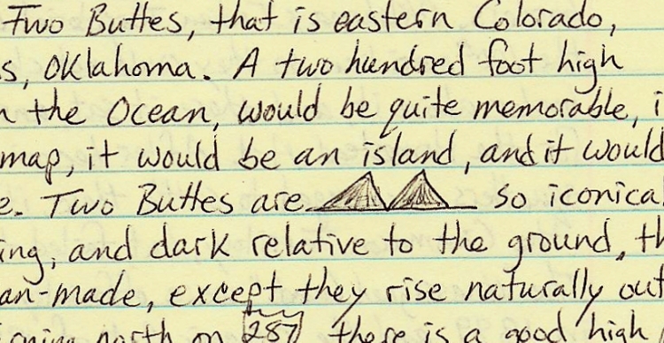
Turning north on Highway 287, there is a good high point vista to the northwest, and another one just to the north before dropping into the Arkansas River Valley. The town of Lamar is on the river, and at that point I turn up river to Lake Hasty State Park for the night.
The plains here are calming and empty, no desperation of people trying to survive, towns that are trying to exert their existence and grow off of everything living in a radius around it >>> which reaches out to the radius of the next town trying to do the same thing. None of that here. Just a road, humbly going along over grassy hills. Savoring the quiet beauty of the plains out here in October, I continued north on Highway 287 up to the towns of Eads and Kit Carson.
Chapter Twenty Five: Fifth loop, orbiting the open center
Pg. 577
Now I’ve completed the fourth loop of the spiral and begin the fifth, heading north into the tighter loops of the spiral. At Kit Carson the route North changes to Highway 59 and in 20 miles, really the middle of nowhere, I cross out of the Arkansas watershed yet again, and into the tight fingers of the Smoky Hill and Republican headwaters. I cross I – 70 at Siebert, continuing north on Highway 59 through the towns of Cope, Joes, Yuma, Clarksville and Haxton. Five towns, less than 1,000 people in over 100 miles. Not so much towns as local memories, of no interest or reference to outside persons.
Just before Sedgwick and I – 76, I cross into the Platte River watershed again and take a break at a park in Julesburg. The heavy, red double lines of the interstates, when printed on a roadmap, look very industrial and busy, and they do carry a lot of truck traffic, but just off of them there’s a lot of peace and quiet along the Platte River, and today I’m receiving a blessing of just such peace, no hurry, plenty of time to eat, rest, and enjoy the simple beauty of this green park.
Taking a frontage road, I follow the interstate, and the river, to Ogallala, Nebraska where I cross out of this South Fork, over the long narrow triangle between the two rivers, and cross the North Fork as well, heading north on Highway 61 into the Sand Hills of Nebraska. The grasses are all turning red now, the native bunch grasses doing their fall color show, the Sand Hills are covered with native prairie grasses, and they look like woolen blankets readying for winter. The Sand Hills are such a luxurious joy to travel through, as I’m doing now, praying my car keeps running, but enjoying the fact that all I have to do is follow a road, a map, a magic string, without which you would be wandering, lost, endless sand dunes covered in the same grass. The Midwest has an enjoyable lack of fences. The wheat, corn, etc. is not fenced at all, for ease of machine harvest, planting and turning; and this gives the land a deserved sense of openness, like you can just walk across it, even if just with your eyes.
After ziging and zagging through the towns of Arthur, Tryon and Mullen, I arrived at a sliver of National Forest on the middle fork of the Loup River and turn in there to camp. Now I get to walk for real in the strange, silent land of sand, grass, and few trees. The night before last I was in northern Oklahoma, now I’m in central Nebraska, circling around this heart, this very large heart of the country. So many crossed it, quickly, and still do, and so few stay here, even less today. It’s not easy being so small, living in a place where yes, humans do rule, but while seeing the dependency upon the very Earth itself for that power to rule. Without gasoline, without electricity, we don’t go very far, very fast.
Now at the top of this fifth loop already, savoring every mile, every minute on this side of the journey, closing, getting closer, closer to the center, but knowing that the center is open yet, wide-open.
The next morning, after spending some time enjoying these hills, I head down to Dunning. Stopping there for gas, I find out the attendant has a cabin near Shavano peak in Colorado, one of my favorite places too, near Princeton Hot Springs. To even know of such a place as Colorado when you live in central Nebraska is to expand your world 100 fold, let alone to go there and experience it. Nearing the top of this loop already, the spirals had ceased to have the feeling of long journeys across regional boundaries, and are condensing into this one region, this heartland, uniform, yet still diverse within itself. I would dip to touch the Arkansas River again, and then rise to touch the Platte River once more, before spiraling into the plains border section – the Smoky Hills of Kansas.
From Dunning I made my way east, to Brewster, then Almeria, crossing my North/South line to Taylor. Since Brewster I was following the Loup River, the major drainage system of the Sand Hills with many parallel tributaries all trending northwest to southeast. The Loup River meets up with the Platte River down in Columbus, Nebraska, which is a geologic crossroads as well. At Burwell I cross the North Fork of the Loup River as the Calamus River comes in from the Northwest. Calamus is a genus of water plants known a sweet flag, and is a popular medicinal herb among the plains Indians. From Burwell I continue east on Highway 91 over to Erickson, and then follow the Cedar River, another tributary of the Loup, down to its confluence through the towns of Spalding, Primrose, Cedar Rapids and Belgrade. I’m leaving the Sand Hills now and getting into more populated, and tilled farmland. At Genoa I cross the Loup’s main branch, and then drop south across the Platte as well at Silver Creek. Heading south in earnest now, I suddenly cross out of the Platte River watershed, as the watershed southern limit is very close to the Platte River itself, the whole way across Nebraska. This is unusual for a River of this size to be smack against one side of its drainage area for such a great distance, about 300 miles.
Going south on Highway 81 to York, Nebraska I cross the headwaters of the Big Blue River, another tributary of the far-flung Kansas River. York is just North of I-80, as the interstate shortcuts the Platte River here on its way to Omaha, and I stop here to do some food shopping. From York, continuing south on Highway 81 and crossing I – 80 and another fork of the Big Blue, I come to Fairmount and jog over to the east on Highway 6, then south again on Highway 15. A nice viewpoint rises up halfway between this turn and Fairbury, about 35 miles to the south. This is the ridge between the Big and the Little Blue rivers. At Fairbury, I cross my East/West line that runs from New York City to Los Angeles, as well as crossing the Oregon Trail route, and the Little Blue River, which the old trail follows from Kansas City to the Platte River Valley near Kearney. Just about 10 more miles south on Highway 15 brings me to the Kansas state line, where I continue, still on Highway 15, down through the towns of Morrowville, Washington and Clay Center.
At this last town, I reach the Flint Hills of Kansas again, and turn to the east into their interior, then follow Highway 77 down their length toward Junction City. Just north of this small town is Milford Lake, a reservoir on the backed up Republican River, which I’ve been shadowing since Clay Center. I camp here at Milford State Park and go for a walk in the calm, clear air. Early in the morning a thunderstorm brings in some rain, so I pack up and wait it out in the car. I go into Junction City for some breakfast before crossing I – 70 and continuing south on Highway 77 to Herington. Still in the heart of the Flint Hills, I pass through some unplowed ground and a viewpoint north of Herington; then turning west and crossing Lyon Creek, find another nice view to the west at a point 7 miles west of the creek, just west of Hope. Maybe this view gave the town its name. West I go, to Gypsum and down to Roxbury, coming to the edge of the Flint Hills.
The city of Salina is just to the north, another intersection of rivers, geology, and interstate highways. It is also the home of the Land Institute, a place where research on native prairie plants is breeding a new kind of agriculture based on harvesting seed from perennial crops that don’t need to be plowed and replanted. This leaves the roots to grow deep into the soil, preventing erosion, making the plant drought resistant, and saving money on plowing, planting seed and fertilizing.
Entering the Smoky Hills, I cross more unplowed ground, and another viewpoint to the west, over the Smoky Hill River Valley. Crossing the river at Lindsborg, and again at Marquette, I continue west to Geneseo and then turn south and drop into the Arkansas River Valley.
7777777777777777777777777777777777777777777777777
Stopping in at the town of Lyons, I visit the Quivira relics Museum. This is where the Coronado expedition ended up in 1541 when their search for the “seven cities of gold” ended, no gold, no cities. I’ve been paralleling the Santa Fe Trail as well, since Herington, and now meet up with it here at Lyons. Obviously a good travel route and good village sites as well, in this “great bend of the Arkansas River” country where the land flattens out and is well watered.
Coronado’s party recorded seeing 1,000 houses here, made of Osage Orange frames and thatched with long grasses, the houses could hold several families. The museum at Lyons had a re-creation, cutaway view of one of these houses, with “bunkbeds” built from the framing wood. This was just one of many bands of the Wichita tribe, which ranged down into northern Texas and up into northern Kansas. The Pawnee tribe was allied with them and lived mainly along the Platte in Nebraska, but ranged down into Kansas as well. So the tribes of the Platte and the Arkansas lived here, overlapping in the Smoky Hills of Kansas. It was really amazing that these conquistadors made it to all the places they went, and made it back too. The account sounds like the Coronado expedition stayed and scouted the area 25 days, going up to the ridge north of Lyons which separates the Kansas and Arkansas watersheds. The Franciscan friar, Juan de Padilla, who came with Coronado, returned to Kansas the next year, but did not return to New Mexico (Tiguex).
From Lyons I go west on Highway 56 to Great Bend and visit their Museum as well and stay there for lunch. Having reached the Arkansas River again, I had west on Highway 96, crossing my north-south line at Rush Center, and continue to follow this road west as it follows a tributary of the Arkansas called Walnut Creek. Back into the Smoky Hills again, even though still in the Arkansas watershed, I jog north at Ness City and then follow Highway 4 west along the watershed divide. There is a good view to the North into the Smoky Hill River Valley, this just west of Shields.
When Highway 4 hits Hwy. 83, I’m back up on the high plains and turn north on 83 for just a couple of miles before turning off and going down into the steep canyon formed by Ladder Creek. Here I camped at Lake Scott State Park and visited the site of some pueblo ruins, built as a hideaway in the 1690’s. Indians from Taos, New Mexico came out here to escape the Spanish for a period of 20 years. In 1701 the Picuris also came out here to live for a couple of years. It’s an amazing place, hidden down out of the plains wind and dry sun, down in this little wet canyon with springs. Irrigation ditches were dug and the little valley was farmed.
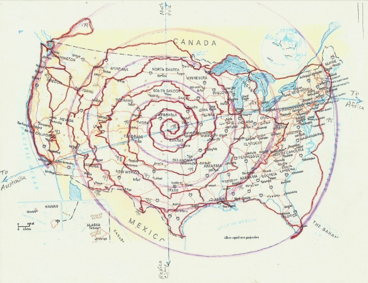 “Spiral Journey”, actual travel (red) with vision guide (purple).
Chapter Twenty Six: A spiral has no beginning and no end
I’m nearing (the end of) the spiral journey, and even though I know it’s just a simple thing, to go along from one place to the next, it is been a great gift, a great blessing to be able to do it, to have the time, to receive the help from all the human and non-human sources along the way. I still feel like there is a long way to go even now, with the loops of the spiral so small, as I’m ending my fifth turn and beginning the sixth, there is not a destination somewhere else other than where I am right now; but still, to do this does require me to be a willing participant, to move along, feeling the connections. I feel like this is my country, and I should be able to walk around freely in it, enjoy it, respect it, learn from it, and when I’m lucky, be able to participate in meaningful life.
In the morning I walk out to the Elm grove and am thankful for being here, knowing about this place, that people were able to take refuge here, and then return home. It’s not a story you really hear about; and then to come across it, just sitting out the open like this, Kansas is like that. It’s not hidden, but nobody sees it, so things just sit here in plain sight. Lots of history, just laying around right where it was left. I drive out north, up some back roads to Russell Springs where there is an old Butterfield Trail Museum. I remember that stagecoach name from California, near where I grew up. This county of Logan that I’m in now, it’s got one town of any size, Oakley at 2,100 people, almost the same as its elevation. The county next to it, Gove, has got four towns with about 100 people each. How do these even rate as counties? Do they count the air blowing through them as income? They do have the Smoky Hill River, and I don’t mind there aren’t any people here, I just don’t know how you can have, or why you want to have, a county that minuscule. Anyway, I take Highway 25 on up to Colby, in Thomas County, where there is a Museum of the Prairie and a community college and everything.
Now the plains are rife with headwaters of every western tributary of the Kansas River. I cross the Saline, both forks of the Solomon, and several creeks that feed the Republican, all within a 30 mile stretch either side of Colby. Up at Atwood, I jog over east to Highway 117 and continue north, crossing Beaver Creek and heading back into Nebraska.
Now on Highway 17, I head up to Culbertson on the Republican River, and then follow along the river on Highway 6 to McCook. Heading north from there on Highway 83 I leave the river and head for Maywood, on one of its northern tributaries. Halfway there is a good lookout to the east and west. Going along crooked Highway 23 to the east, I follow the watershed divide of the Platte to Elwood, where I then head down into the Platte River again, this time to Lexington. This southern sag in the Platte River is one of the big Sandhill Crane migration areas. They come through here in early spring to fatten up on corn for their trip north. I take frontage Road 30, along I – 80 and the river, east over to Kearney. Here I go south, across the river to Fort Kearney State Park to camp for the night. I go for walks and runs in the area around camp, and take the footbridge across the Platte. This was a fairly short and easy day, and I get some rest here, for tomorrow is the big day when I plan to reach the center, where the north-south line, which I just crossed between Lexington and Kearney, intersects with the East/West line, the great circle route between LA and New York City.
The North/South line goes from the North Pole down through Dauphine, Manitoba and down through Laredo, Texas and on a line through Mexico City. The North/South line is fairly parallel with the lines of longitude, a little east of the 100th meridian. The East/West line however, is not parallel with the lines of latitude, not 90° to the North/South line, but is on a slight Northeast/South West line. The spiral loops are oriented to this line as well, so it gives the spiral a tilted and somewhat oval shape, stretched out East and West.
Following the spiral pattern has given me a great sense of focus, while still allowing me time to explore tangents. It all seems very brief, and I relish the time spent in one place, for months, or even weeks. It takes time to get to know a place, and the people of that place. It takes time to find your niche there as well, to be accepted by the locals, to receive your gifts from them, and to properly honor them with your own. This is the beginning of participating in life, instead of just going through it as a tourist. Maybe that’s why tourists aren’t much respected by the locals; that level of participation hasn’t been reached yet. Ecotourism is starting to address some of this process, by connecting people to the place, and the locals, in a meaningful way.
This place I’m staying now, this whole area along the Platte, from Kearney to Grand Island, is already becoming an eco-tourist destination. People come to see the Sandhill Crane migration, and also to see the numerous other ducks, geese and other birds who have found this area to be a safe haven with food, nesting sites, and water.
AAAAAAAAAAAAAAAAAA AAAAAAAAAAAAAAAA
It’s October 23, 1998, and I awake before sunrise, as always, and thankful for this life, for all this fresh water upon which all life depends, I began my day. The visitor center is closed today at the State Park, so I drive along the river a bit to the east, and then drop down to Minden, then shadow the Oregon Trail for a while, zig-zagging over its diagonal path on my right angle roads. Hartwell, Hastings, Ayr, Deweese, and crossing the Little Blue River and the Oregon Trail here, I continue south now on Highway 14 headed for the Kansas border. At the border I also cross my east-west line and the Republican River. Willa Cather lived near here, just upstream about 25 miles at Red Cloud.
After crossing into Kansas and going a few miles on Highway 14, there is a good viewpoint to the south on the divide between the Republican and White Rock Creek. Crossing the creek just upstream from Lovewell reservoir, I drive up the next hill to Montrose where there is an excellent hilltop view in all directions. Going south on Highway 14 I cross the Solomon River at Beloit, then south another 20 or so miles where I turn west on dirt roads, headed for the geodetic center of the US.
West of Montrose about 30 miles is the geographic center of the lower 48 states. This one I’m visiting is about 40 miles south of the geographic center, on Meade’s ranch. The dirt roads get you close, then it’s a short walk up to the marker. Here we are! One of the centers that has been recognized in this country, on the land. Not a lot of fanfare here. In fact, it’s just me, standing below the bluffs just to the north, happy to be here. But this is not the intersection of lines I’ve been drawing on my maps, my center of gravity is still about 60 miles away, so I get back in the car and head south on the dirt roads to Lucas.
This is post-rock country, a subset of the Kansas Hill country, where people quarried the limestone which broke neatly into “posts” or “logs” which could then be used to make fenceposts, houses, bridges, etc., which was handy because there are hardly any trees out here.
Here in Lucas, near the exact center of the country, is marked on the state map of Kansas, “The Garden of Eden”. This is something I have to check out. Expecting something like “Car Henge” in Nebraska, I was utterly surprised by what it actually is. The Garden of Eden is a man’s house, and his little yard, just the same sized lot as all the other little lots in the town of Lucas. He was a Scotsman, and lived here around the turn of the century with his wife, and when he “retired” he built this “log cabin” out of post-rock. He had the rock cut into notched “logs” and stacked them just like wood, overlapping at the corners. It looked just like a log cabin, two stories though, and the interior is all beautifully trimmed and paneled in wood by his own hand. His yard though is where the place gets its name, as it is lined with interlacing cement and steel reinforced sculptures depicting human history from Adam and Eve up to modern times. The work was all done by Mr. Dinsmore and some hired laborers, and is graphically simple, but has a flow and sense of detail to it that makes it interesting, comical, poignant and in its scale, bordering on monumental. When you consider this was all done by hand with cement that came and by sacks on a horse-drawn wagon. I took the four dollar tour led by an interesting local, an elderly man, who did a great job of making us tourists feel welcome while giving us all the detailed history of the place and the man, who by the way, is buried in his own homemade sarcophagus in the back yard with his wife.
At the time he made all this, he had the public in mind, and was giving paid tours even while it was under construction. He also inspired his neighbors and others in the region to do their own artwork and expression – hey, you’re out in the middle of Kansas, at least you should be able to express how you feel, or follow your creative ideas. Now the state has recognized people and places like this and is promoting “grassroots” artists who, with no formal training, have accomplished some major artistic works. The Garden of Eden is now one of the “eight wonders of Kansas”.
@@@@@@@@@@@@ @@@@@@@@@@@@@
Taking my time and enjoying this place, this town, and its message to the world, I slowly make my way back to the small paved roads that doodle through the countryside, following a branch of the Saline River. At Plainville the road pops up onto the flat, featureless High Plains, and now I’m on my north-south line turning north on Highway 183 to meet my east-west line on the North Fork of the Solomon River. Plainville fits its name exactly, and as I travel north from here, the road drops down again into the Hill Country, crossing the south fork of the Solomon at Stockton. This is it, I’m heading to a place, not to continue on the spiral, but to finish, to stop. It’s not a destination of course, it’s an endless plain, a rolling sea of prairie, how could a voyage end in the middle of an ocean? But that’s what I’ve done, I didn’t come here to end here, but to follow something I saw. At first it was on a map, but related to the land. Then I felt it, experienced the spiral loops for myself. Now that I’m at that tight, tiny center of spiral, symbolically at this tiny river shore, I pull off the road, there is no one here, like most of Kansas, and I walk down to the water.
~ End ~
